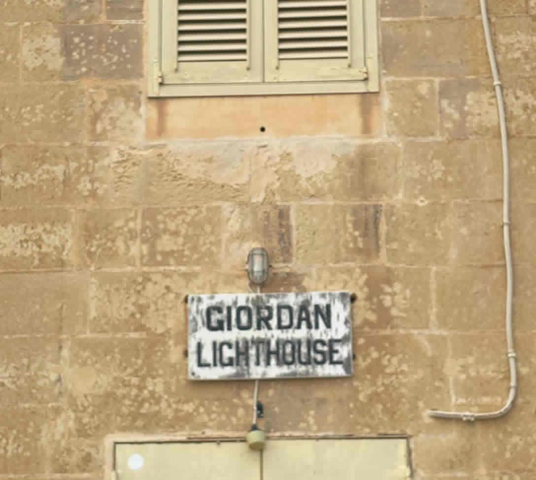
Giordan (Ta’ Ġurdan / Ta’ Gurdan) Lighthouse — full history & construction details
Quick facts
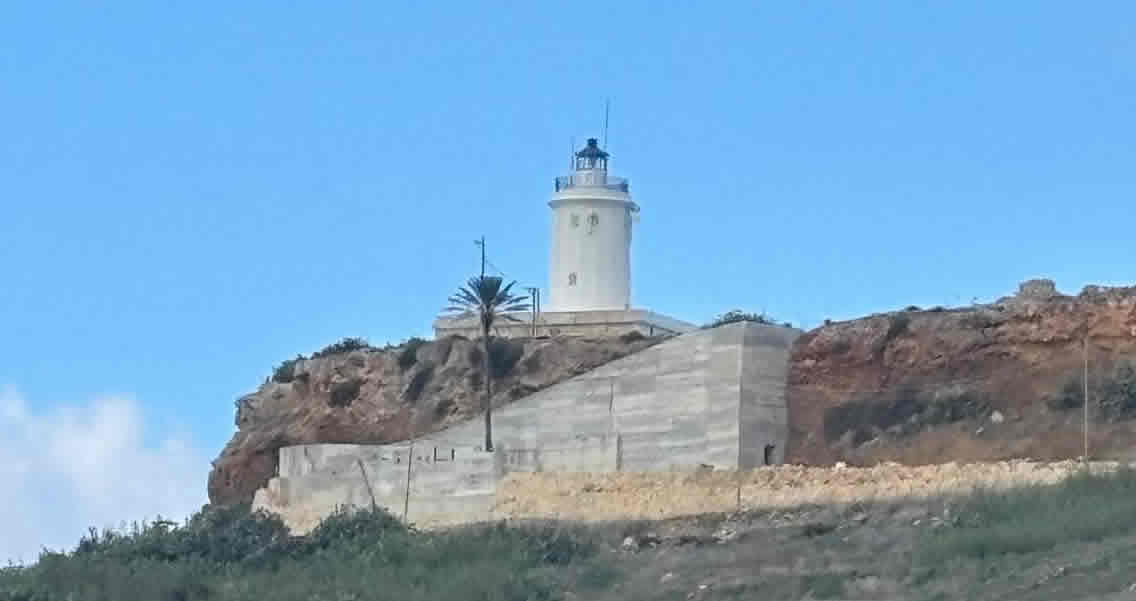
Location: Ġurdan Hill above Għasri, island of Gozo (coordinates 36.07212, 14.21846).
Station established (earlier light): mid-1600s (an earlier light recorded in 1667). Current tower first lit in 1853 (see notes about alternative finish dates below).
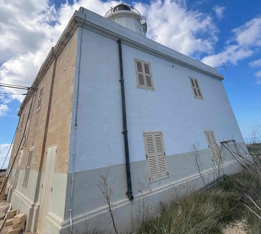
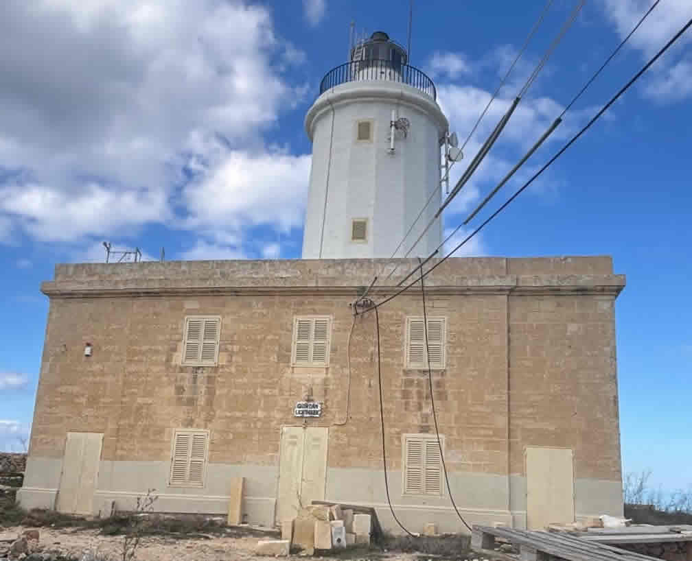
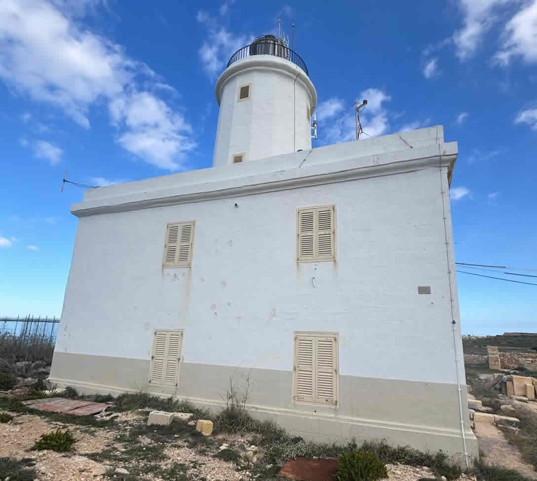
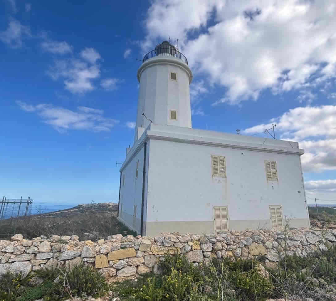
Tower: stone cylindrical tower with lantern and gallery, rising from a two-storey square stone keeper’s house/base. Height ≈ 22 m; focal height ≈ 180 m above sea level.
Light characteristic (current): flashing white every 7.5 s; nominal range ≈ 20 nautical miles. Automated 1994.
Full chronological history
Pre-1850s — a very old station
A light at the Ġurdan hill site is recorded as early as 1667, financed by the Knight Fra Henry de Gourdan (Langue of Auvergne). That early station formed the long-running navigational presence on the hill.
Mid 19th century — construction of the present tower
The present lighthouse was built under British administration to serve increasing maritime traffic around Gozo’s north coast. Construction works began in the early 1850s; the current light was put into operation in 1853 (sources record the current light beginning operation on 15 March 1853). Some local histories/authorities also refer to additional inauguration/finishing ceremonies later in 1853 (different sources mark completion or official ceremonies on different dates — see the note below).
Late 19th / early 20th century — evolution of the lighting apparatus
Early apparatus: contemporary accounts and local summaries describe the early installation as using multiple oil/kerosene lamps with reflectors and lensing (local pages commonly mention “21 oil lamps” and rotating reflectors / large lenses used to project a very long beam). Over time the illumination system was modernised (paraffin/kerosene → later electric / modern optics). (See sources below — note the older/legendary figure “38 nmi” that appears in tourist retellings; the authoritative lighthouse directories list the practical range at ≈20 nmi).
World War II
The station was used for war purposes — the hill and tower hosted an early-warning radar/observation function during WWII (the position’s elevation made it valuable for air/sea observation).
Late 20th century → present
The light was automated in 1994.
The site later became important for atmospheric monitoring: the Giordan Lighthouse station was designated a Global Atmosphere Watch (GAW) background monitoring location (the University of Malta operates air-quality / trace-gas instruments there). The GAW station was established in the early 2000s and received a substantial upgrade (EU / national funding) between 2008–2011.
Restoration/tourism: in recent years conservation/restoration projects have been undertaken to stabilise/restore the lighthouse and enhance it as a viewpoint/tourist attraction (restoration work reported from around 2018 onward).
Construction & technical details
Site & foundation
Siting: placed on the summit of Ġurdan hill (an exposed, elevated site 800 m from cliffs on Gozo’s north-west coast) to maximise focal height; the tower’s high focal plane (≈180 m) is achieved by the hilltop location rather than an extremely tall masonry tower.
Foundation / base: the tower rises from a two-storey square stone keeper’s house / base — keepers’ accommodation and service rooms were integrated with the tower (typical British-era practice when building remote stations).
Tower & materials
Form: cylindrical stone tower with balcony (gallery) and lantern room. Material: local masonry (stone) — traditional lime-mortar masonry typical of Maltese lighthouses of the 19th century. Tower height ≈ 22 m. Exterior painted white with lantern painted white.
Original lighting apparatus & optics
Early light source: contemporary/local records describe the early installation as oil/kerosene lamps arranged with silvered reflectors and large lens elements to concentrate the beam. Several tourist/local summaries mention an original bank of 21 lamps with reflectors, producing a very powerful beam (figures such as “visible to 38 nmi” appear in some narratives). More technical lighthouse directories and Admiralty listings give the operational focal height and practical nominal range (≈20 nmi) used for navigation. In short: early technology = multiple oil lamps + reflectors / lensing; later replaced/upgraded to modern rotating optics and—eventually—electric light.
Note on optics: Fresnel-type lenses were the standard 19th-century technology for lighthouses worldwide; while I could not find a definitive online citation for the exact *order* of Giordan’s original Fresnel lens in the sources I opened, the historical descriptions (multiple lamps + reflectors → lensing) and the station’s long range strongly imply classic 19th-century dioptric/dioptric-reflective arrangements typical of British Admiralty lights. If you need the exact lens order/manufacturer (e.g., “3rd-order Fresnel by XYZ”), I can pull Admiralty or Trinity House / Malta Maritime Authority archival specifications next.
Mechanisms / keepers’ facilities
The two-storey house provided living quarters, fuel stores, spare lamp room and workspace for keepers. A service stair leads to the lantern and gallery; the lantern housed the active optic and rotating mechanism (later electrified and finally automated in 1994). Wartime additions included radar/communications equipment.
Scientific & non-navigational uses
From c.2000 the site became the University of Malta’s background trace-gas / air-quality monitoring station for the central Mediterranean (Global Atmosphere Watch). That role required installation of monitoring instruments and a laboratory link to the University campus on Gozo; the station was upgraded 2008–2011 with EU/national funds. The station’s long-term atmospheric record is now an important scientific resource.
Points of conflict or where sources differ
Inauguration / completion dates: many authoritative sources say the current light began operation in 15 March 1853. Other local histories and a University of Malta note mark the station’s 150-year anniversary on 8 October 2003 (implying a finishing date in October 1853). These differences probably reflect separate events (first lighting vs official completion/ceremony) or variant archival records. I’ve cited both kinds of sources so you can see the discrepancy.
Early range / number of lamps: tourist pages and local council histories repeat the story of “21 oil lamps” and a beam reaching 38 nautical miles; lighthouse directories and Admiralty lists report the practical navigational range nearer 20 nmi. The “21 lamps / 38 nmi” account is widely repeated locally (and may be based on early engineering descriptions), but official navigational figures in directories are the safer technical number for modern use.