📍 Location
The coordinates of Fort Bingemma are:
- 35.903299, 14.362237
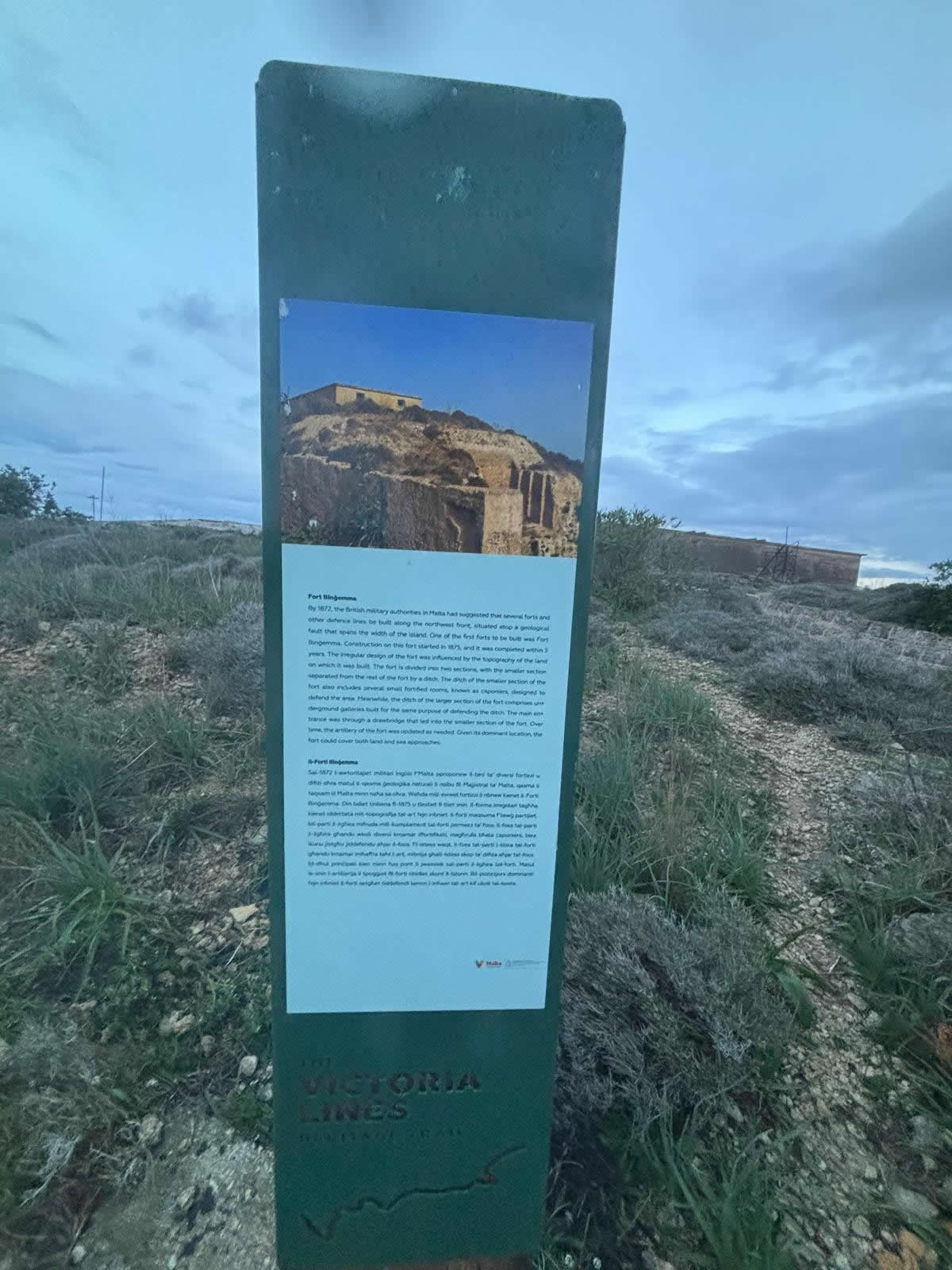
Fort Binġemma (Fort Bingemma) — full history & construction details
Fort Binġemma (sometimes written Binġemma / Bin Jema) — its strategic purpose, how and when it was built, its physical layout and armament, and the major episodes in its later life (20th–21st centuries).
Quick overview
Type / system: British polygonal fort, built as one of the prime strong-points of the Victoria Lines (the late-19th-century defensive belt across northern Malta).
Built: 1875–1878 (first of the Victoria Lines forts).
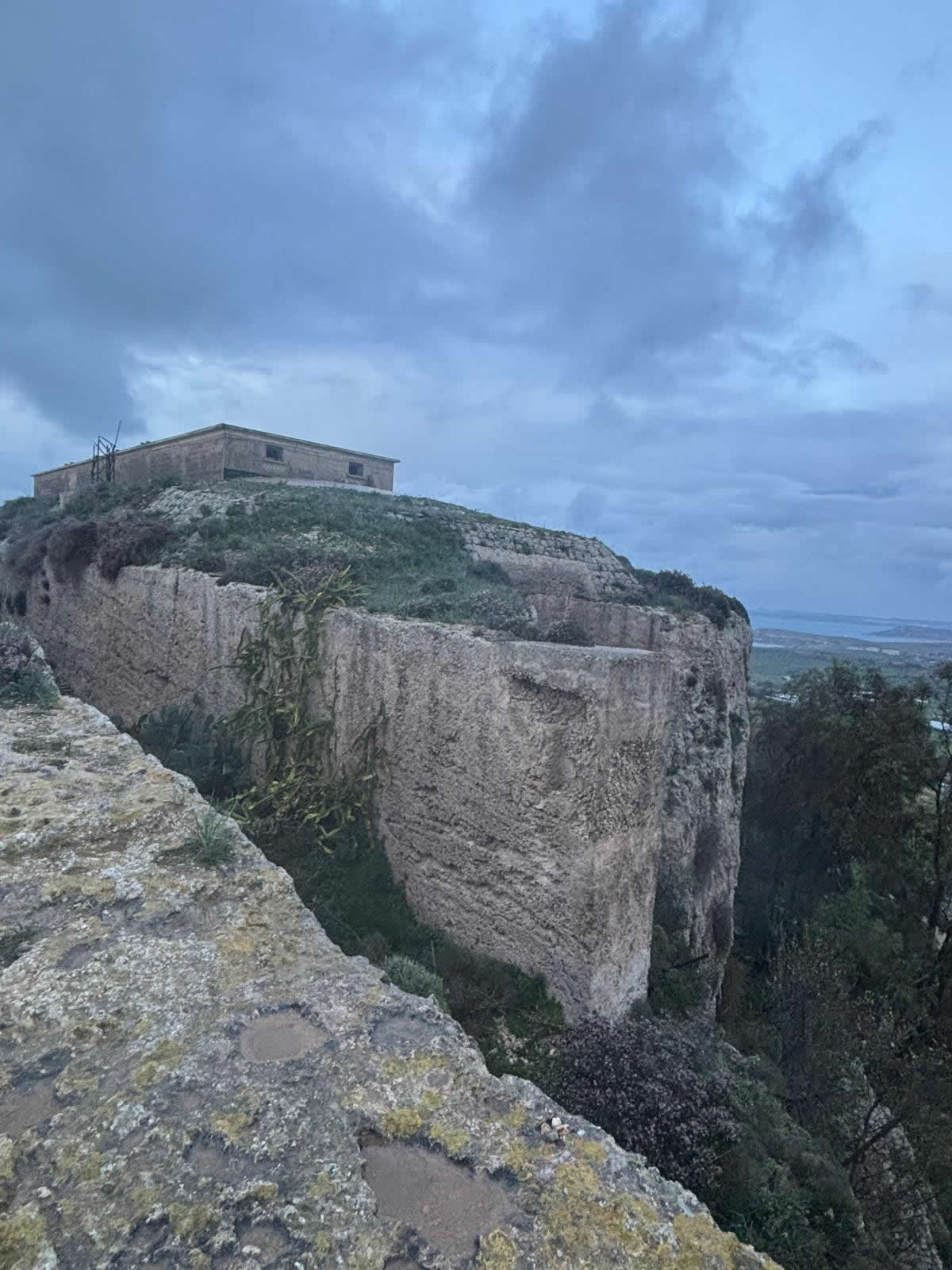
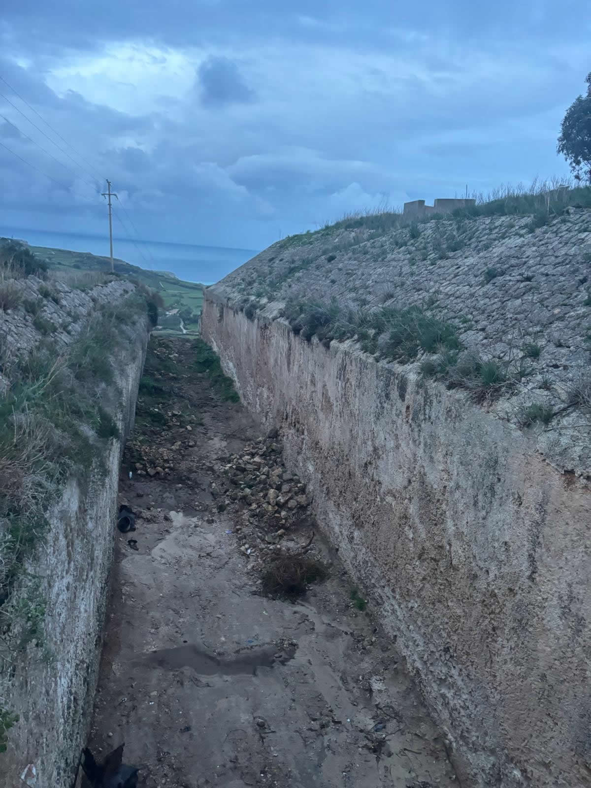
Site: on a hill (c.180 m a.s.l.) in the limits of Rabat / near Mġarr — the cliff on the north side and a dug ditch on the south provided natural and engineered defences.
Later uses: coastal-defence rearmament, WWII & Cold War roles (including training for the Albanian subversion), signal/communications base, then leased for agriculture; illegally occupied 2009–2025 before recent eviction and handover plans.
Strategic context — why it was built
From the 1870s the British military adopted a new defensive concept for Malta: to use the island’s Great Fault escarpment as a defensive “curtain” across the width of the island, denying overland movement from the north toward the Grand Harbour. That scheme — the Victoria Lines — combined a few strongly sited polygonal forts (Mosta, Binġemma, Madalena) with linking infantry parapets, batteries, searchlight emplacements and entrenchments. Fort Binġemma stood at the western extremity of this line and was the first fort started.
Construction — dates, design type and materials
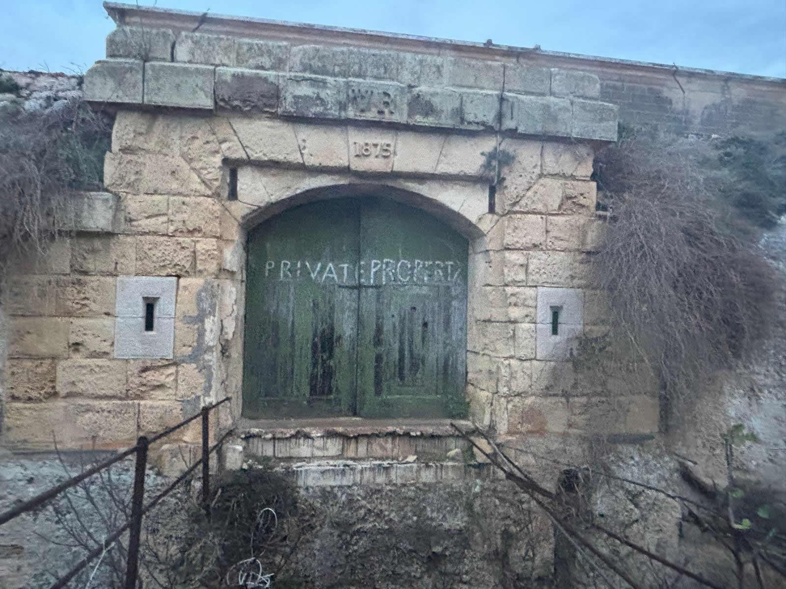
Dates / builder: construction began in 1875 and was essentially complete by 1878; the works were British Army engineering works financed under the Victoria Lines project.
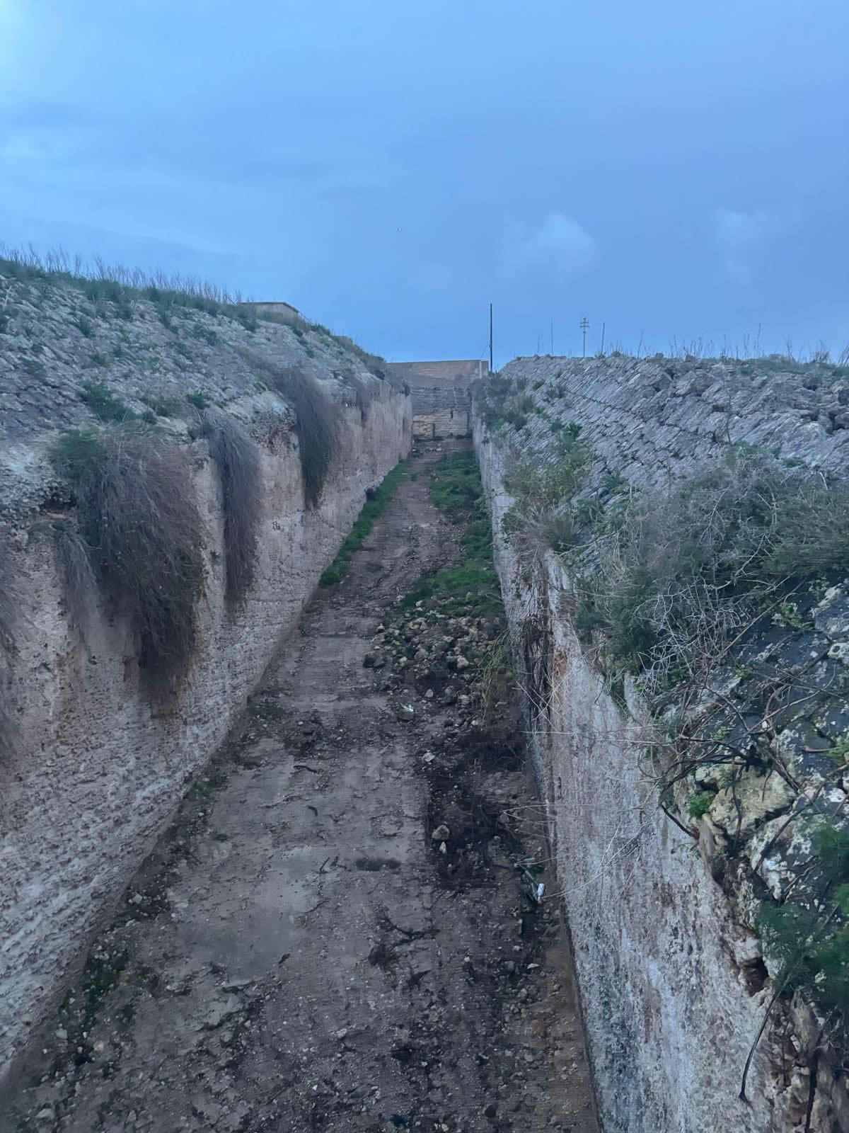
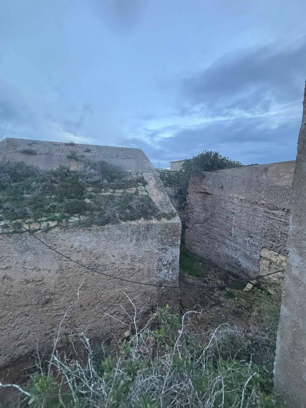
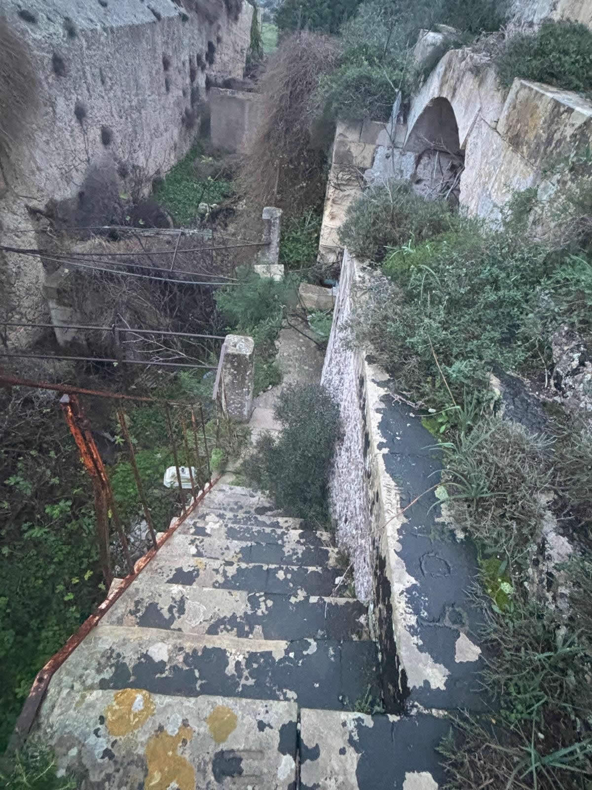
Design type: a polygonal fort (the prevailing late-Victorian system that replaced classical bastioned traces). Polygonal forts used ditches, earthen glacis and angled faces to reduce dead zones and improve fields of fire; Fort Binġemma exploited the natural cliff on one face and an artificial ditch/ glacis on the other faces. Dr Stephen C. Spiteri’s surveys and period plans illustrate the irregular polygonal plan and internal barrack/casemate arrangements.
Materials & construction methods: typical British-era military practice in Malta — thick masonry and concrete revetments faced with local globigerina limestone, rock-cut ditching where possible, earth-covered terreplein for gun emplacements, and internal casemates/barrack accommodation. The ditch and glacis were shaped to create a defensible perimeter; a rolling (or later fixed) bridge would have crossed the ditch at the entrance.
Layout, armament and capability
Layout: the fort’s plan is irregular (adapting to the escarpment). It included a central barrack block, surrounding casemated walls, a defensive ditch on the landward side and glacis; the cliff face provided natural defence to the seaward/north side. Contemporary drawings (Spiteri) show gun emplacements positioned to cover the sea approaches northwest and to command the ridges to the northeast.
Armament (historic): period and later references record that the fort was armed (at different times) with two 6-inch breech-loading guns and one 9.2-inch breech-loading gun, giving an arc of fire of roughly 210° — suitable for both landward coverage of the ridges and coast-defence against shipping. The 9.2-inch pieces were kept (with updates) into the 20th century (the smaller 6-inch guns were removed/dismantled at various times). (These armament details are recorded in fort surveys and photographic captions summarising the fort’s rearmament.)
Operational history — 1900s–1950s
Victoria Lines abandonment (c.1907): the Victoria Lines as a continuous frontier lost strategic priority about the turn of the century (the army revised defensive doctrine). However Fort Binġemma (and some other strong points) remained of use as coastal defence and as a military station for other roles.
Early 20th century and WWII: the fort stayed in military ownership and was used in various defensive roles through both world wars (logistics, observation, communications). Surface-mounted artillery arrangements were modified as weapons and doctrine changed.
Cold War / Albanian Subversion: Fort Binġemma appears in the historical record as one of the training sites used in the late-1940s/early-1950s for covert operations supporting anti-Communist activity in Albania (Operation Valuable / the Albanian subversion). Open sources describe groups of recruits training in Malta (Fort Binġemma is explicitly named in accounts of these operations).
Post-military uses and 21st-century events
Leases and agricultural use: in 1981 the government leased the fort to a private person for agricultural use (reported commonly as livestock/cow or pig-rearing). The lease expired in the late 1990s but occupation continued under informal arrangements.
Illegal occupation & developments: from the 2000s onward the fort became the subject of public controversy: the occupying family (Buttigieg) continued to live and operate inside the protected fort after formal lease expiry; illegal works, unauthorised development and even occasional use as a restaurant were reported. The Planning Authority issued fines; national press covered the case repeatedly.
Eviction & transfer (2025): after protracted legal and administrative processes the fort’s occupants were physically evicted in 2025, and the property was officially transferred by government to **Xjenza / Esplora / Space Park Malta** (announcements in September 2025 describe plans to develop the site as a science / astronomical space-park facility).
Condition and heritage status
The fort survives substantially intact externally (walls, ditch and overall massing), but it has suffered neglect and unauthorised alterations to the interior and courtyard areas during the period of illegal occupation. Most sources describe the structure as intact but neglected, with the site protected under Malta’s heritage/archaeological planning framework — which is why illegal works attracted fines and public concern. The recent eviction creates an opportunity for conservation-led restoration and a new public/scientific use.