Location Map Coordinates 35.851748, 14.386994
At the western edge of Malta, close to the dramatic Dingli Cliffs, you can find a striking set of parallel grooves cut into limestone. These “cart ruts” are among Malta’s most intriguing landscape mysteries. Coordinates: 35.851748, 14.386994.
Overview
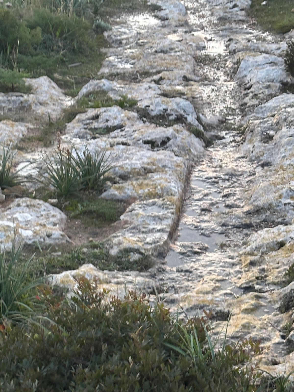
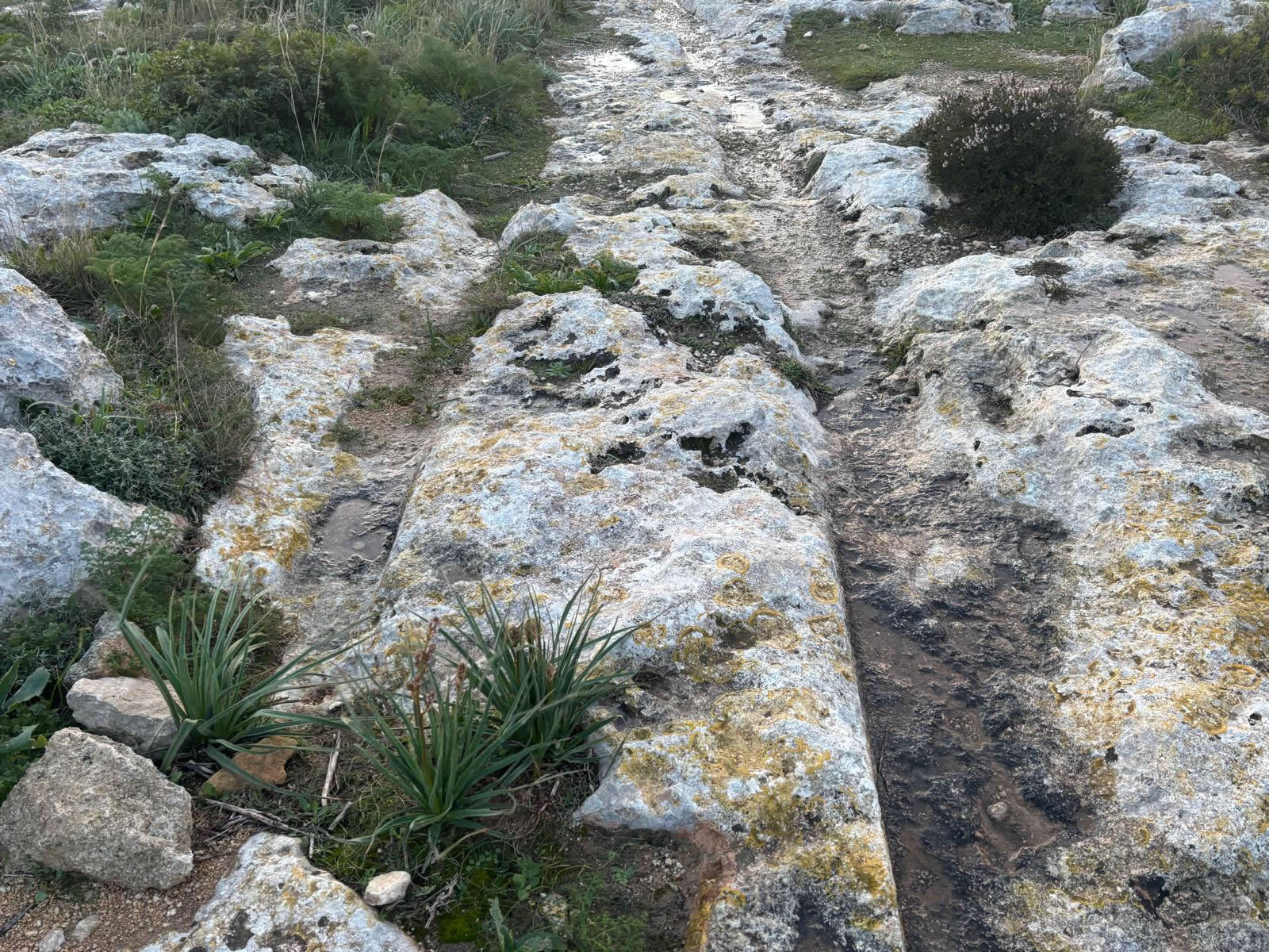
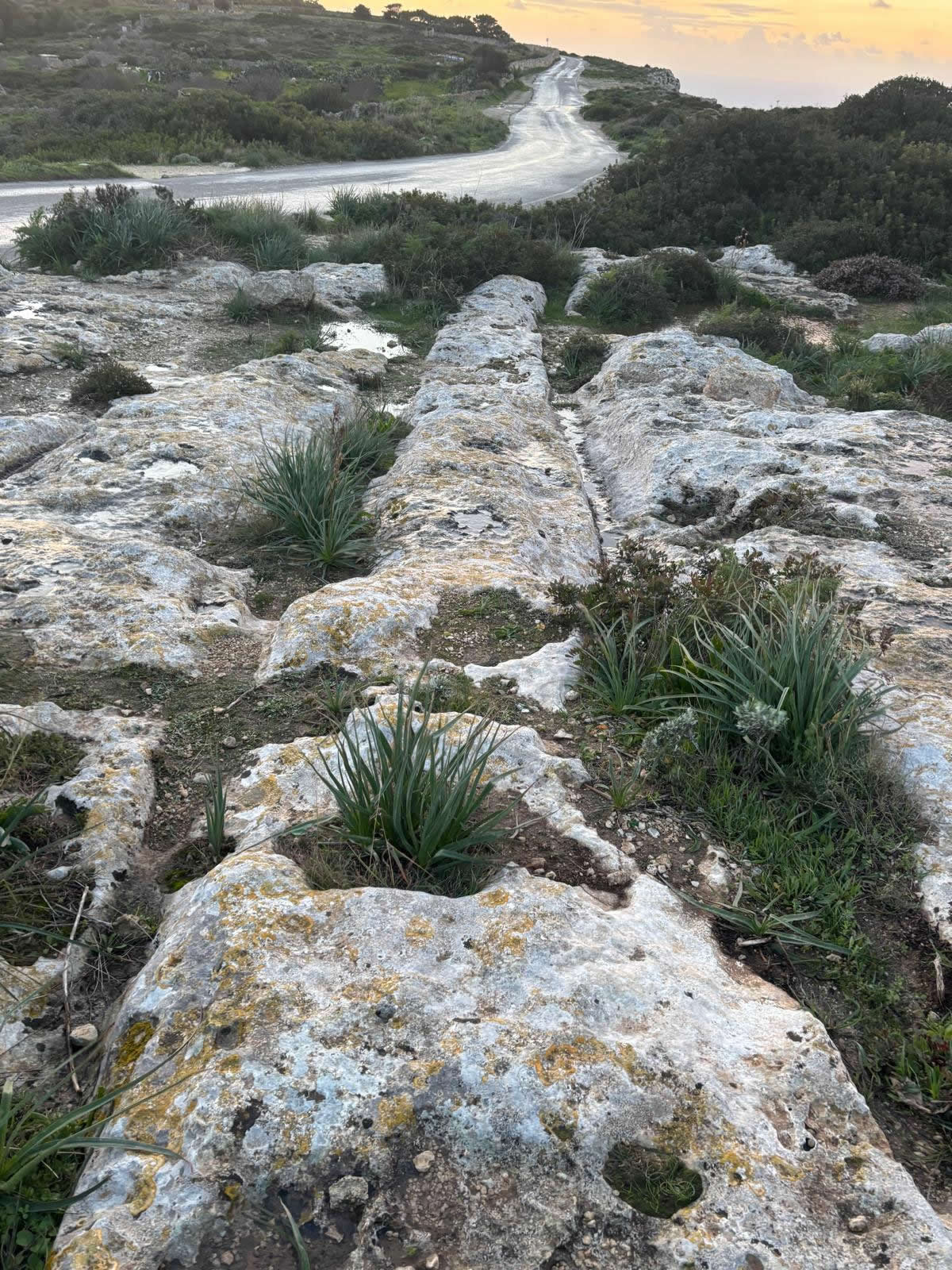
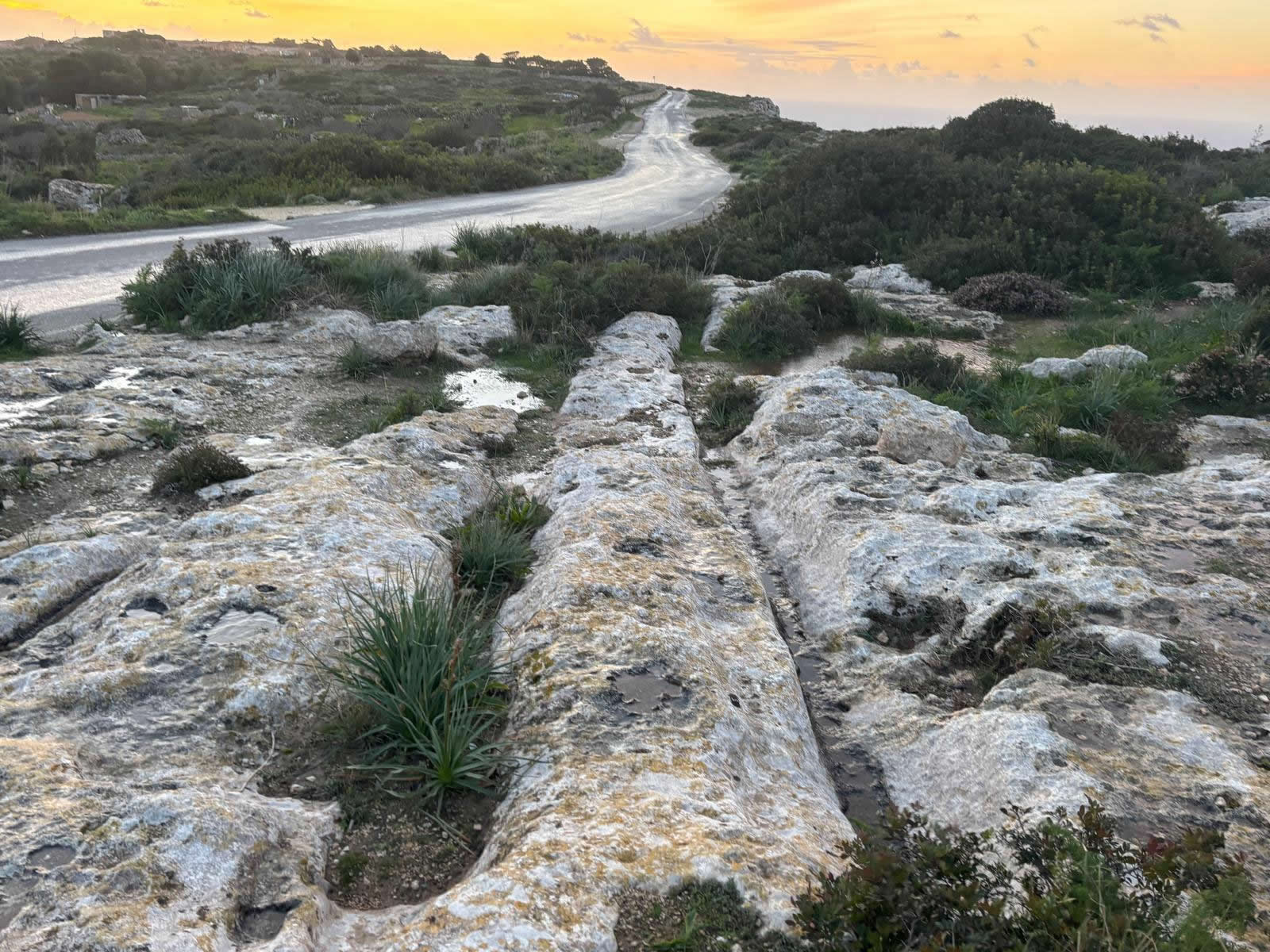
“Cart ruts” are pairs of grooves cut into Malta’s limestone bedrock, sometimes forming long, parallel lines and sometimes branching or intersecting into complex networks. The Dingli area is famous for dense concentrations—often discussed together with nearby networks such as Misraħ Għar il-Kbir (“Clapham Junction”).
- Two parallel grooves running in the same direction, often with consistent spacing.
- Sections where lines converge, split, or cross—creating “junction” patterns.
- Changes in depth where rock is softer, fractured, or eroded by weather.
Background: why Malta’s cart ruts matter
Malta has one of the world’s most concentrated distributions of cart ruts, making them a major topic for archaeologists, geologists, and landscape historians. Research highlights the debate around their age, function, and formation processes, including the possibility that different rut systems formed in different periods, or that older ruts were reused and modified over time.
The Dingli Cliffs region is especially compelling because it combines striking geology (open limestone plateaus and dramatic cliff faces) with carved features that feel both human-made and strangely difficult to interpret.
Leading theories and interpretations
1) Transport routes (carts, sledges, or runners)
One of the most popular explanations is that ruts formed as transport pathways—either by wheeled carts, sledges, or repeated dragging of loads over soft limestone. This could relate to moving stone, agricultural produce, or other heavy goods.
2) Quarrying and stone movement
In some landscapes, ruts are discussed in relation to quarrying zones and the movement of stone blocks. Repeated hauling along the same lines could deepen grooves over time, especially if aided by abrasion (grit) or moisture.
3) Water management, erosion, and “mixed origin” models
Some researchers propose that not all ruts are purely “tracks”: certain channels may have been shaped or widened by water flow and long-term erosion, or reflect multiple phases of human modification and natural weathering.
No single explanation convincingly accounts for every cart-rut landscape in Malta. Many modern discussions favour a multi-cause picture: different uses, different periods, and different local conditions.
Landscape context near Dingli Cliffs
The Dingli plateau is exposed, wind-swept, and geologically suited to carving and weathering: hard limestone surfaces broken by joints, fissures, and softer layers. This creates a setting where carved grooves can remain visible for long periods, while also being reshaped by runoff, soil movement, and vegetation.
- Visibility: ruts stand out best in low-angle light (early morning or late afternoon).
- Seasonality: after rain, grooves can appear deeper due to pooled water—use caution on slick limestone.
- Cliff proximity: always stay aware of edges and sudden drops.
Conservation and responsible visiting
Cart ruts are fragile heritage features. The biggest threats are erosion, vegetation root action, off-path trampling, and vehicle damage. Help protect the site by staying on existing paths where possible and avoiding any action that enlarges grooves or loosens limestone.
- Do: photograph in raking light and from safe angles; use a wide lens rather than stepping onto delicate edges.
- Don’t: scrape, dig, or “clean” grooves; don’t ride bikes or drive over limestone surfaces with visible ruts.
- Do: report vandalism or damage to local authorities where appropriate.
Visiting and map
Coordinates: 35.851748, 14.386994
Tip: paste the coordinates into your maps app: 35.851748, 14.386994.
FAQ
Are these the same as “Clapham Junction” (Misraħ Għar il-Kbir)?
They are in the same broader region near Dingli Cliffs, and people often visit multiple rut clusters in one trip. “Clapham Junction” usually refers to the densest network at Misraħ Għar il-Kbir.
How old are the ruts?
There is no universally agreed date. Published discussions emphasise that the age and purpose are still debated, and some researchers suggest different ruts may belong to different phases.
Why do some ruts seem to go “nowhere”?
Over long periods, landscapes change: soil builds up or erodes, paths shift, and parts of rut systems may be lost to development, collapse, or weathering. In other cases, ruts may represent short functional segments rather than long “roads.”
Sources (for transparency)
- Culture Malta – Cart Ruts (overview; highlights the Dingli-area complexity and references key scholarship).
- Reference summaries on Misraħ Għar il-Kbir and the debated dating/function of ruts.
- Peer-reviewed research discussing variability, formation processes, and debate about function and age.
© emalta.com • Explore more cart ruts in Malta