Location Map Coordinates 35.916087, 14.433838
Coordinates (verified on-site): 35.916087, 14.433838
Locality: Naxxar, Malta
35.916087, 14.433838 (field-checked)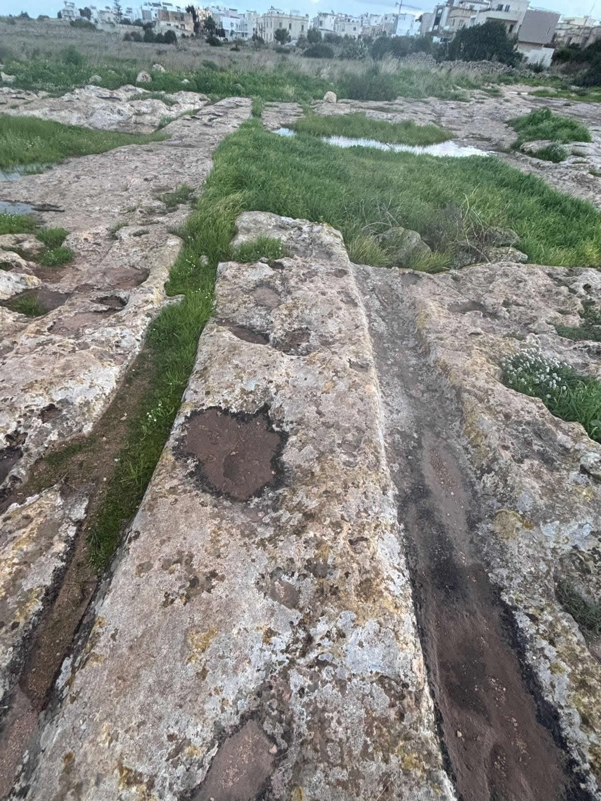
Overview
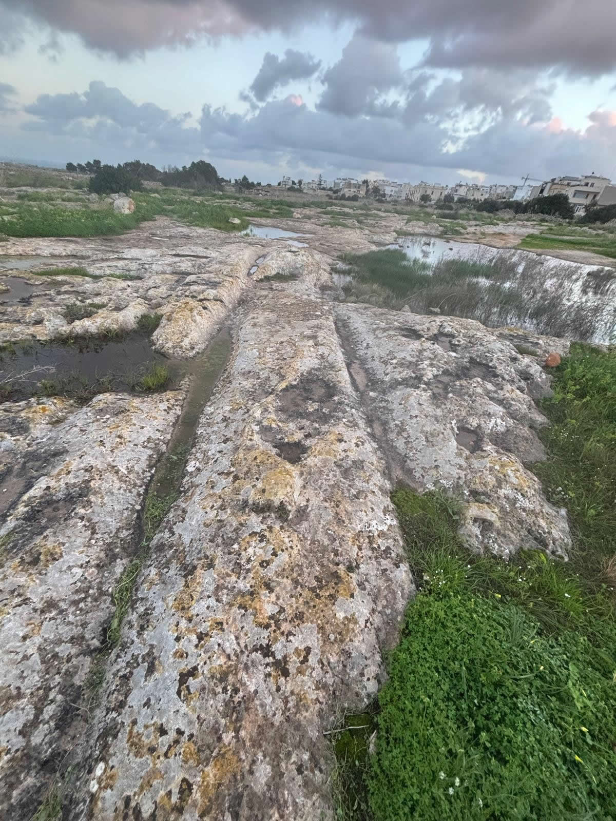
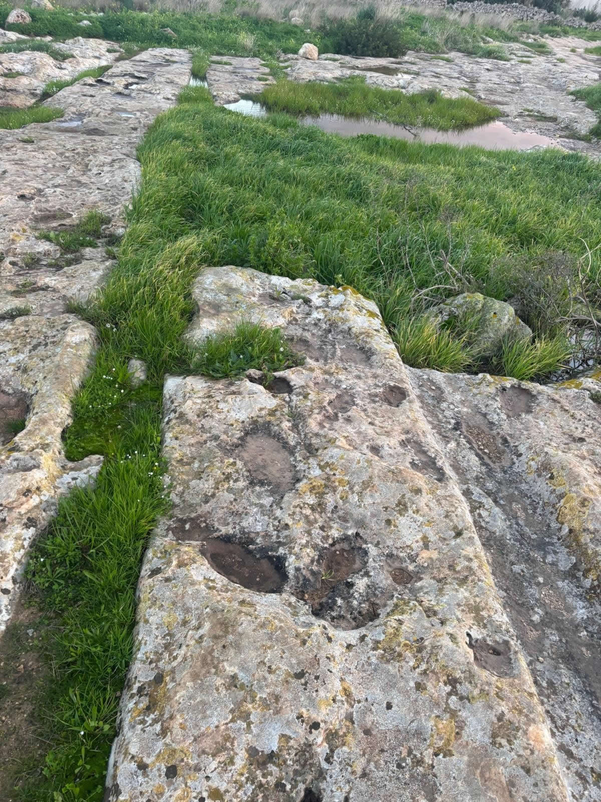
The Naxxar Cart Ruts at 35.916087, 14.433838 are part of Malta’s wider cart-rut landscape: networks of parallel grooves cut into limestone bedrock that remain one of the islands’ most distinctive—and most debated—features. While some cart-rut complexes are extensive, smaller exposures like this one are equally important: they show how cart ruts occur across varied terrain and how they often survive as fragments within a landscape reshaped by agriculture, quarrying, and modern development.
Location & what you’ll see
Naxxar sits on Malta’s northern plateau and ridge system, a landscape of workable limestone that has supported settlement, farming, stone extraction, and movement routes for millennia. Cart ruts are often found where exposed bedrock forms natural corridors across the terrain, especially where repeated travel would concentrate along practical lines of movement.
On-site recognition
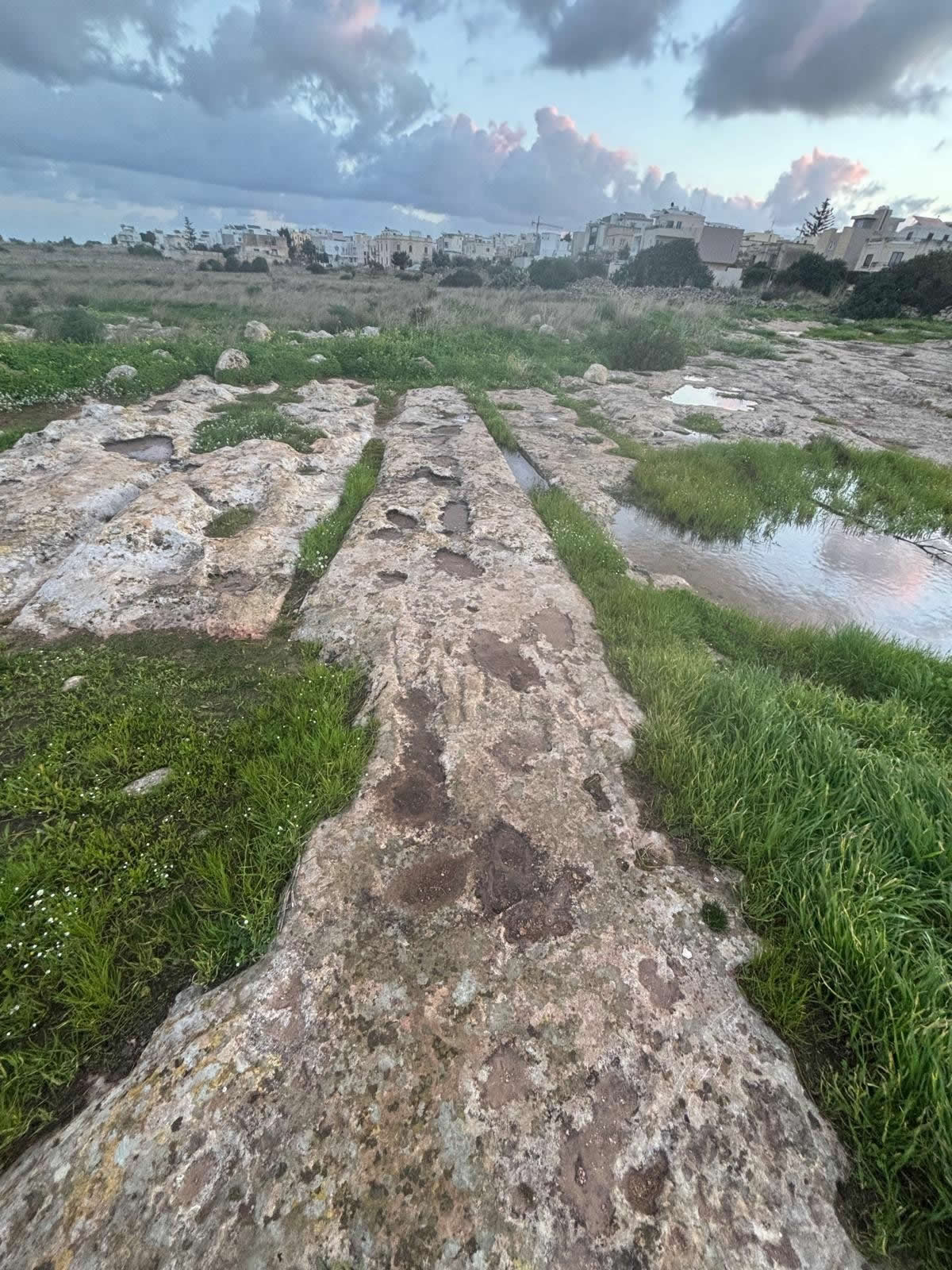
- Parallel grooves forming a paired track, sometimes with a consistent spacing along a run.
- Depth changes where erosion, soil, or later disturbance has altered the rock surface.
- Branches and joins may appear: ruts can split, converge, or form partial intersections.
- Best visibility typically occurs in low-angle light (early morning or late afternoon).
What are cart ruts?
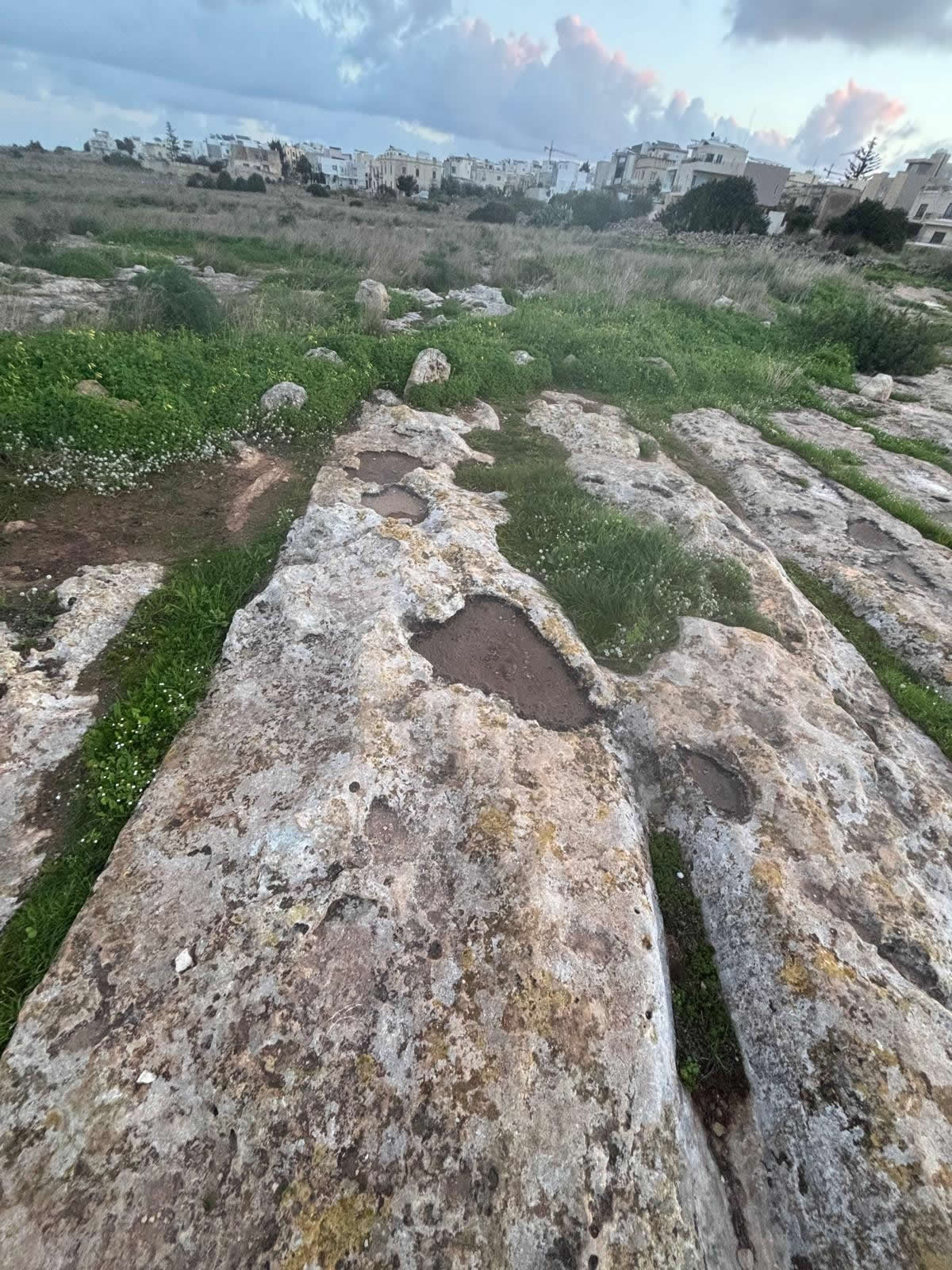
In Malta, “cart ruts” refers to sets of grooves cut into limestone bedrock that often appear as paired channels—like track marks—running across open rock. Some are short and isolated; others form extensive networks with junctions and parallel lines. Their spacing can be remarkably regular in many places, suggesting controlled movement along established routes.
What makes Malta’s cart ruts so compelling is that they do not come with a clear “label” in the archaeological record. They are not accompanied by inscriptions, and direct dating is extremely difficult. As a result, their interpretation relies on careful observation of morphology (shape and spacing), landscape context, and how they relate to known features (fields, quarry zones, settlements, and later tracks).
Full history and landscape context
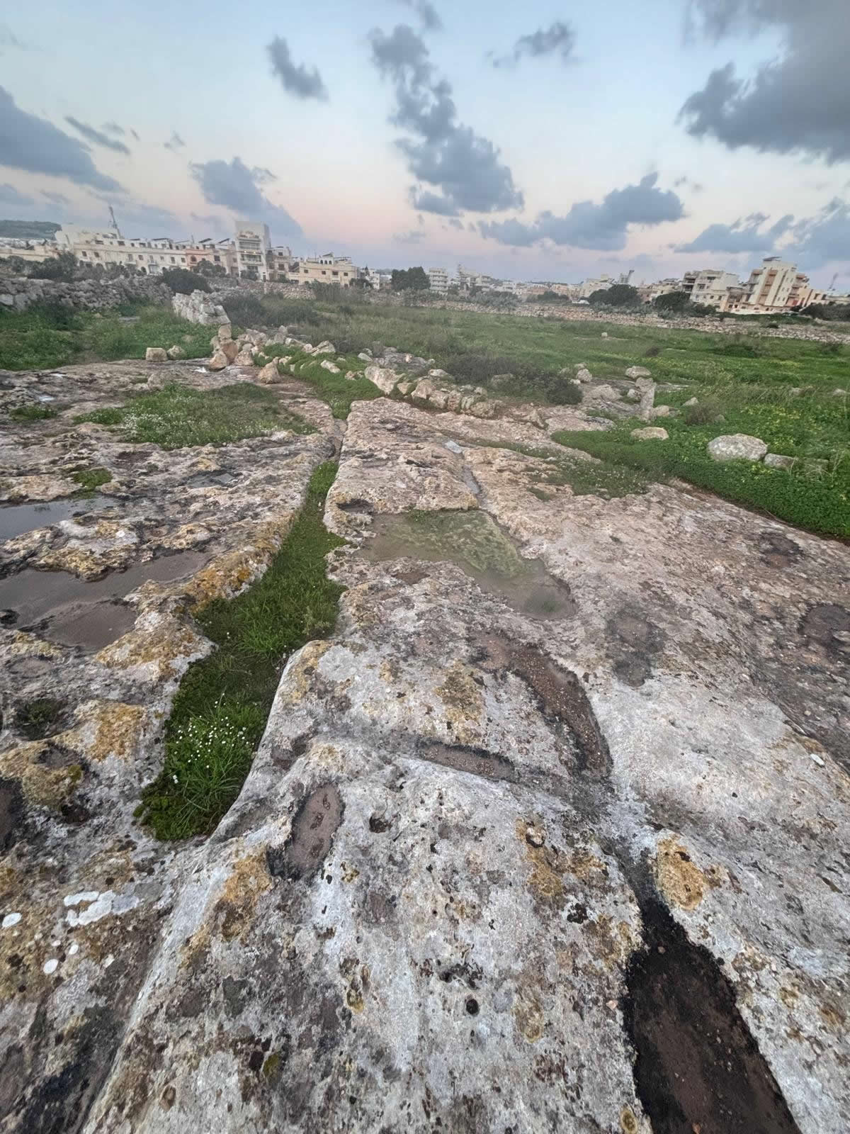
The Naxxar region is layered with human activity. Over long time spans, people moved stone, soil, crops, and water across this landscape, and they reshaped the terrain through cultivation, terracing, quarrying, and construction. Cart ruts fit naturally into such a setting: whether used for transport, haulage, or route guidance, they reflect repeated interaction with exposed bedrock and the need to move heavy loads efficiently across the island’s limestone surfaces.
Why ruts persist in places like Naxxar
- Limestone bedrock exposure: ruts require rock at the surface; Naxxar’s plateau areas provide it.
- Movement corridors: ridges and gentle gradients can guide routes between inland zones and coastal areas.
- Working landscapes: farming and quarrying can both create conditions for rut formation and also reveal ruts by clearing soil.
A changing landscape
It’s important to read cart ruts as surviving traces within a landscape that has changed. Soil depth shifts, vegetation grows and is cleared, and modern works cut new paths and boundaries. A rut exposure visible today may be only a small part of a larger system—some sections may be buried, worn down, or removed altogether.
Dating debate
Cart ruts in Malta are hard to date directly, and scholarly opinions vary. Proposed dates for different rut systems span a wide range, from prehistory into later historical periods. Many researchers also allow for multi-phase use—meaning some ruts could have been created in one period and reused, modified, or extended in another.
For a site page like this, the most accurate approach is to avoid a single fixed date unless there is direct, published evidence tied specifically to this exact Naxxar point. Instead, the ruts are best presented as part of Malta’s broader, still-debated cart-rut phenomenon.
Leading theories on purpose
1) Transport routes formed by repeated movement
A classic interpretation is that ruts represent long-term movement along the same lines—potentially by wheeled carts, sledges, or other haulage systems. Consistent spacing supports the idea of standardised movement, but it does not explain every pattern across Malta.
2) Quarrying and heavy haulage
Another widely discussed idea is that at least some cart ruts relate to quarrying and the movement of stone, rubble, or soil. Deliberate guidance grooves could help manage heavy loads, especially over sloping ground or where control mattered.
3) Deliberate cutting to guide vehicles
Some rut segments appear “engineered” rather than purely worn, suggesting intentional cutting (or re-cutting) to guide movement, reduce lateral slip, or keep loads on stable lines.
4) Multiple uses across time
A practical modern synthesis is that “cart ruts” may not be one single phenomenon. Different rut networks may have different origins, and some may have been reused across long time spans—producing complex, branching landscapes like those found around Malta.
Visitor tips & responsible access
- Footwear: limestone can be sharp and uneven; wear sturdy shoes.
- Safety: be cautious near roads, edges, or loose rock; avoid visiting alone at dusk.
- Do not mark: please don’t chalk, paint, or scratch the grooves for photos.
- Photography tip: low-angle sunlight makes ruts stand out more clearly.
- Leave no trace: keep the site clean and undisturbed.
FAQ
Where exactly is this Naxxar cart-rut site?
Use 35.916087, 14.433838. This page uses the field-checked coordinates provided.
Why can online coordinates be “wrong” for cart ruts?
Many public map pins are approximate (placed “near” a feature rather than directly on it), and cart ruts can extend across an area rather than a single point. Minor shifts can also come from access constraints, changes in paths, or new development.
How old are these ruts?
Without site-specific published dating evidence, it is best to treat this location as part of Malta’s cart-rut phenomenon, which has a wide range of proposed dates and may include multiple phases of use.