Location Map Coordinates 35.946181, 14.424705
- Part of Malta’s wider cart-rut landscape
- Rock-cut grooves carved into limestone bedrock
- Situated close to Salina Bay and modern development
Overview
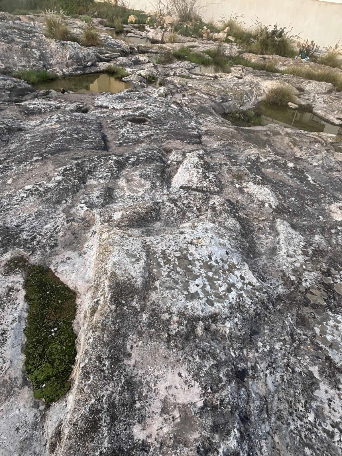
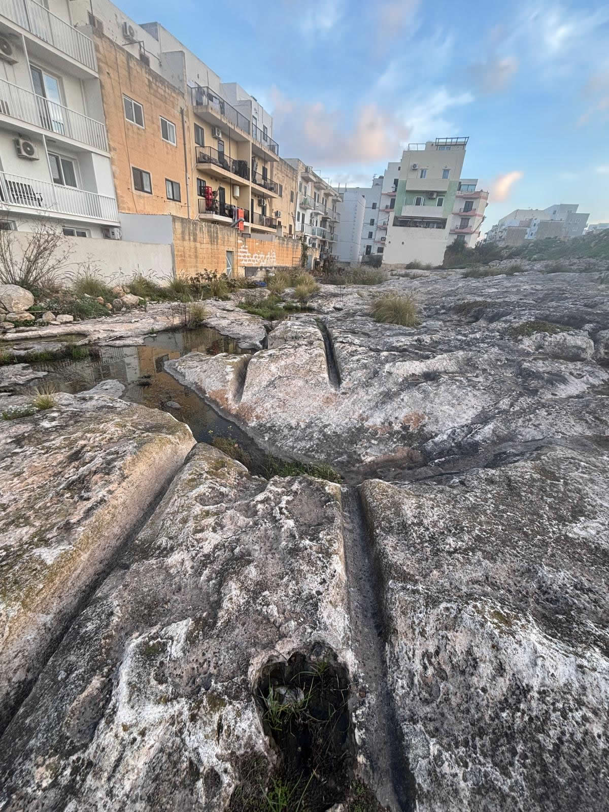
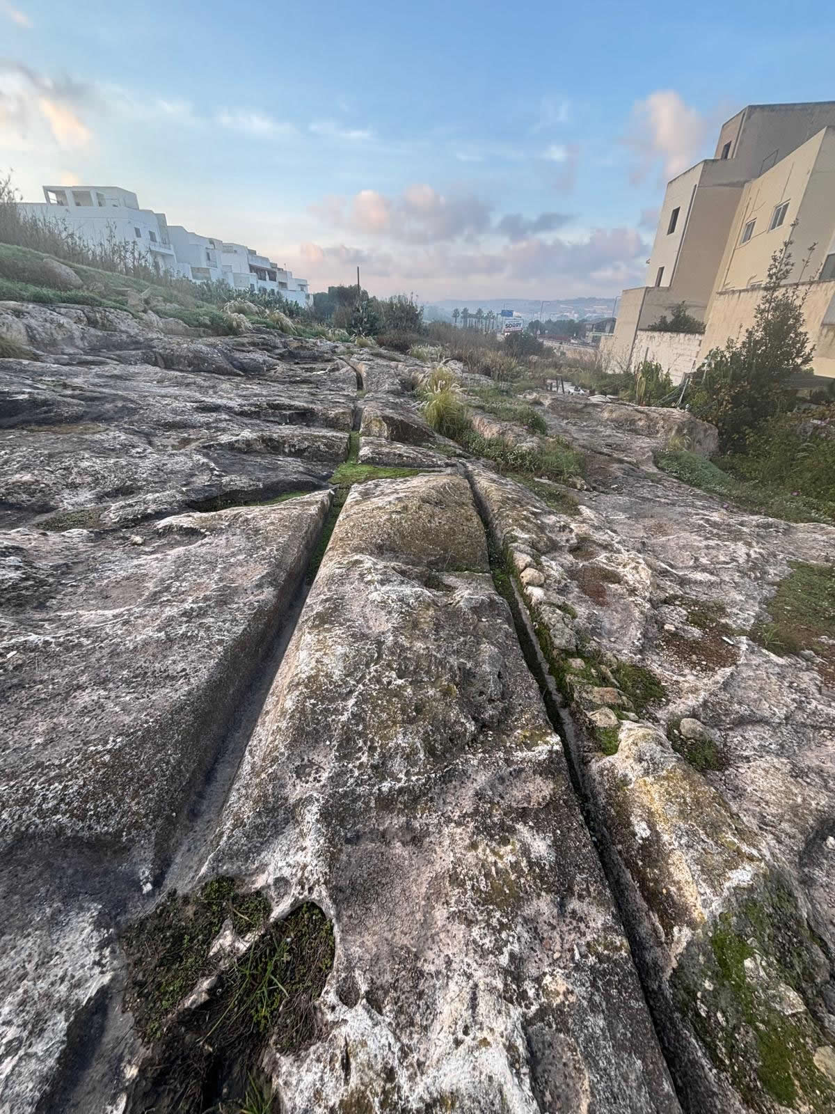
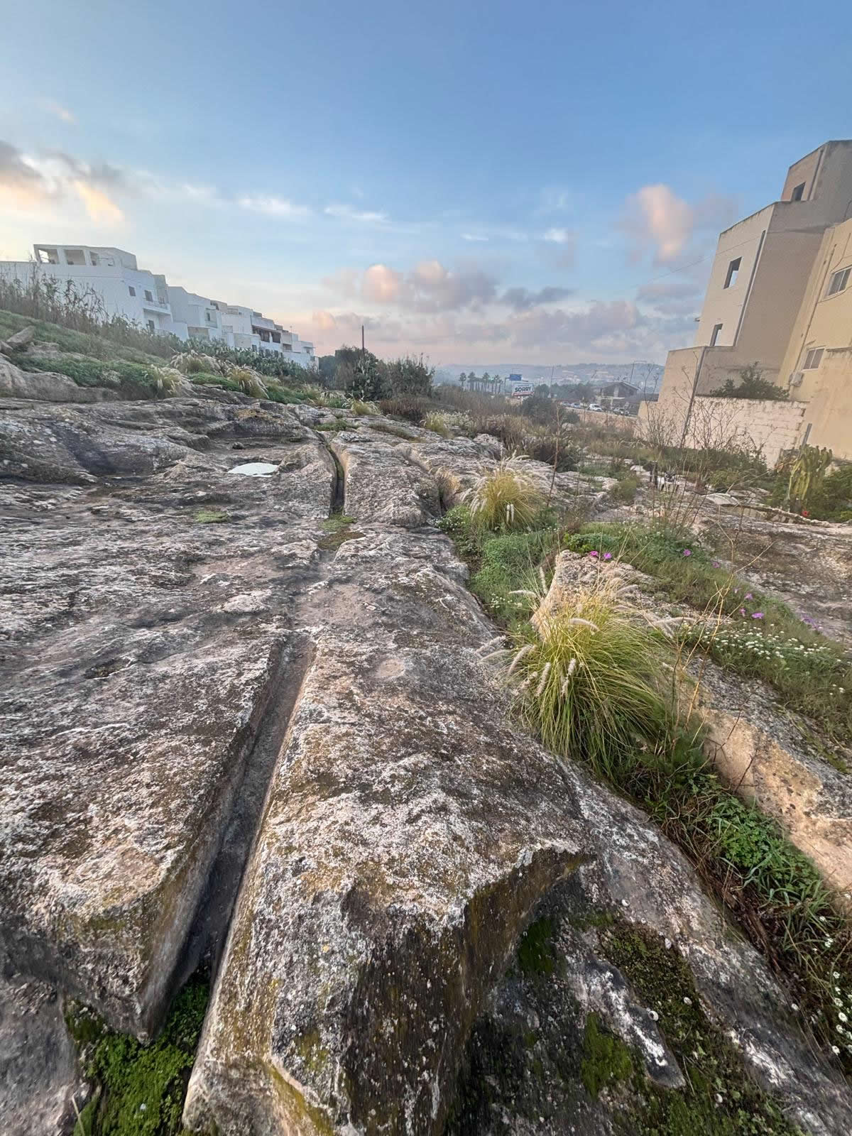
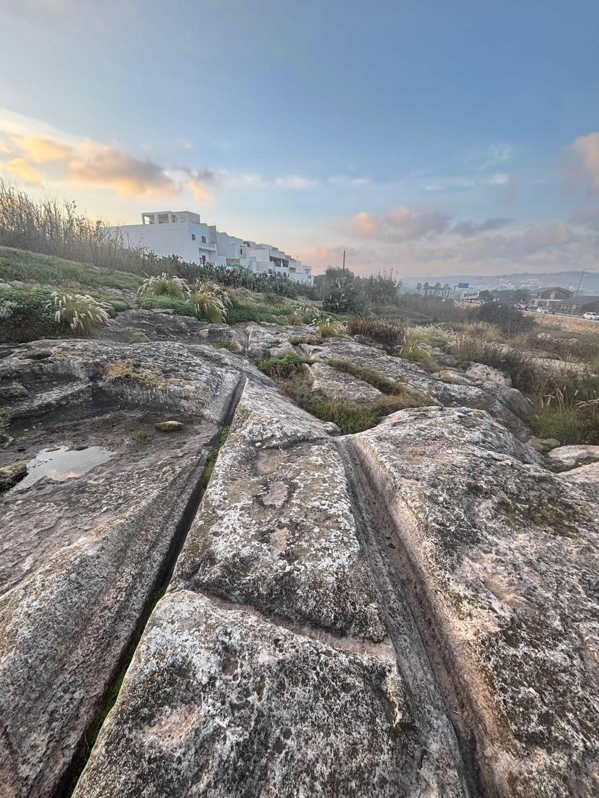
The Salini Cart Ruts are a small but significant group of parallel rock-cut grooves located in the Salini area within the wider Naxxar locality in northern Malta. Like other cart ruts found across the Maltese Islands, they are cut directly into the limestone bedrock and form part of one of Malta’s most distinctive and debated archaeological phenomena.
Location and setting
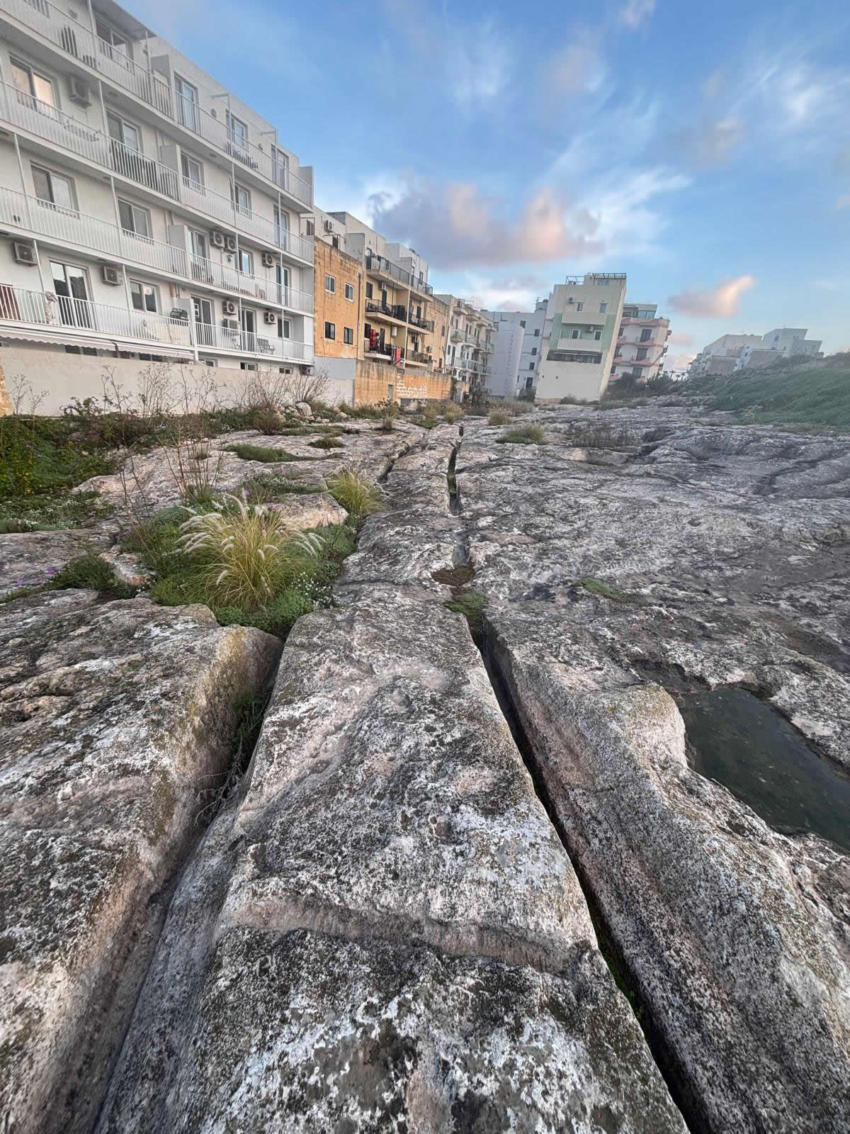
These cart ruts are found at coordinates 35.946181, 14.424705, in a landscape that has seen continuous human activity from prehistory through to modern times. The Salini corridor connects inland areas of Naxxar with the coast and Salina Bay, making it a logical zone for repeated movement, transport, and later development.
What are cart ruts?
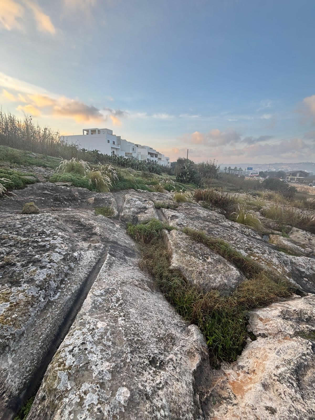
Cart ruts are pairs of parallel grooves carved into rock surfaces. In Malta, they range from shallow impressions to deep channels, often branching, intersecting, or running for considerable distances. Their spacing is frequently consistent, suggesting repeated use along defined routes.
History and landscape context
The Salini cart ruts form part of a wider network recorded in the Naxxar and Salina Bay area. Surveys of this locality have noted multiple rut pairs, some appearing only after vegetation clearance or construction activity revealed the underlying bedrock. This demonstrates how much of Malta’s cart-rut landscape may still be hidden beneath soil or modern surfaces.
Importantly, the surrounding landscape has changed substantially over time. Quarrying, agriculture, erosion, and modern development have altered ground levels and visibility, meaning that what survives today is likely only a fragment of a more extensive system.
Dating and interpretation
One of the central challenges with the Salini cart ruts—like all Maltese cart ruts—is dating them with certainty. No direct dating method exists, and scholars rely on landscape context and association, which can be misleading in areas occupied over long periods.
Proposed explanations include their use as transport routes, quarry-related haulage tracks, or deliberately cut guides to stabilise vehicles or sledges. Many modern researchers now favour a multi-phase interpretation, where ruts may have been created, reused, and modified across different periods rather than belonging to a single moment in time.
Visiting the Salini cart ruts
- Wear sturdy footwear due to uneven limestone surfaces.
- Take care near roads and modern structures.
- Do not mark, cut, or damage the ruts.
- Early morning or late afternoon light makes the grooves easier to see.
Related cart-rut sites
The Salini ruts are best understood as part of Malta’s island-wide cart-rut phenomenon. Other notable concentrations can be found in central and southern Malta, each showing different patterns of layout and preservation.