Location Map Coordinates 35.945742, 14.375038
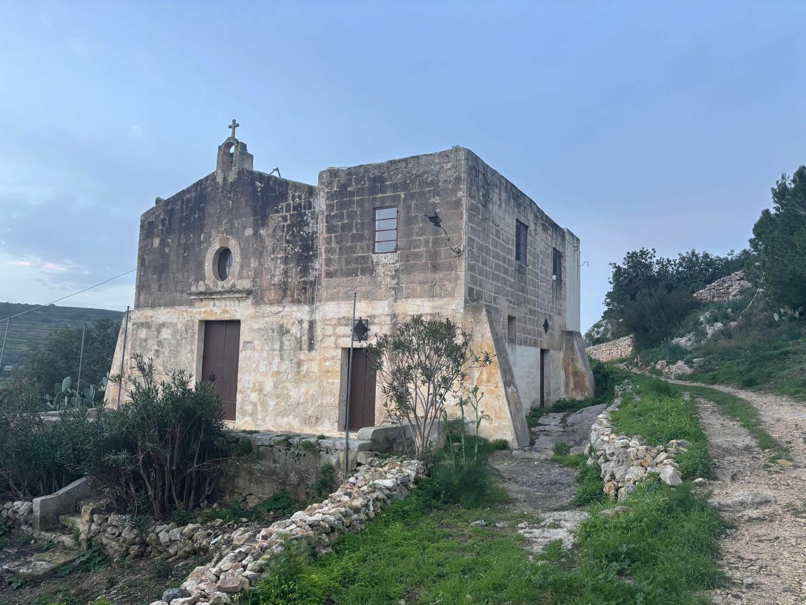
A secluded countryside chapel perched above Wied tal-Pwales near Xemxija (north Malta). Its story spans medieval settlement, rebuilding in the 1600s, periods of abandonment, wartime-era community life, and modern volunteer-led care. Coordinates: 35.945742, 14.375038.
Overview
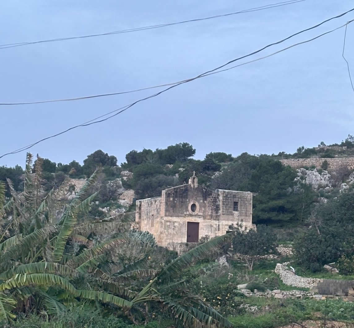
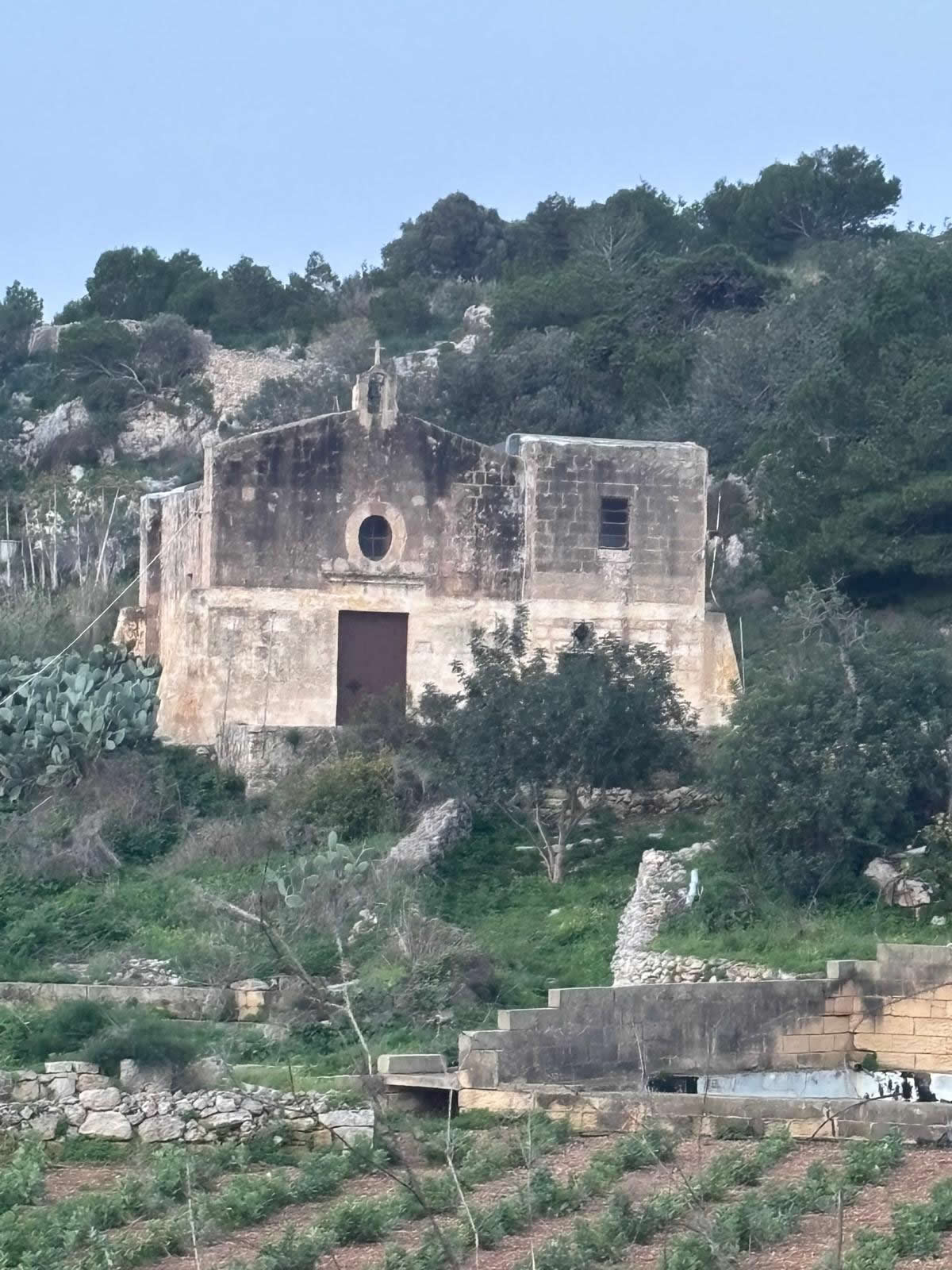
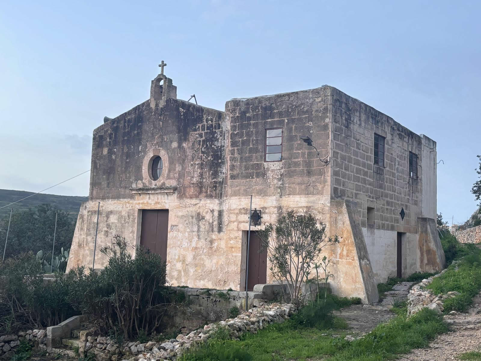
The chapel sits on elevated rock within the valley landscape, partly sheltered by surrounding slopes and carob trees. It is commonly referred to as Sant’ Anna ta’ Pwales, reflecting its setting in the Pwales area and its dedication to St Anne.
- Layered history: medieval chapel traditions, 17th-century rebuilding, and later rededication.
- Rural identity: a chapel historically serving farmers and scattered valley residents.
- Living heritage: maintained by volunteer stewardship and opened for services and feasts.
History and key dates
Medieval settlement and early chapels
Historical writing on the chapel places it within a wider medieval landscape of small hamlets and chapels in the Mellieħa district, including Pwales. The chapel is linked to an earlier dedication to the Nativity of the Virgin Mary, and appears in early mapping as Santa Maria tal-Pwales.
1575: recorded in Dusina’s Apostolic Visitation
In the Apostolic Visitation of 1575 by Monsignor Pietro Dusina, the chapel is described as dedicated to the Nativity of Mary and apparently in good condition (no particular negative remarks recorded).
1672: rebuilt and blessed
The chapel was rebuilt in 1672 and blessed by Bishop Lorenzo Astiria on 1 July 1672. A benefice is documented in notarial acts connected to Pwales lands to support liturgical obligations on the feast.

1731: decline and profanation
During a pastoral visit in 1731, the chapel was found in a very poor state and was again profaned. It was later blessed again (about four decades afterwards) and returned to use.
1798: damage during the French period
In 1798, the chapel suffered theft and vandalism during French attacks on churches; the titular painting (then connected to “Vittorja”) was reportedly slashed. After the French were expelled, a new titular image was installed depicting St Anne and St Joachim, and from then on the chapel became known as St Anne’s.
19th–21st centuries: community use and renewed care
Later accounts describe the chapel continuing to serve local rural communities—especially farmers—and being cared for by individuals and groups. In the early 2000s, restoration and structured volunteer stewardship strengthened its condition and regular use.
- Late 13th–early 14th century: early chapel on/near the site linked to medieval settlement.
- 1575: Dusina visitation records dedication to the Nativity of Mary.
- 1672: rebuilt; blessed on 1 July 1672.
- 1731: found in poor condition; profaned; later returned to use.
- 1798: theft/vandalism during French period; later rededicated in popular usage to St Anne.
- 1860: titular artwork described/attributed to Dun Ġużepp di Stefano (St Anne, St Joachim, and Mary as a child).
- 2004: restoration publicly marked; voluntary association involvement noted.
When was it probably built?
The most accurate public-facing way to state the chapel’s “build” is as a multi-phase site:
- Probably first established: late 13th or early 14th century (as a rural chapel in the Pwales area).
- Present structure: rebuilt in 1672 and blessed on 1 July 1672.
“Medieval origins (late 13th–early 14th century); rebuilt and blessed in 1672; later popularly known as St Anne’s Chapel.”
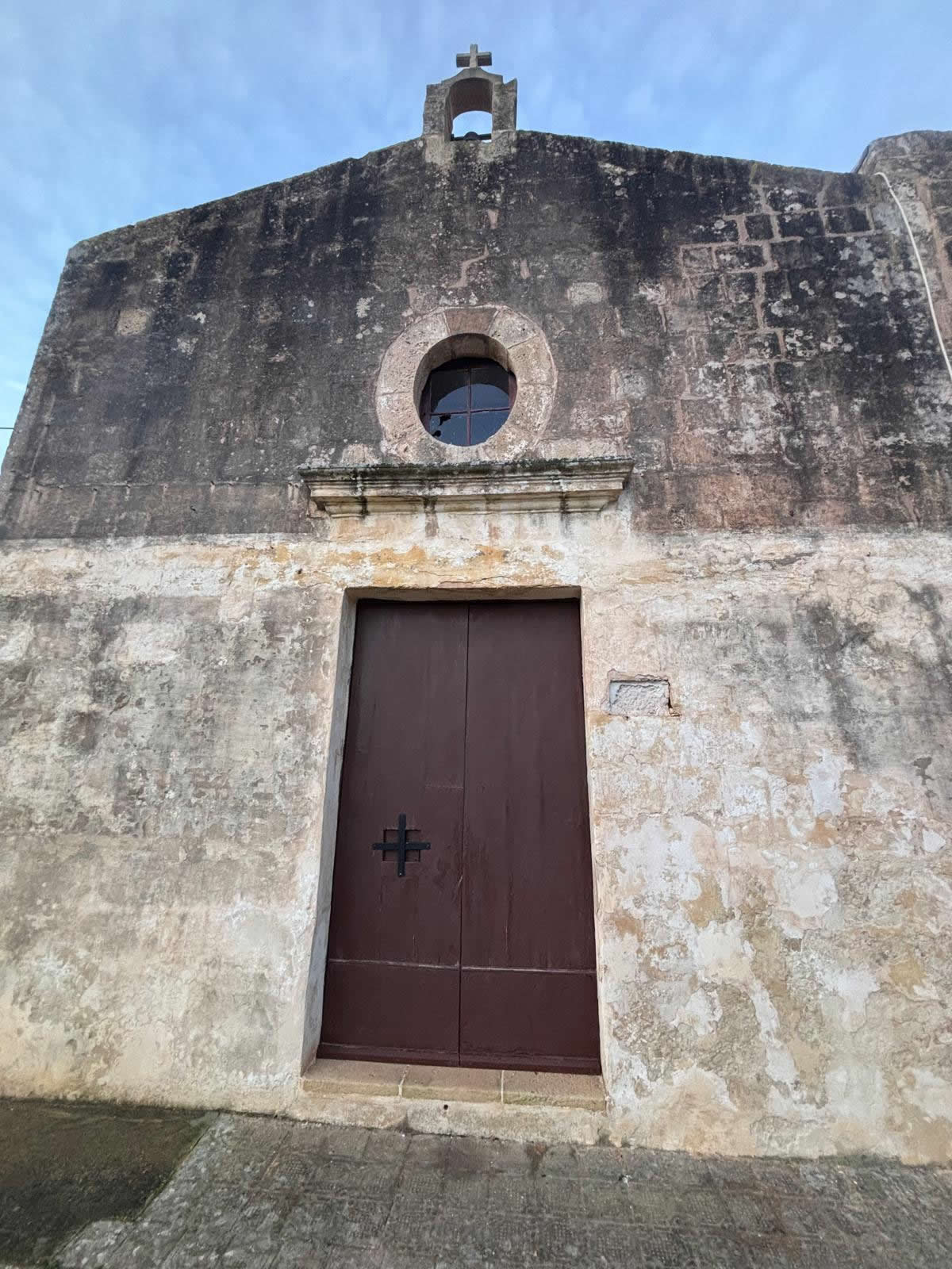
Architecture and features
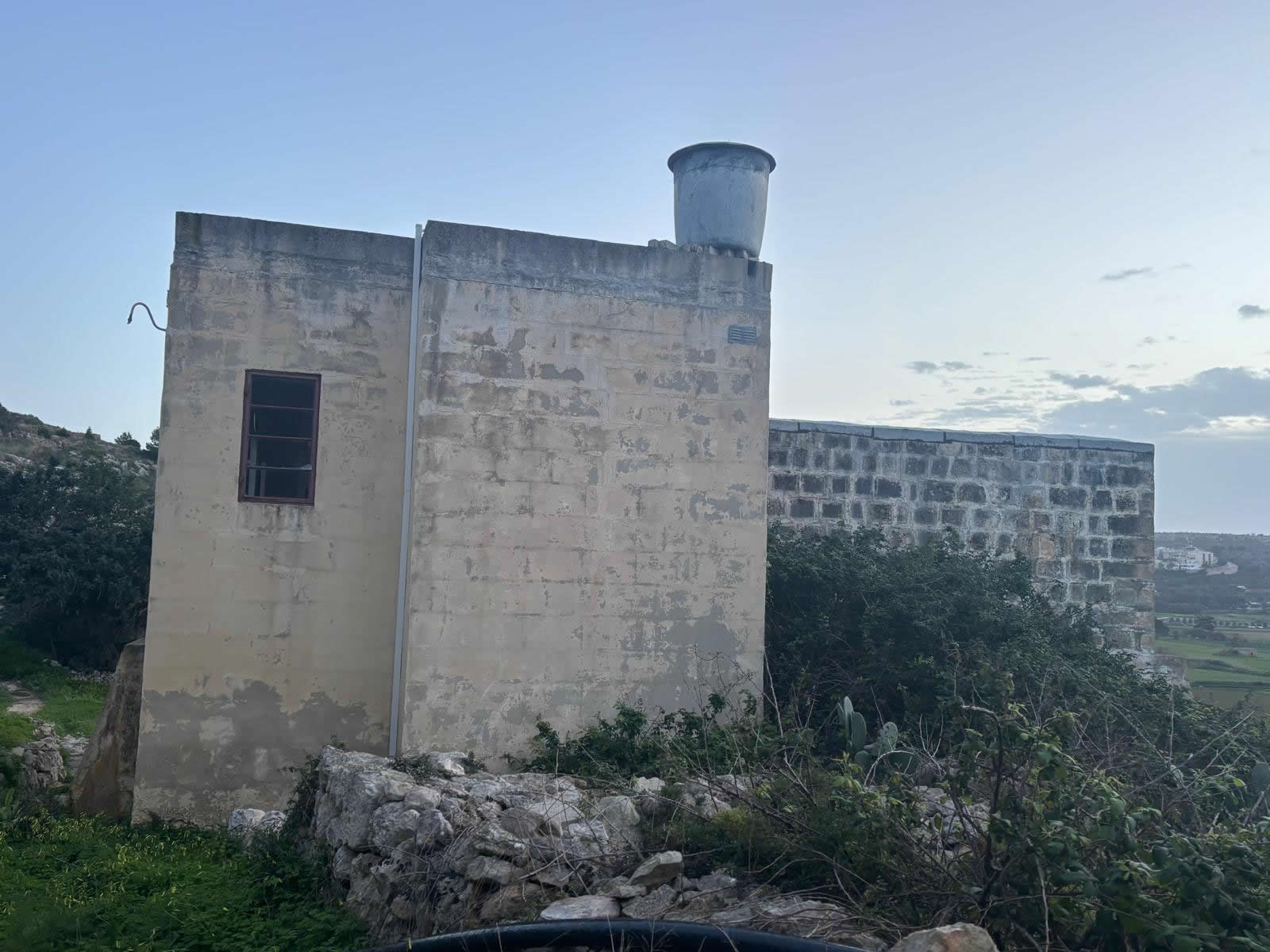
The chapel is a modest limestone countryside structure designed for small gatherings, with a simple façade and a small forecourt (zuntier) often used for outdoor services when needed. Inside, descriptions note an original altar and later additions, with devotional art focusing on St Anne.
Tip for photographers: late afternoon light often flatters the stonework and valley backdrop.
Use: then and now
Historic use
- Wayside worship: serving dispersed rural households and farmers in Pwales and nearby slopes.
- Cycles of disuse: periods of abandonment and return, influenced by security and settlement changes.
- Feast traditions: documented obligations and later revival of St Anne’s feast celebrations.
Current use
Today the chapel is cared for through volunteer stewardship and is opened for religious services (often monthly, depending on organisers), as well as annual feast-related events.
- Respect surrounding fields, rubble walls, and gates (parts of the area are agricultural).
- Leave no litter and avoid candles unless explicitly permitted during organised services.
- Do not climb or tamper with stonework or any fixtures.
Visiting information and map
Coordinates: 35.945742, 14.375038 (Pwales Valley near Xemxija).
Trail note: approaches often use countryside paths from the Xemxija / Pwales side—wear good shoes, especially after rain.
FAQ
Is this chapel “in Xemxija” or “in St Paul’s Bay”?
It is physically close to Xemxija and Pwales Valley, and is often described as “near Xemxija” while also falling within the wider limits historically associated with the San Pawl il-Baħar area. In visitor terms, “Xemxija / Pwales Valley” is the clearest locator.
What makes its history distinctive?
Few rural chapels have such clearly stated phase changes: an early medieval presence, a 1672 rebuild, documented 18th-century decline, 1798 damage, and a later shift in popular dedication to St Anne.
Is it always open?
Not many countryside chapels open only for scheduled services or special occasions. Plan to visit for exterior viewing unless you know of a service.
© emalta.com • Explore more chapels in Malta