📍 Location
Location Map Coordinates 35.879363, 14.553666
A little-known but striking heritage remnant: the ruined remains of a small rural place of worship dedicated to Saint Leonard in Xgħajra. Coordinates: 35.879363, 14.553666.

When it was built
Detailed history
Why it became ruins
Restoration & conservation
Use today
Visiting & map
FAQ
Overview
This site is locally referred to as Knisja ta’ San Leonardo—literally “Church of St Leonard”—but its scale and setting align more closely with Malta’s tradition of small countryside chapels: modest structures serving a local devotional focus, often linked historically to nearby farmland and rural routes.
In Maltese writing, knisja can be used broadly for a place of worship, including chapels. Because this site is not a parish church and is currently ruins, emalta.com classifies it under chapels while acknowledging its common “church” name.
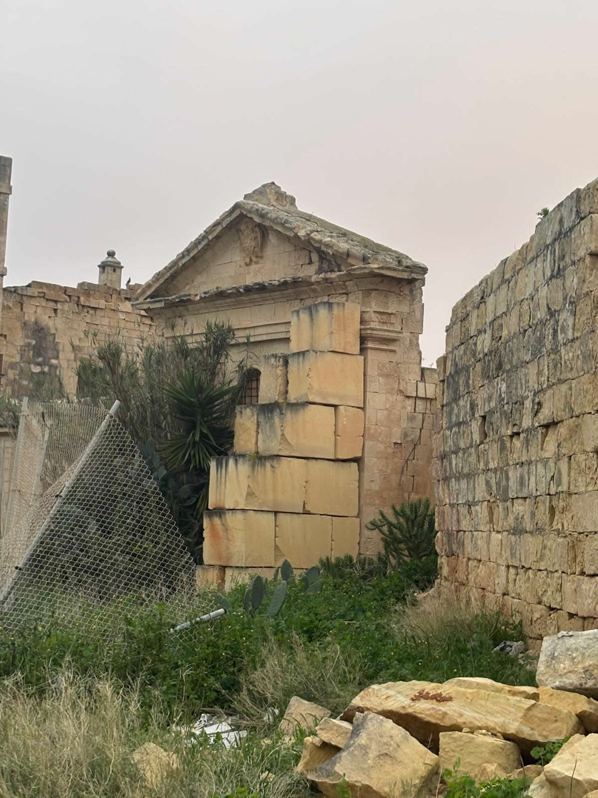
When it was probably built
Probable build period (best public wording): 17th century, commonly cited as 1656. Because the structure survives only as ruins and widely accessible official inventory details are not currently available, this page uses a careful phrasing: “probably 17th century (often dated 1656)”.
Editorial note for emalta.com: if you later obtain an official inventory card, parish archive note, or inscription evidence, update this section with the primary source and keep “1656” as a secondary “commonly cited” date.
Detailed history
Saint Leonard in Maltese devotion
Saint Leonard is a well-established figure in Western Christian devotion, particularly associated with rural communities and popular piety in early modern Europe. In Malta, dedications to saints beyond parish patrons often appear in the countryside as smaller chapels serving farming zones or outlying clusters.
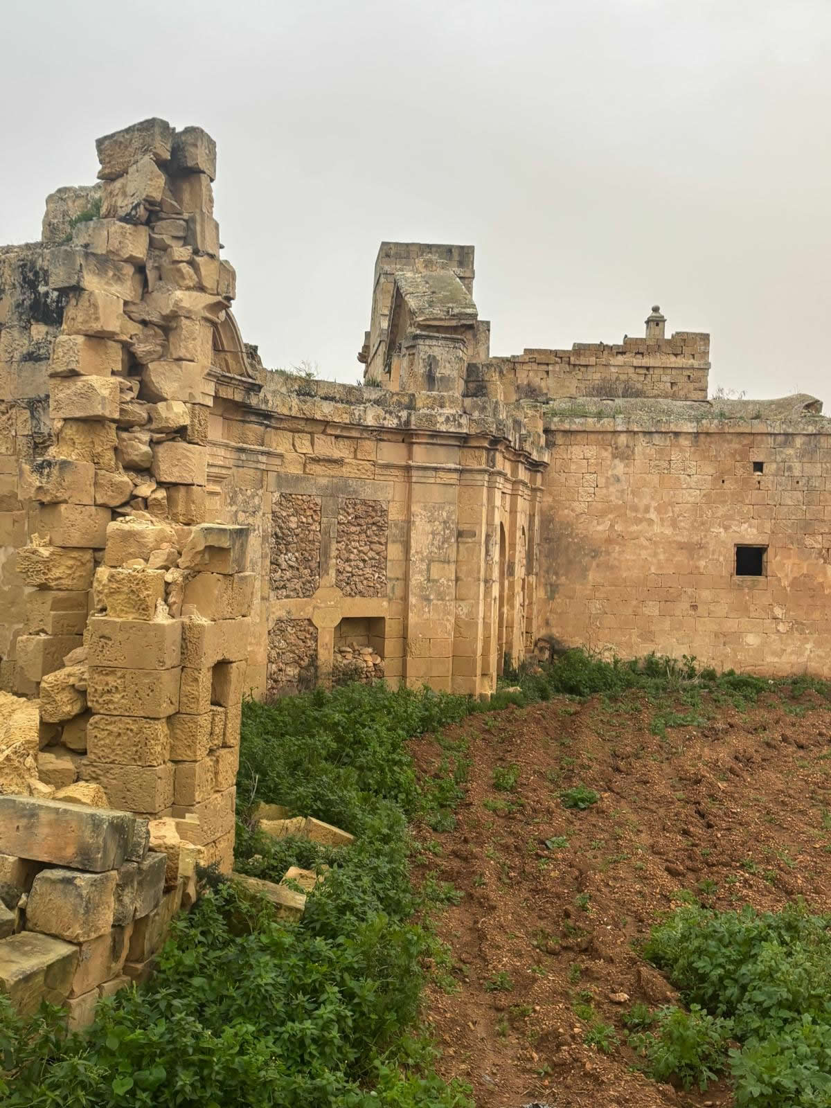
A rural place of worship in an evolving landscape
The chapel’s likely 17th-century date places it in the period when many small Maltese chapels were built, rebuilt, or endowed as communities expanded and devotional practices became more formalised. Even where chapels were privately maintained, they often acted as seasonal prayer points and processional stops rather than full-time churches.
From functioning chapel to abandoned fabric
Over time, small rural chapels can fall out of use as settlement patterns shift, parochial structures consolidate, and maintenance becomes difficult. Once roof coverings fail, water penetration accelerates collapse—turning a building into ruins within decades if repairs are not carried out.
Why it became ruins
The exact “moment of ruin” is often hard to pin down without a dedicated archival record. However, the general pattern in Malta is clear: reduced use, loss of upkeep funding, and exposure to the elements. Ruins can also be affected by stone reuse, land reconfiguration, and informal alterations over long periods.

Restoration and conservation
Because this site is currently a ruin, “restoration” generally means conservation: stabilising masonry, controlling vegetation, improving drainage, and preventing further loss—rather than rebuilding the structure.
In recent years, Maltese localities (including Xgħajra) have participated in national schemes funding the restoration of heritage sites such as chapels, niches, monuments, and historic structures. These initiatives show a pathway for future conservation of fragile sites like the St Leonard ruins when proposals and funding align.
- Remove invasive vegetation from joints under professional supervision.
- Stabilise loose stones and cap wall tops to reduce water ingress.
- Improve runoff drainage to prevent undercutting of foundations.
- Add discreet interpretation signage (history + safety) without harming fabric.
Use today
Today the site functions primarily as a heritage landmark—a visible trace of Xgħajra’s older religious landscape. Because it is in ruins, it is not used as a normal chapel for services; its modern value is cultural and educational: a stop for heritage walks, local memory, and landscape history.
Visiting and map
Coordinates: 35.879363, 14.553666
Tip: paste the coordinates into your maps app: 35.879363, 14.553666.
FAQ
Is this a church or a chapel?
Best description: a small rural chapel (often called a “church” in general usage). Maltese knisja can refer to both. It is not a parish church, and the structure is currently ruins.
When was it built?
It is safest to publish: “probably 17th century (often dated 1656)”, reflecting the most commonly cited date in available references.
Can it be restored?
Full rebuilding is unlikely or undesirable for heritage authenticity. The best approach is conservation: stabilisation, vegetation control, and interpretation so the ruins can survive safely and meaningfully.