Overview
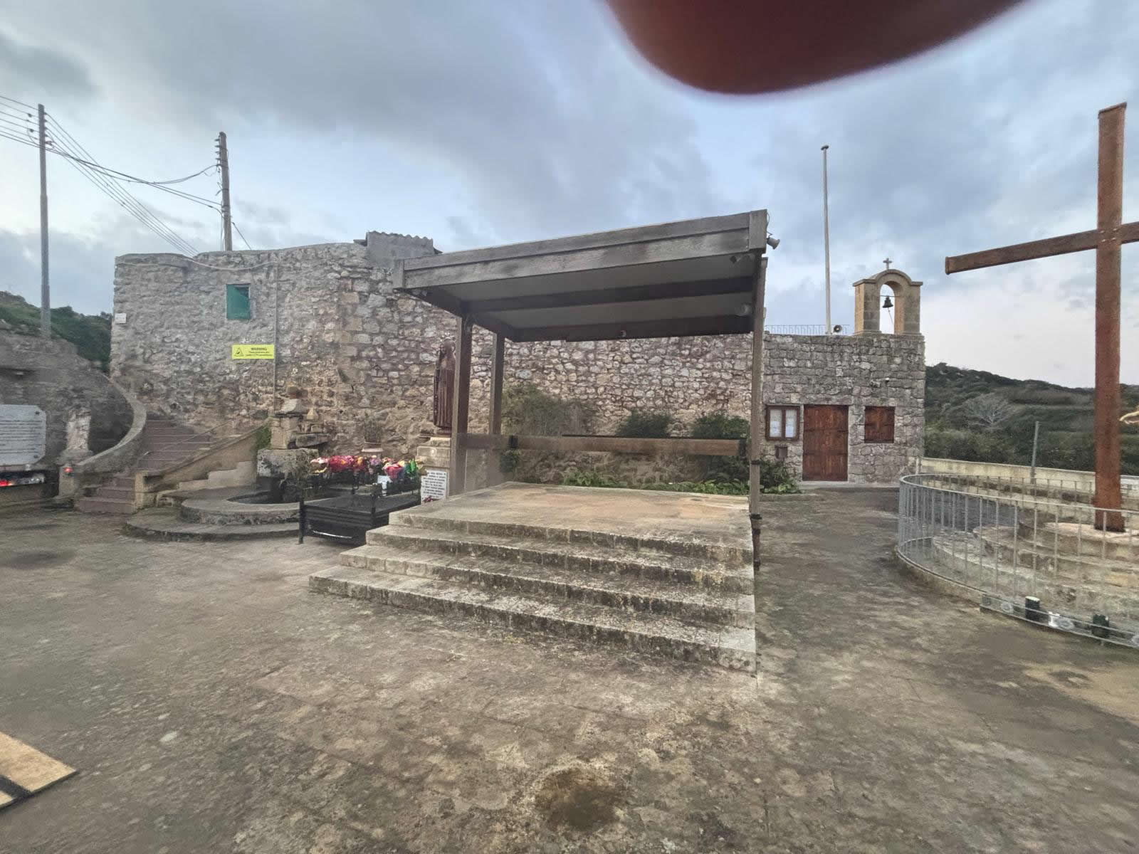
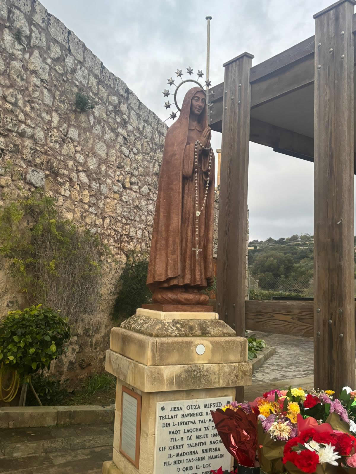
Girgenti is a rural area close to Siġġiewi, known for its valley landscape and countryside paths. Accounts describing Our Lady of Girgenti present the location as a devotional focal point established in the late 20th century, with a statue erected close to the place where apparitions were reported.
Location & coordinates
- Coordinates:
35.853152, 14.410994 - Locality: Siġġiewi (Girgenti area), Malta
- Setting: countryside valley side, best approached on foot with care around rural roads

Key dates (development, additions, and use)
These dates are taken from published accounts describing the shrine’s development and additions.
- 1950s (reported) — visions of Our Lady are claimed to have been experienced in Siġġiewi.
- 1983 — accounts state that the visionary disclosed earlier experiences, and later described an apparition in the Girgenti valley.
- 5 May 1986 — a commissioned statue is stated to have been placed at Girgenti.
- 1987 — a committee/movement is described as being founded, continuing to organise prayer meetings.
- May 1988 — a stone water trough is described as added to the site and blessed.
- May 1992 — a large timber cross is described as erected at the shrine.
- February 1993 — statue of St Michael is described as blessed and installed.
- November 1995 — statue of St Joseph is described as erected at the shrine.
- 28 October 1996 — death of the visionary is reported in the account; the committee continues organising meetings.
- May 2007 — weathered cross described as replaced; the original conserved elsewhere.
- 7 June 2009 — a statue of the Suffering Christ is described as blessed at the shrine.

History & devotional context
Accounts of the site describe a personal devotion centred on Mary under the title Il-Madonna tal-Girgenti, with prayer meetings and a developing outdoor shrine incorporating devotional statuary and symbolic elements over time.
Note: reported visions/apparitions are matters of personal belief. This page documents the site history as described in published accounts.
Construction and additions
Rather than a single “build date” like older chapels, the Girgenti site is described as a shrine that expanded through successive additions—statue placement (1986), water trough (1988), cross (1992; replaced 2007), and further devotional statuary (1993, 1995, 2009).
Restoration, conservation & safeguarding
Published accounts emphasise replacement of elements affected by weathering (notably the timber cross replaced in 2007), illustrating a practical conservation approach for an outdoor devotional site.

Current use (prayer meetings)
The site is described as administered by a committee and hosting regular prayer meetings, reported as taking place on the first and third Sunday of each month (with additional private meetings at other times).
Visiting tips
- Bring water and sun protection—this is an exposed countryside location.
- Stick to existing paths and avoid trampling vegetation or field edges.
- After rain, limestone and clay soil can be slippery—wear grippy footwear.
Link this page to your chapels cluster
Replace these placeholders with your real Emalta chapel URLs to strengthen internal linking and topical authority:
- All chapels in Malta (hub)
- Kappella ta’ San Blas (Siġġiewi)
- Our Lady of Hodegetria (Itria) Chapel
- Siġġiewi village guide
FAQ
- Is this an indoor chapel?
- Published descriptions focus on an outdoor shrine/chapel area developed from 1986 onward, with multiple devotional features added over time.
- What’s the best way to navigate here?
- Use the coordinates
35.853152, 14.410994in your map app.