Cart Ruts near Sannat, Gozo
Cart Ruts in Sannat, Gozo (Ta’ Ċenċ Plateau)
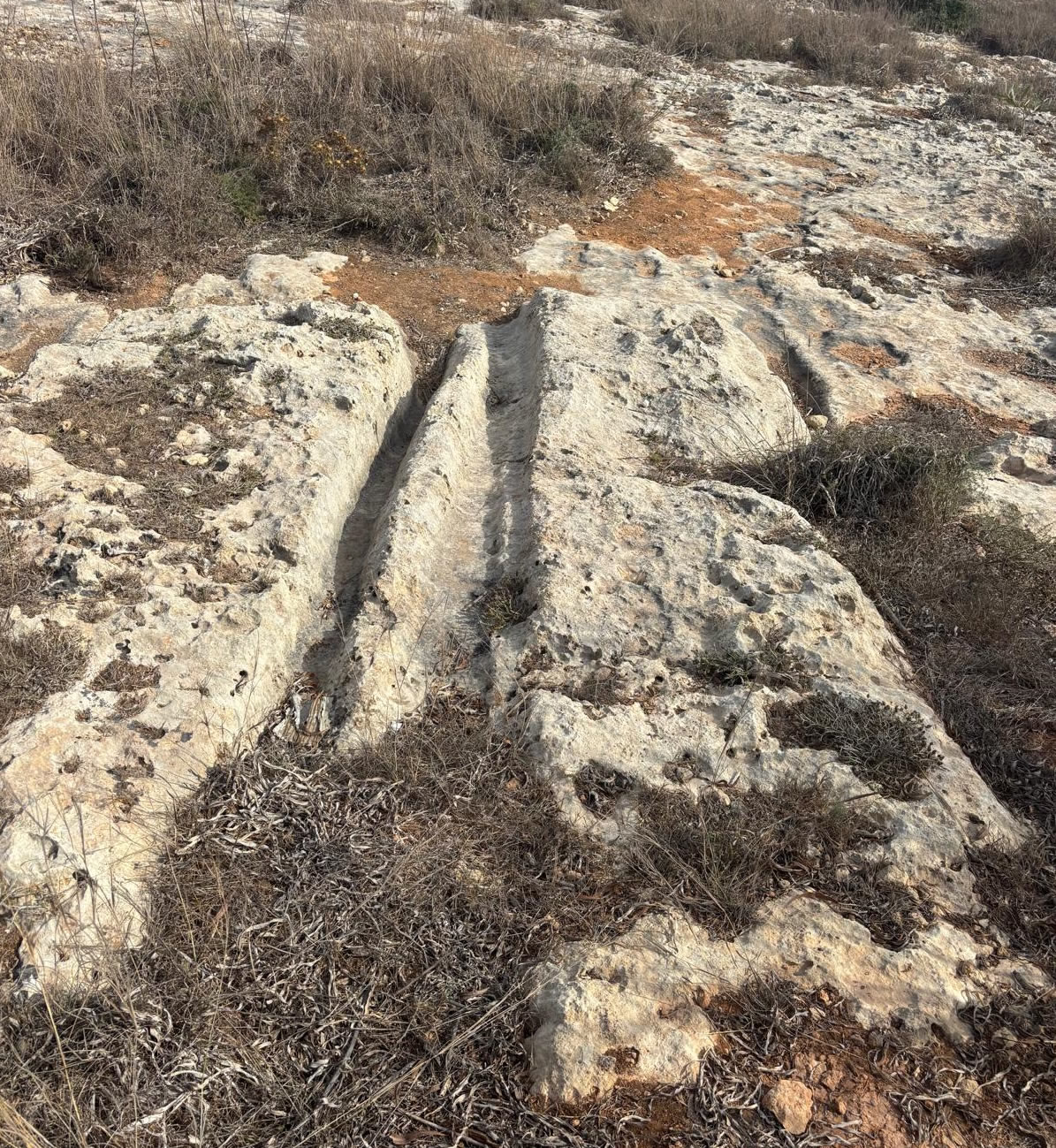
What Are Cart Ruts?
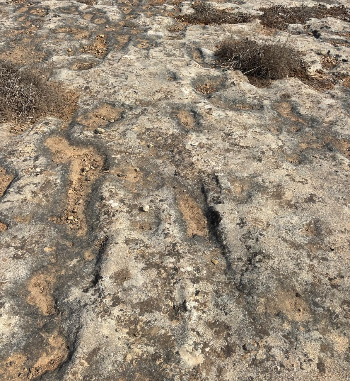
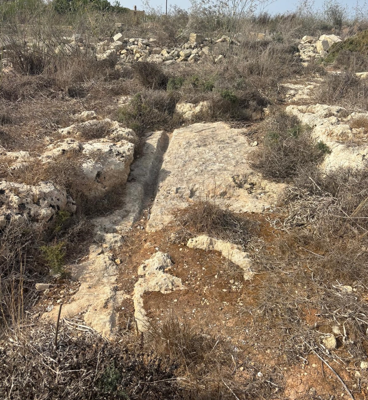
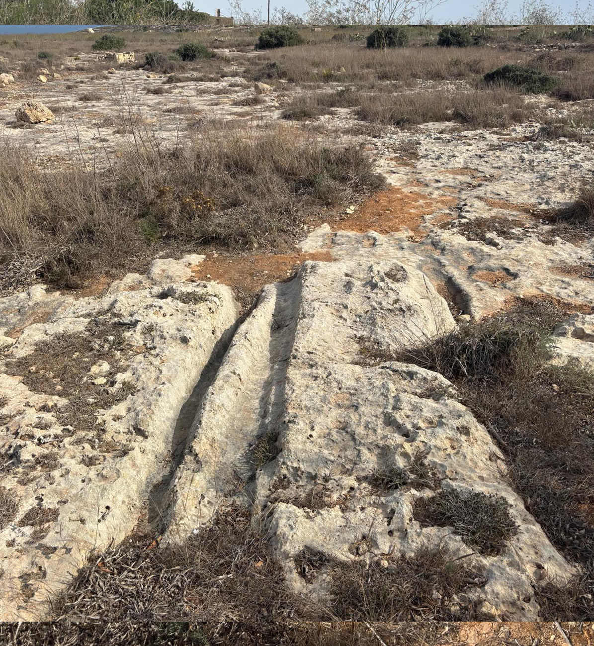
Cart ruts are parallel grooves cut into the limestone bedrock.
They typically measure:
Width between ruts: \~1.4 m (varies slightly).
Depth: ranges from shallow (a few cm) to deep (up to 60 cm).
They are found across Malta and Gozo (over 150 sites), with famous examples at Clapham Junction (Rabat, Malta) and Ta’ Ċenċ (Sannat, Gozo).
Sannat / Ta’ Ċenċ Cart Ruts
Location: On the Ta’ Ċenċ plateau, near the Sannat dolmen and prehistoric standing stones, overlooking the southern cliffs of Gozo.
Visibility:
The ruts run across the flat rock surface, sometimes intersecting.
Some head directly towards the cliff edge, which suggests the landscape has changed since they were cut (erosion, cliff collapse, or sea-level rise).
Associated Sites:
Found close to Bronze Age dolmens and other prehistoric remains.
This indicates the Ta’ Ċenċ plateau was an important settlement and ritual area.
Theories on Function
The purpose of cart ruts has been debated for centuries. Leading theories include:
1. Transport Tracks – possibly made by wooden carts with stone wheels, repeatedly wearing into the limestone.
Counterpoint: Many ruts go nowhere, split, or lead to cliffs.
2. Quarrying / Stone Transport – used to move large stone blocks from quarry sites to construction areas.
3. Irrigation Channels – less likely, as they don’t connect to reservoirs consistently.
4. Ceremonial / Ritual – some scholars argue they may have had symbolic or ritual uses, not purely practical.
At Ta’ Ċenċ, the association with dolmens suggests a ritual-funerary landscape, rather than just practical transport.
Dating
Cart ruts are notoriously difficult to date directly.
General scholarly consensus: Late Bronze Age (c. 2000–700 BCE) to Classical/Punic times (Phoenician/Carthaginian period, 800–200 BCE).
Since they are near Bronze Age dolmens at Sannat, it’s possible that the Ta’ Ċenċ ruts date from the Bronze Age.
Importance of the Sannat Ruts
They provide archaeological continuity with the dolmen and menhirs, showing Ta’ Ċenċ was a hub of activity over millennia.
The fact that some ruts lead towards cliffs might suggest that the plateau extended further in prehistory and that erosion later altered the landscape.
They are one of the most picturesque rut sites, with the backdrop of Gozo’s cliffs and the Mediterranean.
In summary:
The cart ruts of Sannat (Ta’ Ċenċ plateau) are Bronze Age to Classical-period trackways cut into the limestone. Found near dolmens, menhirs, and burial sites, they reinforce the idea that Ta’ Ċenċ was a key prehistoric and later ritual/settlement area. Their exact function remains uncertain, but they are part of Malta and Gozo’s wider cart rut network, one of the most enigmatic features of the islands’ archaeology.
Nearby points of interest
- Ta' Ċenċ Cliffs and lookout points
- Cart ruts and other low‑visibility megalithic markers on the plateau
- Sannat village attractions and dramatic coastal views
For any formal research, quote or citation, consult primary excavation reports and the National Inventory of the Cultural Property of the Maltese Islands (NICPMI) / Heritage Malta archives.