Here’s a full historical overview of Qalet Marku Tower, also known as Torri ta’ Qalet Marku and St. Mark's Tower one of Malta’s important watchtowers:
Qalet Marku Tower – Overview
History
Construction
Built in 1658 during the magistracy of Grand Master Martin de Redin.
Part of the series of 13 De Redin towers, which were later expanded to 16, forming a near-continuous ring of coastal surveillance posts.
The system aimed to spot corsair raids early and relay warnings inland and to Valletta.
Purpose
Served as a lookout and signaling post rather than a strong fortification.
Communication was by smoke signals (day) and fire beacons (night).
Its location was especially strategic, since the **Salina coast and St. Paul’s Bay** were vulnerable landing sites for raiders.
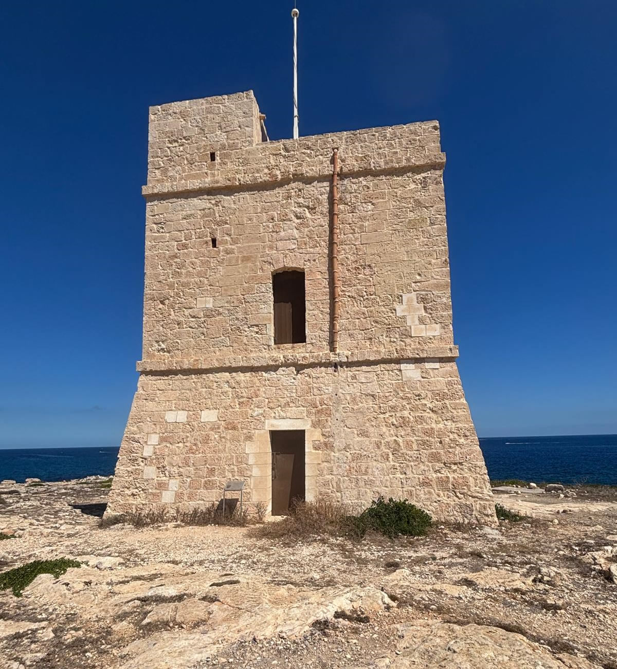
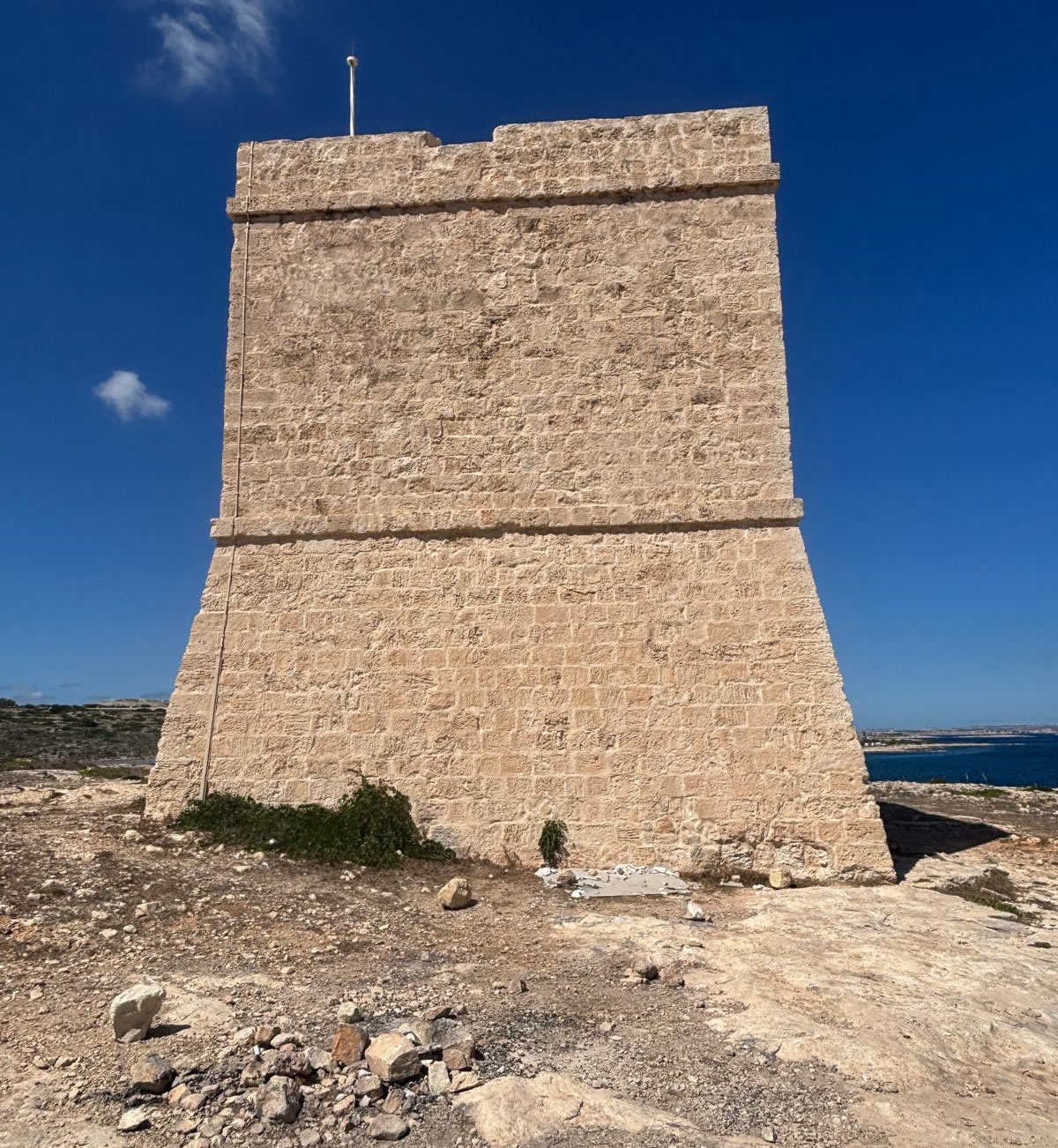
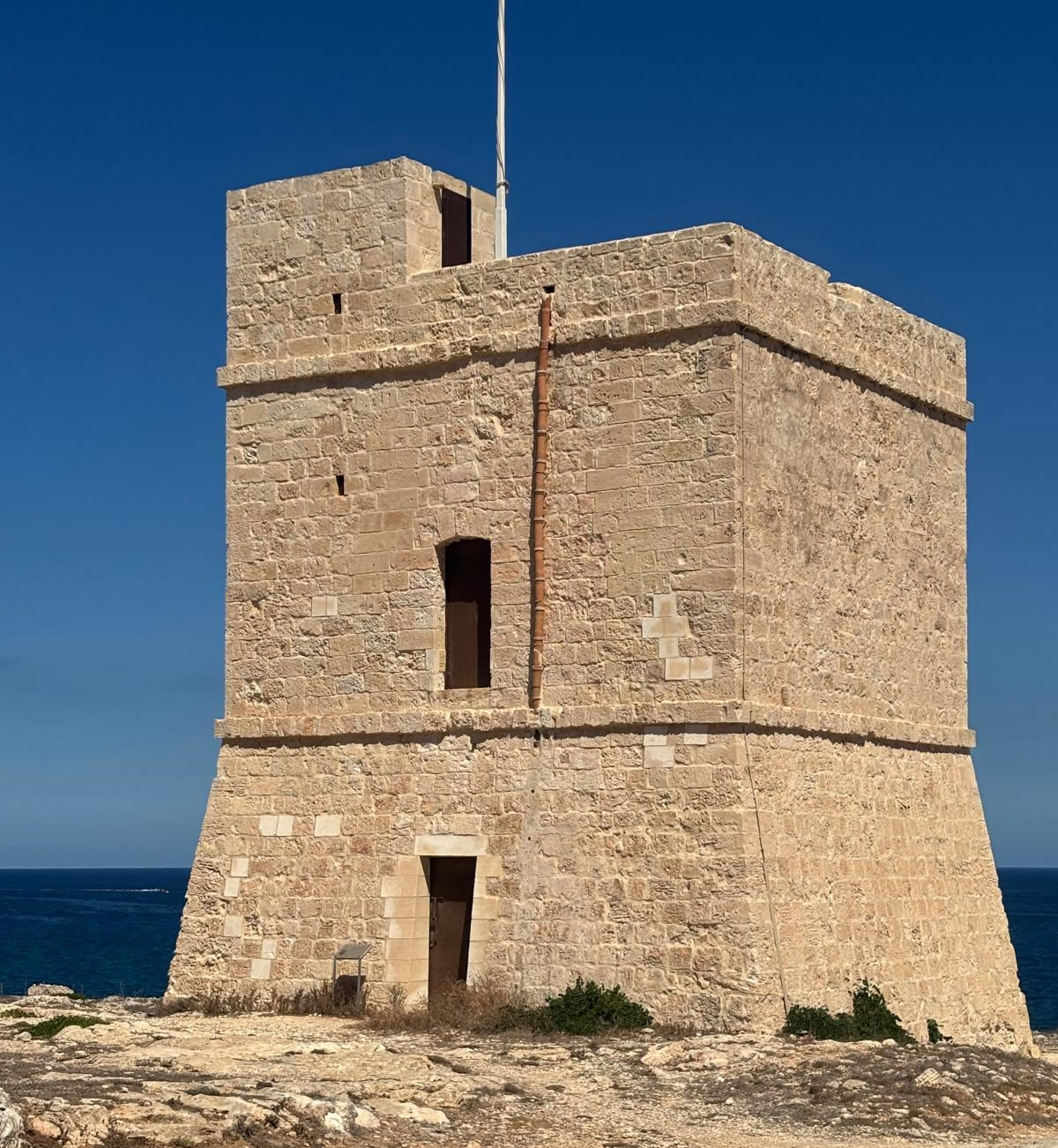
Architecture
Standard De Redin design, similar to Għallis Tower and others:
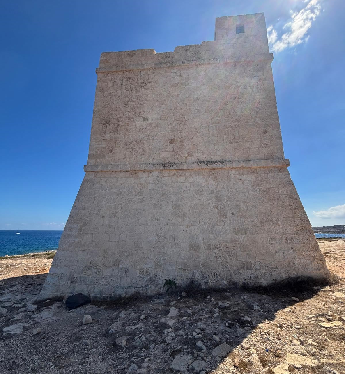
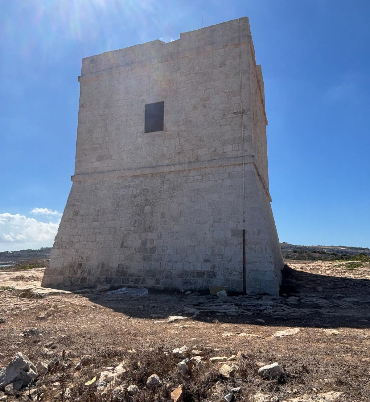
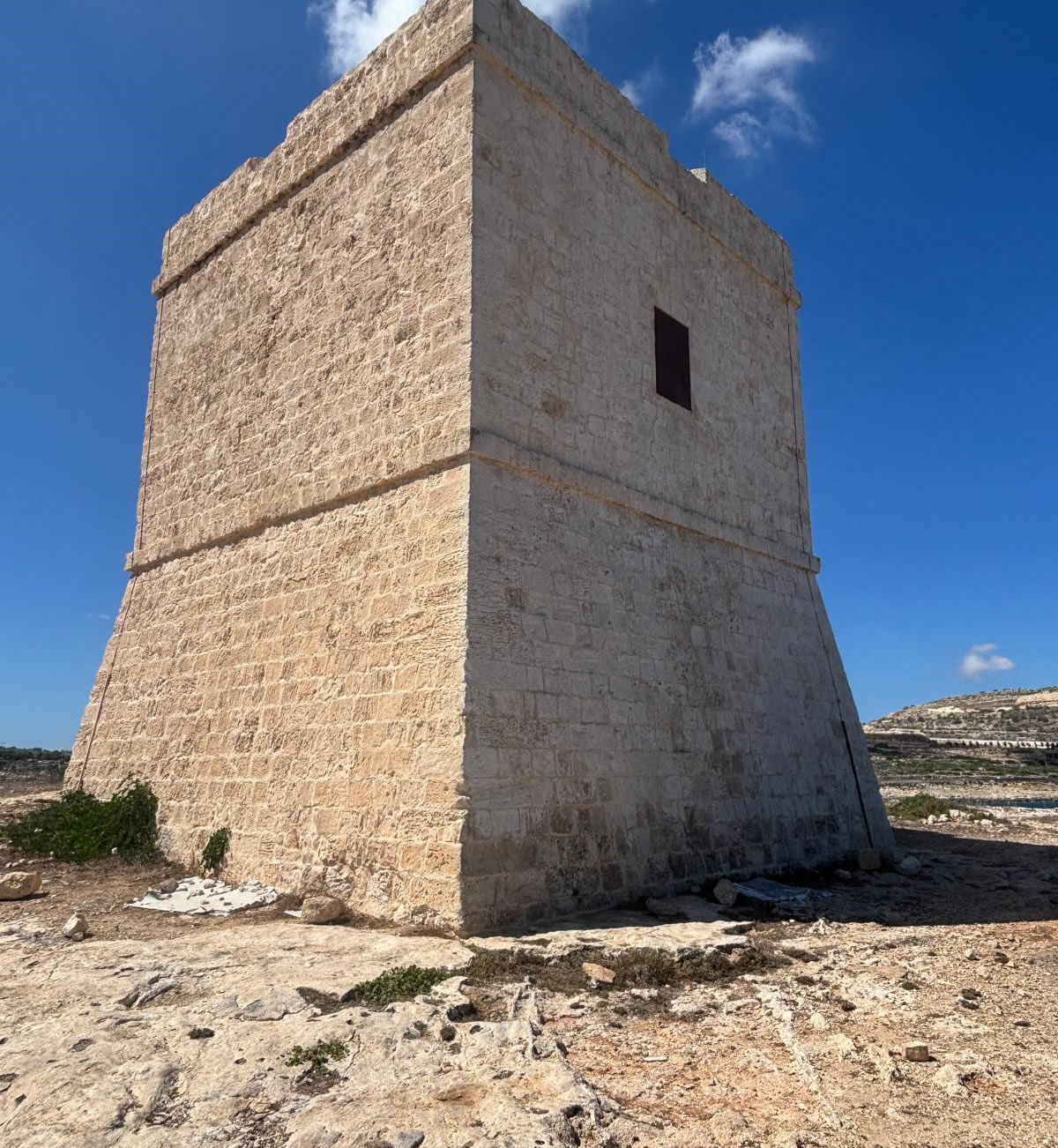
Square base, roughly 12 m wide.
Two storeys:
Lower level (storage), accessible only via trapdoor.
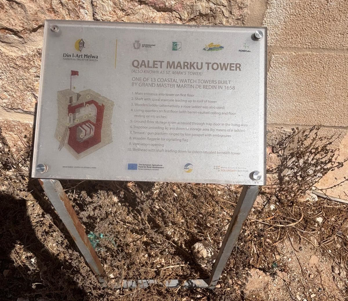
Upper level (guardroom), with a first-floor doorway.
Sloping scarped base** with vertical walls above.
Flat roof surrounded by a parapet, used for surveillance and signals.
Garrison: typically 4 men plus a *capo torriero* (chief gunner).
Could mount a small cannon for defense, but its role was primarily observation.
Later Use & Decline
18th century: Continued in use under the Order of St. John.
19th century (British era): Fell into disuse as newer military technologies (telegraphs, batteries, forts) took over
20th century:
By the mid-1900s, the tower was in a state of neglect and partial ruin.
The roof and sections of the walls collapsed.
Used as a landmark but not maintained.
Present day:
Ruined condition – unlike nearby Għallis and Madliena Towers, Qalet Marku Tower has not been fully restored.
The base and lower walls remain, but it is roofless.
Still recognisable and protected as a scheduled heritage site.
Current Significance
Despite its ruined state, Qalet Marku Tower remains an important example of the De Redin coastal defense system.
It illustrates the continuity of line-of-sight defense, positioned between Għallis Tower (west) and Madliena Tower (east).
Today, it is a point of interest for history enthusiasts and hikers exploring the Baħar iċ-Ċagħaq–Qawra coastline.
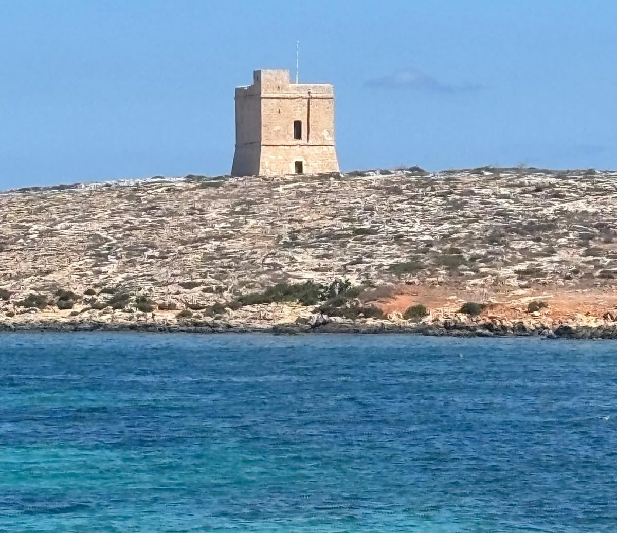
Location
Stands on the headland of Qalet Marku, between Baħar iċ-Ċagħaq and Salina Bay (northern Malta).
Coordinates: 35.946445, 14.453407.
Its position allowed it to oversee the channel between Malta and St. Paul’s Islands, and signal both Madliena Tower (to the southeast) and Għallis Tower (to the northwest).
Summary
Qalet Marku Tower (1658) was one of the De Redin towers, built to guard the vulnerable coast near Salina and St. Paul’s Bay. It followed the standard square-plan design with two levels and a rooftop beacon platform, manned by a small garrison. Unlike other towers, it fell into ruin and remains unrestored, but it still stands as a visible link in Malta’s 17th-century coastal defense chain.