Overview
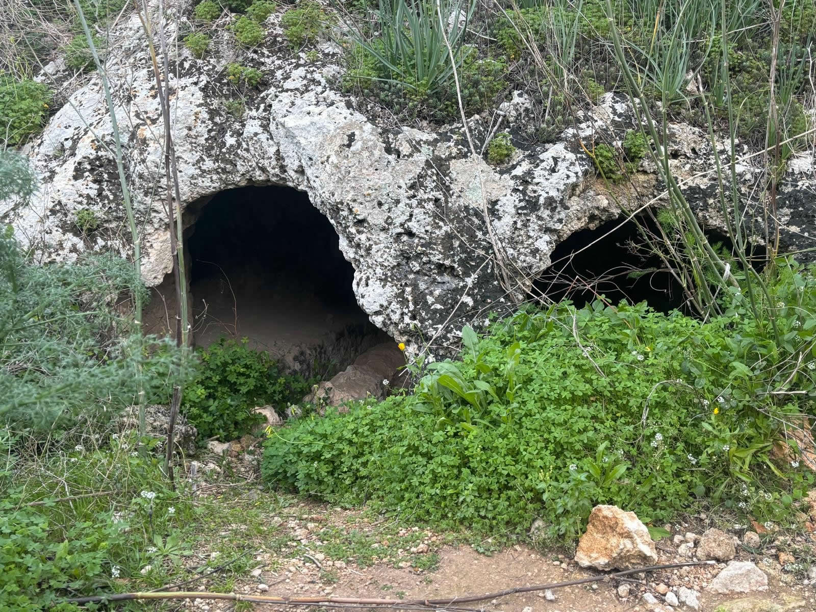
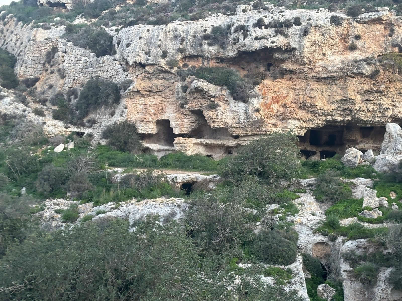
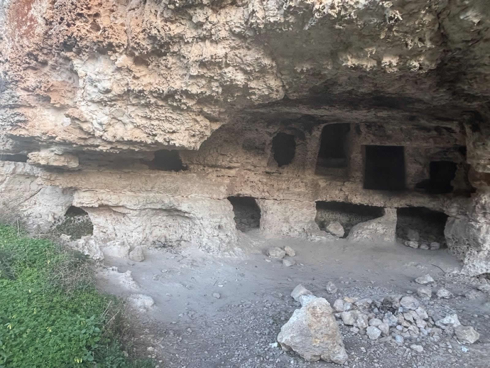
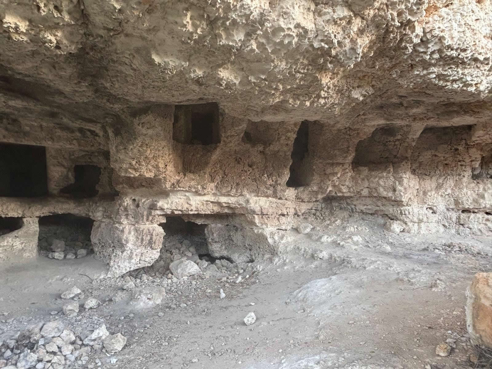
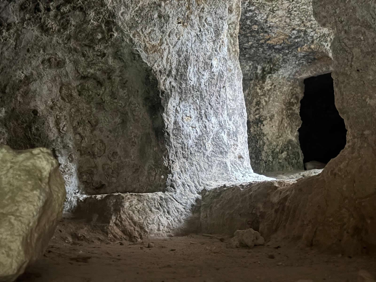
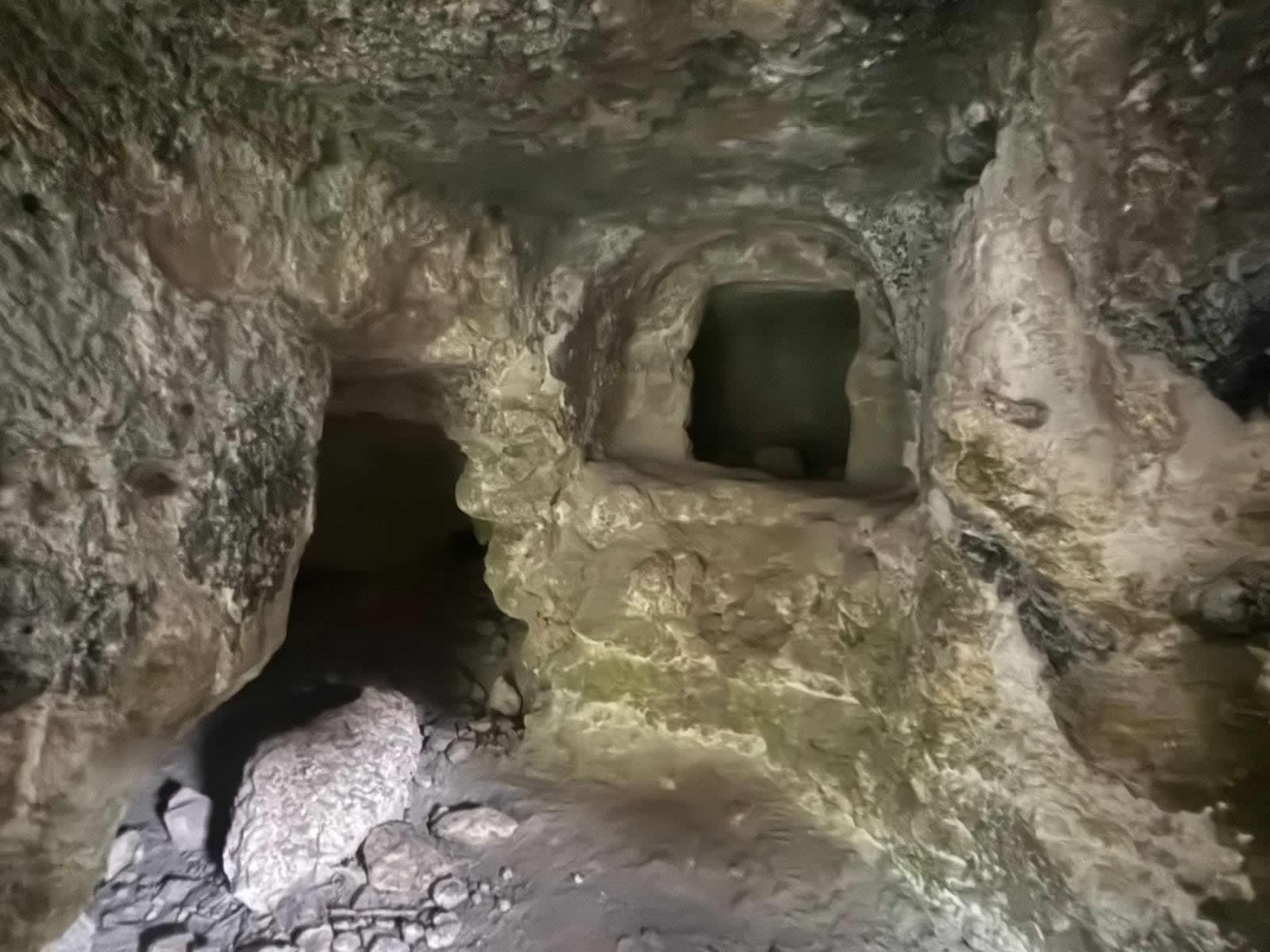
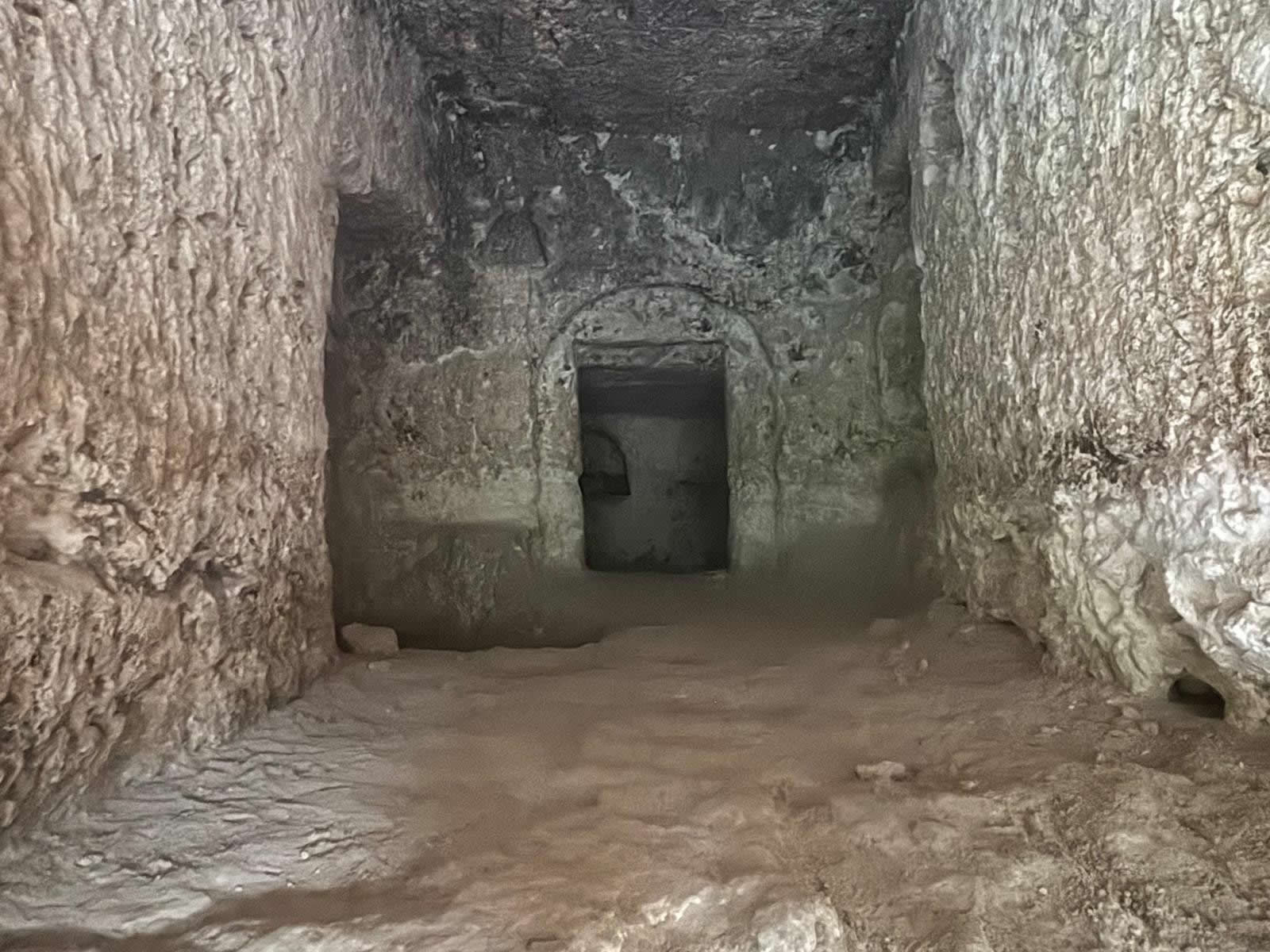
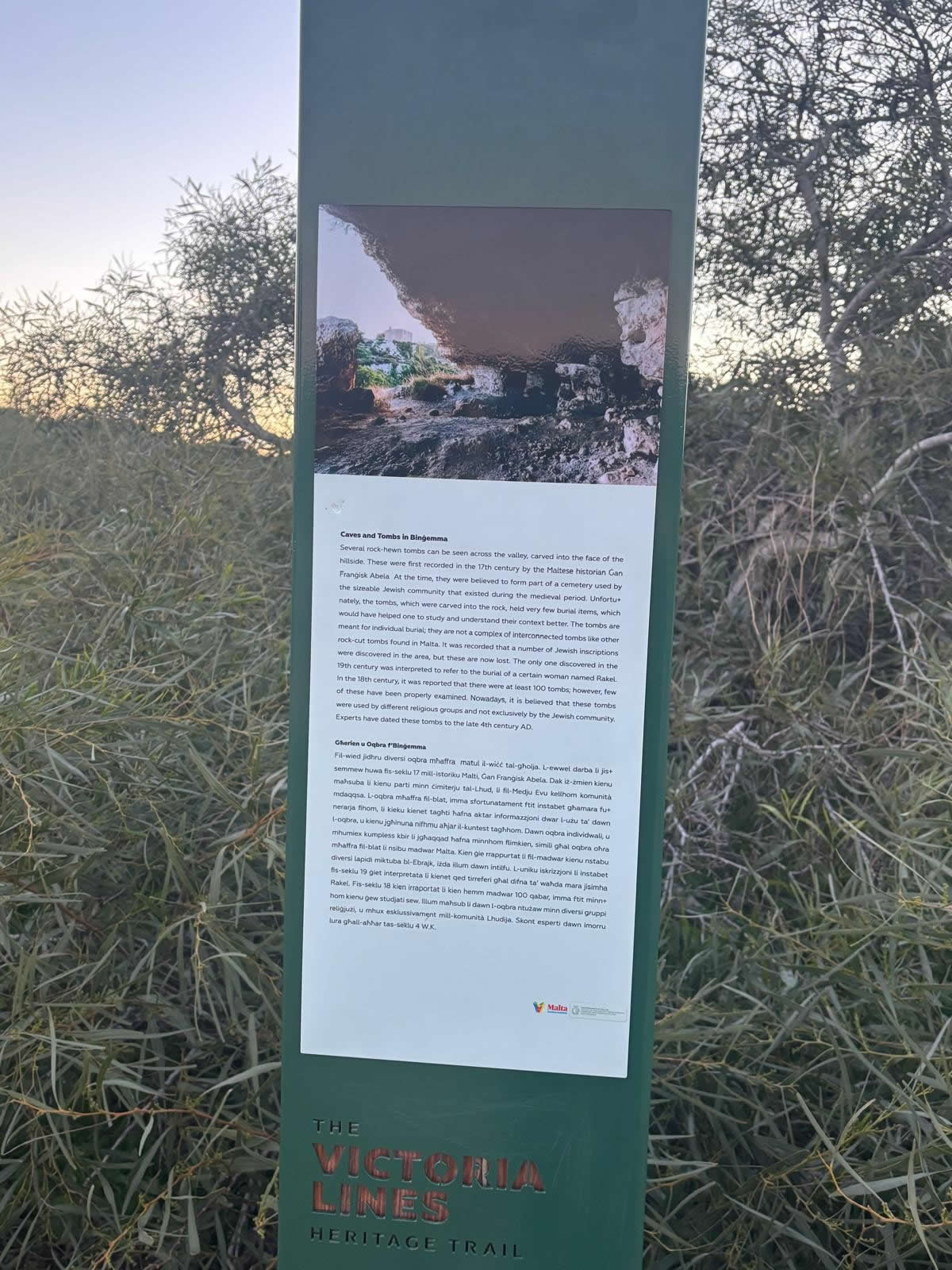
The Binġemma Necropolis is a cluster of rock-cut funerary features and cave-cut chambers on the Bingemma escarpment near Mġarr. Based on your on-site observation at these coordinates, the layout is striking: larger caves higher up (some with a more “inhabited” feel) and a dense spread of tombs lower down cut directly into the rock face.
The complex is also known locally as Għerien il-Lhud (“Jewish caves”). This traditional name is widely repeated in heritage notes, but it should be treated as a label rather than proof of Jewish burials—some sources explicitly caution that the name alone is not sufficient to confirm attribution.
History & relevant dates
Binġemma is best described as a multi-phase landscape. Some writers emphasise Punic/Roman use, while others propose earlier origins for parts of the complex (and later re-uses). The timeline below lists the most commonly cited periods and recorded milestones.
- 8th–2nd century BC (Punic period context): Rock-cut tomb traditions are well attested in Malta. Binġemma is frequently labelled “Punic” in modern heritage descriptions, especially for the lower cliff tomb cluster.
- 218 BC onward (Roman period in Malta): Many accounts describe the complex as “Punic/Roman”, implying reuse or continued use into the Roman period.
- 1582–1655 (Abela era reference): Local heritage notes attribute early documentation of the caves/tombs to Giovanni Francesco Abela, with reports of Hebrew-inscribed markers in related contexts—often mentioned with caution in modern summaries.
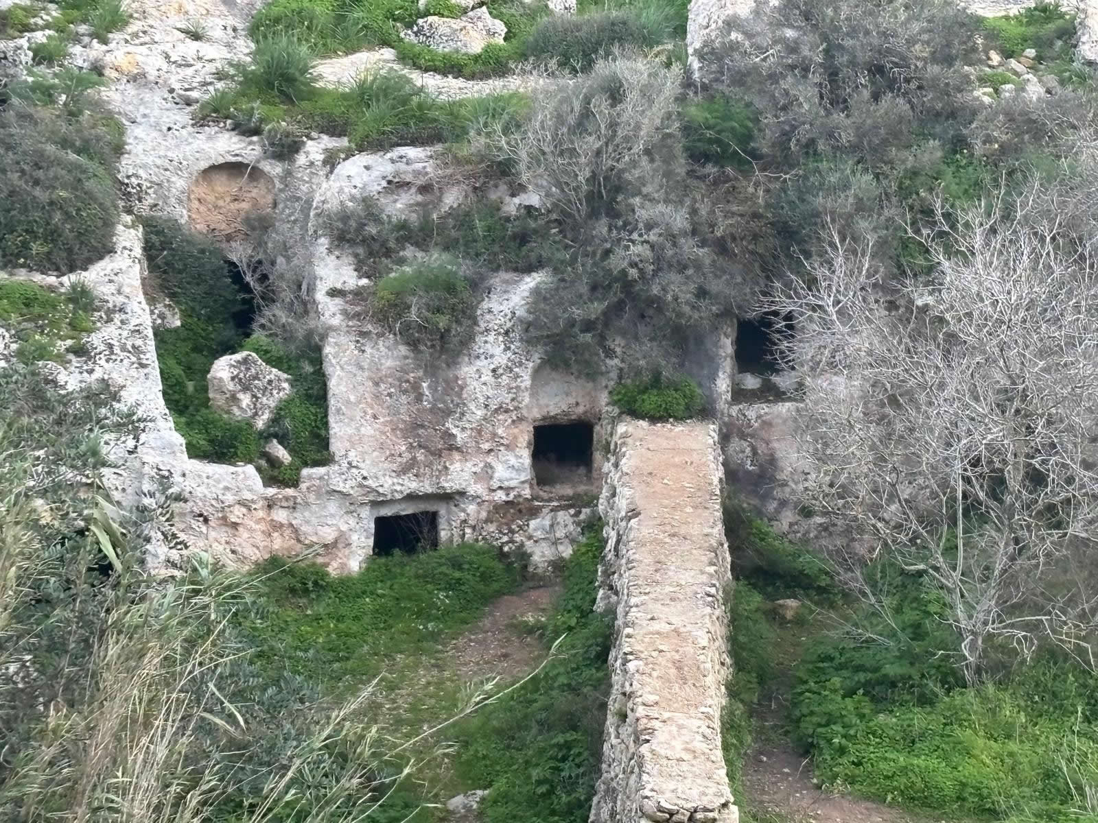
- 1600 / 1680 (nearby chapel landmark): The Chapel of Our Lady of Itria (Hodegetria) on Triq Binġemma is recorded as founded/dedicated in 1600 and completed in 1680, dramatically positioned on the cliff edge above a rock-cut tomb.
- 1874 (reported finds): During works connected with fort foundations in the area, Royal Engineers reportedly recovered jars and pottery from cave-tombs on the same hill—described in local council heritage notes as indicating Phoenician origins.
- 1875–1878 (Victoria Lines context): Fort Binġemma was built as part of the Victoria Lines defensive system, strengthening the wider historical landscape around Bingemma Gap.
- 3 October 1934 (reported discovery): Local notes record a tomb found in a field known as Tal-Maqbar in the Binġemma area, with pottery found inside.
- 1939–1945 (World War II): Multiple accounts note the caves were used as temporary shelters during wartime bombing.
What you’ll see on site
- Lower cliff tombs: numerous rock-cut openings clustered along the face, consistent with a necropolis layout.
- Upper chambers: larger caves and corridors that look more “habitable” in scale—often interpreted as later reuse for shelter/storage/refuge rather than primary burials.
- Landscape views: the escarpment setting is part of a wider heritage zone near Bingemma Gap and the Victoria Lines area.
- Nearby landmark: the Chapel of Our Lady of Itria (Hodegetria) sits on the cliff edge above a tomb and is a strong visual anchor for the area.
Visiting tips (responsible access)
- Footwear: wear sturdy shoes; the approach and rock surfaces can be slippery after rain.
- Light: bring a small torch if you intend to look into chambers—never enter anything unstable.
- Safety: avoid cliff edges and do not climb the rock face. Caves can have loose debris and sudden drops.
- Respect: do not touch or scrape stone surfaces, widen openings, or remove stones/pottery; leave no litter.
- Access: follow any signage or barriers. If an area is fenced or marked restricted, do not enter.
Heritage reminder: rock-cut tombs and caves are fragile. A “leave no trace” visit protects the site for everyone.
FAQ
Is Binġemma a “catacomb”?
It’s often discussed alongside Malta’s catacombs because it is subterranean and rock-cut, but it’s best described as a rock-cut necropolis (tomb cluster) with larger chambers that appear to have been reused later.
Why is it called “Għerien il-Lhud”?
The name is a long-standing local label (“Jewish caves”), but modern heritage notes caution that the name alone does not prove Jewish burials. Use it as a traditional place-name and keep attribution phrased carefully.