The water is typically clear and inviting. In summer, the bay can be busy—swim inside designated areas and watch for small craft.
📍 Location
Location Map Coordinates 36.030563, 14.217070
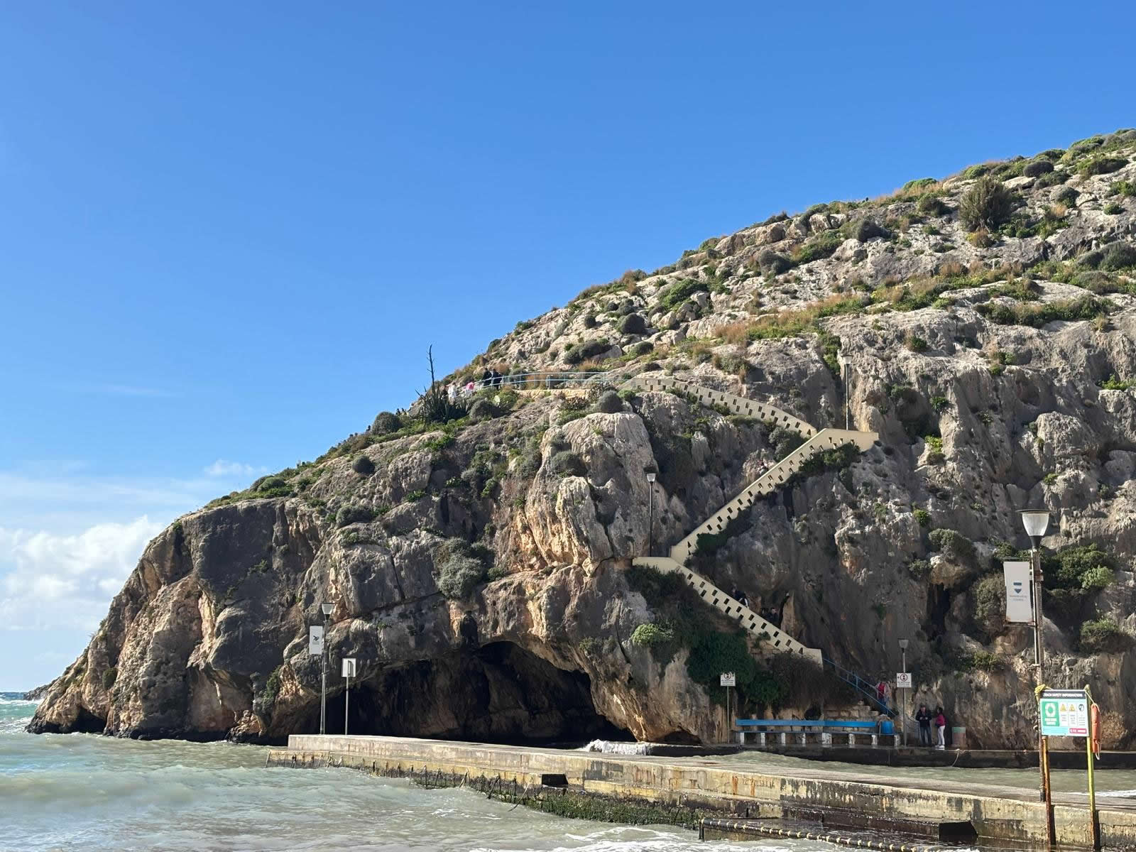
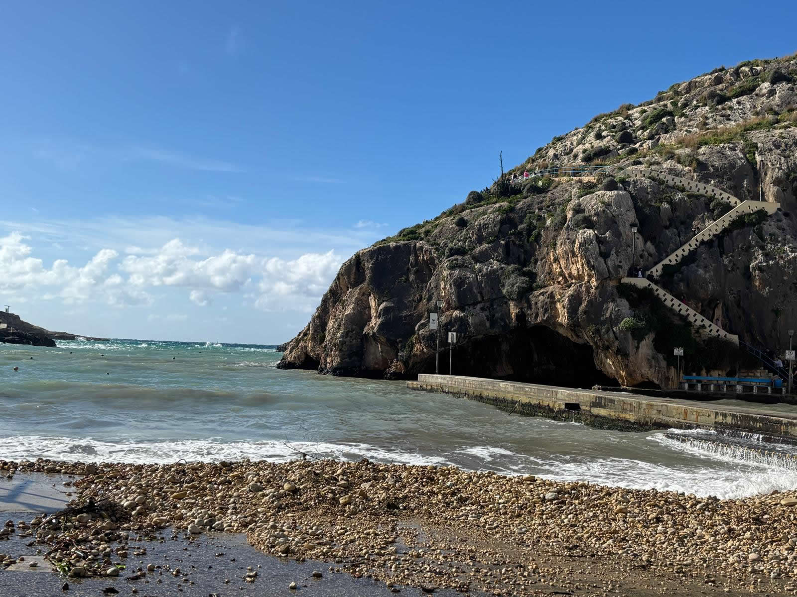
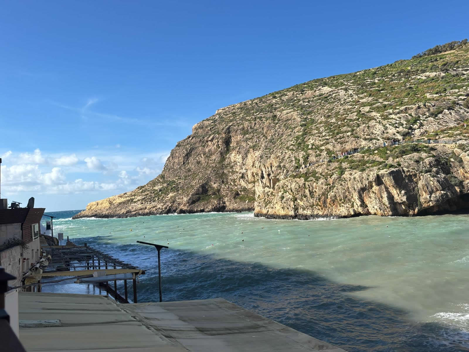
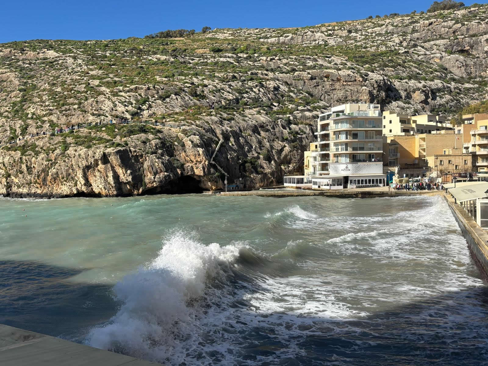
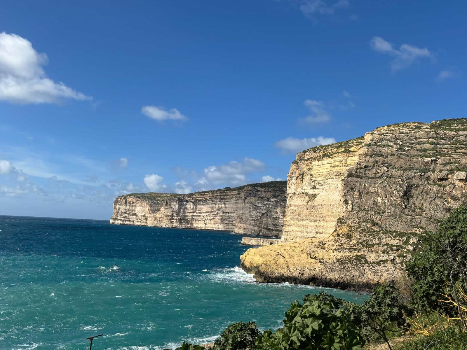
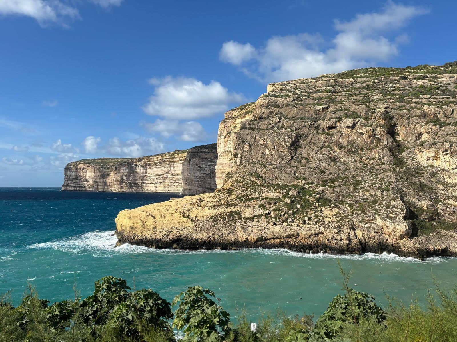
Xlendi Bay is one of Gozo’s most photographed inlets: steep limestone cliffs, clear water, a compact beach, and an easy waterfront promenade lined with cafés and restaurants. Coordinates: 36.030563, 14.217070.
Overview
Xlendi began as a small fishing inlet and later grew into a compact seaside resort area. Its shape creates a naturally sheltered feel compared with open-coast swims, and the clear water and rocky edges make it popular with snorkelers and divers as well as casual swimmers.
What makes Xlendi Bay special
- Big scenery in a small space: cliffs, a narrow mouth, and a bright blue swimming zone.
- Easy mix of activities: beach time, a short coastal walk, then dinner by the water.
- History on the headland: a watchtower built to guard the bay mouth.
History: from working inlet to visitor bay
Harbour value and shelter
The surrounding cliffs help shelter the inlet from strong winds, which supported small-boat use over time. Coastal inlets like Xlendi were valuable for landing, fishing, and moving goods on a rugged shoreline.
Xlendi Tower: guarding the bay mouth (built 1650)
At the entrance to the bay, Xlendi Tower was built in 1650 as part of Gozo’s coastal watch system. Its purpose was to watch the approaches and warn of hostile landings, helping protect the island’s vulnerable inlets.
Underwater heritage (responsible note)
Xlendi has been associated with maritime use for centuries. If you snorkel or dive, treat anything historical as protected: do not move objects and respect all heritage and conservation rules.
Beach, swimming and snorkeling
The bay’s shoreline combines a compact mixed beach (often described as sand-and-pebbles) with rocky margins. In calm conditions, this creates multiple ways to enjoy the water—wading from the beach or entering from steps/rocks.
Rocky edges and clear visibility make Xlendi a strong choice for snorkeling. Always check sea state and avoid exposed outer areas in swell.
Xlendi is popular with divers thanks to underwater topography and visibility. Use licensed operators and follow local safety guidance.
Sea safety
- Conditions can change quickly—avoid entering the sea when there is swell pushing into the bay mouth.
- Use aqua shoes if you’re sensitive to pebbles and rocky entries.
- Be visible and keep clear of boat routes and mooring areas.
Cliffs, caves and coastal walks
One of Xlendi’s best experiences is stepping away from the promenade and walking the edges of the valley and headlands. Short trails lead to viewpoints above the bay and towards the tower area, with dramatic limestone scenery and occasional caves/rock formations.
Best viewpoints
- Bay mouth viewpoint: the classic “postcard” angle across the water and cliffs.
- Headland paths: higher vantage points for sunset and wide sea views.
Cliff caution
Keep a safe distance from edges, especially in strong wind or after rain when limestone can be slippery.
Promenade, cafés and seaside dining
Xlendi’s waterfront is designed for slow travel: an easy stroll along the water, quick stops for coffee or gelato, and long dinners with a bay view. In peak season, evenings are especially lively.
Local tip
Do your swim and walk earlier, then return around golden hour for the best light on the cliffs and the calmest promenade vibe.
Practical tips
- Best season: late spring to early autumn for swimming; winter for quiet walks and dramatic seas.
- Family-friendly? Yes, but the bay gets busy—keep children in shallow zones and supervise near steps/rocks.
- What to pack: water, sun protection, aqua shoes, and a light jacket for evening breezes.
- Respect residents: Xlendi is a lived-in village—keep noise down late at night and dispose of litter properly.
Map
Coordinates: 36.030563, 14.217070
© emalta.com • Explore more places in Malta & Gozo