Location Map Coordinates 35.9399320, 14.4558608
Overview
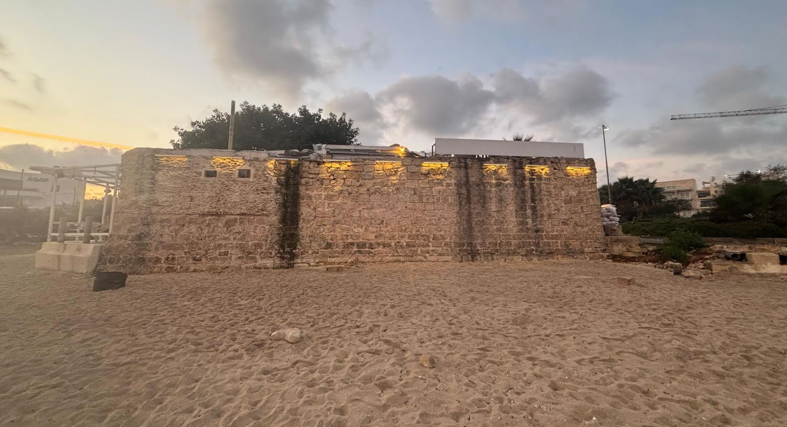
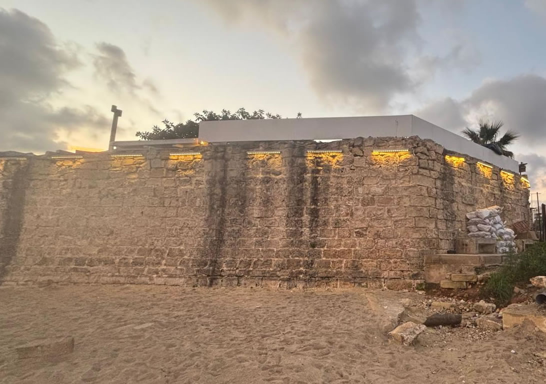
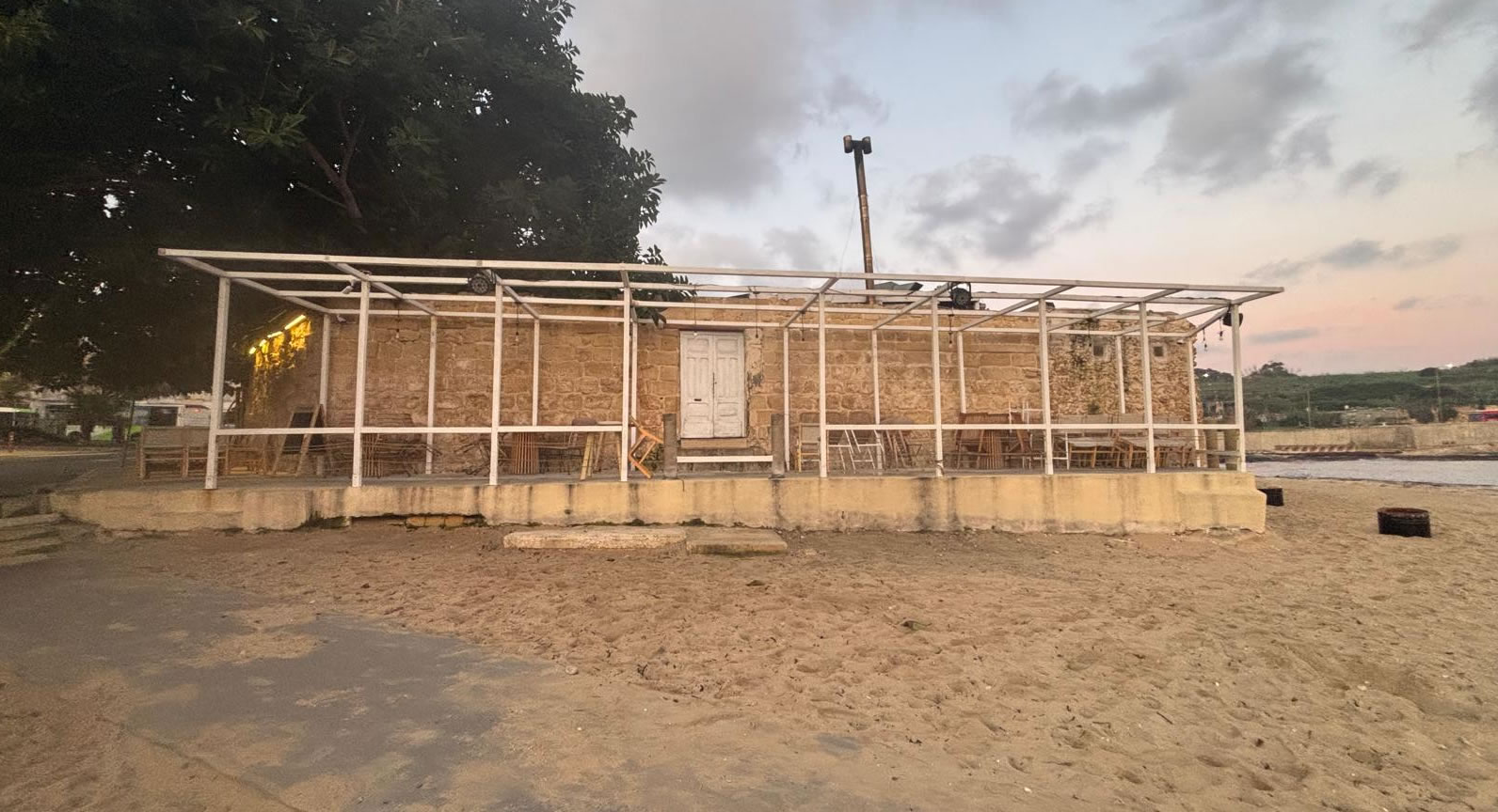
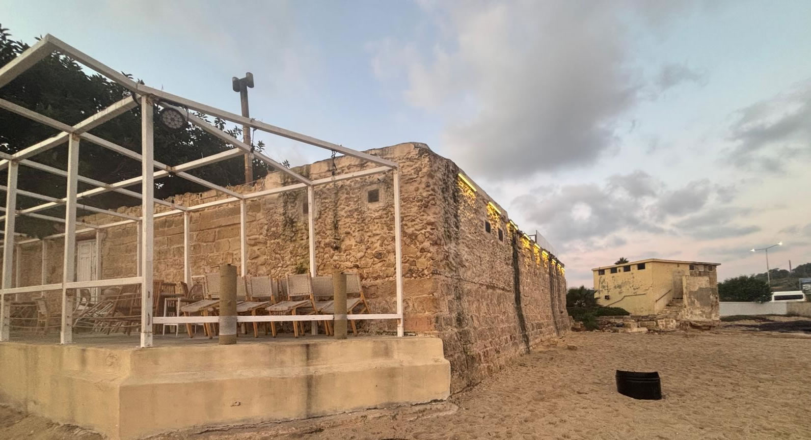
Baħar iċ-Ċagħaq Redoubt (Maltese: Ridott ta’ Baħar iċ-Ċagħaq) is a limestone coastal fortification in Baħar iċ-Ċagħaq, within the limits of Naxxar, Malta. Built in 1715–1716 by the Order of Saint John, it formed part of a broader programme of shoreline defences designed to protect vulnerable landing points around the Maltese Islands.
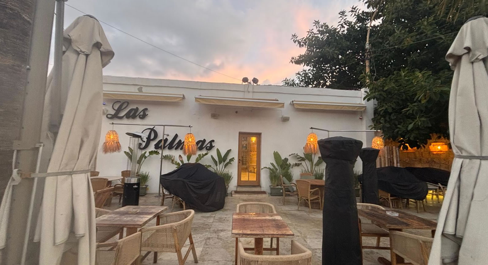
Today, the redoubt remains intact and is notable for a rare blend of heritage and everyday life: it is open to the public because it is operated as a bar/restaurant by a private tenant.
History: Why it was built (1715–1716)
The redoubt was erected during the early 18th century when the Order of Saint John expanded Malta’s coastal defence system with a network of batteries, towers, and redoubts. These structures were positioned to watch over bays and shore approaches, providing early warning and defensive fire in the event of an attempted landing.
Baħar iċ-Ċagħaq Redoubt is associated with nearby defensive sites in the area, reflecting how the Knights designed layered protection along key stretches of coastline.
Other names you may see
- Vendôme Redoubt
- Madliena Redoubt
These alternate names appear in different references and local usage, so using them in searches can help you find more material.
Architecture & layout: what to look for
The redoubt’s form is typical of Maltese coastal redoubts from the period: a defensive platform with parapets, combined with an internal blockhouse element. It was designed to be practical, compact, and effective for its role rather than ornate—an approach well suited to fast coastal construction in exposed locations.
Key features (spot these on site)
- Limestone construction suited to Malta’s building traditions and available materials.
- Defensive platform and parapet intended for observation and firing positions.
- Central internal structure (blockhouse) used historically for shelter, storage, and control of access.
- Coastal setting with open sightlines—ideal for monitoring the shoreline.
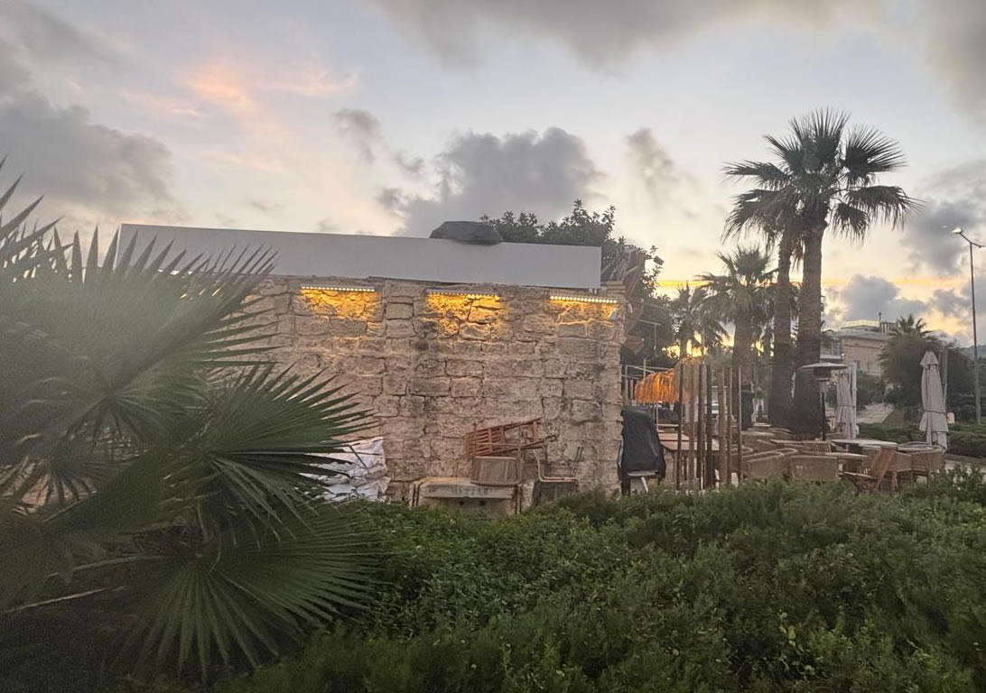
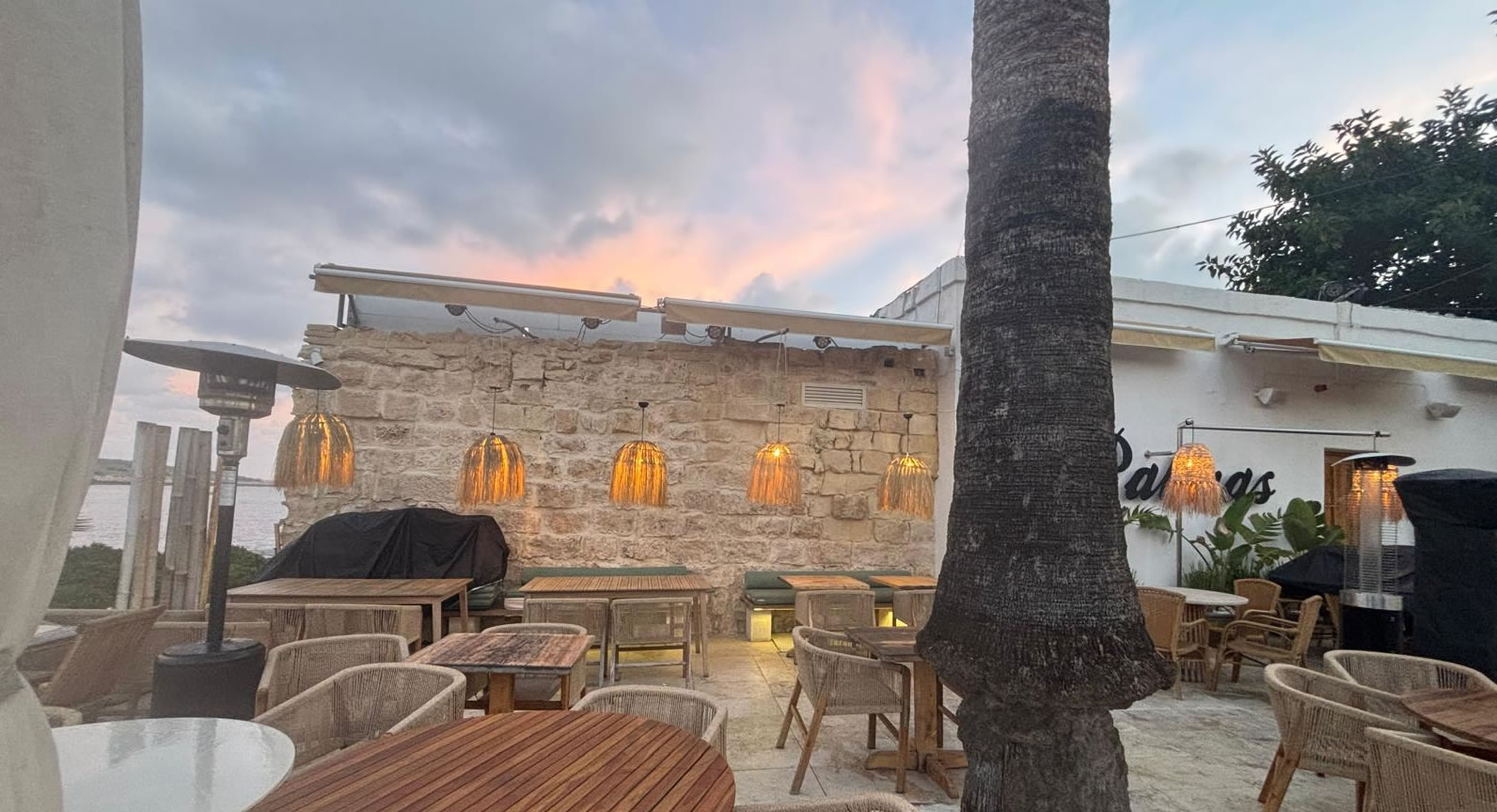
The redoubt today: heritage site + restaurant
Unlike many small fortifications that are closed or difficult to access, Baħar iċ-Ċagħaq Redoubt is publicly accessible in practice thanks to its adaptive reuse as a hospitality venue. This has helped keep the structure in active use—though, as with many heritage conversions, it also means the visitor experience blends historic fabric with modern fittings.
Current use
The redoubt has been used as a bar and restaurant. One commonly referenced operator is Las Palmas, a coastal venue associated with the site.
Tip: If your goal is purely architectural photography, consider visiting outside peak dining hours to reduce crowds and visual clutter.
How to visit: location, access & practical tips
Location
Area: Baħar iċ-Ċagħaq (within Naxxar), Malta
Coordinates: 35.9398167, 14.4560444
Getting there
- By car/taxi: The Coast Road corridor makes this stretch straightforward to reach from Sliema/St. Julian’s and other coastal hubs.
- By bus: Baħar iċ-Ċagħaq is served by public routes along the coast; check current routes/timetables before you go.
- On foot: Combine your visit with a seaside walk—sunset is especially popular for coastal photos.
Best time to go
- Golden hour: Late afternoon for warmer stone tones and calmer light.
- Quieter visits: Weekday daytime tends to be less busy than weekend evenings.
- Windy days: Expect stronger sea breezes along this exposed coastline.
Nearby ideas (pair it with these)
- Coastal viewpoints along the north-eastern shore (great for sea panoramas).
- Other Knights-era fortifications in the region (towers, batteries, and entrenchments).
- Beach/rocky swim spots in season—always check sea conditions and entry points.
Frequently asked questions
When was Baħar iċ-Ċagħaq Redoubt built?
It was constructed in 1715–1716 by the Order of Saint John.
Is the redoubt open to the public?
Yes—access is generally possible because the building is used as a bar/restaurant. Practical access is usually best during venue operating hours.
What is Baħar iċ-Ċagħaq Redoubt also called?
You may see it listed as Vendôme Redoubt or Madliena Redoubt.
Where exactly is it located?
It is on the coast at Baħar iċ-Ċagħaq, within the limits of Naxxar, Malta. Coordinates: 35.9399320, 14.4558608.
Is it suitable for a quick stop?
Yes. Many visitors treat it as a short heritage/photo stop, especially if they’re already driving the coast road or exploring nearby seaside areas.
References & further reading
- National inventories / cultural property listings for Knights-era fortifications (search using the name and alternate names).
- Historical overviews of the Order of Saint John’s 18th-century coastal fortifications in Malta.
- Mapping sources using the coordinates: 35.9399320, 14.4558608.
Note: If you publish this page, replace example.com URLs (canonical + images) with your real domain and media paths.