📍 Location
Location Map Coordinates 35.989171, 14.358097
An Authoritative Architectural Guide and Field Survey of the Tal-Bir Infantry Fortification
1. Strategic Context and Historical Foundations
The early eighteenth century forced a dramatic paradigm shift in the defensive doctrines of the Order of Saint John (Knights of Malta). Following decades of focusing resources on the dense urban strongholds surrounding the Grand Harbour and the Cottonera lines, the vulnerable open bays of northern Malta stood unprotected. Recognizing that aggressive Ottoman forces or marauding Barbary corsairs could execute unchallenged amphibious landings on the isolated beaches of Mellieħa, Grand Master Ramon Perellos y Roccaful ordered a systematic overhaul of coastal surveillance and point-defense systems.
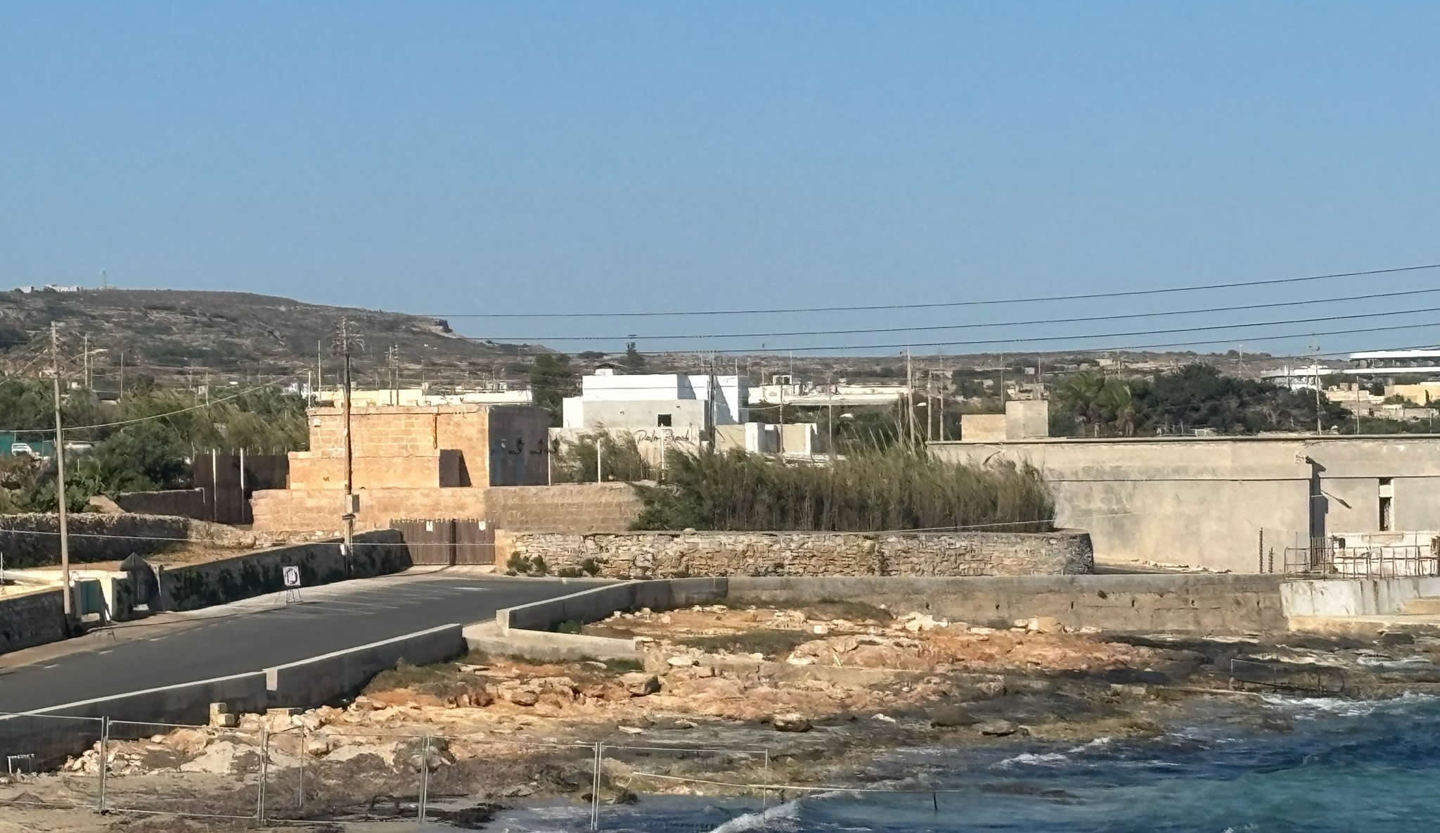
Conceived during the massive fortification push that commenced in 1715, Crivelli Redoubt—historically categorized in archival maps as Ridott ta' Crivelli or the Tal-Bir Redoubt—was positioned to command the narrow shoreline margins flanking the northern Marfa ridge sector. Its exact position on the modern map settles at coordinates 35.989171, 14.358097, granting it an optimal line-of-sight overlooking the shallow approaches of the South Comino Channel.
Unlike the large-scale stone batteries located along nearby points (such as Vendôme Battery to the east), redoubts were meticulously engineered as semi-permanent, infantry-focused strongpoints. Their primary military function was to act as operational breakout hubs for local militia regiments (the Dejma) and regular Hospitaller infantrymen. Armed primarily with muskets and small anti-personnel pivoting guns, the defenders occupying Crivelli Redoubt could unleash concentrated fields of fire across the sandy shores, keeping invading forces pinned down until major cavalry or artillery reinforcements arrived from inland strongholds like the Citadel or the old capital of Mdina.
The construction of this redoubt was personally sponsored and named in honor of Fra Ferdinand Crivelli, an influential and highly decorated Knight of the Italian Langue. Crivelli’s heavy financial endorsements into the Congregation of Fortifications allowed the engineers to source premium globigerina limestone blocks, ensuring the walls could handle the shock of kinetic impacts and coastal weathering better than basic dry-stone field trenches.
2. 1715 Construction Records and Engineering Timeline
The physical breaking of ground for the Crivelli Redoubt occurred during the late spring of 1715. The logistical coordination required for this northern outpost was immensely complex. Because Mellieħa was largely unpopulated at the dawn of the 18th century due to the persistent threat of pirate raids, master masons, stone-cutters, and laborers had to be carted in daily from central villages along with food supplies, water rations, and building tools.
Under the supreme technical supervision of military engineers Philippe de Vendôme and René Jacob de Tigné, the layout of Crivelli Redoubt was adapted directly to match the sloping topography of the Tal-Bir coastal basin. The construction schedule progressed through distinct, tightly audited operational phases:
| Timeline Phase | Historical Benchmark / Engineering Action | Strategic Purpose |
|---|---|---|
| May – June 1715 | Bedrock leveling, excavation of the shallow rear ditch lines, and clearing of vegetation at the Tal-Bir shoreline. | Secures a solid foundation into the lower coralline and globigerina rock beds to support heavy stone block loads. |
| July – September 1715 | Erection of the double-skinned outer revetment walls using coarse ashlar blocks. Packing of inner walls with rubble stone. | Creates the distinct pentagonal defensive envelope designed to deflect incoming naval cannon blasts. |
| October 1715 | Completion of the rear rectangular blockhouse, installation of the roof slab, and cutting of the loopholed musket slits. | Provides secure, weather-resistant shelter for the garrison while offering a fallback shooting platform. |
| December 1715 | Final structural inspection by the Congregation of Fortifications; formal handoff to the local militia commanders. | Enters active operational duty within the unified northern coastal defense network of the Order. |
Archival payroll slips and quarry ledgers show that local rock-cutters extracted stone blocks directly from small outcrops situated just a few dozen meters south of the redoubt's location. This hyper-local approach saved massive amounts of transport time, allowing the main defensive envelope to rise out of the earth in less than eight months. By the turn of 1716, Crivelli Redoubt stood fully operational, structurally integrated into an unbroken chain of defense lines linking the Aħrax Tower network to the open spans of Mellieħa Bay.
3. Detailed Architectural Profile & Defensive Layout
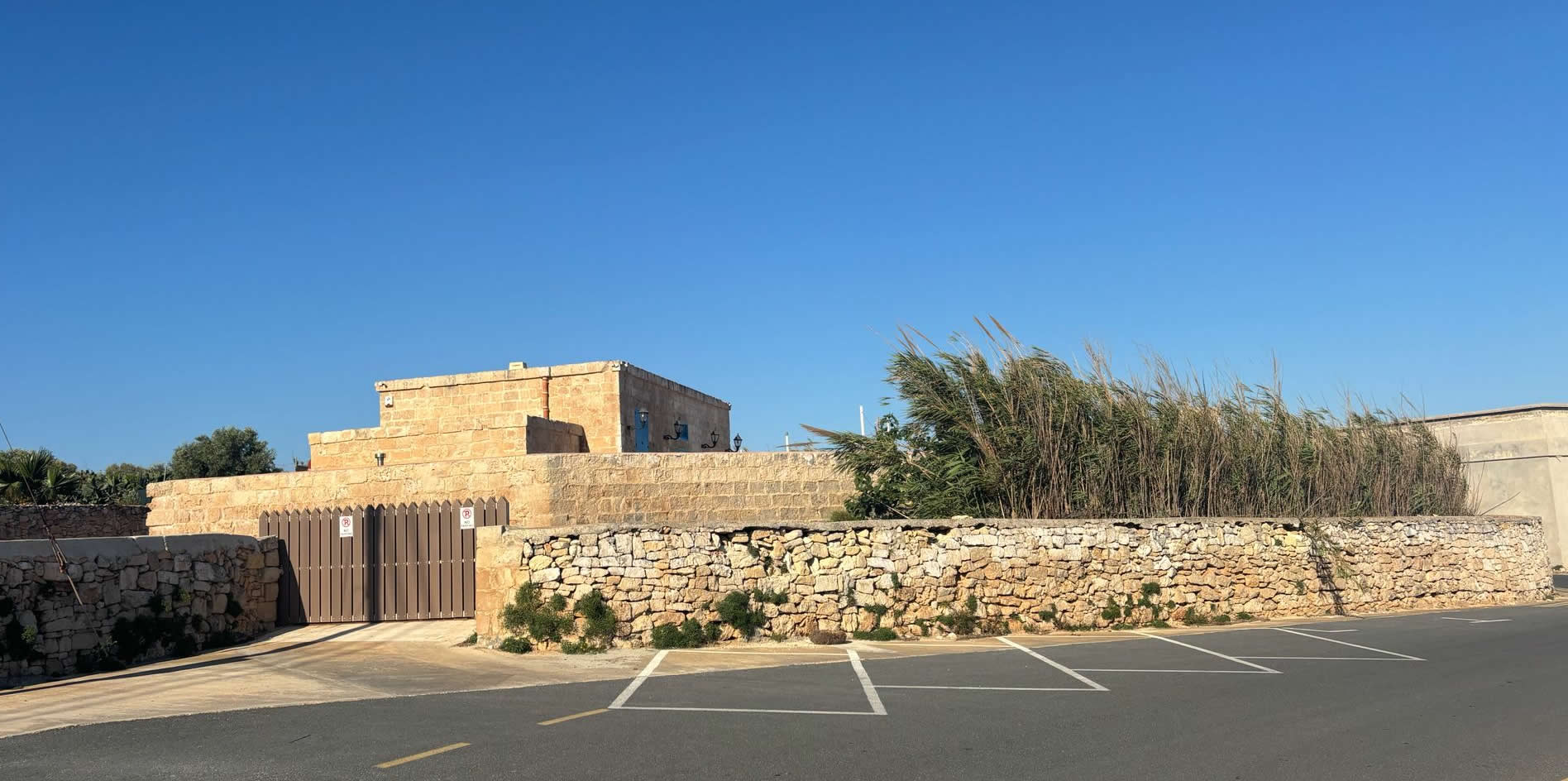
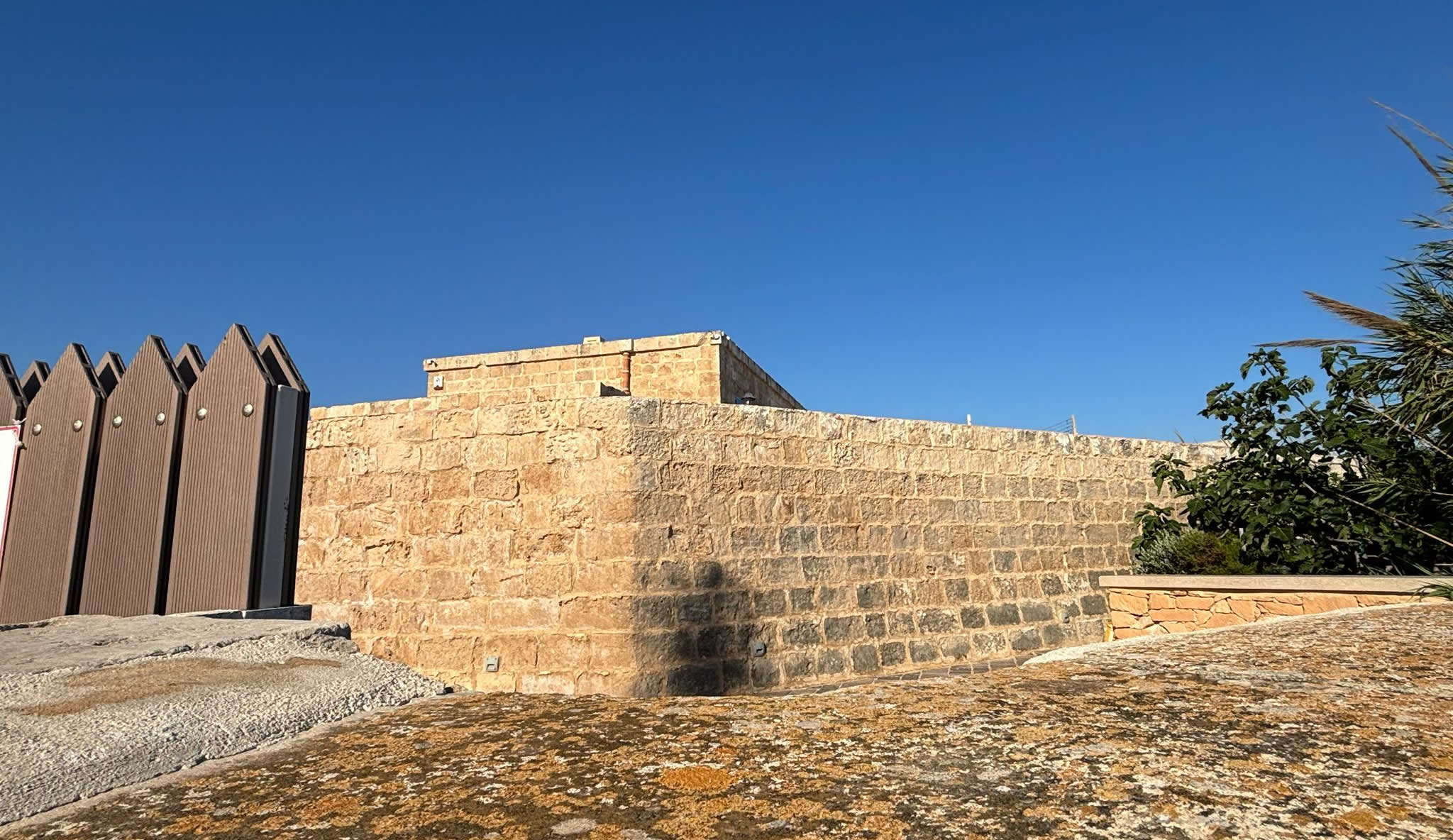
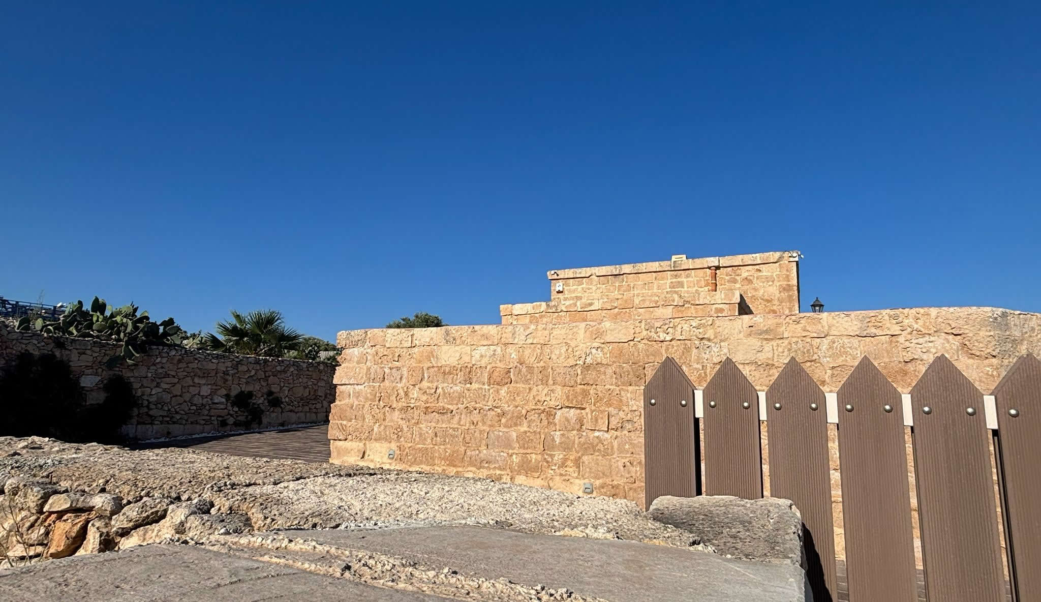
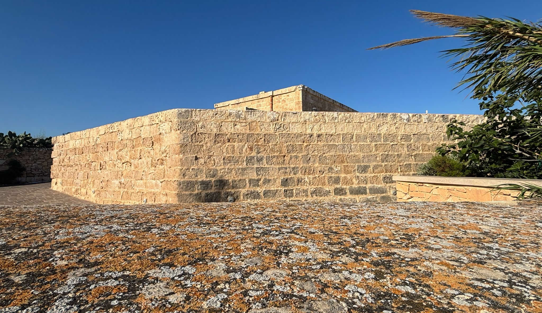
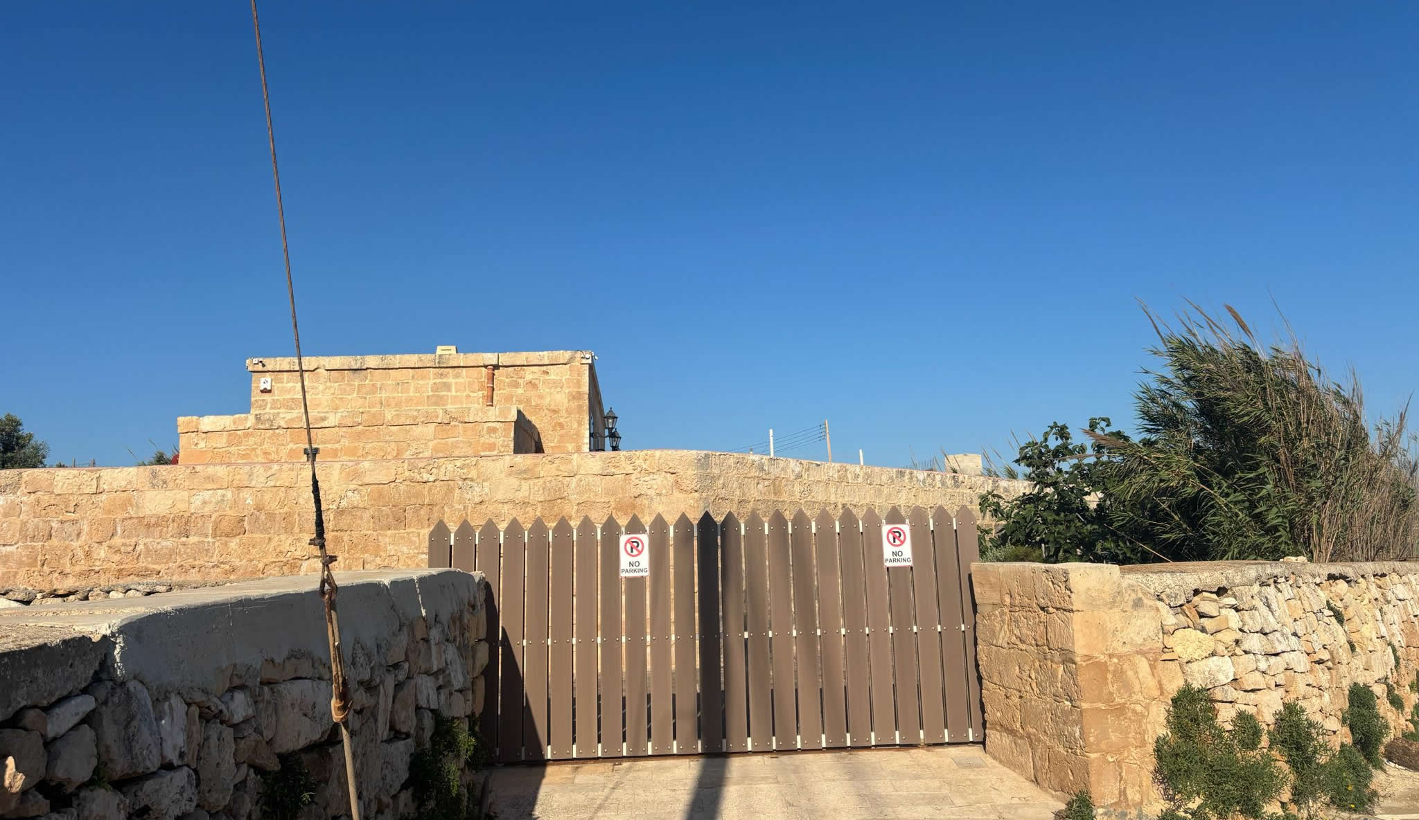
Architecturally, Crivelli Redoubt conforms closely to the standard pentagonal and semi-circular hybrid models preferred by French military engineers during the early 1700s. The site consists of three primary interconnected elements: the low-slung front defensive platform, the rear rectangular blockhouse, and the encompassing enclosing boundary walls.
The Pentagonal Defensive Platform
The forward-facing trace of the redoubt features a distinct pentagonal design pointing directly toward the coastline. This profile wasn't just stylistic; it was a calculated geometry designed to minimize dead zones. If enemy boats successfully touched down on the rocky shore below, the angled parapet allowed defenders to fire downward along both flanks without leaning dangerously over the edge of the stonework. The walls are constructed using wide ashlar blocks on the exterior, filled internally with tightly packed soil and quarry waste to absorb the heavy concussions of incoming ship-borne artillery fire.
The Landward Blockhouse
Positioned securely at the rear wall of the fortification sits the rectangular blockhouse. This structure served a dual purpose: it functioned as a secure barrack house for the small infantry detachment stationed there, and it acted as a final fallback defensive strongpoint if the front platform was breached. The landward-facing walls of the blockhouse are pierced by narrow vertical loopholes (musket slits). These slots are wider on the inside and taper down to small openings on the outside, providing a wide angle of fire for the defenders' muskets while leaving minimal target space for enemy counters.
The Defensive Ditch and Entry Gate
Access to the interior of Crivelli Redoubt was heavily restricted. The main gateway was located at the rear wall of the blockhouse, historically shielded by a shallow, rock-cut defensive ditch. Entry was gained via a removable wooden drawbridge or a highly secure timber ramp that could be rapidly pulled inside or smashed to pieces if the position was about to be overrun by invading forces.
4. Historic Ordnance and Armament Inventories
Because redoubts were designed primarily to facilitate mobile infantry tactics rather than heavy artillery duels, their permanent armament lists were generally modest. However, during periods of heightened international tension, the Order of St. John regularly re-allocated heavier ordnance pieces from regional depots to bolster these outpost sites.
An official military audit and inventory compiled by the Knights' artillery officers reveals the exact configuration of arms, munitions, and defensive stores held inside Crivelli Redoubt at its operational peak:
SWIVEL WALL GUNS (ESMERY): 2 Pieces (Mounted on Parapet)
LEAD MUSKET BALLS: 1,200 Rounds
READY CORNED POWDER: 1.35.0 (Kantar.Rifle.Rotolo)
PRIMARY ORDNANCE DEPOT: St. Agatha’s Tower (Red Tower Link)
The blackpowder weight listing of 1.35.0 utilizes the classic historical weight system used across the Maltese islands during the Hospitaller and British colonial eras. This notation translates into **1 Cantaro (Kantar), 35 Rotoli (Roti)**. In modern metrics, with one rotolo equaling approximately 0.8 kilograms, this means the garrison held a dedicated operational reserve of roughly 108 kilograms of high-grade corned gunpowder inside the small, dry internal magazine room of the blockhouse.
5. Modern Field Survey, Restoration, and Current Status
Today, Crivelli Redoubt presents a fascinating case study in the preservation and adaptation of coastal military heritage. Over the course of the late 19th and 20th centuries, as the threat of amphibious pirate invasions vanished, the strategic value of the site evaporated. The structure was officially decommissioned by the military authorities and eventually passed into the hands of civil administrators, who leased out the surrounding coastal land plots for local agricultural use.
Location Reference: Tal-Bir Coastal Margin, Mellieħa (35.989171, 14.358097)
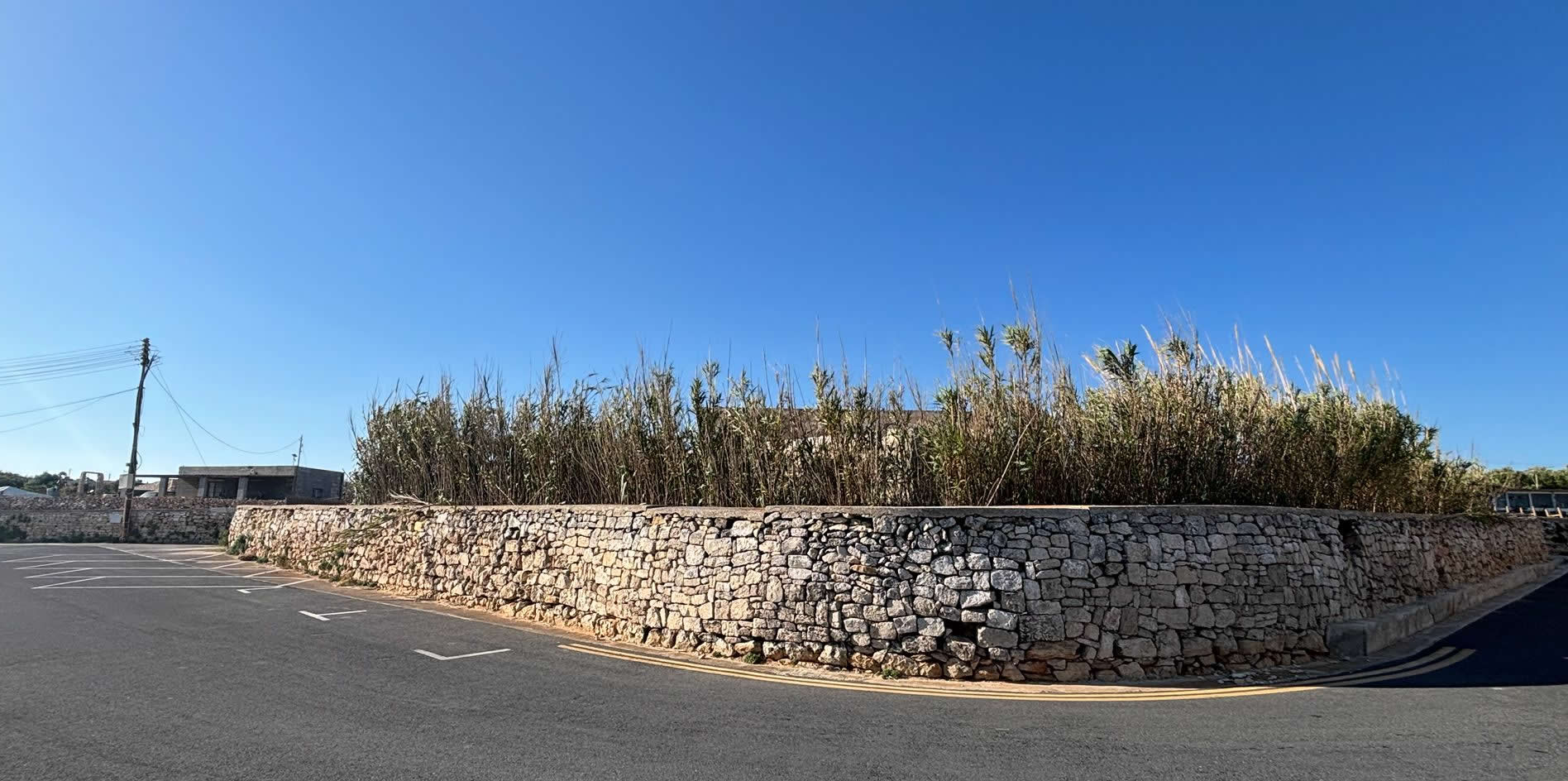
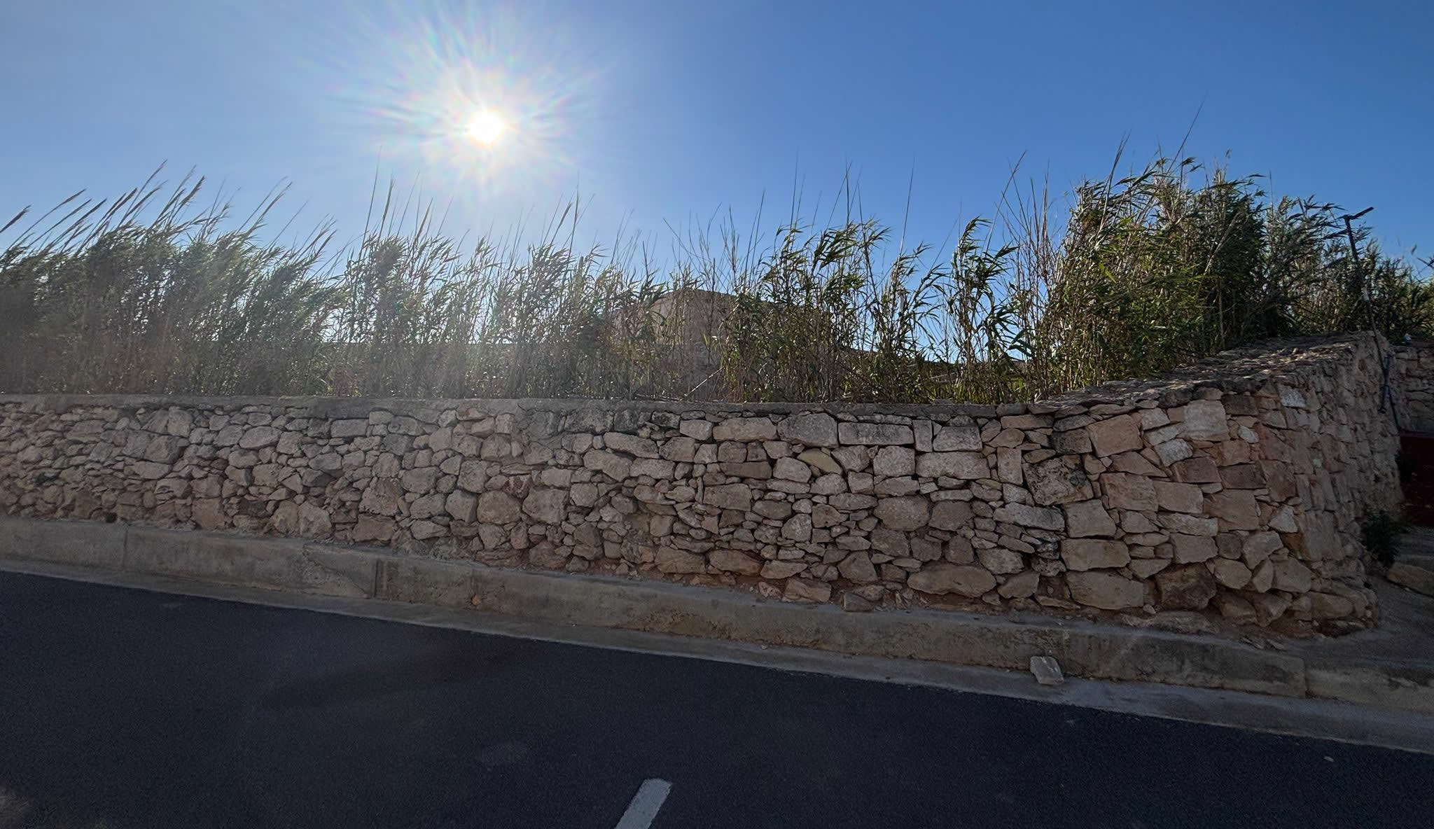
Preservation Profile: Front pentagonal platform walls are partially obscured by modern rural boundary stones and agricultural alterations. The structural footprint of the rear blockhouse survives but has been modified over the decades to serve as a rural farming storehouse (Għorfa).
While some sections of the front parapet have suffered stone loss due to decades of intense winter sea spray and human modifications, the core foundations remain remarkably sound. The local globigerina limestone blocks have developed a deep, protective gray-brown patina, preserving the tooling marks left behind by the original Maltese stonemasons back in 1715.
Currently, the site is recognized by heritage authorities as a Grade 1 national monument, granting it legal protection against demolition or unsympathetic modern development. Local cultural groups and preservationists have continuously pushed for an expansive restoration campaign to clear out the modern agricultural additions, repair the eroded ashlar stone blocks, and establish an informational heritage trail linking Crivelli Redoubt directly to its neighboring coastal defenses across the Marfa ridge.
6. Frequently Asked Questions (FAQ)
❓ What is the historical meaning behind the name "Crivelli"?
The redoubt was named to honor Fra Ferdinand Crivelli, a prominent Knight of the Italian Langue within the Order of St. John. He personally provided a substantial financial endowment to fund the construction of this specific site during the 1715 coastal reinforcement campaign.
❓ How do I access the Crivelli Redoubt site?
The site can be viewed externally by walking along the public coastal paths at Tal-Bir in Mellieħa, overlooking the South Comino Channel. However, because parts of the inner structural footprint are integrated into long-standing private agricultural leases, visitors must respect local property boundaries when exploring the area.
❓ Was Crivelli Redoubt ever used in an actual military conflict?
There are no historical records showing that Crivelli Redoubt directly traded heavy fire with invading warships. Its value was primarily deterrent-based; its active presence alongside towers and redoubts made the northern bays too risky for enemy fleets, forcing them to reconsider their tactical options.
❓ Where can I find more records about other redoubts in Malta?
You can view detailed architectural breakdowns, coordinates, and historical records for all surviving structures by visiting our master directory at https://emalta.com/RedoubtList.html.