📍 Location
Location Map Coordinates 35.919422, 14.372884
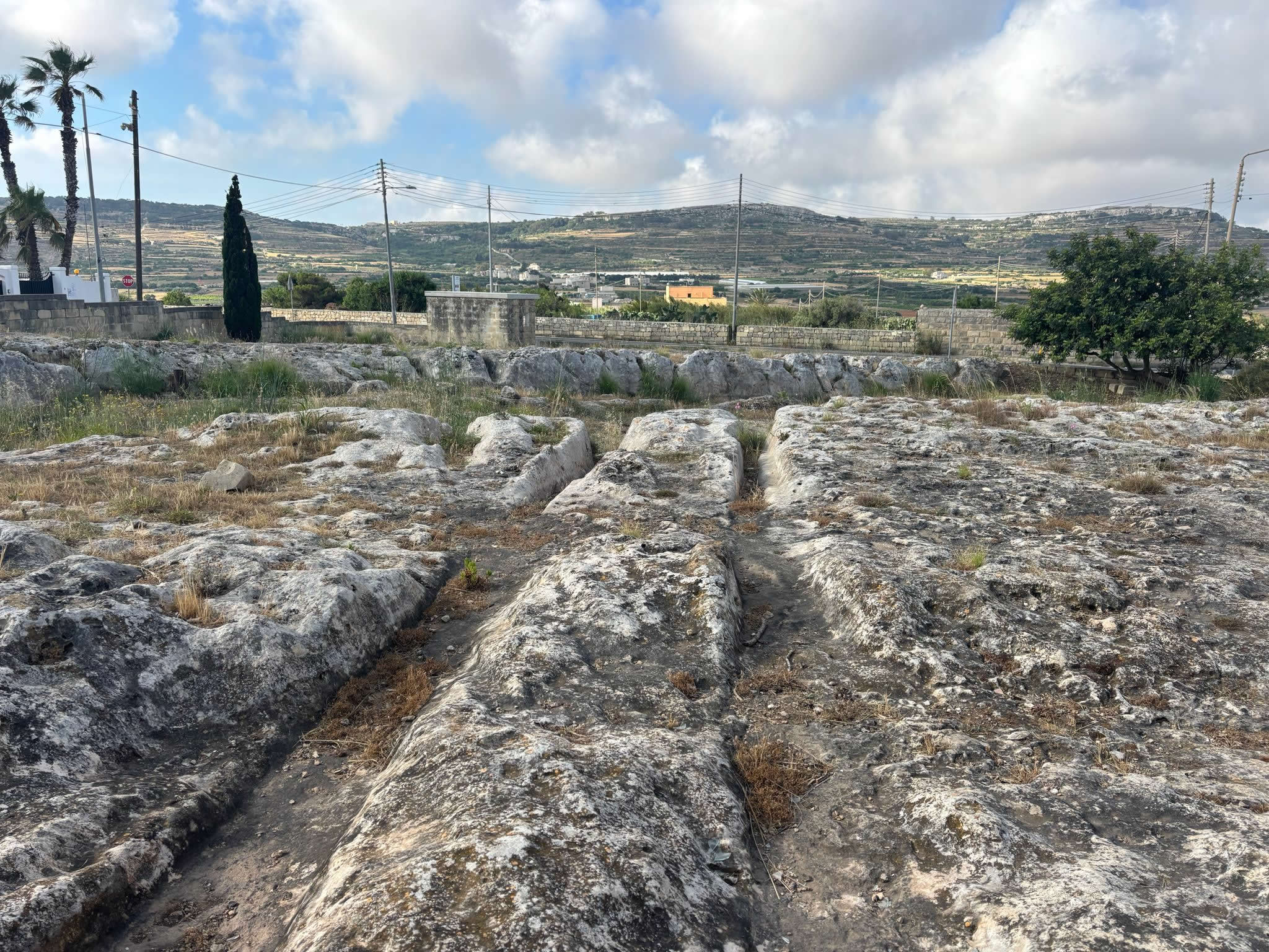
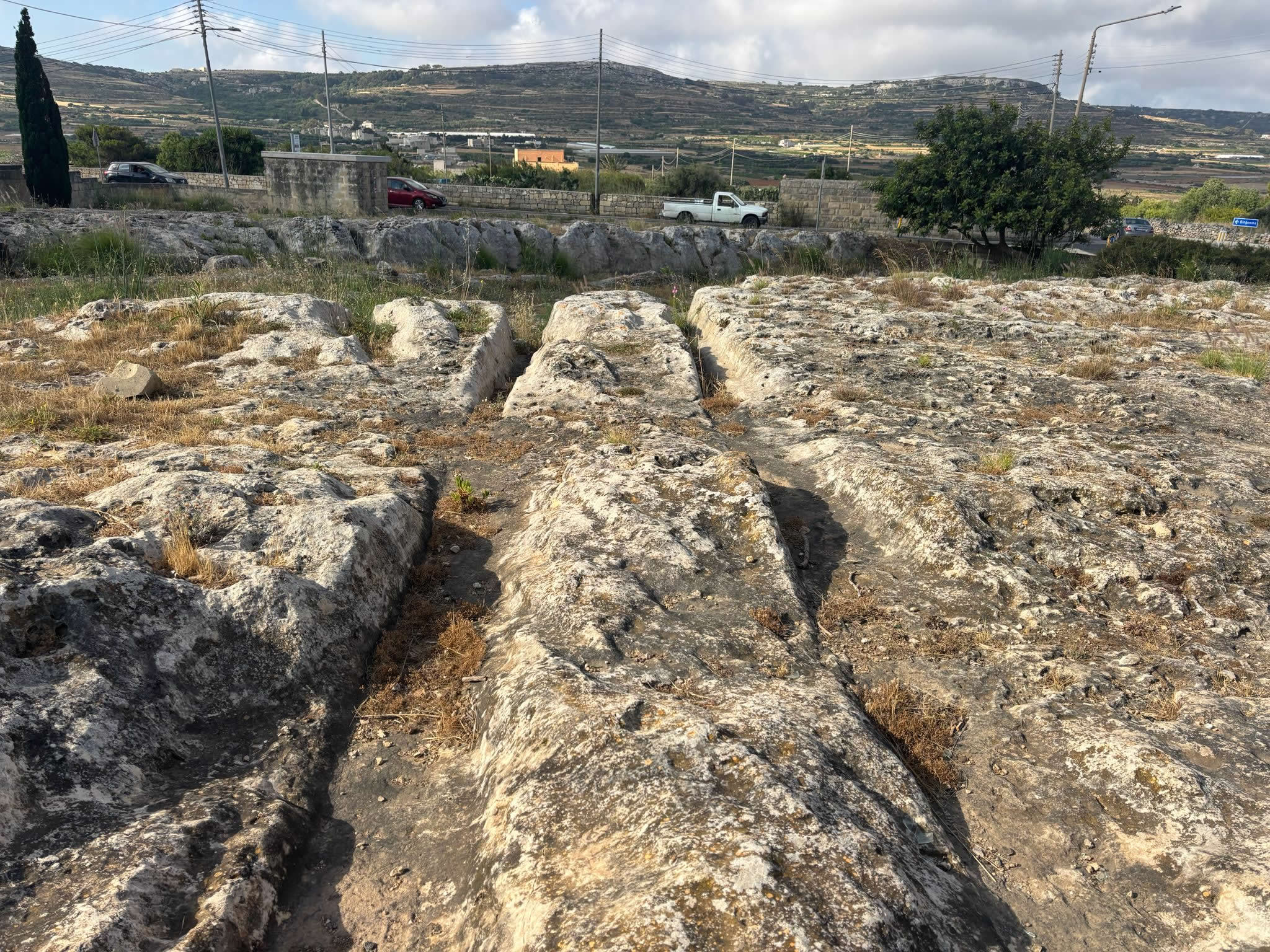
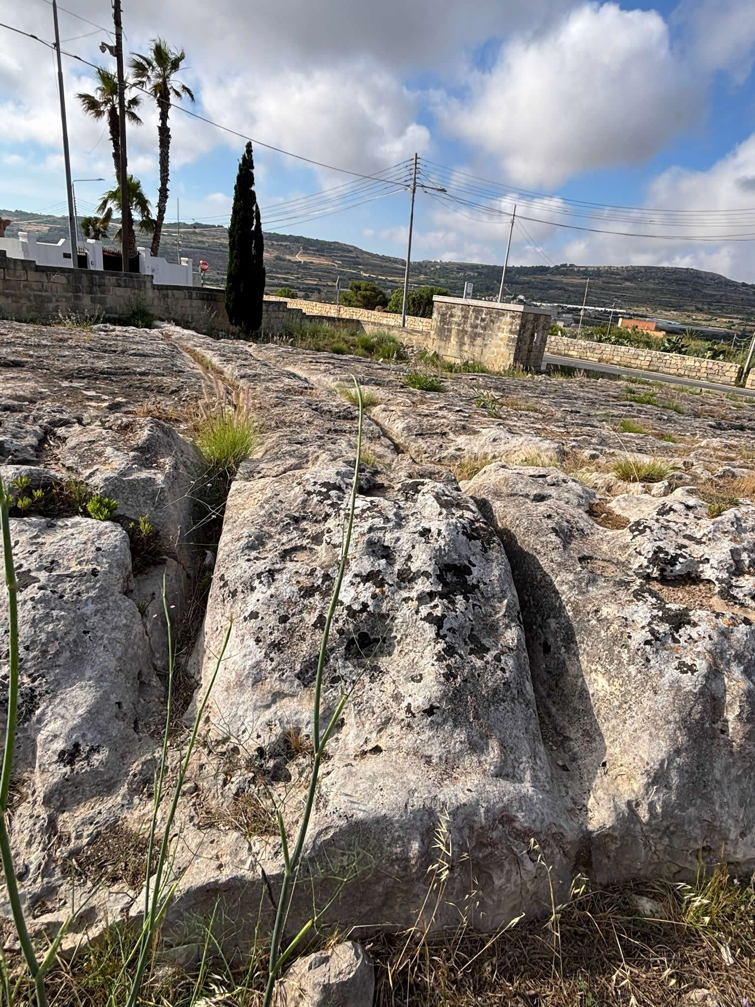
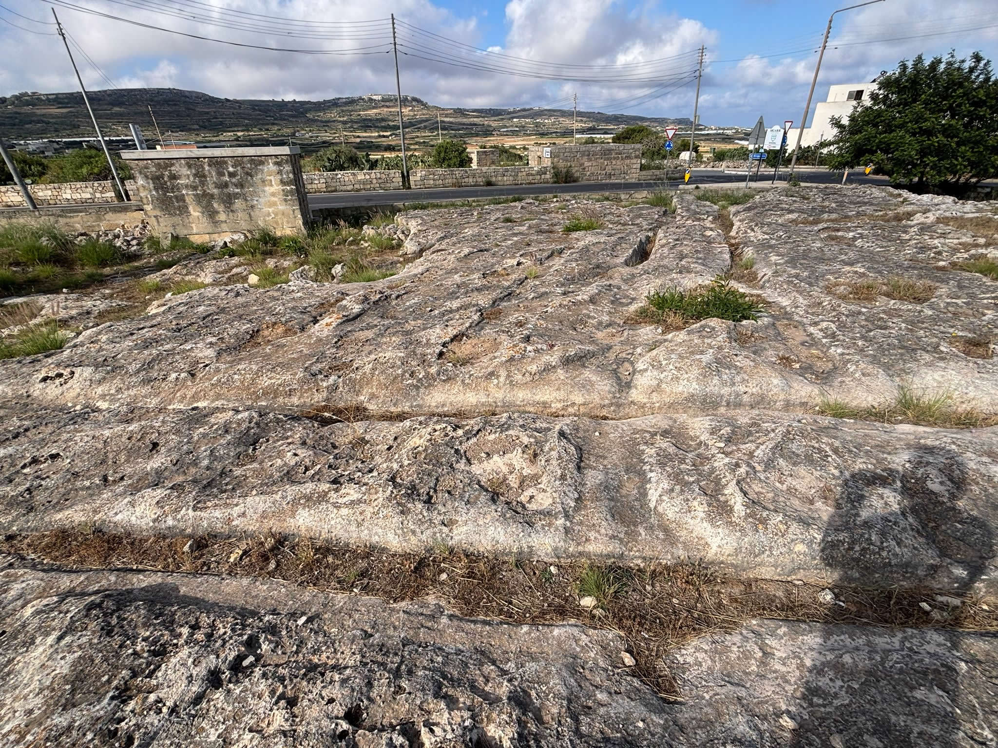
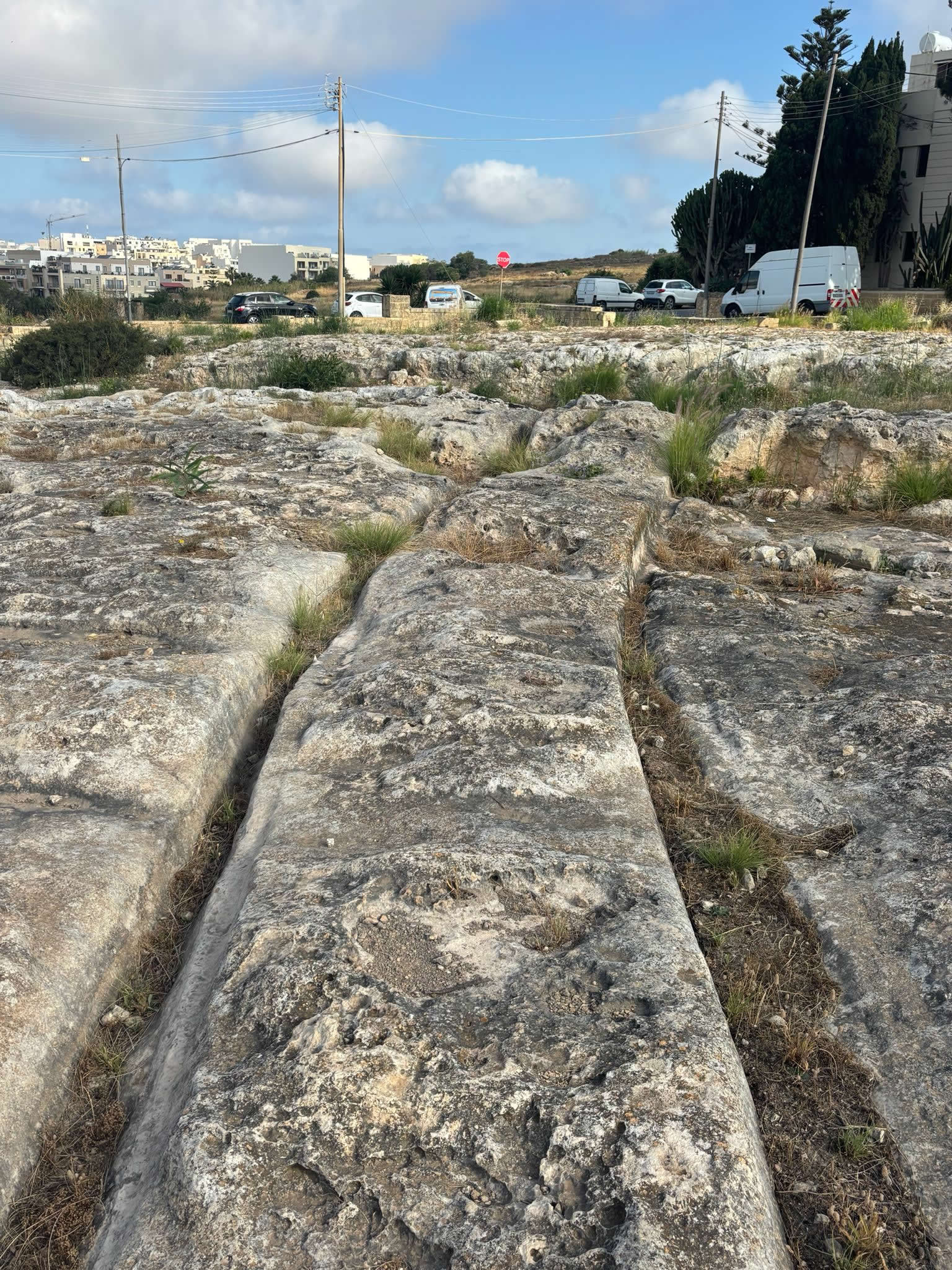
Ancient Rock-Cut Tracks of Malta's Prehistoric Landscape
Introduction
The Mġarr Cart Ruts are among the most intriguing archaeological features found in the Maltese Islands. Located within the historic rural landscape surrounding Mġarr in north-western Malta, these parallel grooves cut deeply into the natural limestone bedrock form part of the wider network of mysterious cart ruts found across Malta and Gozo.
Despite more than a century of archaeological investigation, the true purpose of Malta's cart ruts remains uncertain. The Mġarr examples provide an important insight into this enduring archaeological mystery and help demonstrate the extent of prehistoric activity across the region.
Location
The Mġarr Cart Ruts are situated at:
- Latitude: 35.919422
- Longitude: 14.372884
They occupy an area of exposed limestone within a landscape rich in archaeological remains, agricultural terraces and ancient pathways.
What Are Cart Ruts?
Cart ruts consist of pairs of parallel channels carved into solid rock. In many places throughout Malta they appear as extensive networks which intersect, diverge and cross the landscape in seemingly complex patterns.
The grooves often measure between 10 and 20 centimetres deep, although some examples are significantly deeper due to centuries of erosion and weathering.
The Mġarr cart ruts follow the characteristic appearance found elsewhere on the islands and are part of a wider archaeological phenomenon unique to Malta and a small number of Mediterranean regions.
Archaeological Importance
The Mġarr cart ruts are particularly significant because they are located within one of Malta's richest prehistoric landscapes. Nearby are:
- Ta' Ħaġrat Temples
- Skorba Temples
- Ancient agricultural terraces
- Historic rural pathways
- Traditional Maltese farmsteads
The concentration of archaeological sites suggests that the Mġarr area was occupied and utilised continuously for thousands of years.
Theories of Origin
Numerous theories have been proposed to explain the cart ruts.
Ancient Transportation System
One of the most widely accepted theories suggests the grooves were created by repeated movement of wheeled vehicles carrying goods, agricultural produce or stone.
Stone Quarrying Routes
Another theory proposes that the tracks were used for transporting large stone blocks from quarries to construction sites.
Agricultural Use
Some researchers believe they formed part of an agricultural transport network used by prehistoric communities.
Bronze Age Activity
Several archaeologists associate the cart ruts with Malta's Bronze Age population, suggesting they developed after the main temple-building period.
Unknown Purpose
Despite many theories, no explanation has been universally accepted. The exact function of the Mġarr Cart Ruts remains one of Malta's greatest archaeological mysteries.
Relationship to Prehistoric Temples
The cart ruts occur close to important prehistoric temple sites including Ta' Ħaġrat and Skorba. This proximity has led some researchers to speculate that the systems may have served communities connected with these monuments.
However, direct archaeological evidence linking the ruts to temple construction has not been conclusively established.
Geology and Landscape
The cart ruts are carved into Malta's Globigerina Limestone, a relatively soft rock that can be worked yet remains durable enough to preserve ancient features.
The landscape around Mġarr contains valleys, ridges and agricultural land that would have influenced movement patterns throughout history.
Historic Observations
The cart ruts attracted scholarly attention during the nineteenth century when early antiquarians began documenting Malta's archaeological remains.
Subsequent archaeological surveys identified numerous cart rut systems across Malta, including those around Mġarr.
Timeline
| Date | Event |
|---|---|
| c. 5000 BC | Early farming communities occupy the Mġarr region |
| 3600–3000 BC | Construction of nearby Ta' Ħaġrat Temples |
| Bronze Age | Possible period of cart rut development |
| Roman Period | Agricultural activity continues across the area |
| 1800s | Early scholars begin recording cart rut systems |
| 1900s | Archaeological investigations increase |
| Present Day | Cart ruts remain an important archaeological feature |
Visiting the Site
Visitors should exercise care when exploring the area, as exposed limestone surfaces can become slippery, especially after rain. The site remains part of an open rural landscape and should be treated with respect.
Photography is particularly rewarding during early morning and late afternoon when shadows enhance the visibility of the carved grooves.
Preservation
The preservation of Malta's cart ruts remains important for understanding the island's prehistoric past. Natural erosion, vegetation growth and human activity can all affect these fragile archaeological features.
Continued documentation and conservation help ensure that future generations can study and appreciate this unique part of Malta's heritage.
Conclusion
The Mġarr Cart Ruts represent one of Malta's most fascinating archaeological enigmas. Set within a landscape already rich in prehistoric monuments and agricultural history, they continue to challenge researchers while offering visitors a direct connection to the island's distant past. Whether viewed as an ancient transport system, a quarrying network or something entirely different, the cart ruts remain among the most remarkable surviving traces of Malta's early civilisation.