Location Map Coordinates 35.838467, 14.466480
An Epigraphical, Demographic, and Epidemiological Survey of the Southern Quarantine Enclave (1830–1951)

WGS84 Reference Grid: 35.838467 Latitude, 14.466480 Longitude.
1. Introduction, Spatial Setting, and Historical Context
The rural landscape surrounding the southern village of Qrendi contains a wealth of cultural assets, spanning from the prehistoric megaliths of Ħagar Qim to the traditional wayside sanctuaries that dot old agricultural pathways. Among these quiet fields sits a sobering reminder of Malta's public health struggles: Iċ-Ċimiterju tal-Ars (popularly known as the *Tal-Ars Cemetery*). Unlike large municipal burial grounds or typical parish vaults, this site was built with a specific purpose—to serve as an emergency isolation and containment cemetery for individuals who died from highly contagious and infectious diseases.
For generations across the Maltese islands, the deceased were traditionally laid to rest beneath the stone flagstones of local parish churches (*oqbra tal-knisja parrokkjali*), often covered with stone slabs and laurel leaves. However, as medical knowledge advanced under the British colonial administration, public health authorities (*L-Awtorità tas-Saħħa*) realized that burying infectious disease victims inside populated town centers posed a severe biological risk to the community. Consequently, alternative extramural burial sites were established on the outskirts of villages. To explore how this site fits into the wider history of the Maltese islands, you can view our comprehensive directory, the Definitive Matrix of Verified Maltese Cemeteries and Maltese Plague Cemeteries Index.
2. Epidemiological Role: Quarantine and Pandemic Burials
A central question in regional history is whether Tal-Ars Cemetery contains victims of major historical epidemics. Records confirm that the site played a critical role during the devastating Second World Cholera Pandemic, which struck the Maltese archipelago with severe force during the sweltering summer of 1837. The outbreak created an immediate public health emergency, prompting Bishop Francesco Saverio Caruana to issue urgent pastoral letters that altered traditional funeral protocols and required immediate, isolated burials far from village residential cores.
While the infamous 1813 bubonic plague epidemic slightly predates the cemetery's continuous registry, the site was fully operational during subsequent cholera and smallpox scares throughout the 19th and early 20th centuries. Because cholera spreads rapidly through contaminated water and close contact, the high stone boundary walls of Tal-Ars served as a vital shield, protecting local wells, natural aquifers, and the surrounding agricultural community from further infection.
3. Demographic Breakdown: A Regional Repository of Casualties
Historical ledgers from the Qrendi and Mqabba parish archives provide an exact demographic record of the individuals interred within the quiet walls of Tal-Ars. Because of its location along the border of these southern towns, the cemetery served as a shared regional repository during epidemiological emergencies. In total, 212 individuals are historically recorded as having been laid to rest here between the years 1830 and 1951.
This distribution highlights the shared challenges faced by these neighboring southern communities during health crises. The single interment from Żurrieq underscores the strict quarantine measures of the era; if an individual passed away near the borders of Qrendi while under isolation protocols, health regulations mandated immediate burial at the nearest specialized containment yard, regardless of their home parish.
4. Architectural Profile, Site Configuration, and Structural Contents
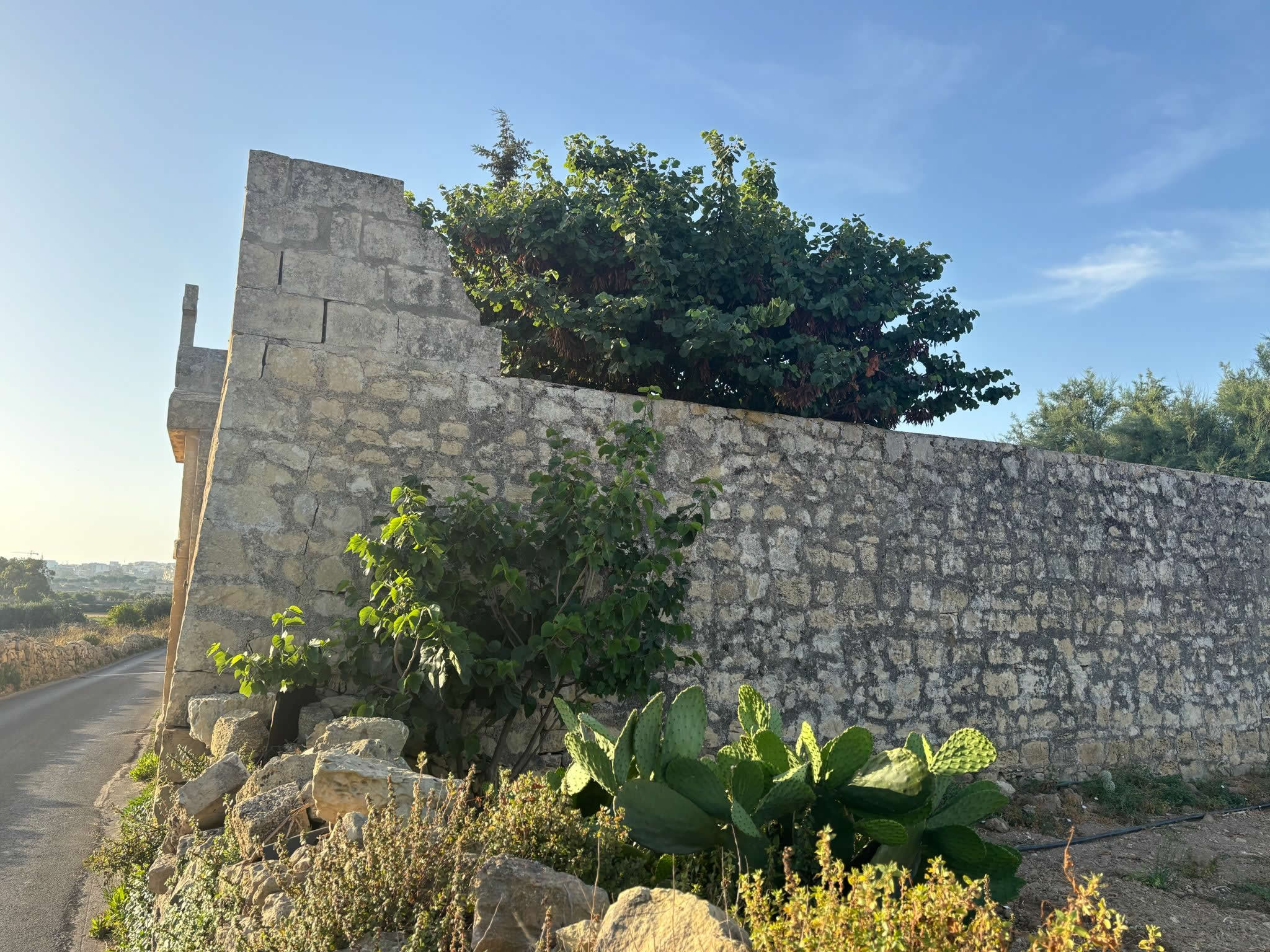
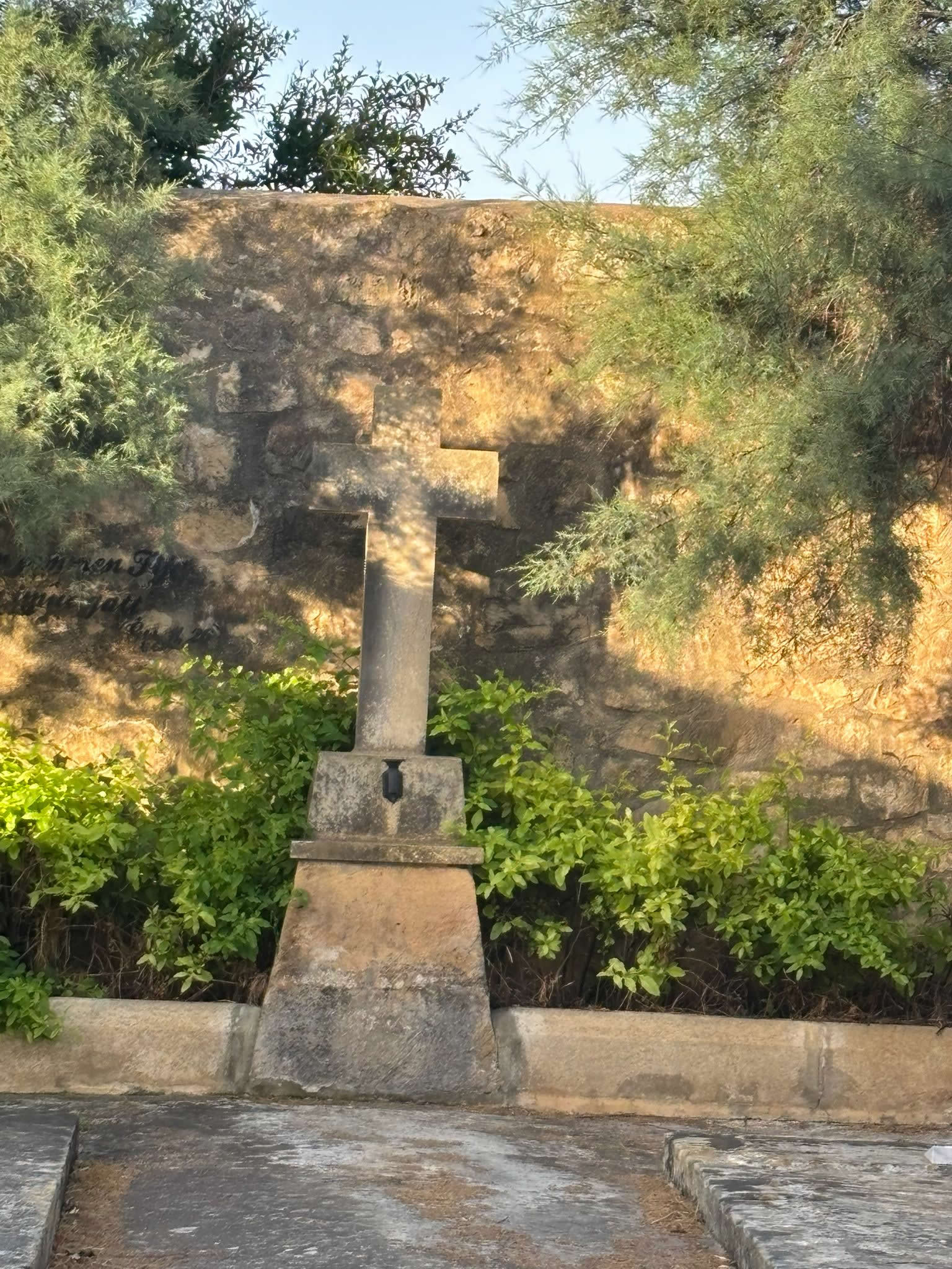
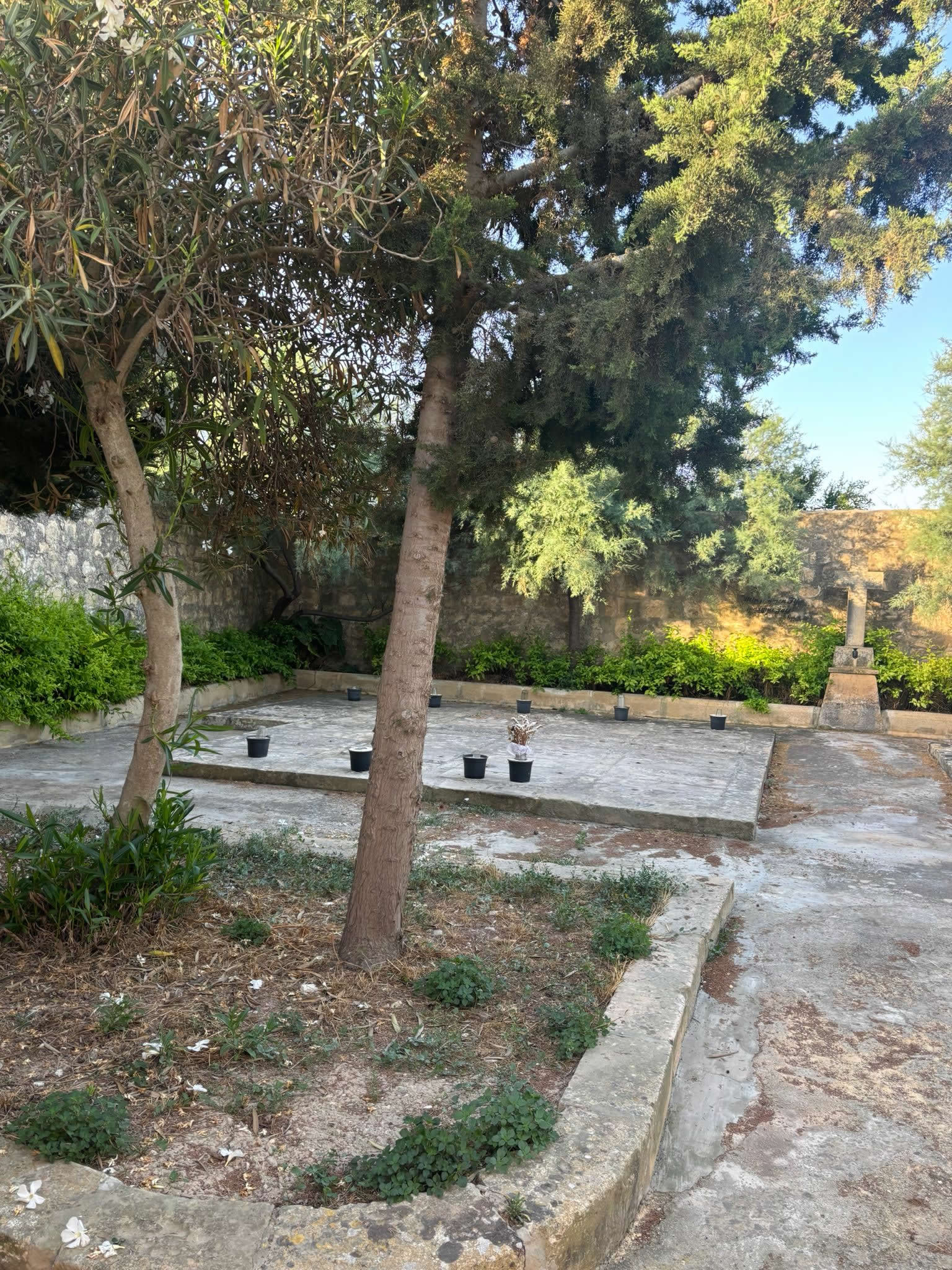
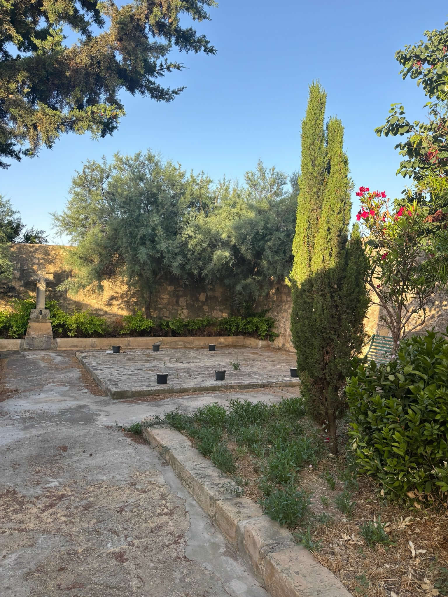
Architecturally, Tal-Ars Cemetery reflects its functional purpose as an emergency burial ground. It lacks the grand, ornate mausoleums seen in municipal cemeteries, focusing instead on a simple, solemn, and highly secure design. The complex is defined by a row of basic stone graves enclosed by high limestone rubble boundary walls (*ħajt tas-sejjieħ għoli*), built to prevent unauthorized access and maintain the site's strict isolation protocols.
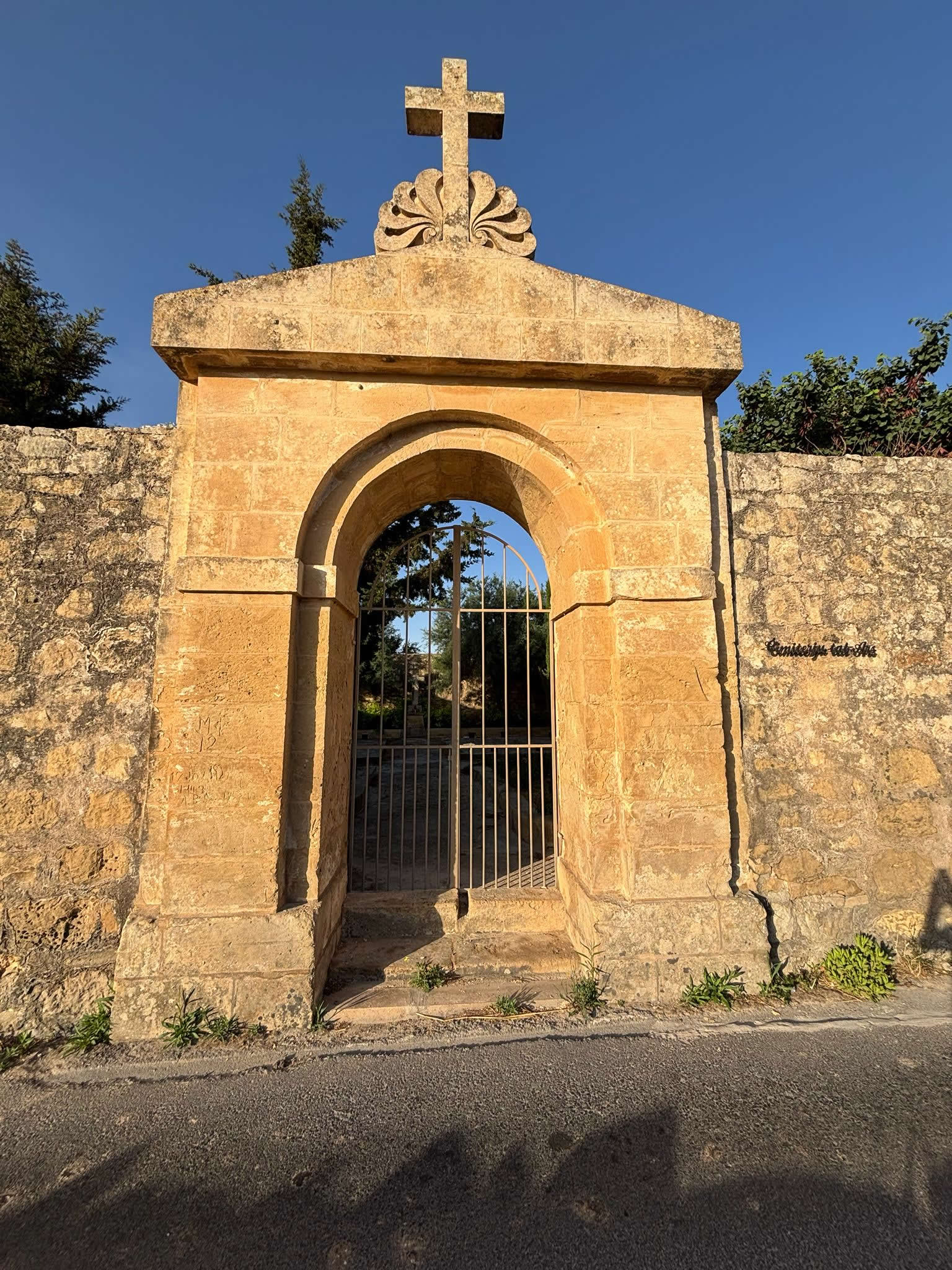
The interior features a stone ossuary or mortuary room (*Kennirja*), built to store remains securely. The religious identity of the site is marked by simple stone crosses set on square bases. In recent years, local councils have recognized the importance of preserving this heritage, initiating clean-up efforts and structural assessments to ensure that these delicate dry-stone boundaries and historical markers are protected from weathering and environmental wear.
5. The Neighboring Enigma: Ir-Razzett tal-Ars
The area's historical depth is further enriched by a fascinating structure standing directly adjacent to the cemetery walls: Ir-Razzett tal-Ars (The Ars Farmhouse). This private building is a remarkably well-preserved example of early vernacular architecture. Its most striking features are five distinct geometric carvings and circular designs etched directly into the ancient limestone building blocks near the window frames.
Cultural historians and architectural experts suggest these distinctive patterns point to early Arab or vernacular Moorish influences, dating back centuries before the cemetery was established. Although the farmhouse is located on private property and its main street-facing door has been sealed for decades, its close proximity to the burial ground adds a unique layer of mystery to the area, drawing the attention of hikers and historians exploring the ancient pathways of the southern region.
6. Technical and Administrative Dataset Profile
The data matrix below compiles the verified historical, geographical, and demographic parameters of the Tal-Ars complex:
| Administrative Survey Parameter | Field Inventory Reference Data |
|---|---|
| Official Nomenclature | Iċ-Ċimiterju tal-Ars (Tal-Ars Cemetery) |
| Geographic Locality | Outskirts of Qrendi (bordering Mqabba), Malta |
| WGS84 Reference Grid | 35.838467 Latitude, 14.466480 Longitude |
| Active Operational Span | 1830 – 1951 (121 Years of active service) |
| Primary Primary Threat Served | The Second World Cholera Pandemic (1837) & Contagious Poxes |
| Total Confirmed Interments | 212 Total Graveyard Casualties |
| Demographic Breakdown | 119 (Qrendi), 92 (Mqabba), 1 (Żurrieq) |
| Structural Contents | High rubble walls, simple graves, stone crosses, Kennirja (Ossuary) |

7. Frequently Asked Questions (FAQ)
❓ What does the name 'Ars' signify in the context of this cemetery?
The name 'Ars' refers to the specific geographic area outside Qrendi where the cemetery and an adjacent historic farmhouse are located. The name has ancient roots, with the nearby farmhouse showing architectural features linked to early Arab influences on the island.
❓ Did any plague or cholera victims get buried at Tal-Ars Cemetery?
Yes, Tal-Ars served as a critical quarantine burial site during the 1837 Cholera Pandemic. It was built specifically to isolate the remains of individuals who died from highly contagious diseases, keeping them away from populated village centers.
❓ Is Tal-Ars Cemetery currently open for active public burials?
No, the cemetery is no longer active. Its operational period spanned from 1830 to 1951. Today, it stands as a preserved historical site, offering a window into the evolution of medical quarantine and funerary practices in Malta.
❓ Can the general public visit the adjacent Razzett tal-Ars farmhouse?
No, the Razzett tal-Ars is located on private agricultural property, and its original street-facing entrance has been sealed for many years. However, its exterior stone carvings can still be viewed from the public country roads running alongside the cemetery.