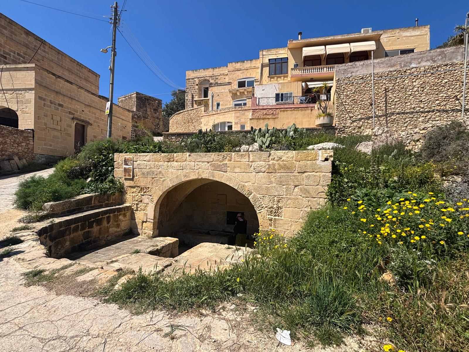
Hidden away from the main thoroughfares of Gozo, along a steep, narrow dirt track flanking the fertile valley network on the border of Ta' Kerċem and Fontana, lies the historical wash house of Għajn Tuta (alternatively spelled Għajn Tohta). This beautifully preserved structure represents a pristine survivor of Gozo’s rural vernacular heritage, serving for centuries as a vital lifespring and communal laundering station for families living on the higher ridges of the valley slopes.
Quick Reference Data
| Official Name | Għajn Tuta (The Mulberry Spring) |
|---|---|
| Location | Triq Għajn Tuta, Ta' Kerċem, Gozo |
| Historical Era | Late 16th / Early 17th Century (Knight's Period adaptations) |
| Hydrological Context | Fed by Perennial Perched Aquifer (Upper Coralline breaking over Blue Clay) |
| Protection Status | Scheduled Heritage Site (Restored by Ministry for Gozo & Kerċem Local Council) |
Geological Foundation & Hydraulic Engineering
Like its grander counterpart down at the valley floor (L-Għajn il-Kbira), the existence of Għajn Tuta is entirely dictated by Gozo’s distinct topography. Water filters down through the upper porous globigerina and coralline limestone layers of the Kerċem plateau until it strikes an impermeable horizontal layer of dense Blue Clay. Prevented from sinking deeper, the pressurized fresh water forces its way outward, emerging naturally as a perennial spring along the hillside.
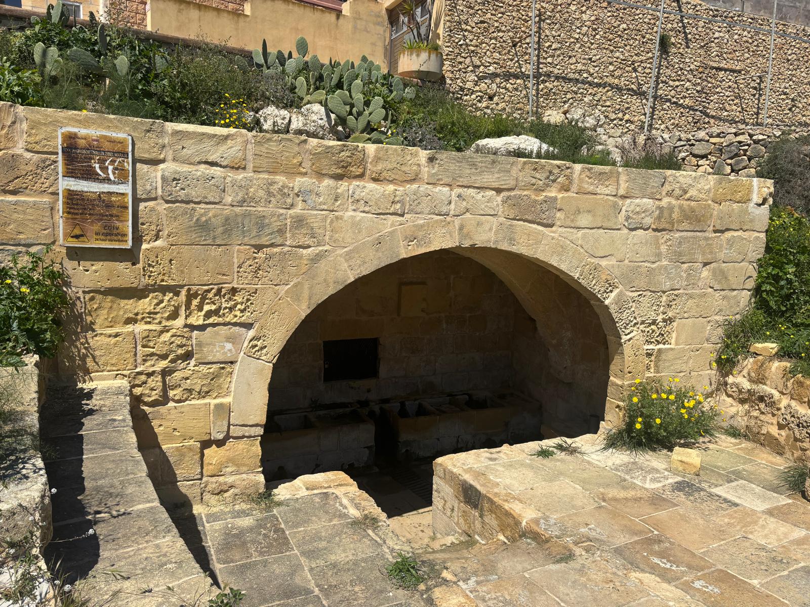
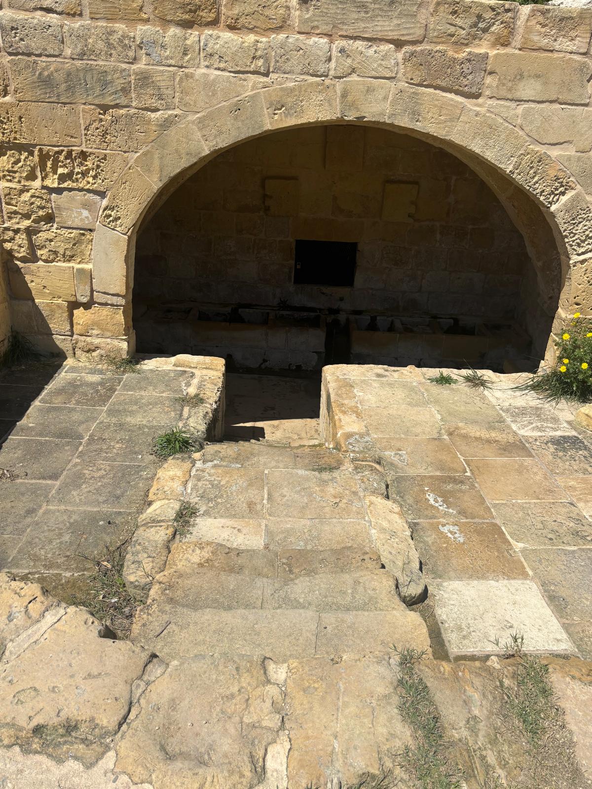
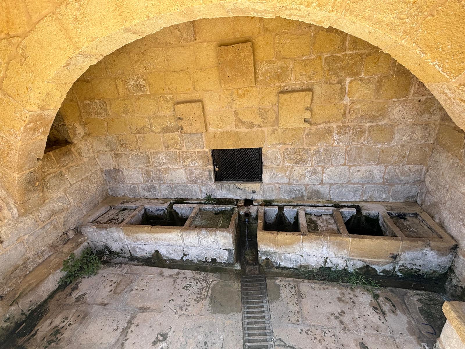
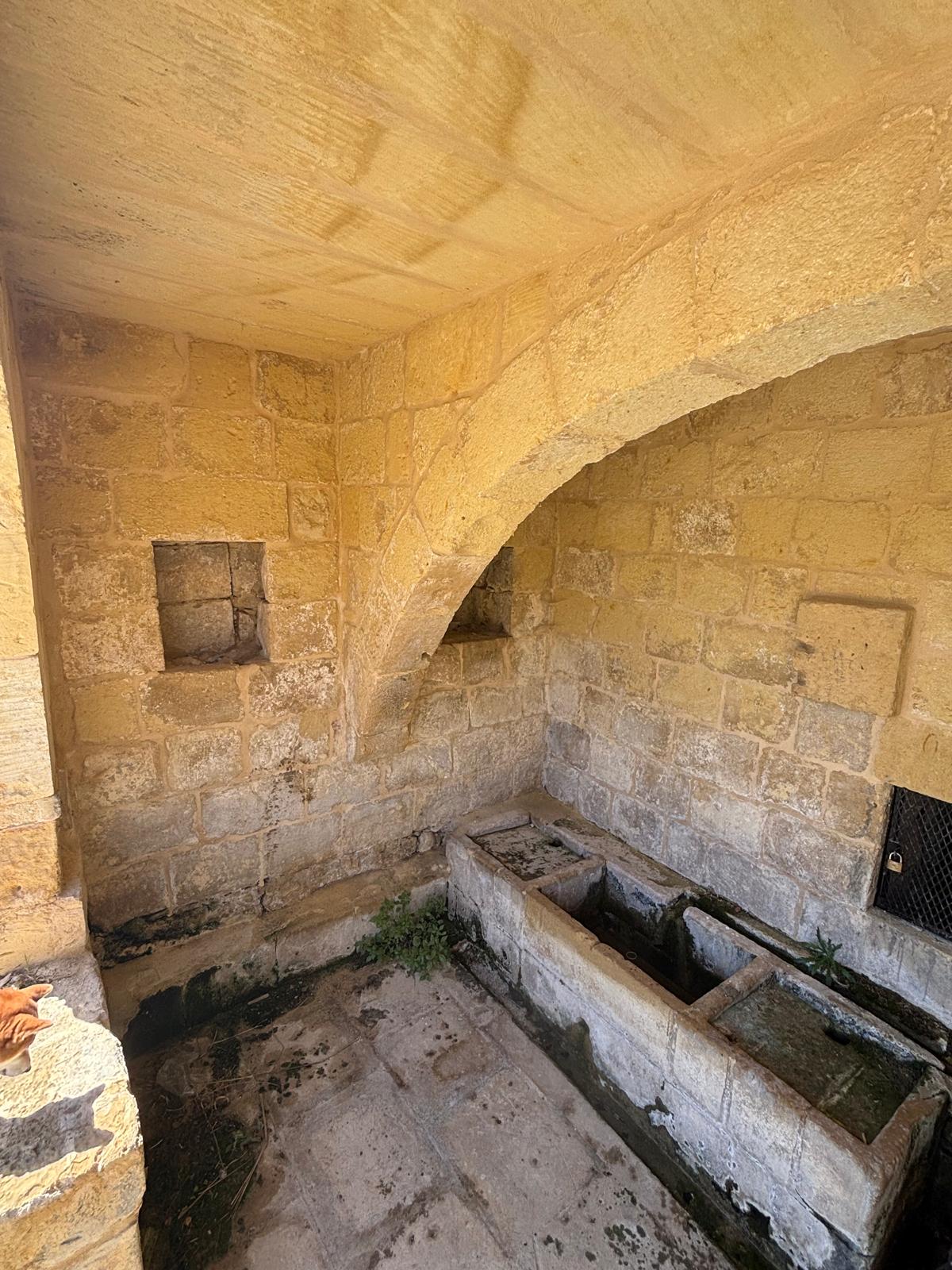
The structural layout of Għajn Tuta is a masterclass in vernacular hydraulic management. The entire facility is built flush into the rising clay embankment. A single, wide, masterfully constructed limestone arch forms a cavernous shelter designed to protect workers from the Mediterranean sun and winter downpours. By recessing the arch into the hill, builders effectively stabilized the wet earth behind it, preventing seasonal mudslides from choking out the water source.
Social History and the Inscribed Blocks
The name Għajn Tuta translates historically to the "Mulberry Spring," a nod to the ancient mulberry orchards that historically lined the well-watered valleys of Kerċem and the nearby Lunzjata wetlands. For generations of village women, trekking down the steep hillside path to Għajn Tuta was a laborious daily or weekly ritual. Carrying heavy bundles of woven sheets and household clothing, the spring offered a reliable, quiet space away from the busier traffic hub down at Fontana.
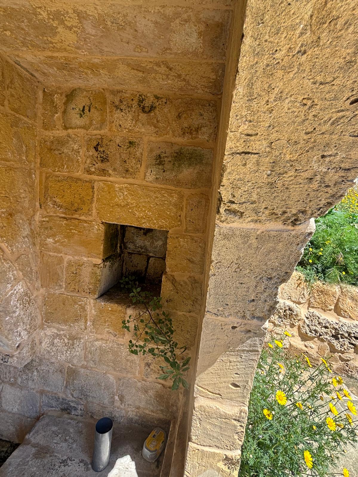
Inside the back wall of the limestone arch, directly above the washing basins, multiple rectangular stone blocks are integrated into the masonry work. These blank or weathered frames historically served to hold small votive religious statues, protective icons, or commemorative inscriptions designed to bless the waters. Today, the structure stands fully restored, complete with an official municipal plaque declaring its protected status under Gozo's regional council oversight.
Field Photography Documentation
The following original photographic archive demonstrates the precise structural mechanics, restoration status, and layout of the Għajn Tuta stone complex:
Frequently Asked Questions (FAQ)
Research & Documentation
- Researcher: Paul Berman
- Last Updated: 2026
This page forms part of eMalta's ongoing documentation of the historical, cultural and religious heritage of Malta and Gozo.
Information has been compiled through site visits, field research, historical publications, archival records, maps, plans and other reference sources.
All locations that currently exist featured on eMalta have been personally visited and documented. Where historic sites no longer exist, information has been researched from archival sources and contemporary records.
Images used on eMalta include original photography as well as historical illustrations, maps and photographs reproduced with permission from archives, institutions and copyright holders where applicable. Individual image credits and archive reference numbers are provided where available.