Msida Valley Spring Public Wash House
Msida, Malta

The Definitive Digital Archive of Maltese History & Architecture
Home - Directory of Churches in Malta and Gozo - Malta - Gozo - Comino - Heritage - Places - Travel - Guides - Contact - About
eMalta Heritage
The Definitive Digital Archive of Maltese History & Architecture

📍 Location

Location Map Coordinates 35.896584, 14.486102

Google Map Link

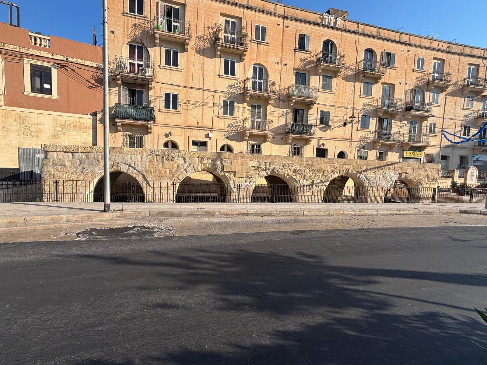
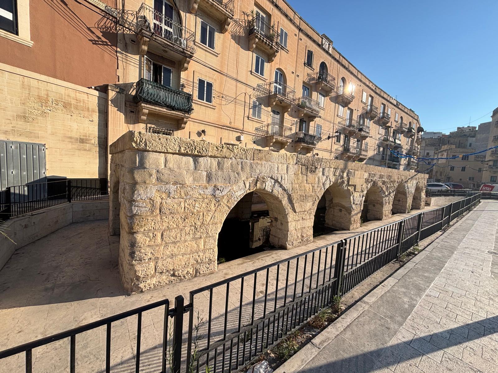
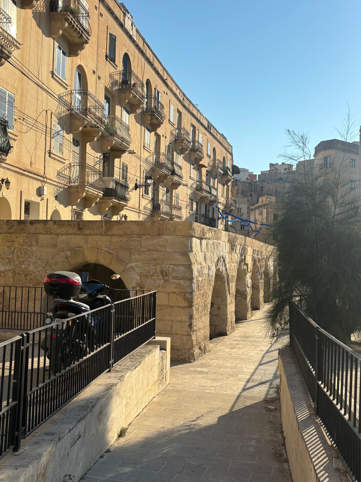
Located along the bustling thoroughfare of Triq il-Wied, the Msida Valley Spring Wash House (traditionally known as Għajn tal-Wied) offers a striking juxtaposition of old and new. Sitting beneath mid-20th-century apartment blocks, this historic limestone structure serves as a physical reminder of the vast natural water networks that once trickled down the valley toward the sea. Formalized during the late 18th century under the rule of Grandmaster Emmanuel de Rohan-Polduc, it remains a rare urban survivor of Malta's public hydraulic infrastructure.

Quick Reference Data

Official Name Għajn tal-Wied (The Valley Spring Wash House)
Location Triq il-Wied (Valley Road), Msida, Malta
Historical Era Late 18th Century (Order of St. John / Grandmaster de Rohan period)
Hydrological Context Natural freshwater catchment collected from the water table of the extensive Msida Valley system
Architectural Form Linear low-slung stone arcade featuring segmented limestone arches and a flat flagstone roof

Urban Hydrology & Architectural Footprint

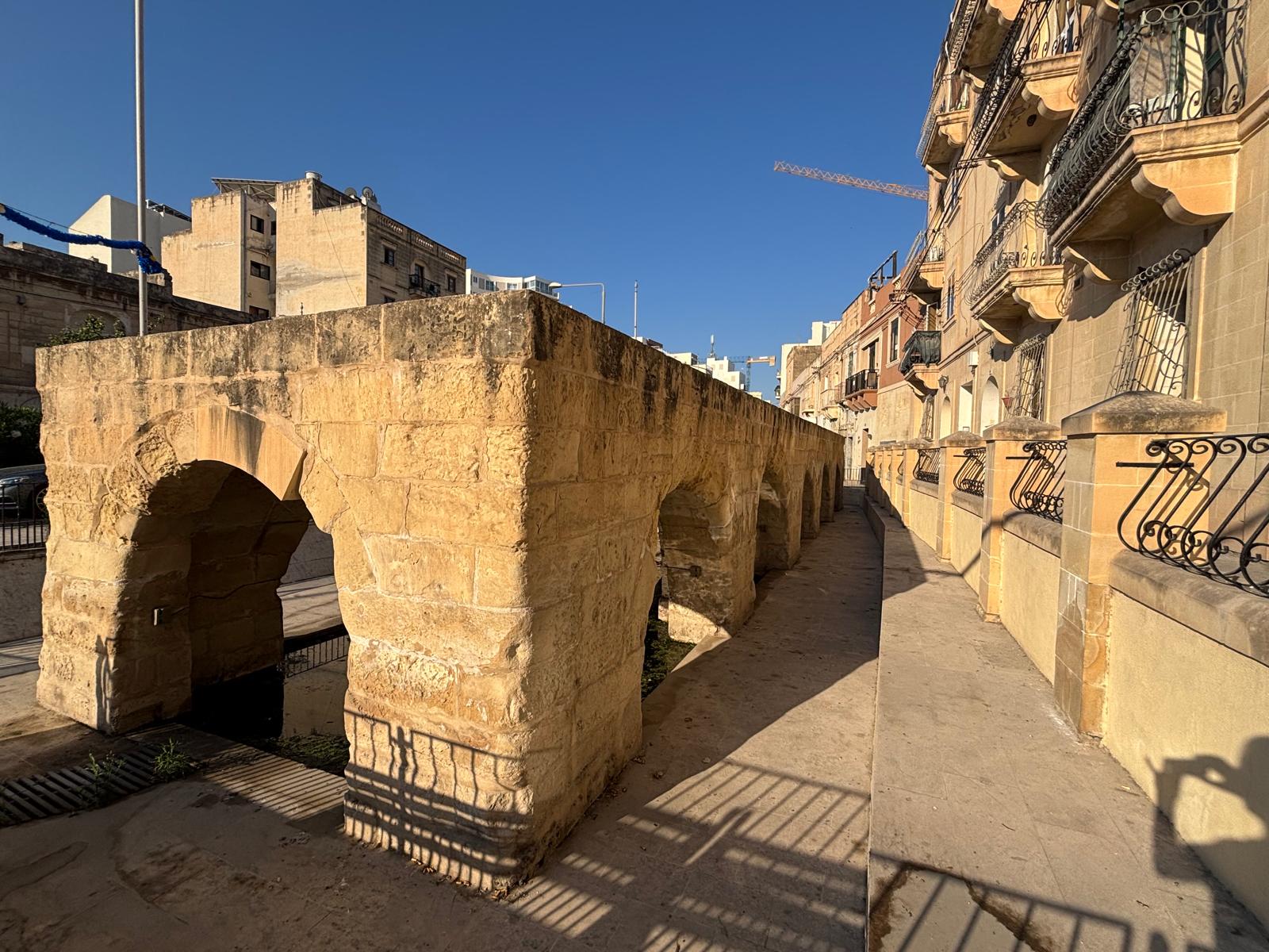
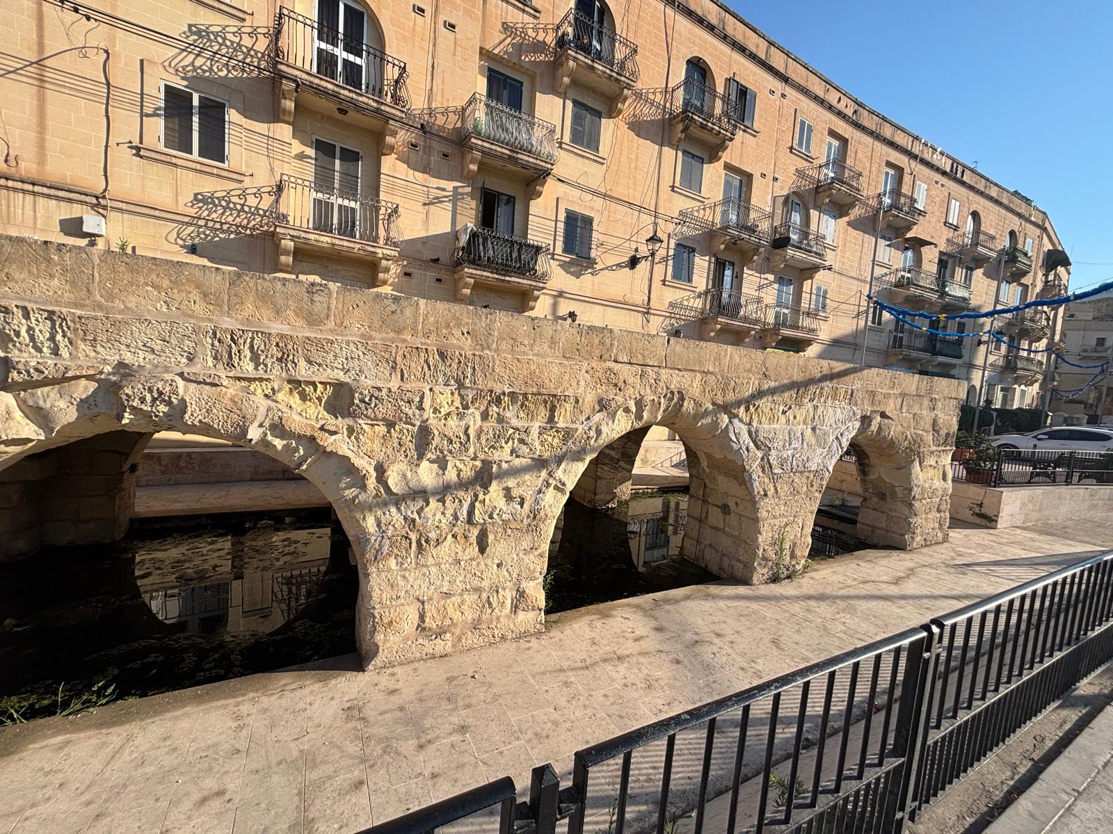
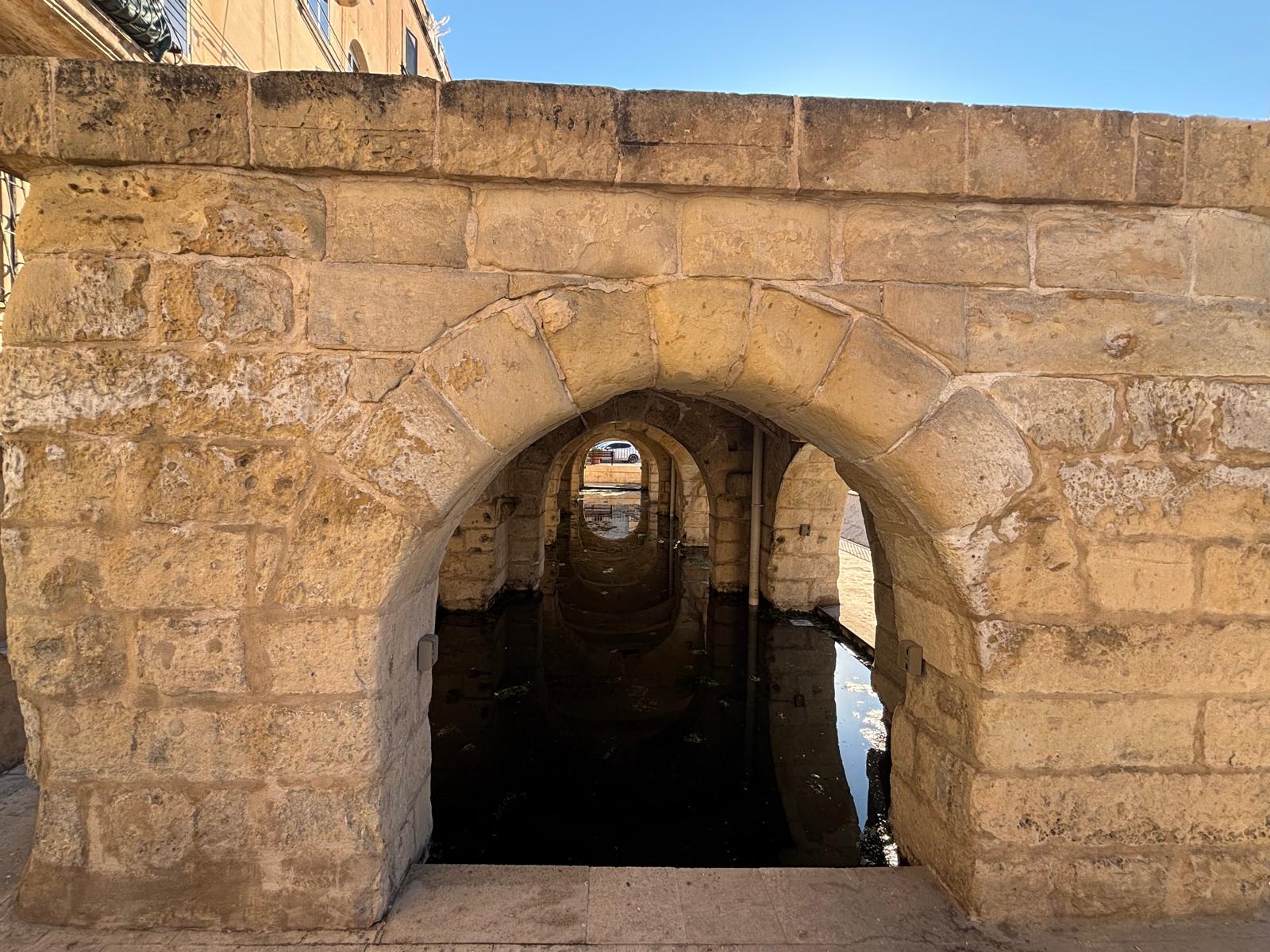
Before the urbanization of Birkirkara and Msida, Valley Road was a wide, natural stormwater channel fed by deep inland aquifers. Fresh water consistently pooled along this low basin, leading historical engineers to construct a long, defensive stone arcade over the water channels. This design kept the clean washing supply insulated from dust, heat, and flash flooding cascading down the valley path.

The layout consists of a continuous, low-slung limestone corridor punctuated by a series of repetitive, thick-set stone arches. This segmented arcade supports a solid, flat slab roof that aligns neatly with modern street levels. Today, protective modern iron railings run the length of the structure, separating the historical open water basin from the busy roadway and pedestrian footpaths.

Hydraulic Survival: Despite being surrounded by dense modern buildings, concrete pavements, and heavy road infrastructure, the natural aquifer still forces its way upward. The subterranean floors of the stone chambers are frequently filled with a deep pool of fresh, clear standing water, creating vivid architectural reflections through the concentric layout of the stone arches.

Field Photography Documentation

The following original field photos demonstrate the architectural layout and urban integration of the Msida Spring complex:

The historic low stone arch wash house structure sitting at the base of multi story modern apartment flats on Valley Road Msida
Urban Contrast: The low, historic stone wash house on Valley Road, standing directly in front of multi-story modern residential apartment buildings.
Side profile look down the long flat roof and thick stone columns of the Msida public wash house arcade
Linear Profile: Side view highlighting the flat flagstone top and thick stone pillars of the long, arched corridor.
Close up view of the thick textured limestone block arches of Ghajn tal-Wied wash house in Msida
Masonry Profile: Close-up view of the rugged, hand-cut limestone arches and the protective street railings running along the outer boundary.
Concentric view through the inside of the Msida wash house showing arches reflecting perfectly in a pool of clear standing spring water
Concentric Water Mirror: Looking down the internal axis of the arcade, where clear standing valley water creates sharp reflections through the stone portals.
Wide angle road view of the complete arched Msida spring public wash house structure flanked by modern asphalt roads
Roadside Elevation: A wide-angle view showing the full length of the historic site and how it integrates into today's busy asphalt street network.
Pedestrian ramp and pavement pathway leading down to the entrance arches of the historic Msida spring
Pedestrian Access: The lowered stone-paved walkway and ramp that guide visitors alongside the arches from the main street level.

Frequently Asked Questions (FAQ)

When was the Msida Valley Spring wash house constructed?
The structure was formalized during the late 18th century, under the governance of the Order of St. John, specifically connected to the regional development projects of Grandmaster Emmanuel de Rohan-Polduc.
Is there still water inside the Msida wash house today?
Yes. Because it is built directly over the natural low-point water table of the valley basin, fresh water continues to seep through the ground, often forming a standing pool inside the stone chambers.
Where exactly on Valley Road is it located?
The site is situated on Triq il-Wied (Valley Road), Msida, sitting directly between the modern roadway and the tall block of residential apartment flats near the central urban crossroads.

Research & Documentation

  • Researcher: Paul Berman
  • Last Updated: 2026

This page forms part of eMalta's ongoing documentation of the historical, cultural and religious heritage of Malta and Gozo.

Information has been compiled through site visits, field research, historical publications, archival records, maps, plans and other reference sources.

All locations that currently exist featured on eMalta have been personally visited and documented. Where historic sites no longer exist, information has been researched from archival sources and contemporary records.

Images used on eMalta include original photography as well as historical illustrations, maps and photographs reproduced with permission from archives, institutions and copyright holders where applicable. Individual image credits and archive reference numbers are provided where available.