Hand-Carved Basins, Coastal Hydrodynamics, and Artisanal Crystals on Gozo's Southern Coast
Geographic Location and Technical Data
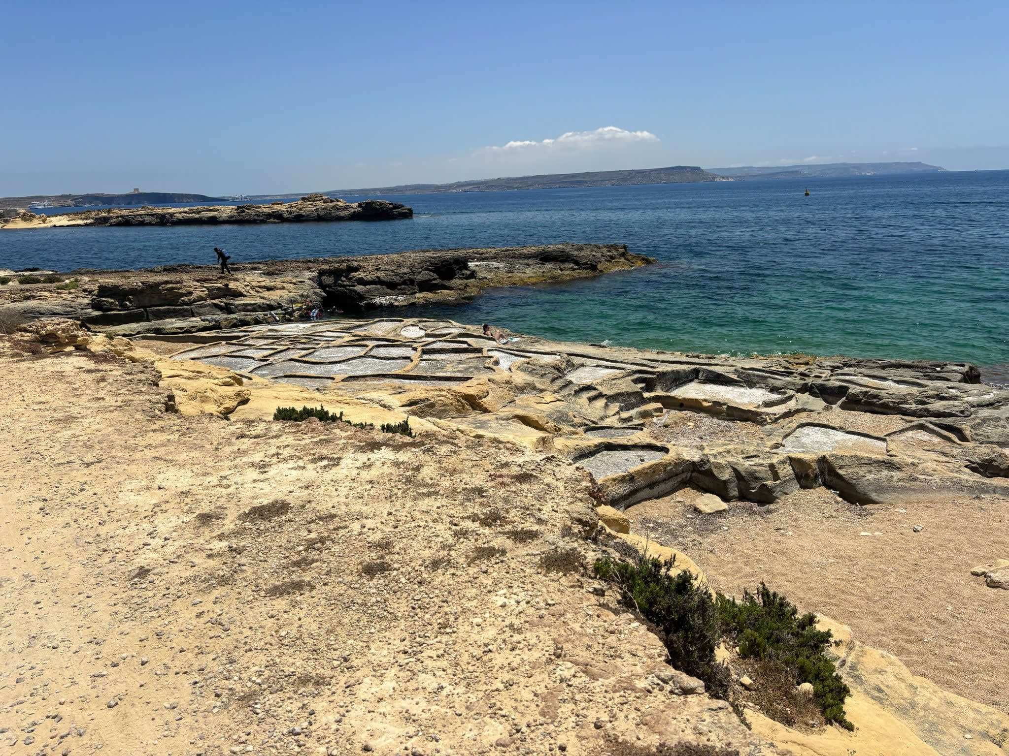
Situated along the scenic, wind-swept southern coast of Gozo, the Xatt l-Aħmar Salt Pans represent an intricate example of localized coastal engineering. Positioned within the geographic boundaries of Għajnsielem, this low-lying limestone terrace guards the entrance to the bay of Ix-Xatt l-Aħmar (The Red Beach)—a region highly celebrated by divers, historians, and geologists alike. Shielded from harsh northern winds but highly exposed to the baking southern summer sun, this microclimatic location provides the ideal environment for solar salinity crystallization.
| Site Technical Specifications | |
|---|---|
| Official Site Name | Xatt l-Aħmar Salt Pans (Għajnsielem, Gozo) |
| GPS Coordinates | 36.019846, 14.288403 |
| Typology | Rock-Cut Linear Grid Matrix (Manually Chiseled) |
| Scale | Small-Scale Intimate Section |
| Rock Composition | Lower Coralline Limestone (Highly Impermeable Bedrock) |
| Primary Crop | 100% Organic Fleur de Sel / Artisan Crystal Sea Salt |
The Art of the Chisel: Historical and Geological Foundations
While Gozo boasts several vast, sprawling salt pan networks, the cluster at Xatt l-Aħmar is unique due to its small, intimate scale and its clear display of manual craftsmanship. These pans are not natural geological erosion hollows; rather, they form a carefully planned, rock-cut section chiseled directly out of the flat coastal stone by generations of Gozitan families.
The builders utilized the incredibly tough, dense layers of Lower Coralline Limestone that define this part of Għajnsielem’s shore. This specific rock type was favored because it naturally prevents water leakage, ensuring that precious sea brine remains trapped in the shallow basins without seeping into the bedrock. Using hand-picks and metal wedges, ancient salt-harvesters carved out a neat grid of shallow square and rectangular pans (*ħwat*), accompanied by a network of narrow, hand-carved feeding channels designed to distribute water evenly across the entire terrace.
The Crystallization Process: Solar Evaporation Mechanics
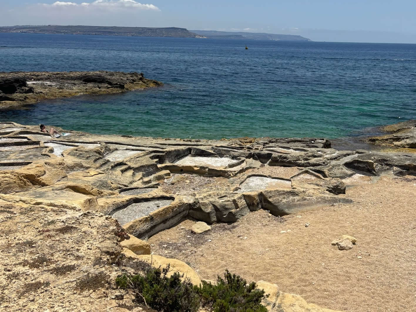
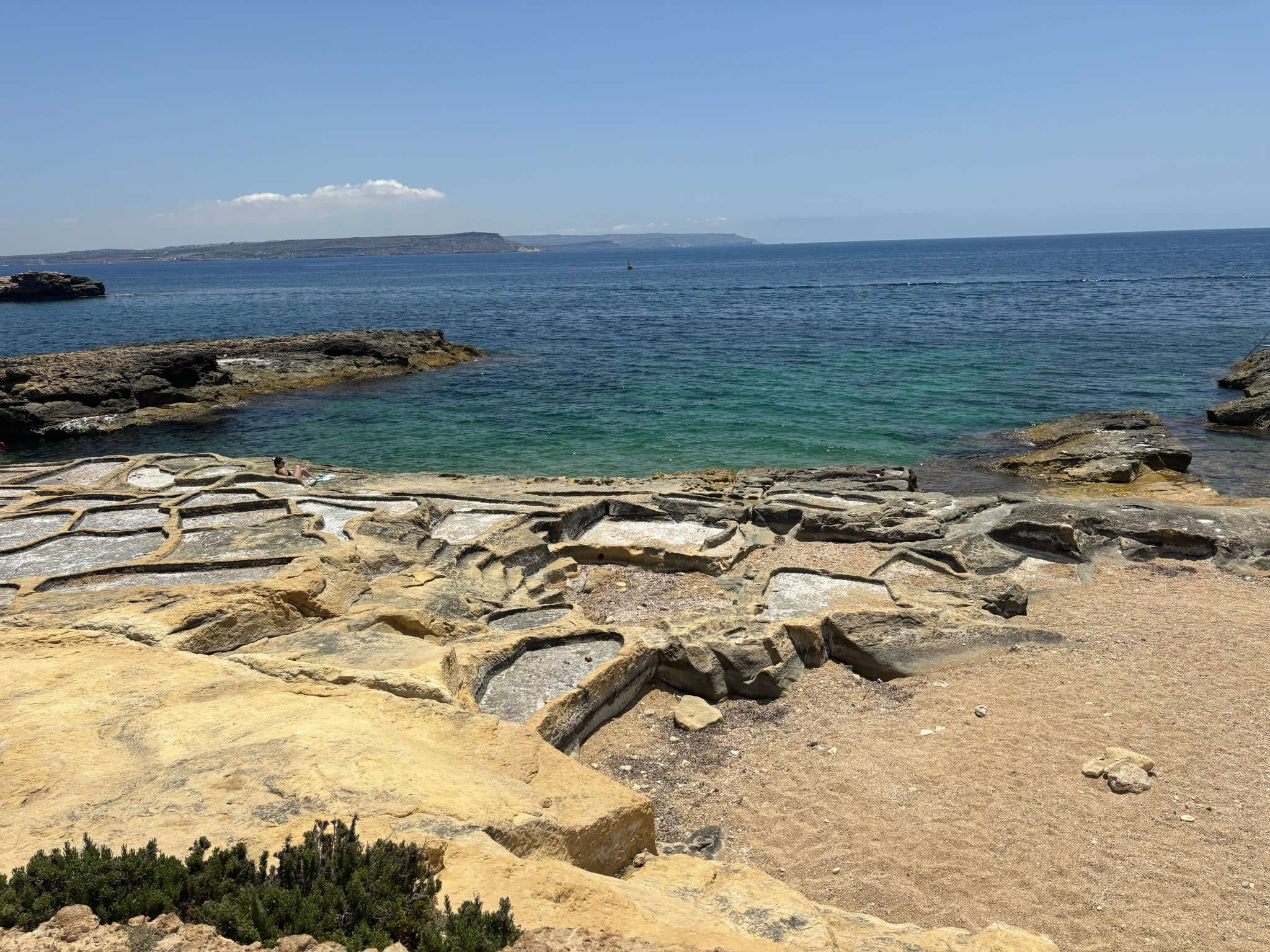
The operation of the Xatt l-Aħmar rock-cut pans follows the strict environmental cycles of the Maltese summer. Because these hand-carved grids sit just above the normal high-water mark, they are protected from minor summer wave action but remain close enough to the sea to allow for efficient manual filling.
The cycle begins in late spring, when the family or local caretakers manually scrub the rock-cut squares to remove the silt, algae, and salt-crusts left behind by winter storms. Sea water is then introduced into the primary holding reservoirs (*vaġelli*), where it sits to catch the initial heat of the sun, steadily increasing its salinity. This concentrated brine is later skimmed and channeled into the smaller, shallower evaporation pans.
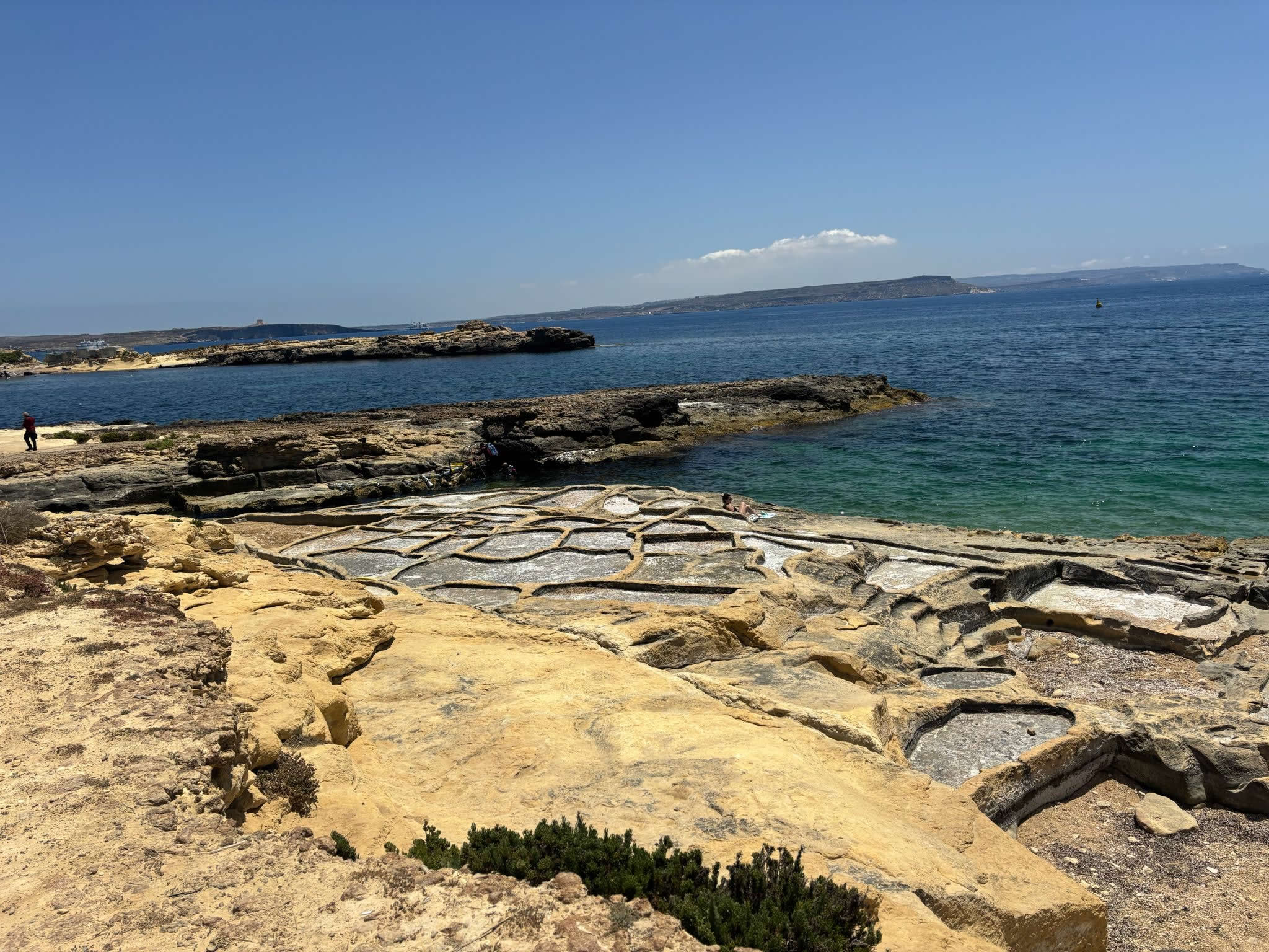
Throughout July and August, the intense solar heat completely evaporates the remaining water content, leaving behind a pristine layer of shimmering white sea salt. Harvesters then descend onto the limestone shelf at dawn, using traditional flat wooden scrapers to gather the crystals into small pyramids. This traditional method ensures that no stone debris breaks away from the hand-carved basin floor, keeping the final product pure, raw, and highly rich in marine minerals.
Frequently Asked Questions — Xatt l-Aħmar
The salt pans are located along the rocky shoreline of Ix-Xatt l-Aħmar bay in Għajnsielem. Visitors can drive down the winding country road toward the bay's main beach area and then follow the rocky coastal path on foot to reach the exact coordinate location (36.019846, 14.288403).
The southern coast of Gozo features steeper, more rugged cliffs than the north. Because large flat coastal shelves are rare here, historical harvesters could only carve out smaller, more intimate sections of rock wherever a suitable limestone ledge naturally occurred close to the water level.
No. Visitors should strictly avoid walking across the salt pans or stepping on the delicate stone walls partition grid. Footwear can track dirt into active food production zones and accelerate the erosion of the historic, hand-carved limestone ridges that have been preserved for centuries.
The area around Ix-Xatt l-Aħmar is rich in history. Overlooking the bay stands the iconic 18th-century Fort Chambray, while the surrounding coastal shelf contains remnants of British-era defense fortifications and pristine underwater shipwrecks, making it a major hub for both historical walks and scuba diving.