Carved directly into the low-lying Lower Coralline Limestone shelves of the Naxxar coastline, the salt pans of Baħar iċ-Ċagħaq represent an exceptionally well-preserved example of industrial vernacular heritage. For centuries, these geometric rock-cut systems harnessed the combined power of the Mediterranean Sea, intense solar radiation, and persistent northwesterly winds to secure one of Malta's most valuable historic commodities: marine salt.
Historical Timeline & The 1742 Expansion
While basic salt harvesting along the northeastern coast dates back to antiquity, the systematic, grid-aligned industrial layout visible today owes its structural growth to the mid-18th century. Historical documentation confirms that the Baħar iċ-Ċagħaq system was formally expanded and optimized in 1742 to meet growing local consumption needs and export quotas handled by the treasury of the Knights of St. John.
The 1742 works standardized the depths of the evaporation pans, improved the layout of feeding channels, and hand-chiseled larger holding wells into the higher terrace lines. This intervention ensured a more regulated distribution of brine, minimizing waste during seasonal high tides and dramatically increasing production efficiency before the autumn rains set in.
Technical Layout and Hydraulic Engineering
The system is divided into two distinct functional elements chiseled directly out of the coastal limestone:
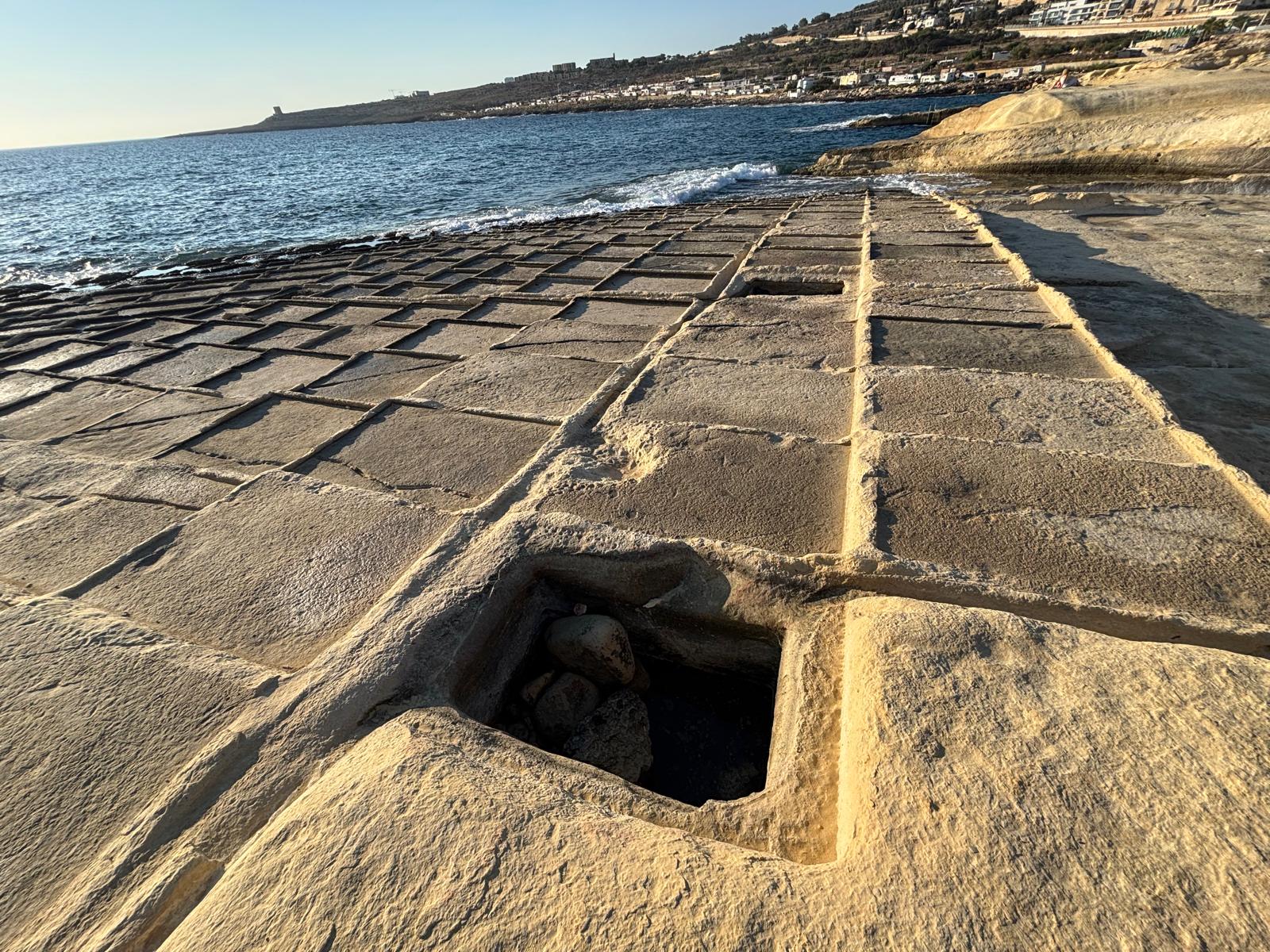
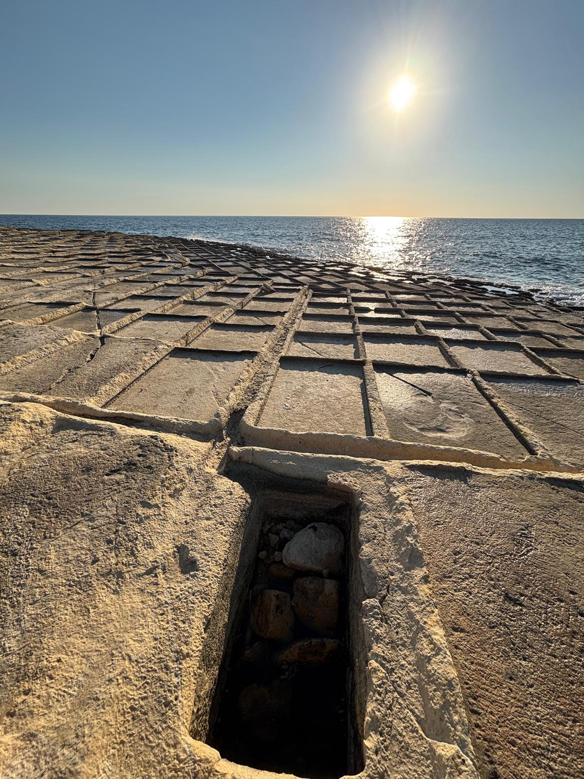
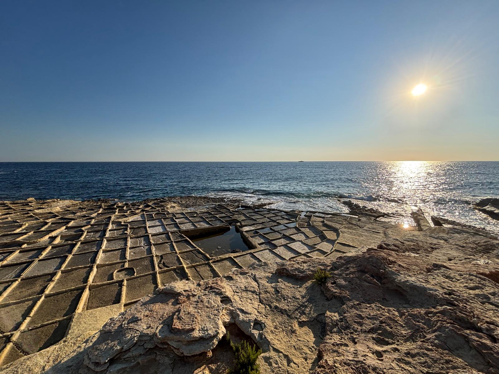
- The Supply Wells (Wiri): Deep, rectangular reservoir basins located closer to the upper landward slopes. These reservoirs collected raw seawater—either washed in during rough seas or filled manually—allowing sand, silt, and heavy impurities to settle to the bottom.
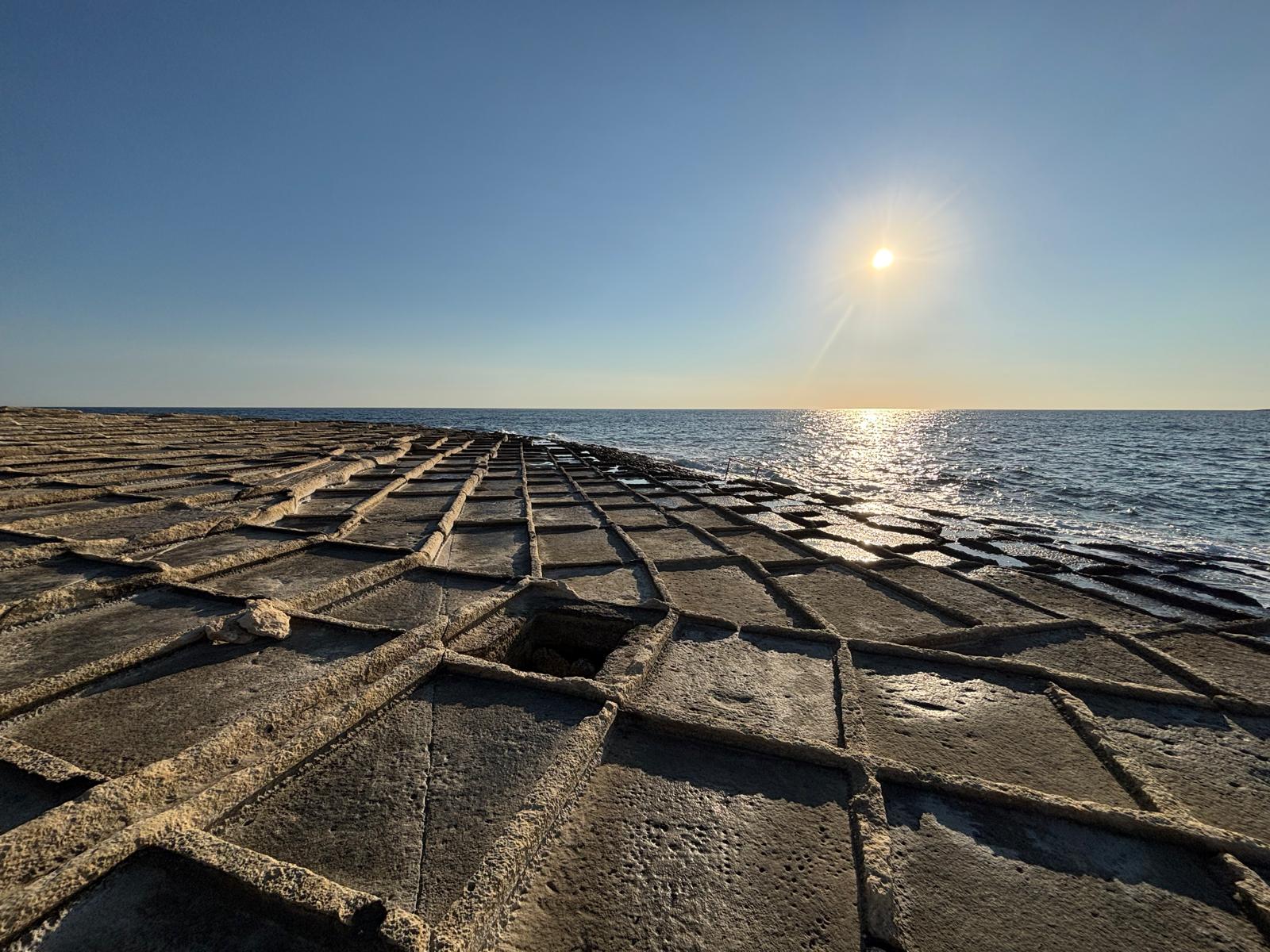
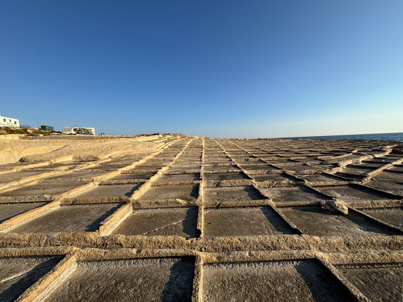
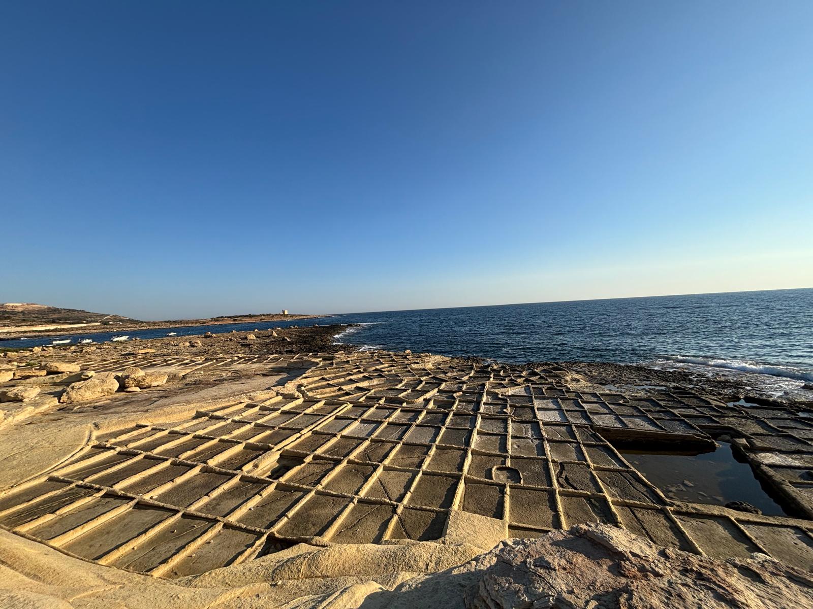
- The Crystallizing Pans (Mejji): A vast network of shallow, square, and rectangular basins arranged in a cascading terrace formation down toward the surf line. Small rock-cut sluice grooves regulated the gradual gravity feed of the concentrated brine into these shallow beds.
Once filled into the shallow pans, solar evaporation naturally concentrated the salinity levels until crusts of pure sea salt formed on the limestone floor, ready to be scraped, gathered, and stored in nearby rock-cut storage depots or stone huts.
Field Photography & Structural Visual Guide
The following high-resolution survey captures the intricate masonry layout, rock-cut reservoirs, and current conservation status of the Baħar iċ-Ċagħaq system at low tide:
Conservation Status and Environmental Protection
Today, the Baħar iċ-Ċagħaq salt pans stand as an vulnerable testament to Malta's maritime heritage. While they are no longer worked on a commercial scale, the rock formations remain fully intact. However, they face constant threats from natural wave-cut erosion, modern coastal road development, and heavy foot traffic from seasonal bathers.
Preserving these rock-cut installations is critical for maintaining the cultural landscape of Naxxar, serving as an open-air historical museum that illustrates traditional sustainable manufacturing practices long before modern industrial alternatives appeared.