📍 Location
Location Map Coordinates 36.081336, 14.230905
Għar il-Qamħ of Żebbuġ, Gozo – An Architectural and Subterranean Hydraulic Marvel
Introduction
Carved high upon the rugged northern limestone shelves of Gozo lies one of the Maltese islands' most ingenious coastal installations: the Clockmaker's Salt Pan System. Locally known as Ta’ l‑Arloġġar, this historical landmark sits perched at Għar il-Qamħ within the boundaries of Żebbuġ. Unlike traditional coastal pans sitting flush at sea level, this highly calculate complex represents an ambitious 18th-century industrial exploit built far higher than the reach of normal tides, utilizing a daring design to draw sea water right out of the earth itself.
The Chronicles of Boisgelin (1804)
The remarkable origins of the site were recorded by Louis de Boisgelin in his landmark 1804 text, Ancient and Modern Malta. Boisgelin documents that roughly forty years prior to his record (circa 1764), a master clockmaker took up the arduous task of hand-hewing an extensive salt pan facility out of the rock platform. Sitting between 12 and 15 meters above the crashing surf, the elevation made collecting water nearly impossible via ordinary physical transport, driving the clockmaker to invent a brilliant, yet highly unpredictable hydraulic system.
The Subterranean Sea Grotto & Borehole Shaft
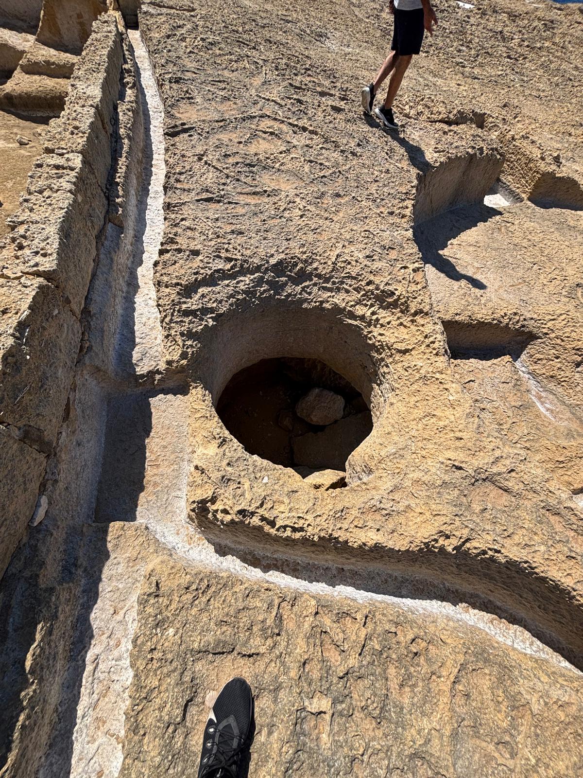
During his surface excavations, the clockmaker discovered that an underwater cave system or marine grotto extended directly beneath his coastal worksite. Seizing a unique engineering shortcut, he meticulously pierced the living rock face vertically, creating a straight drop well directly into the belly of the sea cave below. This vertical conduit allowed him to seamlessly lower buckets straight down into the grotto to harvest incoming sea water, cutting out the grueling task of cliff-side lifting.
However, modifying natural geology on a coast prone to savage seasonal changes introduced a terrifying element of danger. As recorded by Boisgelin:
"One day in winter, a terrible storm arose and the violence of the wind drove the raging waves into the grotto. The body of water, increasing considerably, and being confined in this almost circular spot, acted with a [tremendous pressure...]" — Boisgelin L., (1804) Ancient and Modern Malta
When heavy winter gales funneled roaring seas into the mouth of the cave, the water and trapped air mass condensed under violent forces, turning the clockmaker's circular water borehole into a massive, erupting geyser-like blowhole.
Visual Survey of Ta’ l-Arloġġar
The layout below presents the meticulous engineering and remaining geological structures of the clockmaker's achievement. (Images are optimized uniformly for close visual study):
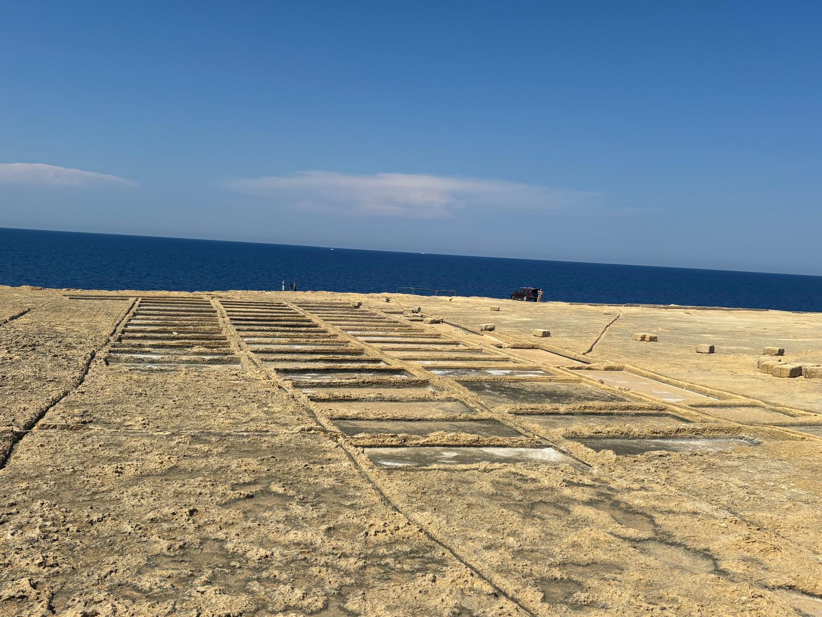
clockmakerssaltpans1.jpg - Overview of the high coastal platform and grid matrix of the pans looking out towards the horizon.
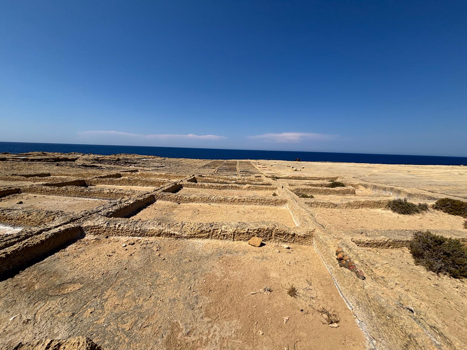
clockmakerssaltpans2.jpg - The famous circular vertical borehole pierced by the clockmaker to tap into the subterranean marine cave.
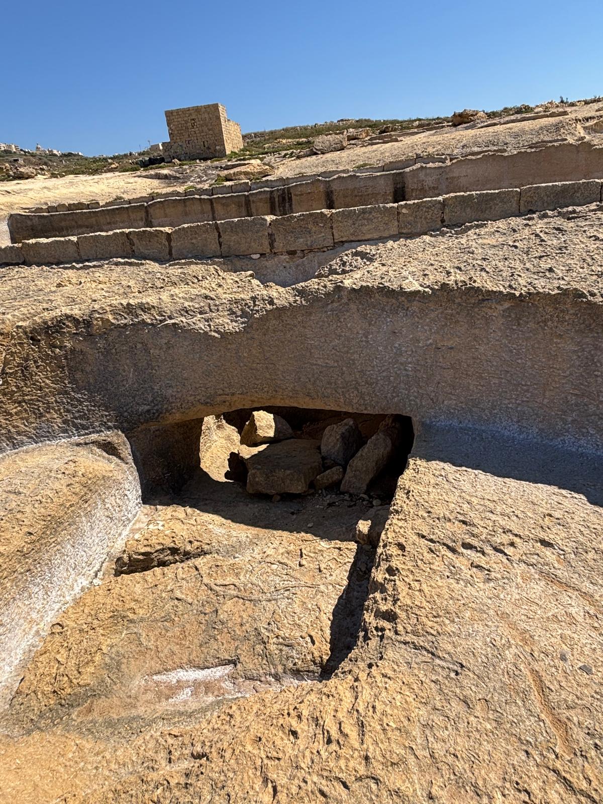
clockmakerssaltpans3.jpg - Looking directly down the throat of the circular shaft where winter storm pressures created a massive blowhole effect.
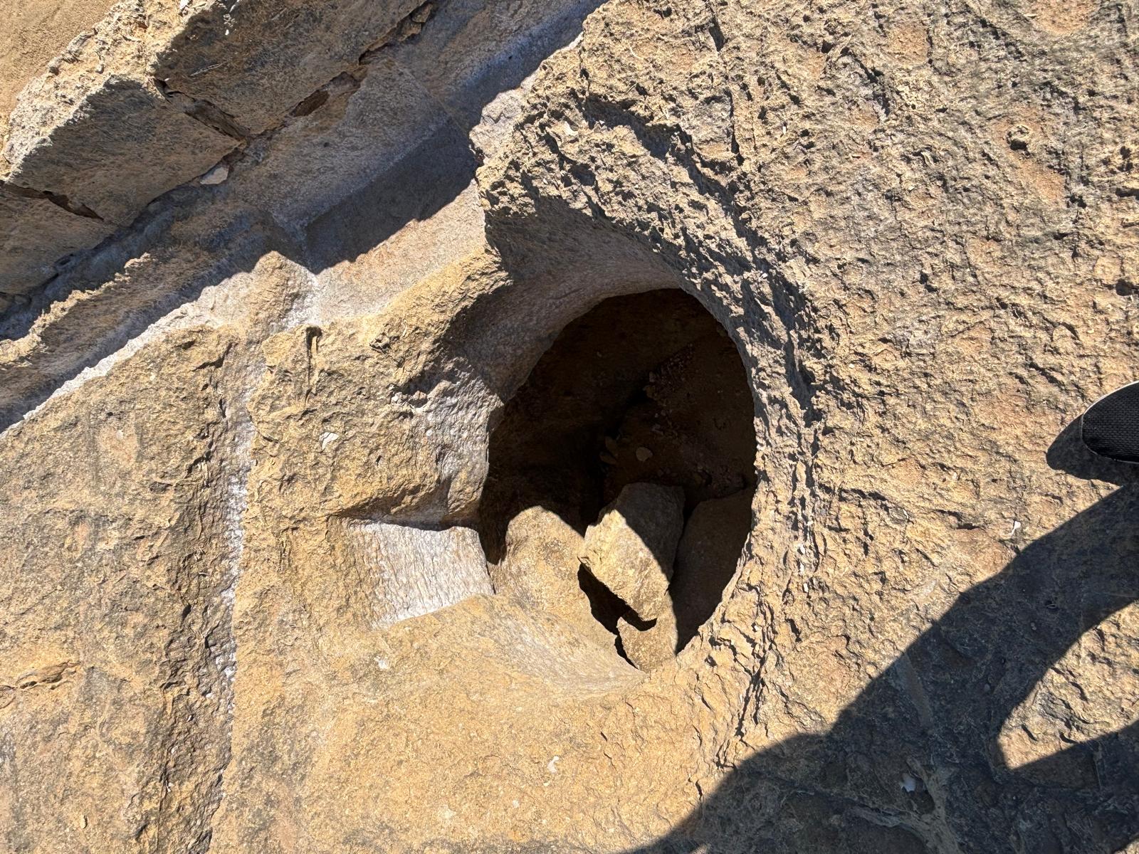
clockmakerssaltpans4.jpg - The structural rock archway and lower channels indicating the hollowed-out spaces of the underlying marine cave system.
clockmakerssaltpans5.jpg - Terraced evaporation pans situated 12 to 15 meters above sea level, showcasing the massive scale of the clockmaker's layout.
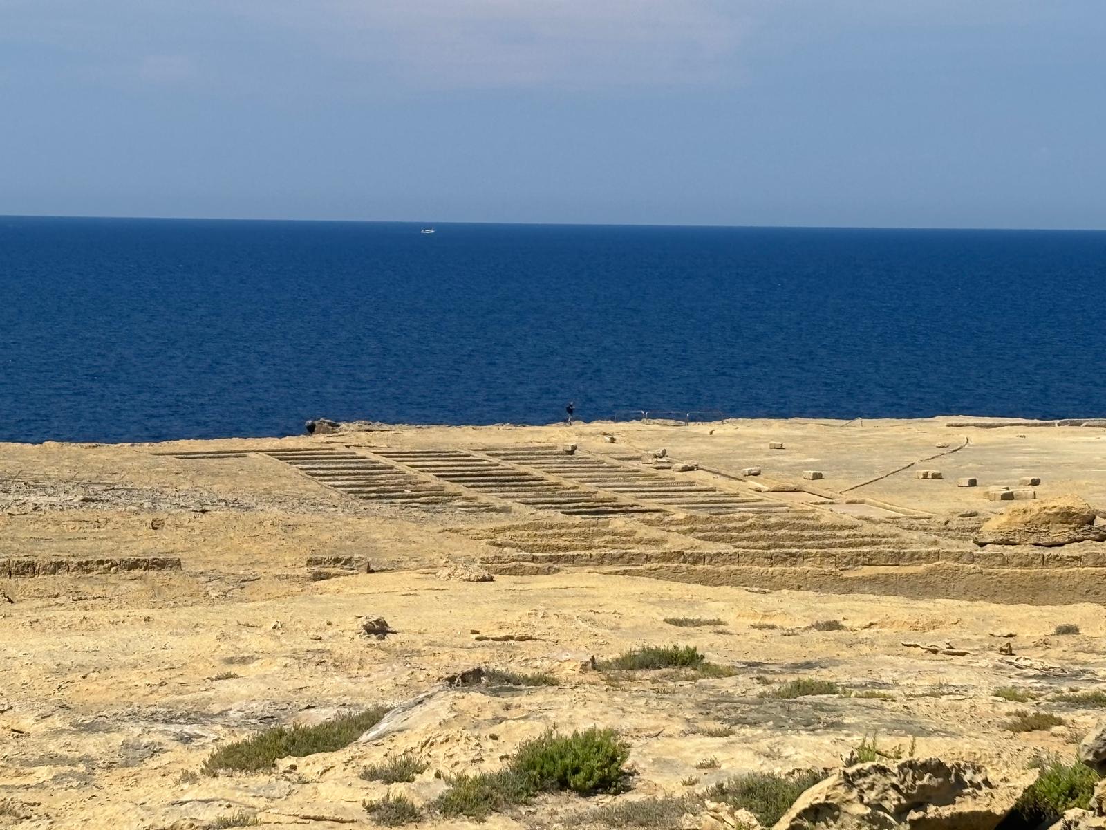
clockmakerssaltpans6.jpg - Fine parallel lines and distribution gutters displaying the mathematical precision expected of an 18th-century artisan clockmaker.
Frequently Asked Questions (FAQ)
Who built the Ta’ l-Arloġġar salt pans?
Historical texts from Louis de Boisgelin state that a local clockmaker dug this entire system out of the solid limestone coast circa 1764 to harvest salt on a highly elevated platform.
Where is the circular well hole mentioned in historic texts located?
The circular borehole can be observed directly on-site at coordinates 36.081336, 14.230905. Visually, this is the circular opening documented clearly in clockmakerssaltpans2.jpg and clockmakerssaltpans3.jpg.
Why did the clockmaker pierce a hole down into the rock?
Because the salt pans sat 12 to 15 meters above sea level, hauling seawater over the cliffs was impractical. By boring a vertical hole straight down into a underlying marine grotto, the clockmaker formed a protected well system to cleanly haul sea water directly to his pans from below.
Research & Documentation
- Researcher: Paul Berman
- Last Updated: 2026
This page forms part of eMalta's ongoing documentation of the historical, cultural and religious heritage of Malta and Gozo.
Information has been compiled through site visits, field research, historical publications, archival records, maps, plans and other reference sources.
All locations that currently exist featured on eMalta have been personally visited and documented. Where historic sites no longer exist, information has been researched from archival sources and contemporary records.
Images used on eMalta include original photography as well as historical illustrations, maps and photographs reproduced with permission from archives, institutions and copyright holders where applicable. Individual image credits and archive reference numbers are provided where available.