📍 Location
Location Map Coordinates 35.872348, 14.423631
A Contemporary Architectural Survey and Analysis of the Ħaż-Żebbuġ Communal Grounds and Proximity to the 1813 Ta' Trapna Plague Site
1. Structural Typology: Resolving the Historical Distinction
In the field of Maltese local topography and funerary architecture, researchers frequently encounter generalized classification lists that mistakenly group any outlying extra-mural burial ground into the historic "plague site" category. For generations, the name Sant' Andrija Cemetery (Ċimiterju ta' Sant' Andrija) on the outskirts of Żebbuġ (Ħaż-Żebbuġ) has occasionally been bundled into accounts of the 1676 or 1813 epidemics. However, rigorous field analysis, photographic documentation, and archival reviews confirm that a clear distinction must be made between these sites.
Our comprehensive survey shows that there is no definitive historical or archival evidence to prove that the current Sant' Andrija layout was used as an emergency containment trench for plague victims. Instead, the true, officially documented repository for the devastating 1813 bubonic outbreak in this area is the historic, long-abandoned Ta' Trapna Cemetery, which stands approximately 300 meters away. This distinction is crucial for maintaining historical accuracy across the eMalta database.
Sant' Andrija represents a completely different phase in Malta's funerary history: the late 19th and early 20th-century transition away from intra-mural church crypt burials toward dedicated, hygienic communal cemeteries located outside town walls. Rather than being born out of emergency quarantine panic, Sant' Andrija was planned and constructed as a permanent municipal resource. It was placed along a quiet countryside route and named after the historic Chapel of Saint Andrew (San Andrija) that has long served as a landmark for travelers in this part of the island.
2. Geodetic Profile and Spatial Topography
Sant' Andrija Cemetery is positioned on a flat, agricultural ridge on the western outskirts of Ħaż-Żebbuġ. The site sits at the precise coordinates of 35.872348, 14.423631, placing it along a historic route that links the village center with outlying agricultural complexes and countryside lanes.
This geographic position is highly characteristic of Malta's late nineteenth-century municipal planning, where burial sites were purposefully shifted away from residential cores while remaining accessible to families. The location offers a stark contrast to true plague fields, which were typically hidden in remote hollows downwind from local settlements. Today, the cemetery is fully surrounded by protected agricultural lands, designated within an Outside Development Zone (ODZ) that preserves the rural context of both Sant' Andrija and the neighboring historic landmarks.
| Technical Survey Parameter | Field Inventory Reference Data |
|---|---|
| Official Nomenclature | Sant' Andrija Cemetery (Ċimiterju ta' Sant' Andrija) |
| Functional Typology | Active Communal Parish Cemetery |
| WGS84 Coordinate Grid | 35.872348 Latitude, 14.423631 Longitude |
| Proximity to True 1813 Plague Site | ~300 Meters Northwest of Ta' Trapna Cemetery |
| Primary Structural Status | Fully operational, beautifully maintained family plots |
| Zoning Designation | Outside Development Zone (ODZ) / Rural Fringe Buffer |
3. Architectural Analysis and Active Site Layout
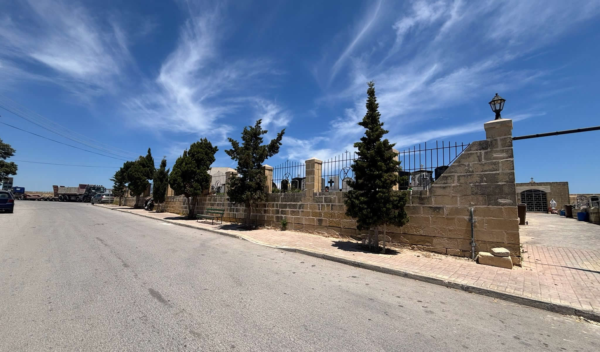
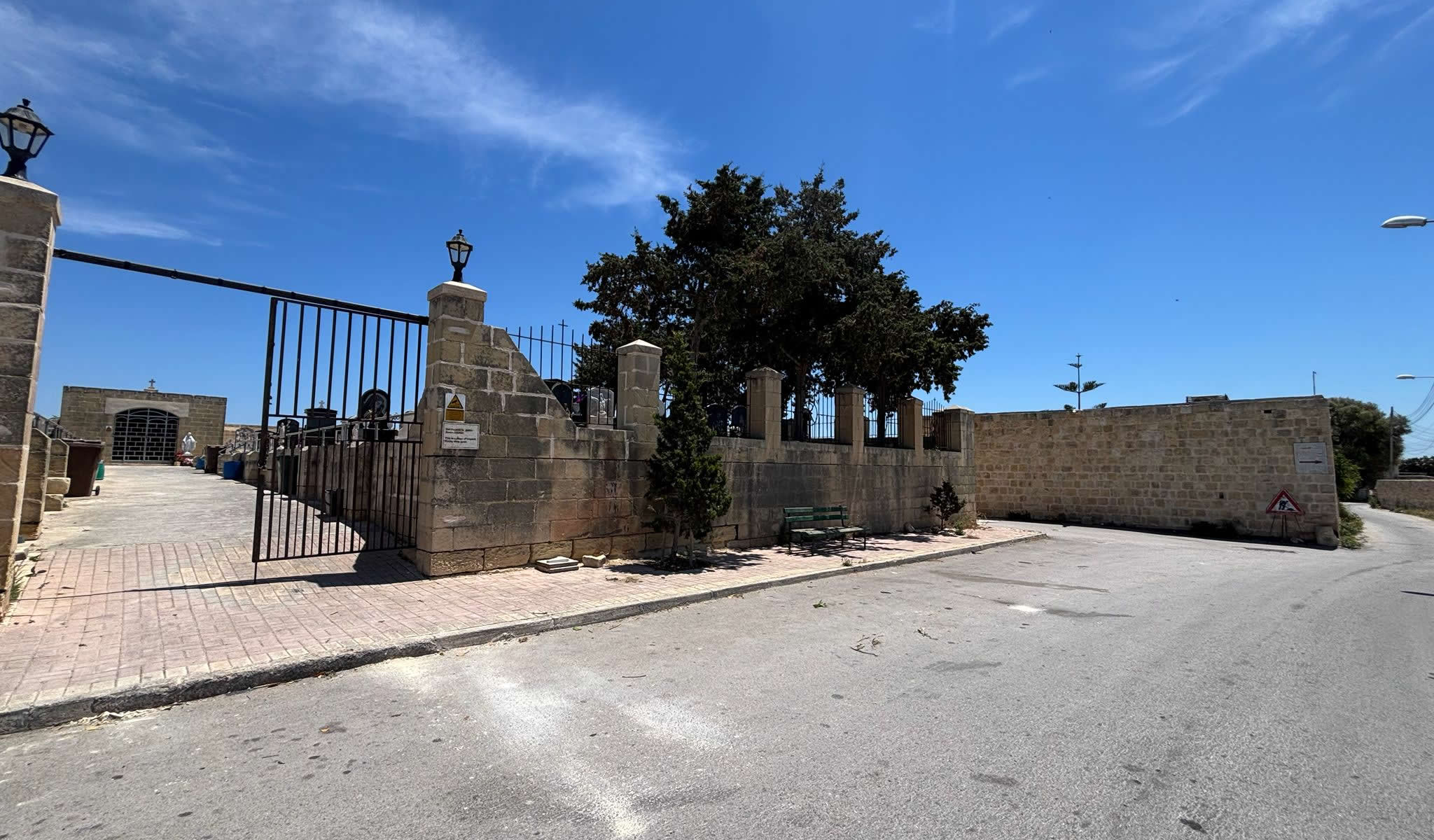
Architecturally, Sant' Andrija Cemetery displays a distinct modern communal layout, showing no signs of the emergency defensive style seen in old, sealed pestilence enclosures. The front facade features a wide, welcoming street-side presence built from finely cut limestone blocks. This perimeter wall is topped with decorative, black wrought-iron security railings, combining structural functionality with classical design elements.
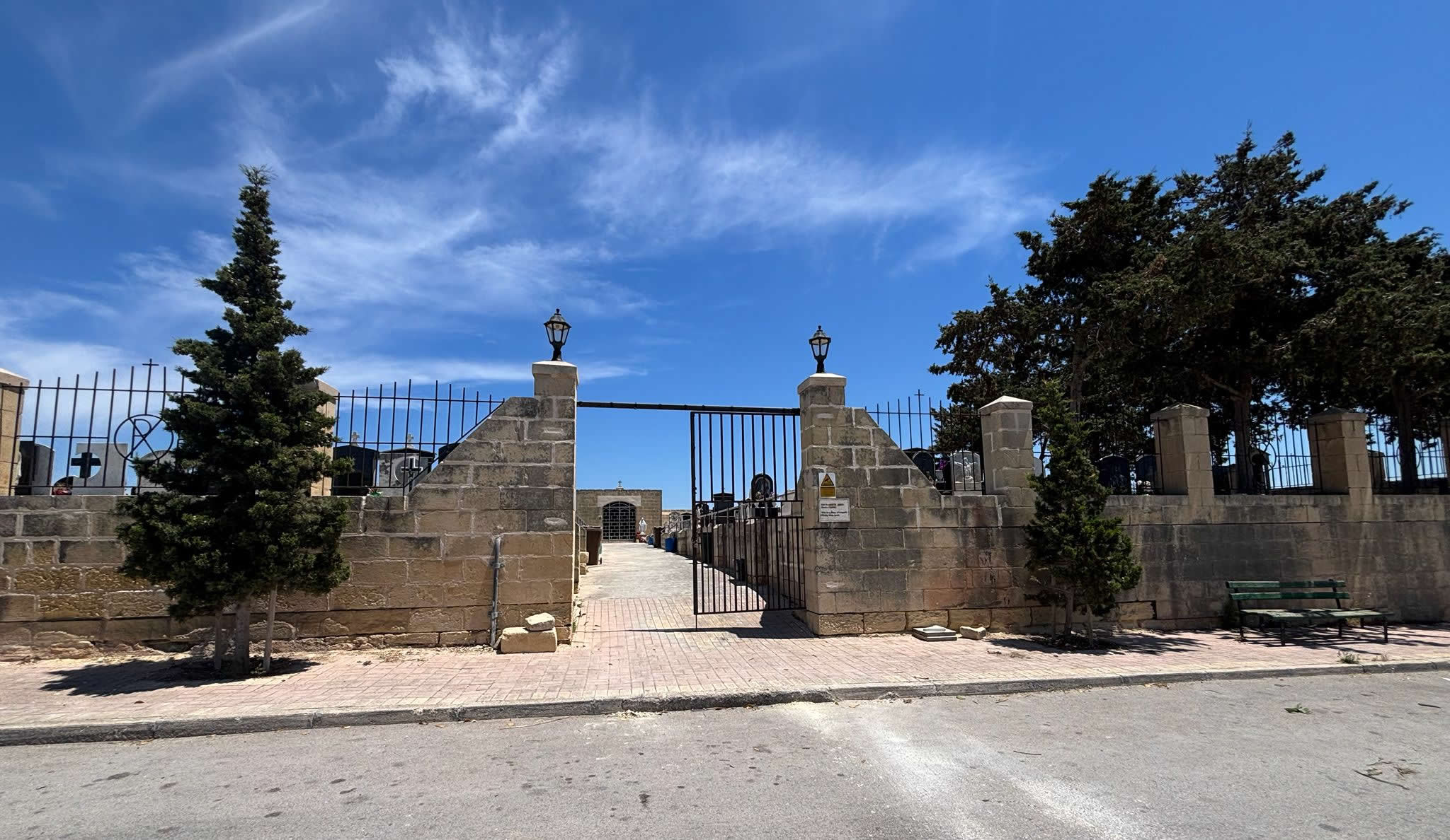
The main entrance is defined by two large limestone pillars equipped with outdoor lanterns that illuminate the gateway. These pillars support a prominent wrought-iron double gate that remains open during visiting hours, inviting the community to step inside. This design stands in sharp contrast to true historical plague enclosures across Malta, which typically feature high, solid walls and permanently blocked or bricked-up entryways intended to keep the public away from the site.
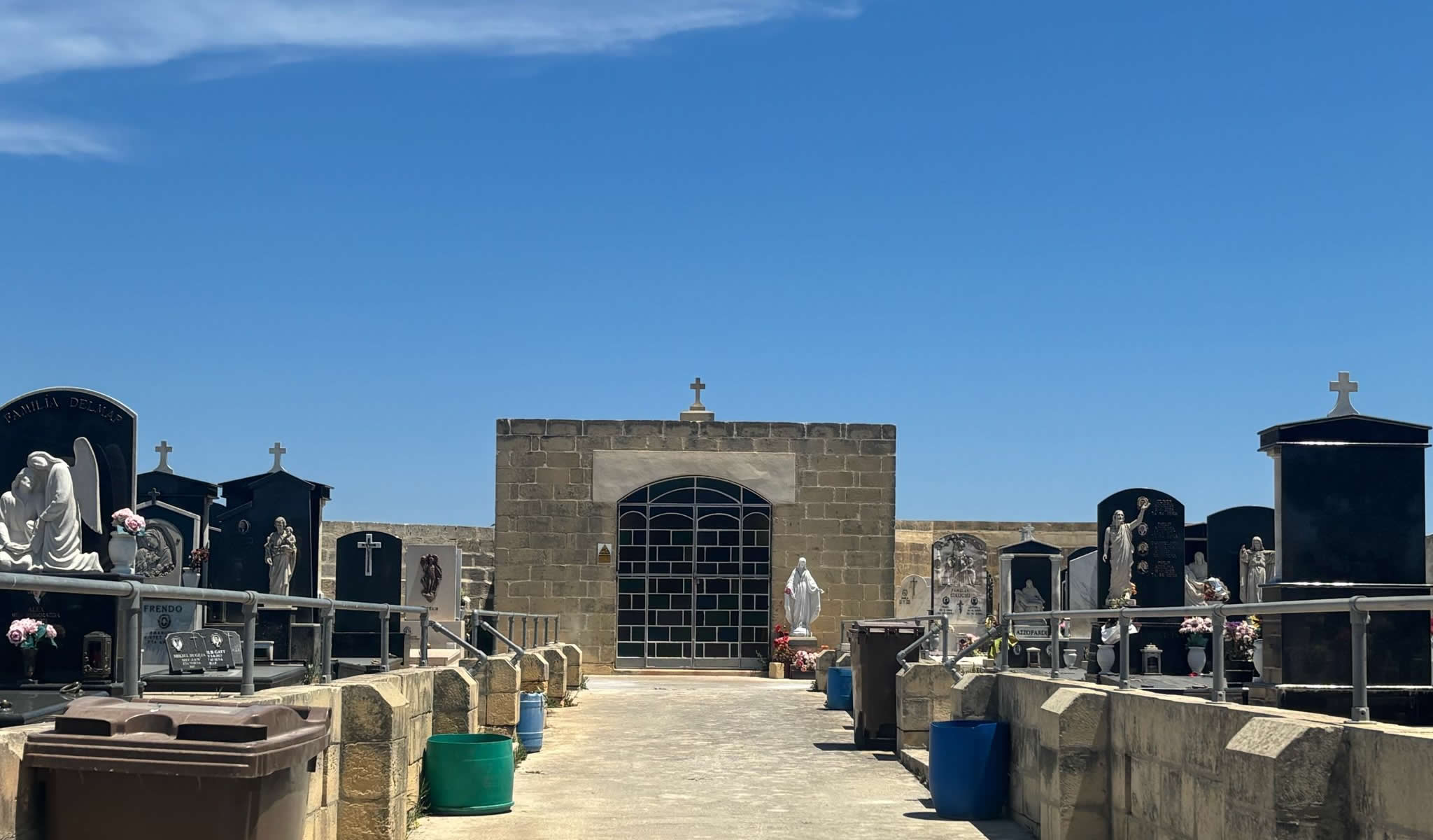
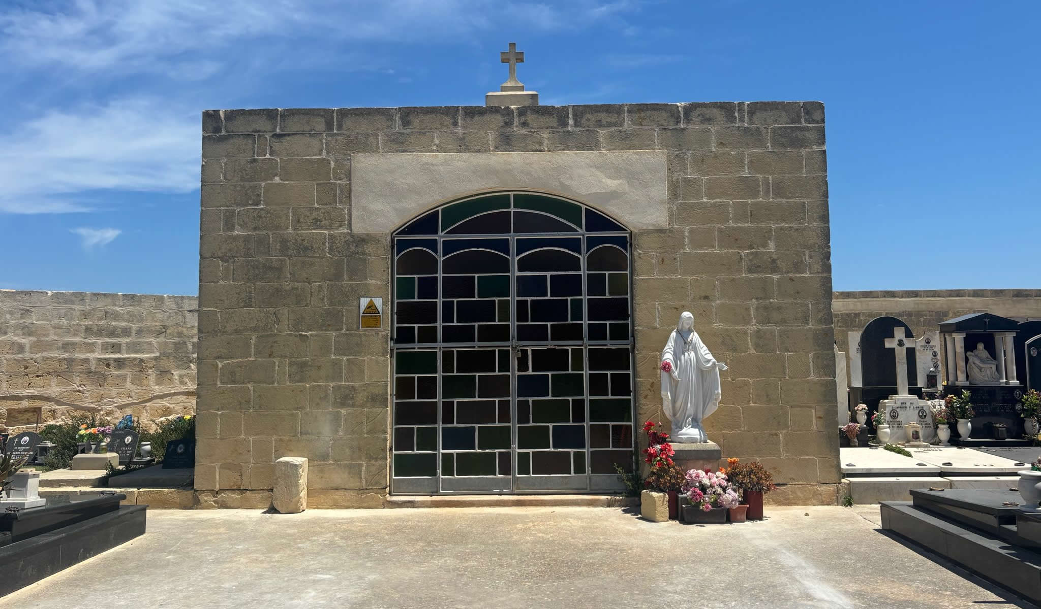
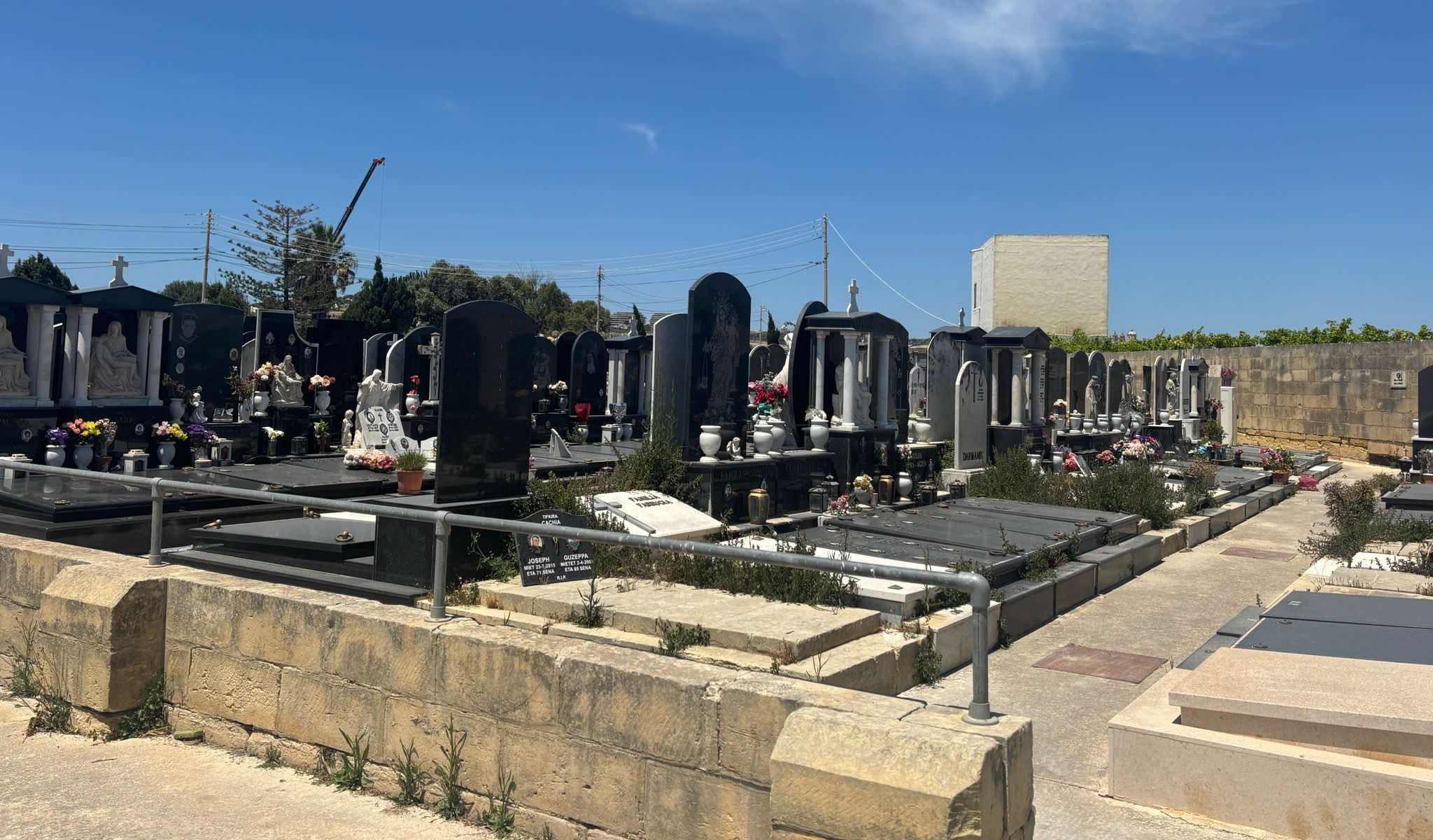
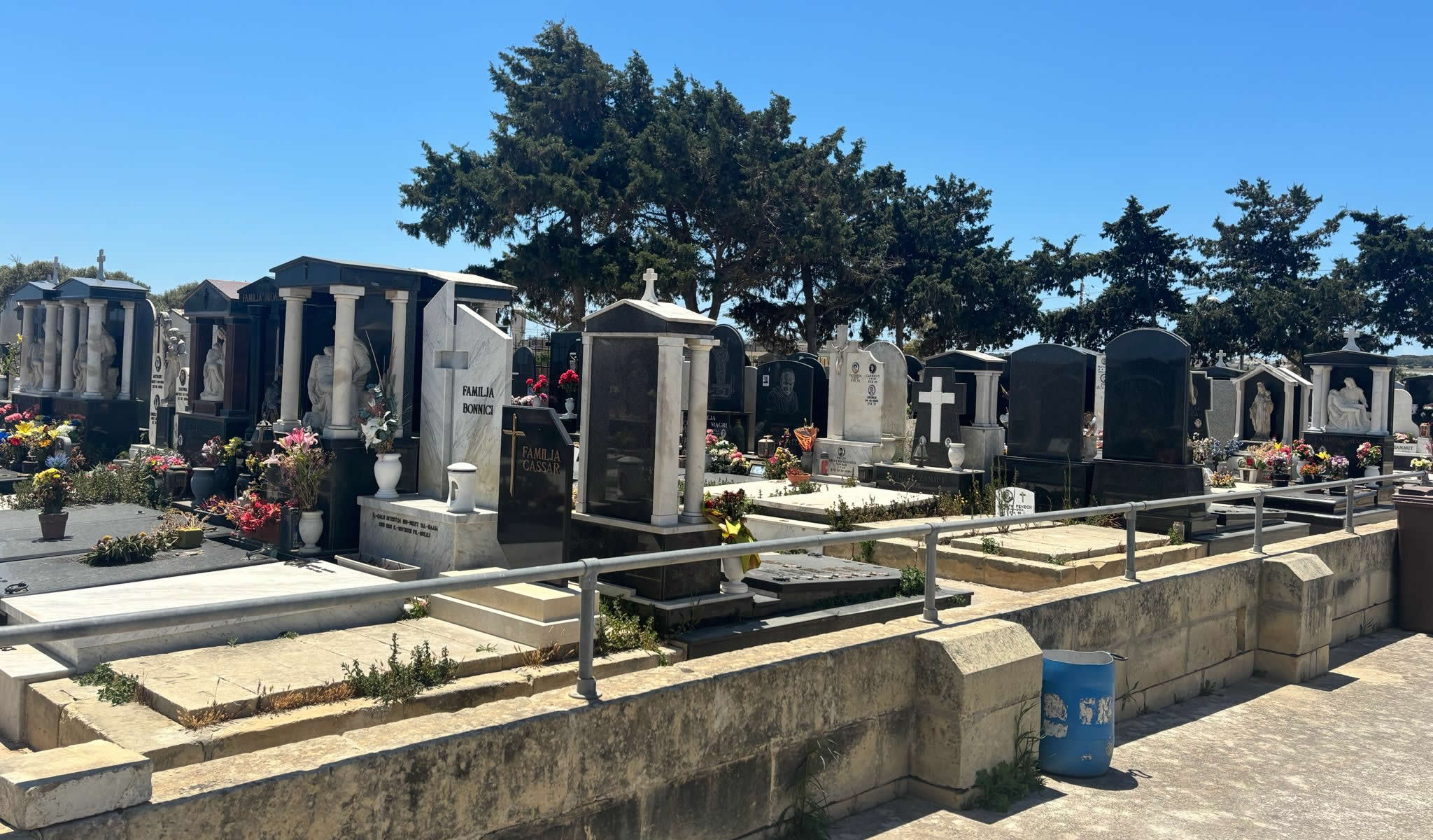
Inside the boundary walls, the layout is meticulously organized to serve the ongoing needs of the parish. Clean, paved concrete walkways divide the cemetery into orderly sections, ensuring easy access to all areas. Rather than unmarked earth or wild, overgrown trenches, the ground features rows of modern family graves built from polished dark granite and light marble blocks. Many plots are adorned with traditional white marble statues, custom inscriptions, and commemorative flower arrangements, highlighting the site's role as an active place of remembrance for modern Ħaż-Żebbuġ families.
4. The Historic Proximity to the Ta' Trapna 1813 Plague Site
While Sant' Andrija functions as an active modern cemetery, its location is deeply connected to Malta's epidemiological history due to its close proximity to the true Ta' Trapna Plague Cemetery, situated just 300 meters away. This close relationship explains why the two sites are frequently confused in regional documentation and travel logs.
During the devastating summer of 1813, when the bubonic plague spread across the local plains, British administrators set up an emergency isolation hospital in the nearby 'Tal-Barakki' field. The deceased from this hospital were interred in the Ta' Trapna field, which was later sealed and marked with an official commemorative plaque from the Archdiocese of Malta. Decades later, when the town needed a permanent municipal cemetery, the fields near the St. Andrew landmark were selected due to their existing distance from the village core, creating a layered landscape of public health history where a modern cemetery sits alongside an older, emergency burial ground.
When cataloging sites in Ħaż-Żebbuġ, researchers should use the following classification framework:
1. Ta' Trapna Site: The authentic, historic 1813 emergency mass grave enclosure and official informational plaque. In the 1950s, all the human remains were formally exhumed from the field and transferred to the 'Qalb ta' Ġesù' (Sacred Heart) Cemetery located in the village center of Ħaż-Żebbuġ.
2. Sant' Andrija Site: The active communal cemetery featured today, containing modern granite family plots and open wrought-iron security gates.
To see how both the Sant' Andrija and Ta' Trapna sites fit into the broader grid of historical burial markers, modern municipal extensions, and cultural monuments across the islands, you can consult our definitive directory at the Cemeteries of Malta and Gozo Master List.
5. Frequently Asked Questions (FAQ)
❓ Is Sant' Andrija Cemetery an authentic historical plague site?
No. Archival research shows that Sant' Andrija is a modern communal cemetery. The true 1813 plague cemetery in this area is the Ta' Trapna site, situated roughly 300 meters away along the same rural outskirts.
❓ Why do some historical lists classify this location as a plague site?
This confusion stems from its close geographic proximity to the true 1813 Ta' Trapna burial grounds, which led some general heritage forums to mistakenly group both locations under the same historical category.
❓ Can the interior of Sant' Andrija Cemetery be visited today?
Yes. Because it is an active municipal cemetery, its main wrought-iron gates remain open to the public during standard daytime hours, allowing family members and visitors to enter the grounds freely.
❓ Where can I find info on the actual 1813 plague graves in Żebbuġ?
You can read our complete historical profile, view archival mapping data, and examine inscriptions for the authentic epidemic site by visiting our dedicated page for the Malta and Gozo Cemeteries Directory.