📍 Location
Location Map Coordinates 35.857131, 14.420740
Comprehensive Historical Survey, San Teodoro Inscriptions, and Architectural Evolution of the 1813 Epidemic Enclosure

1. The 1813 Bubonic Plague Outbreak and Siġġiewi
The historical backdrop of Ta' Brija Cemetery (historically known as the Ċimiterju ta' San Teodoro) is intimately tied to the devastating public health disaster of 1813. During this year, Malta suffered a highly destructive epidemic of bubonic plague, which had been introduced into Marsamxett Harbour via the British merchant ship San Francesco. As the pathogen broke initial containment lines in Valletta, it swept aggressively southward into the large agricultural inland villages, deeply impacting rural communities like Siġġiewi.
In the early 19th century, rural communities possessed little understanding of microbiological epidemiology or vectors of transmission like rat fleas. As mortalities quickly mounted within the parish boundaries of Siġġiewi, the traditional practice of burying the deceased within local church crypts or interior stone vaults created dangerous hotspots for further contamination. The enclosed, poorly ventilated spaces of town churches exacerbated the health crisis, transforming holy spaces into active centers of pestilence.
To halt this compounding demographic collapse, the British Civil Commissioner, Sir Thomas Maitland, implemented draconian sanitary edicts across the islands. Maitland stripped regional parish authorities of their burial autonomy, transferring all responsibility for handling plague corpses to specialized, state-directed sanitary workers known as becchini. Local medical committees were ordered to identify remote, extra-mural agrarian zones well outside the inhabited town center to serve as isolated containment trenches. This context led directly to the establishment of the emergency burial ground at Ta' Brija, ensuring that infected tissue remained segregated from the town's living populace.
2. Geographic Profile and Topographical Isolation
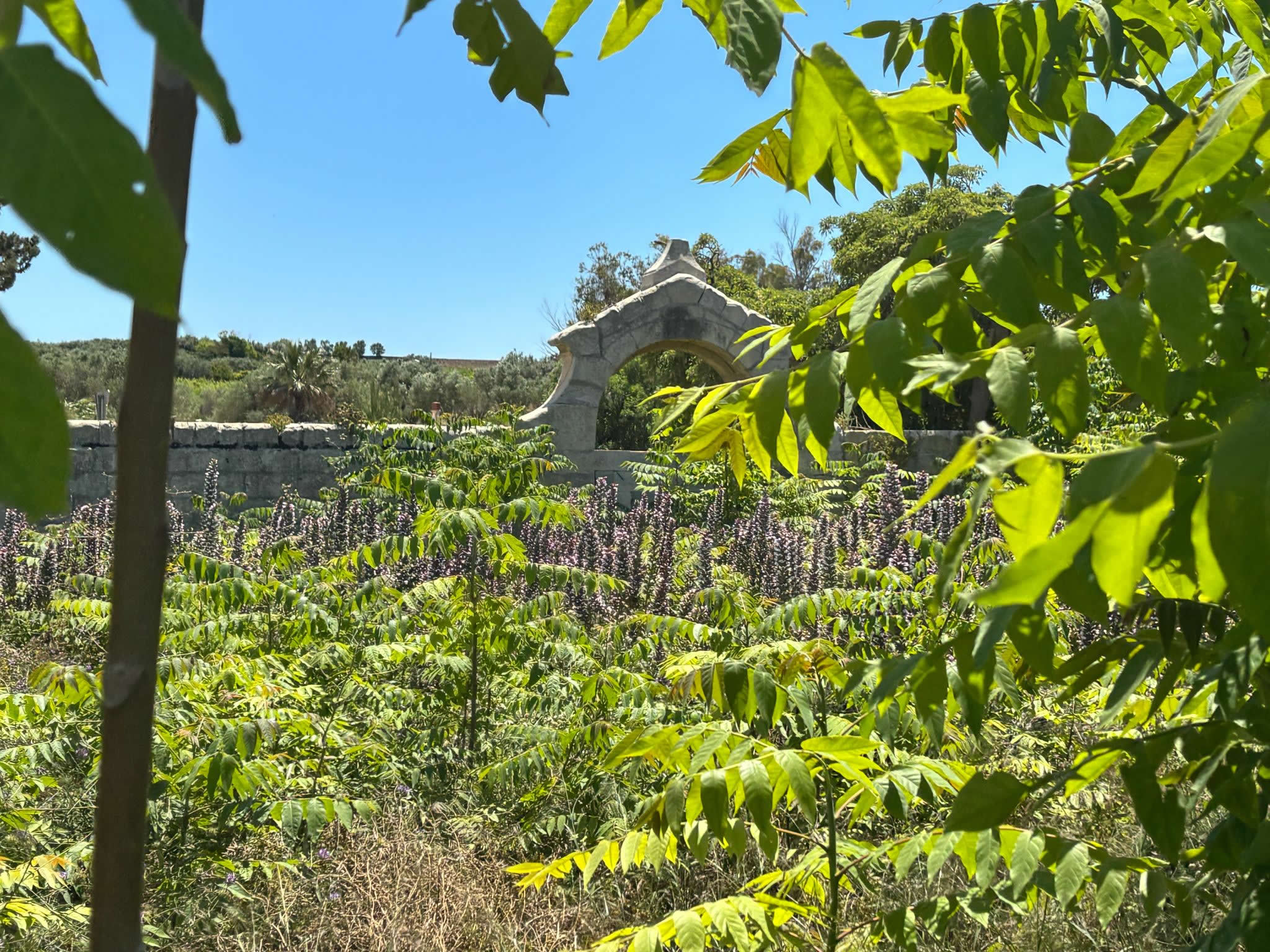
The positioning of Ta' Brija Cemetery was a deliberate choice dictated by early British quarantine principles and local topographic features. The plot is situated at the precise spatial coordinates of 35.857131, 14.420740, placing it along the winding country lane of Triq ta' Brija on the rural outskirts of Siġġiewi. This location sits along a wayside valley approach leading toward the historic Saint Blaise (San Blas) chapel and the steep accent toward the tal-Virtu hill and Girgenti frontiers, providing a natural buffer zone against the village core.
This strict isolation protocol served a dual sanitary purpose. First, it placed the dead downstream or downwind of prevailing rural microclimates, preventing contaminated runoff from entering local agricultural spaces. Second, the remote location minimized contact between families and the burial parties. Bodies could be transported quickly from neighboring farms directly to the site without passing through central residential roads. The isolated location represents the physical separation required by early 19th-century public health administrators battling highly contagious outbreaks.
| Spatial Parameter | Technical Survey Reference Data |
|---|---|
| Primary Nomenclature | Ta' Brija Cemetery (Ċimiterju ta' Brija) |
| Alternative Dedication | San Teodoro Cemetery (Ċimiterju ta' San Teodoro) |
| WGS84 Coordinates | 35.857131 Latitude, 14.420740 Longitude |
| Regional Jurisdiction | Siġġiewi Local Council (Limits of Girgenti / San Blas) |
| Zoning Designation | Outside Development Zone (ODZ) / Environmentally Sensitive Landscape |
| Burial Typology | Emergency Mass Common Grave Enclosure (1813 Outbreak) |
3. Structural Analysis and Architectural Design
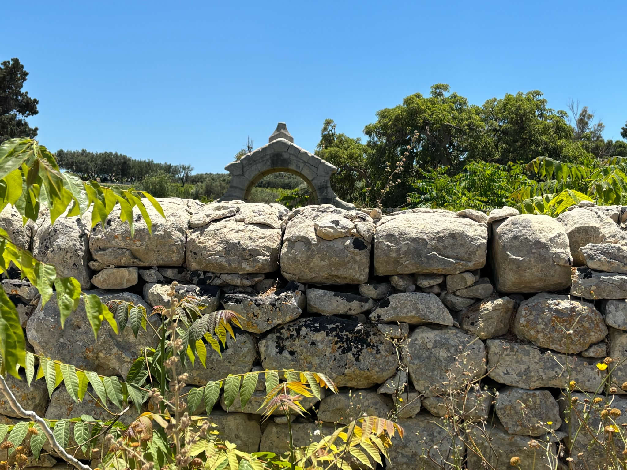
Architecturally, the front facade of Ta' Brija Cemetery displays a striking example of Maltese extra-mural funerary masonry. The perimeter consists of a high, robust ashlar boundary wall constructed from local globigerina limestone blocks (ġebla tal-franka). Unlike typical simple agricultural dry-stone walls (ħitan tas-sew), this boundary was carefully built to seal the interior from scavenging animals and unauthorized human entry, strictly enforcing the state-mandated quarantine lines.
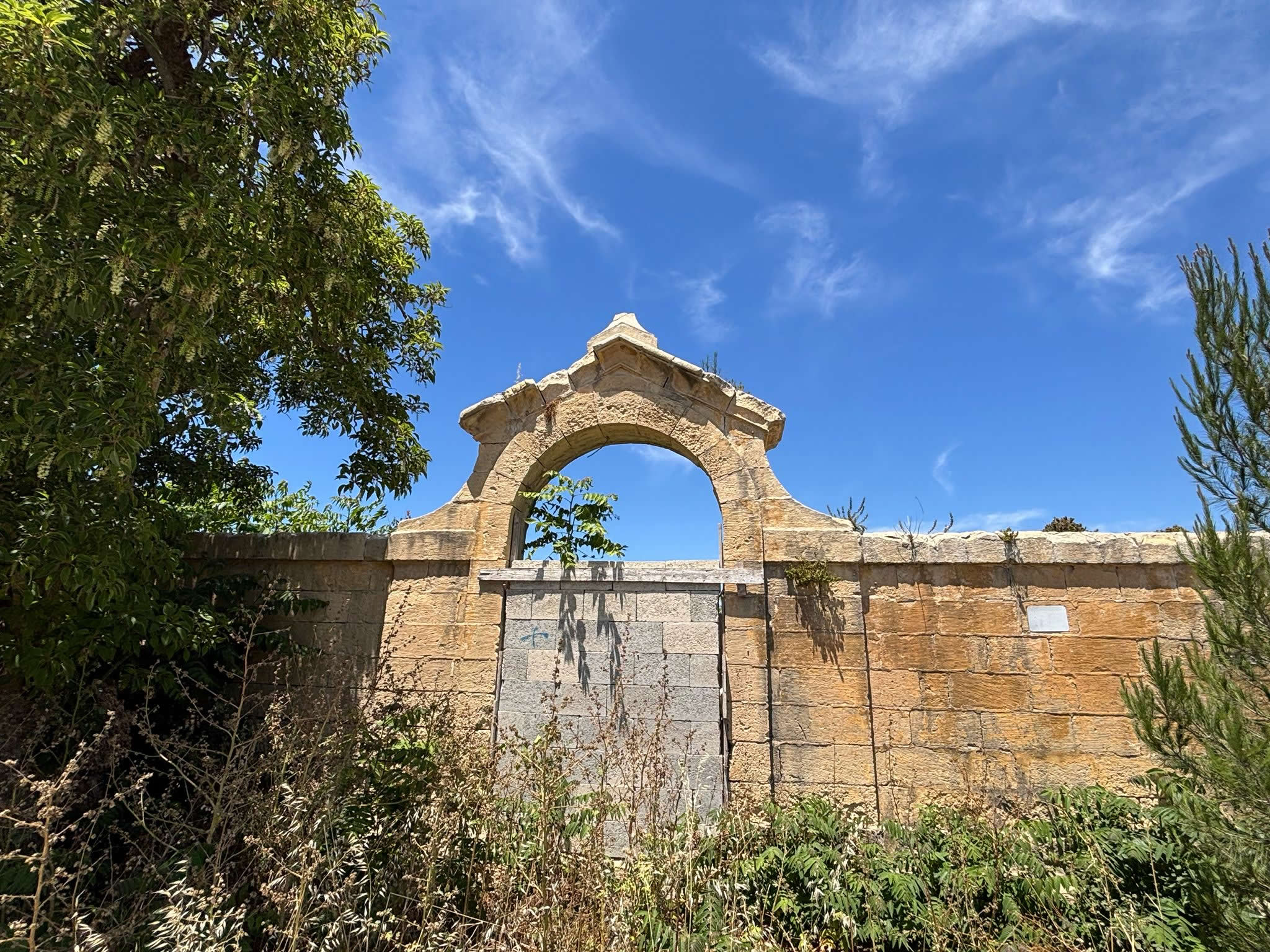
Front Entrance Facade of Ta' Brija Cemetery, Siġġiewi. Features the central semicircular ashlar limestone archway surmounted by a classical triangular pediment with a missing corner apex block, over a modern sealed concrete block barrier gate.
The primary architectural focus is the formal front entrance. The gate is framed by a grand, semi-circular ashlar limestone archway that rises above the level of the flanking walls. This arch is surmounted by a classical triangular molding or pediment, though time and weather have caused the stone blocks on the upper left apex corner to break away. This design choice elevates the structure above a basic field wall, imbuing the emergency enclosure with a sense of formal solemnity. To maintain security and prevent entry into the interior mass graves, the main opening has been sealed beneath the stone archway with a heavy concrete block barrier wall.
The interior layout reflects the severe urgency of the 1813 crisis. No individual, family-owned plots or ornate stone sarcophagi were constructed inside. Instead, historical and modern planning assessments confirm that individual graves were completely bypassed; all plague victims brought to Ta' Brija were interred collectively in a large common grave or mass trench. Over the decades, the long-abandoned interior has been reclaimed by nature, developing into an dense growth of wild weeds and a thick forest of wild sumac trees that cover the unmarked common earth below.

4. The Dedication to San Teodoro and Historical Memory
A fascinating historical mystery of the Ta' Brija site is its formal dedication to San Teodoro (Saint Theodore). While the surrounding topography and local oral history simply refer to it by the location-based name *Ta' Brija*, early nineteenth-century records explicitly designate the ground under the spiritual protection of Saint Theodore. This choice reflects a common custom during plague outbreaks, where sites were dedicated to early Christian military martyr saints who were invoked as spiritual protectors against sudden, unexpected death and pestilence.
Unlike other plague sites across Malta that received restorative attention or informational signage in the late twentieth century, Ta' Brija remained largely forgotten by the public. For generations, it sat quietly along a rural country road between Rabat and Siġġiewi, its historical identity faded into myth. The lack of individual headstones or commemorative plaques inside means the names and precise number of the Siġġiewi residents buried within the common trench remain lost to history, leaving the wild sumac trees as the only markers over the site. This isolation makes Ta' Brija an evocative destination for *thanatourism* and dark tourism in the Maltese countryside, representing a raw, uncommodified monument to the island's past health crises.
5. The Modern Planning Era: Cemetery Extensions and Crematorium Proposals
In recent years, the long-abandoned Ta' Brija Cemetery has transitioned from an isolated historical landmark into a key subject of modern planning and land-use debates in Malta. Because the site sits entirely within an Outside Development Zone (ODZ), any physical alterations to the surrounding landscape are subject to intense environmental and cultural heritage reviews. Documentation shows that the cemetery lies within a proposed Area of Ecological Importance and an Area of High Landscape Value that encompasses the wider picturesque Girgenti valley ecosystem.
The site's modern development timeline includes several key milestones:
- September 2020 Cemetery Extension Approval: After a lengthy review process that began in 2006, the Planning Authority officially approved a private extension to the historic cemetery. While the original proposal requested over 5,000 square meters to house 375 graves, the approved plans were scaled back to 3,458 square meters. The final layout authorized 150 graves across four tiers, an underground reservoir, landscaping, and a small prayer room. The approval was granted on the condition that the developer restore the historic fabric of the original Ta' Brija structure.
- The 2026 Crematorium and Columbarium Proposal: In February 2026, a new planning application was submitted by a private funeral operator to significantly expand the project's scope. The 2026 plans propose a large crematorium and columbarium complex covering 11,615 square meters of agricultural land next to the original enclosure. The design includes a formal mortuary, a multi-faith funeral chapel, and 54 columbarium units set within a 2,059 square meter formal memorial garden.

This 2026 application leverages a specific planning policy exception. While standalone crematoria are generally restricted in open rural zones, the policy permits them if they are built adjacent to an existing cemetery or an approved cemetery extension. However, the scale of the 2026 proposal has drawn criticism from environmental bodies. The Environment and Resources Authority (ERA) and agricultural committees have raised formal objections, warning that the extensive formal gardens and associated outbuildings risk urbanizing a highly sensitive rural landscape.
Because Ta' Brija sits within an archaeologically sensitive landscape with documented ancient tombs nearby, the heritage authorities have mandated strict requirements. Any future construction or restoration work requires continuous archaeological monitoring under direct expert supervision to ensure the historic 1813 structures and older subterranean features remain protected.
To understand how this site fits into the broader network of emergency containment zones, quarantine lazarettos, and epidemic burial fields established across the islands during this era, you can view the complete directory at the Plague Cemeteries of Malta and Gozo Master List.
6. Frequently Asked Questions (FAQ)
❓ Why was Ta' Brija Cemetery built so far outside the Siġġiewi town center?
It was established at a distance in 1813 to comply with emergency quarantine codes introduced during the bubonic plague outbreak. Placing the burial site in a remote area helped prevent contaminated vectors from reaching the healthy population in the village core.
❓ Are there individual headstones or graves inside the cemetery walls?
No. Due to the high risk of infection and the urgent nature of the 1813 burials, individual plots were not created. All victims interred at the site were placed collectively within a single common grave trench.
❓ Why is the front entrance archway blocked with concrete blocks today?
Following its long historical abandonment, the main entrance opening was sealed with heavy stone and concrete blocks to protect the inside of the site, prevent vandalism, and stop illegal dumping inside the historic enclosure.
❓ What is the status of the crematorium project proposed for the site?
A planning application submitted in early 2026 proposes a crematorium, mortuary chapel, and columbarium garden on the agricultural land adjacent to the historic cemetery. The project is currently undergoing review by environmental and cultural heritage authorities.