📍 Location
Location Map Coordinates 35.871581, 14.423973
Epidemiological Analysis, Structural Field Notes, and Archival Registry of the 1813 Outbreak Site
1. The 1813 Bubonic Plague Outbreak in Ħaż-Żebbuġ
The year 1813 stands as one of the darkest chapters in the demographic and health history of the Maltese islands. Shortly after the formal establishment of British colonial governance, the merchant vessel San Francesco slipped into Marsamxett Harbour from Alexandria, carrying an invisible, catastrophic payload: fleas infested with the lethal bacterium Yersinia pestis. Within weeks, despite hasty quarantine attempts, the bubonic plague broke containment and swept like wildfire through the dense, tightly packed urban core of Valletta, before systematically penetrating the rural agricultural villages (the casali) of the interior hinterlands.
Among the hardest-hit inland settlements was the ancient town of Ħaż-Żebbuġ. Characterized by a large agrarian population that lived in close quarters, the community possessed no natural immunity or scientific understanding of the contagion vectors. As the mortality rate rapidly spiked during the blistering summer months of 1813, the daily reality of handling highly infectious corpses completely overwhelmed local parish structures. Traditional religious protocols—which dictated that the deceased be carried into the town center and interred beneath the stone floors of the local parish church or private family vaults—instantly became major hubs for further disease transmission.
Faced with an unprecedented public health emergency, the newly appointed British Civil Commissioner, Sir Thomas Maitland, enforced a series of radical, uncompromising sanitary edicts across the island. Maitland placed the worst-affected villages under strict military containment cords, threatening immediate execution for anyone attempting to slip past the barriers. Concurrently, the physical handling of plague victims was stripped away from civilian families and handed exclusively to the becchini. Under explicit orders from the central health boards, these workers were directed to establish dedicated, isolated burial clearings far beyond the town borders, giving rise to specialized, extra-mural emergency sites like the Ta' Trapna Historical Cemetery (known locally as the *Ċimiterju tal-Pesta*).
2. Geographical Positioning and Topographical Choice
The selection of the Ta' Trapna site was dictated entirely by early 19th-century concepts of sanitary isolation and emergency medical logistics. Military doctors and local medical authorities recognized that to prevent the unmitigated spread of the disease within the central living quarters of Ħaż-Żebbuġ, the infected had to be physically segregated from the healthy population at the very first sign of symptomatic presentation.
The cemetery sits at precise geographical coordinates 35.871581, 14.423973, placed within a rural agricultural pocket that originally lay well outside the inhabited perimeter of the village. Archival evidence shows that this specific tract of land was an active farming area known as the 'Tal-Barakki' field. The name itself hints at the quick construction of temporary wooden or limestone huts designed to act as quarantine quarters.
Crucially, the 'Tal-Barakki' field was chosen because a temporary emergency plague hospital was built right next to it. This positioning minimized the dangerous transit of contaminated bodies; when an isolated patient succumbed to the horrific effects of the bubonic infection inside the field hospital, the becchini could instantly transport the corpse into the adjacent trenches of the Ta' Trapna plot without passing any public roads or civilian homesteads, effectively containing the pathogen vectors to a single, tightly controlled zone.
3. Structural Construction and Site Layout
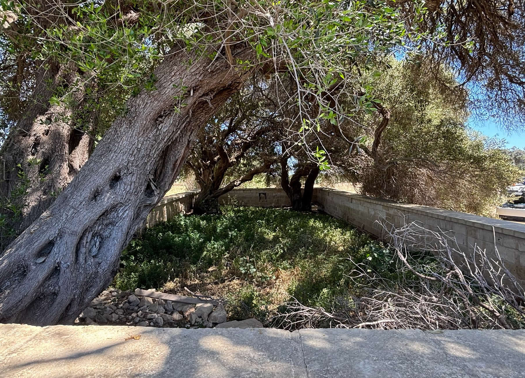
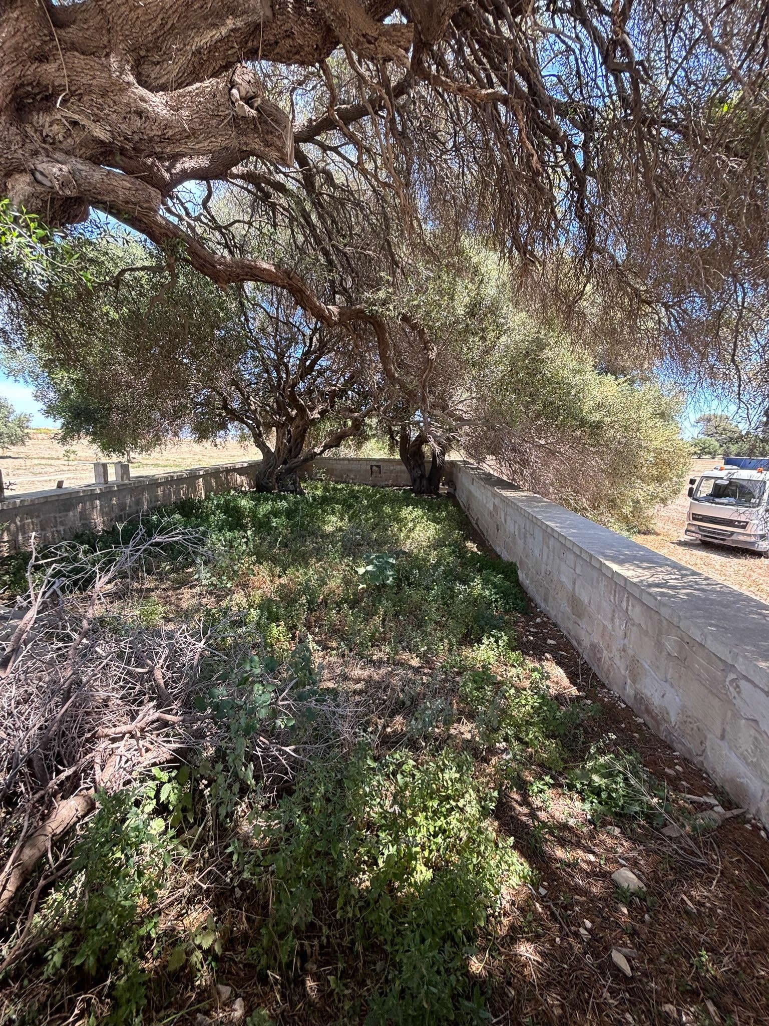
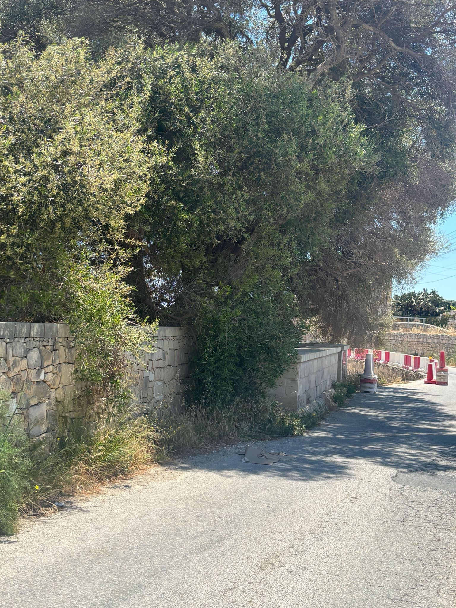
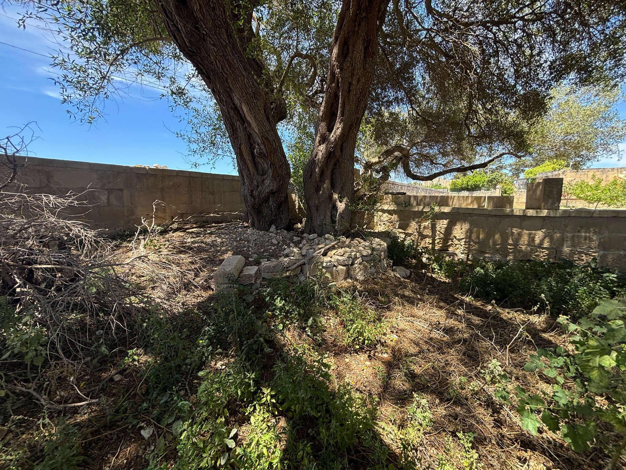
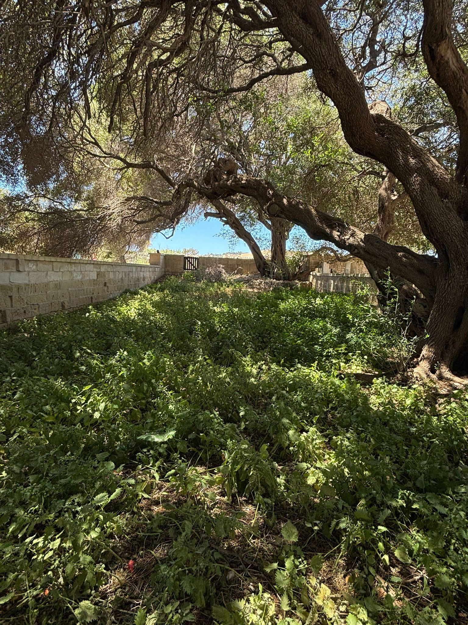
From an architectural standpoint, the Ta' Trapna site reflects the raw, functional simplicity typical of early 19th-century emergency sanitary enclosures. Unlike the monumental civic burial grounds of the later Victorian era, this plot retains the distinct footprint of an adapted rural agricultural field. The perimeter is defined by a low-slung stone boundary wall, built using local globigerina and coralline limestone without the addition of grand monumental pillars or ornate stone gateposts.
Access into the sacred enclosure is granted through a simple, modest wooden gate, emphasizing the rustic and unpretentious nature of this historical boundary. This minimalist design speaks volumes about the speed and isolation protocols of the 1813 epidemic campaign, where the primary goal was secure territorial containment rather than architectural display. Internally, the ground is shaded by three large, ancient olive trees (*siġriet tar-żebbuġ*) positioned on the cemetery's periphery. Botanical and historical estimations indicate that these trees were likely planted roughly 200 years ago during or shortly after the tragic epidemic wave. They were purposefully set down to offer physical shelter to the somber clearing while serving as a beautiful, living, perennial symbol of sorrow and enduring town memory for the disease victims.
4. Analysis of the Official Wall-Mounted Inscription Notice
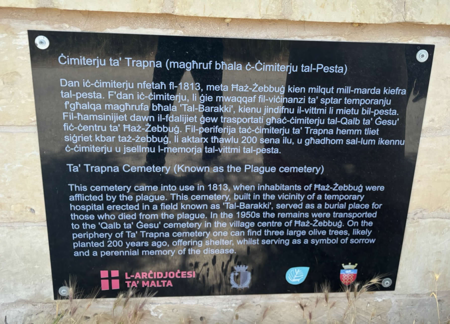
The historical timeline, administrative actions, and eventual mid-20th-century structural adjustments of the site are formally verified by a modern, high-authority informational plaque mounted securely to the exterior limestone wall. Curated jointly by the Archdiocese of Malta (L-Arċidjoċesi ta' Malta) and regional authorities, this plaque provides vital primary text that explicitly outlines the lifecycle of the burial ground.
The inscription is displayed in both Maltese and English, ensuring that the solemn history of the site is accessible to local researchers and international visitors alike. The verbatim English text from the field marker reads as follows:
This cemetery came into use in 1813, when inhabitants of Ħaż-Żebbuġ were afflicted by the plague. This cemetery, built in the vicinity of a temporary hospital erected in a field known as 'Tal-Barakki', served as a burial place for those who died from the plague. In the 1950s the remains were transported to the 'Qalb ta' Ġesù' cemetery in the village centre of Ħaż-Żebbuġ. On the periphery of Ta' Trapna cemetery one can find three large olive trees, likely planted 200 years ago, offering shelter, whilst serving as a symbol of sorrow and a perennial memory of the disease.
This document provides an essential revelation for the site's modern layout: the human skeletal remains are no longer physically under the soil of this field. During a major post-war civic and religious reorganization in the 1950s, the health authorities and church wardens conducted a complete exhumation of the old 1813 plague trenches. The bones were carefully collected, purified under sanitary protocols, and transferred directly into the consecrated ground of the 'Qalb ta' Ġesù' (Sacred Heart) Cemetery situated safely within the inner urban core of Ħaż-Żebbuġ, allowing the original Ta' Trapna field to transition from an active active burial ground into a peaceful, protected memorial shrine.
5. The Mystery of the Wall Niche Artifact
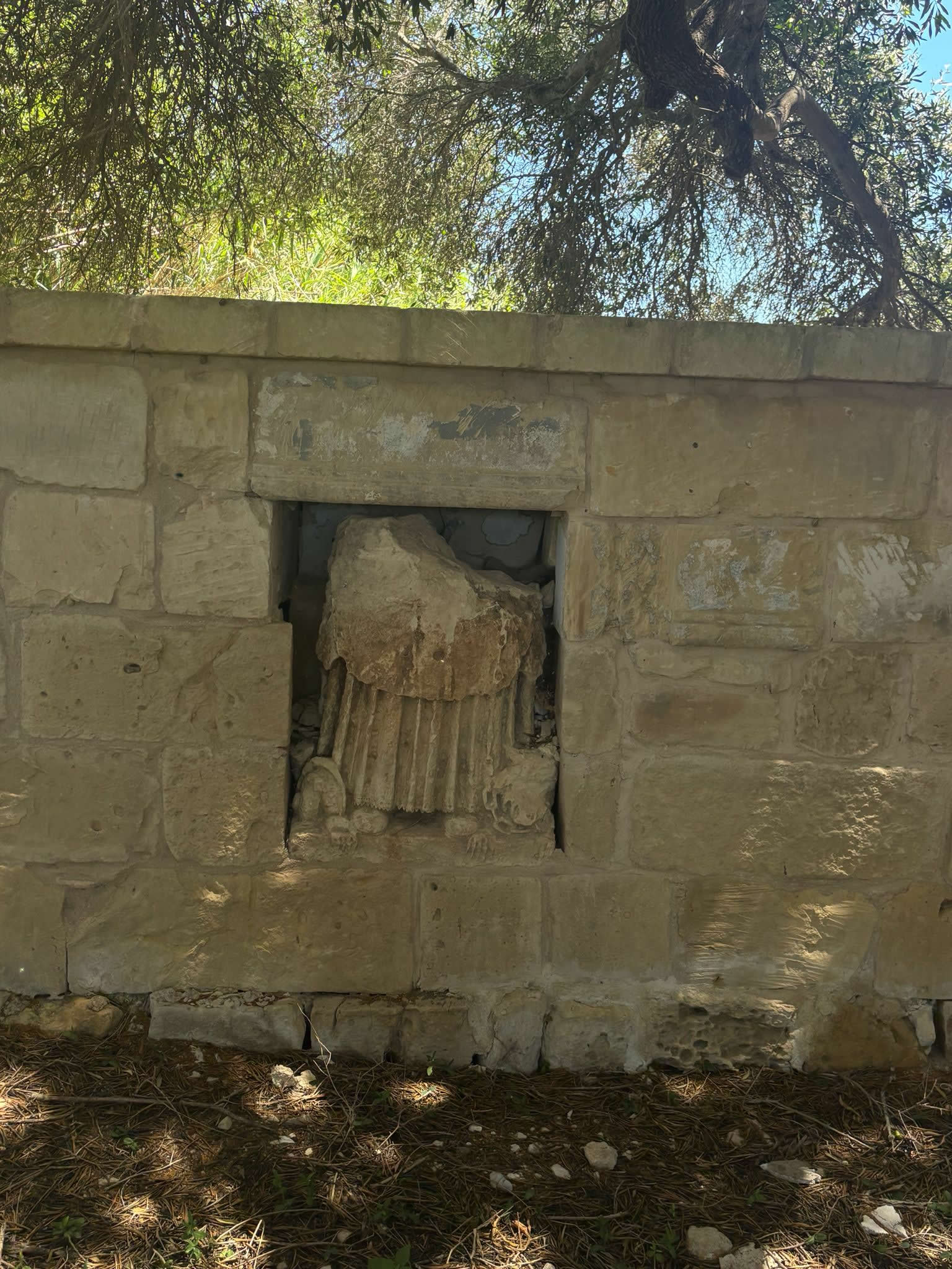
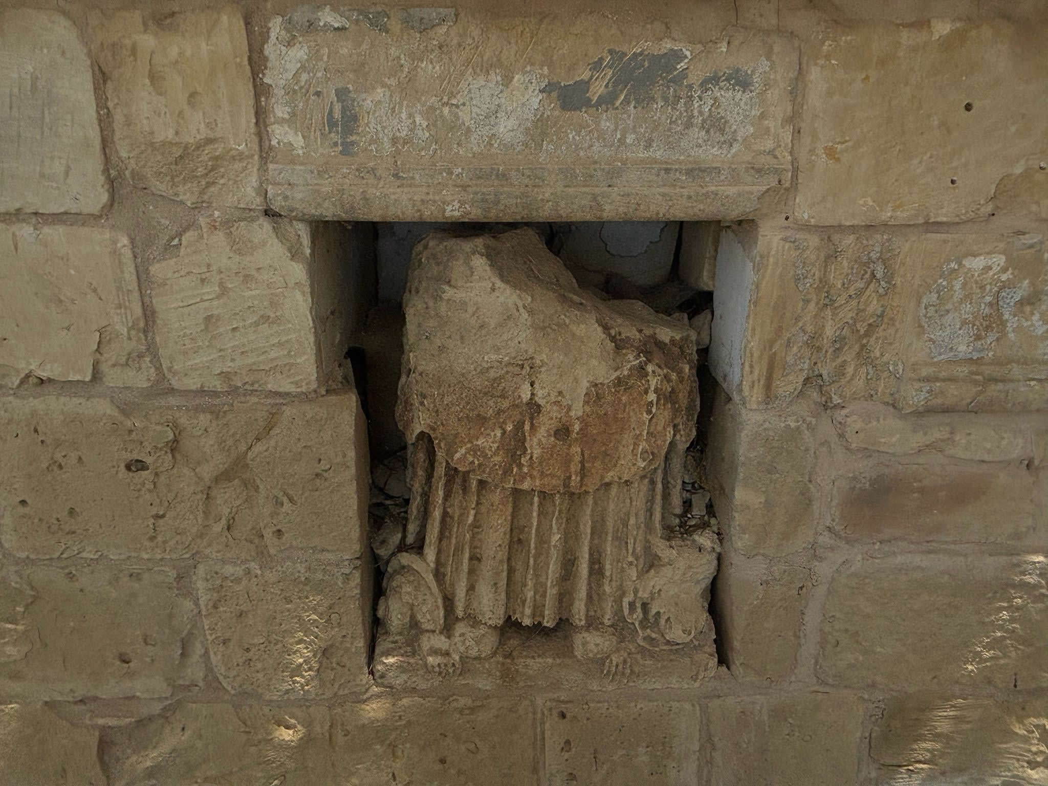
Even though the human remains were relocated in the 1950s, the field retains a highly unusual, enigmatic architectural feature built directly into its back wall. Embedded inside a cleanly framed, recessed rectangular window alcove is a heavily weathered, ornate fragment of a classical carved limestone column base or decorative pedestal.
This fragment is a prime example of historical spolia. It features deeply cut vertical fluting along its upper section and elegant, scrolled architectural volutes at its base corners. Because the rest of the cemetery is defined by completely unadorned, low rustic walls and a simple wooden gate, this high-quality piece of professional stonemasonry stands out dramatically, indicating a deliberate act of historical preservation.
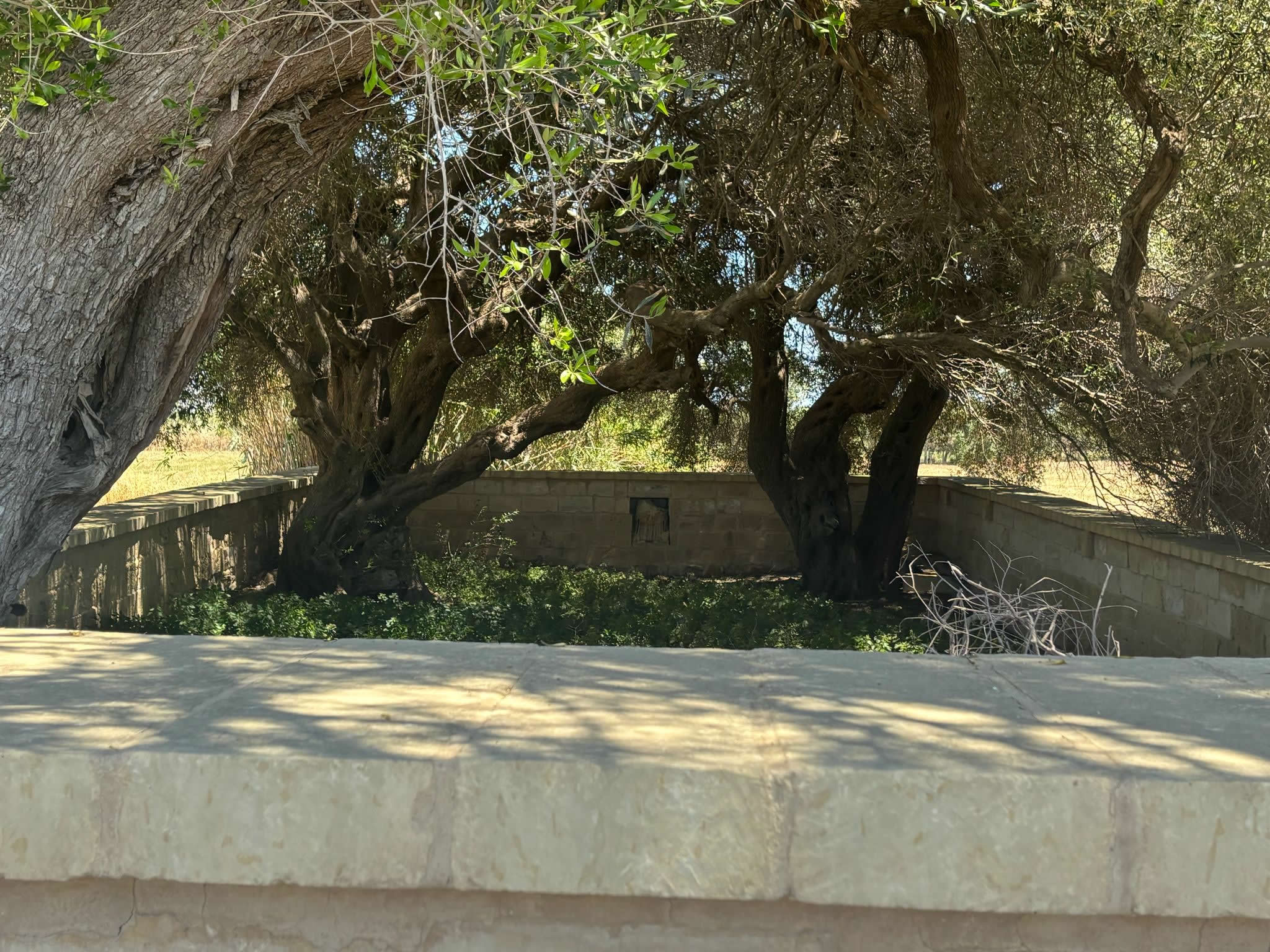
When the 1813 plague trenches were cleared in the 1950s, a central stone memorial cross or individual monumental markers inside the field had to be dismantled. Rather than destroying or discarding the most beautiful piece of sacred masonry, the workers meticulously fashioned a protective stone window niche in the back boundary wall to safely cradle this fluted column fragment. It was left behind as a permanent architectural anchor—a silent, artistic witness ensuring that the spot's history as an emergency sanctuary and place of deep communal loss would never be forgotten.
To explore how the Ta' Trapna site fits into the wider grid of emergency containment zones, pestilence houses, and field plots established across the islands during this catastrophic era, you can consult our definitive regional index tracking Malta's health crises at the Plague Cemeteries of Malta and Gozo Master List.
6. Frequently Asked Questions (FAQ)
❓ Why was this site historically called the 'Tal-Barakki' field?
The field was called 'Tal-Barakki' because a temporary emergency isolation hospital composed of quick wooden or stone barracks was built there in 1813 to isolate infected Ħaż-Żebbuġ residents outside the town center.
❓ Are there still plague victims buried inside the Ta' Trapna site today?
No. In the 1950s, all the human remains were formally exhumed from the field and transferred to the 'Qalb ta' Ġesù' (Sacred Heart) Cemetery located in the village center of Ħaż-Żebbuġ.
❓ How old are the large olive trees inside the cemetery gates?
The three large olive trees on the periphery were planted roughly 200 years ago, serving as a perennial monument of sorrow and memory for the victims of the 1813 disease outbreak.
❓ Where can I read more about other 1813 plague sites across Malta?
You can view comprehensive historical guides, coordinate maps, and structural profiles for all remaining epidemic-era grounds by exploring our master directory at https://emalta.com/heritage/plague-cemeteries-malta-gozo.html.