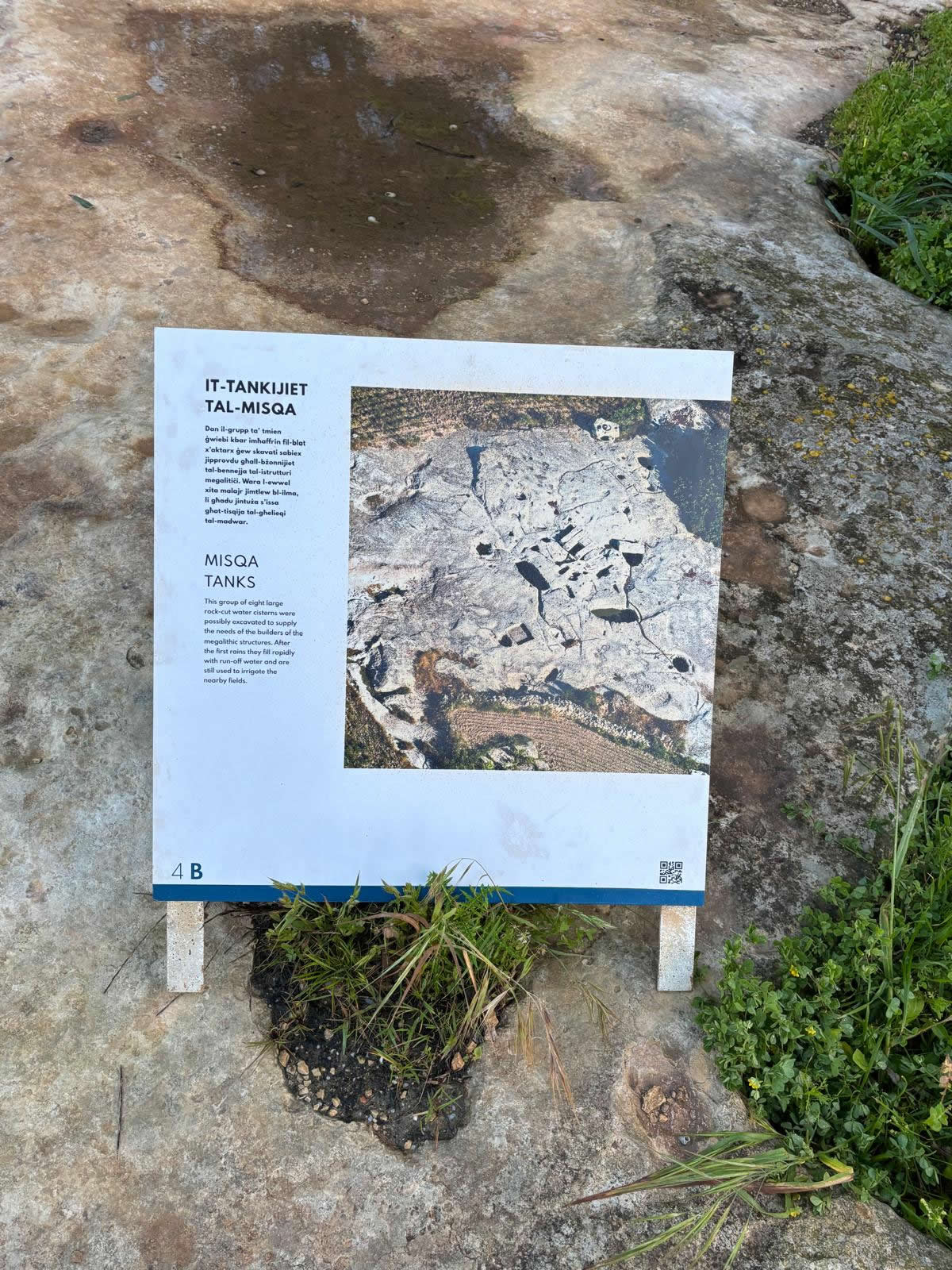
Il-Misqa (“the watering place”) is a cluster of deep, rock-cut reservoirs on the Magħlaq plateau near Mnajdra and Ħaġar Qimone of Malta’s most intriguing
examples of early rainwater harvesting and storage.
Overview
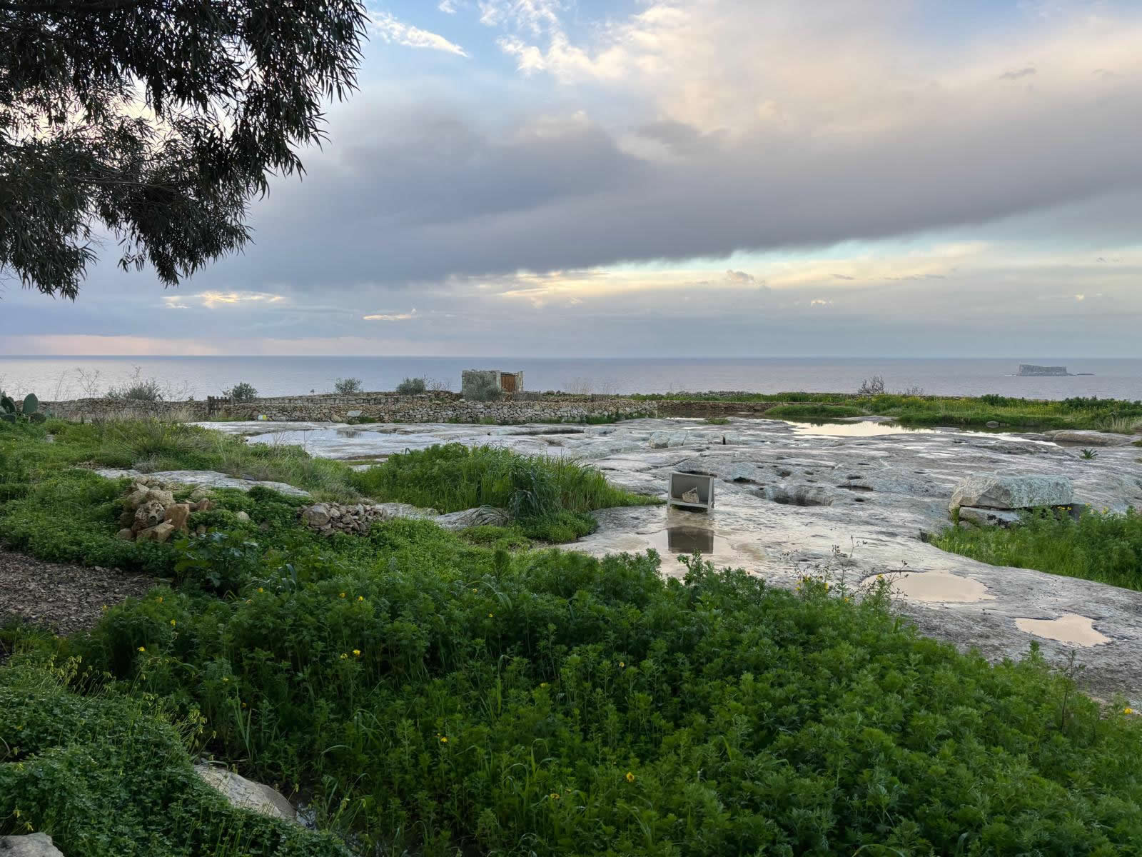
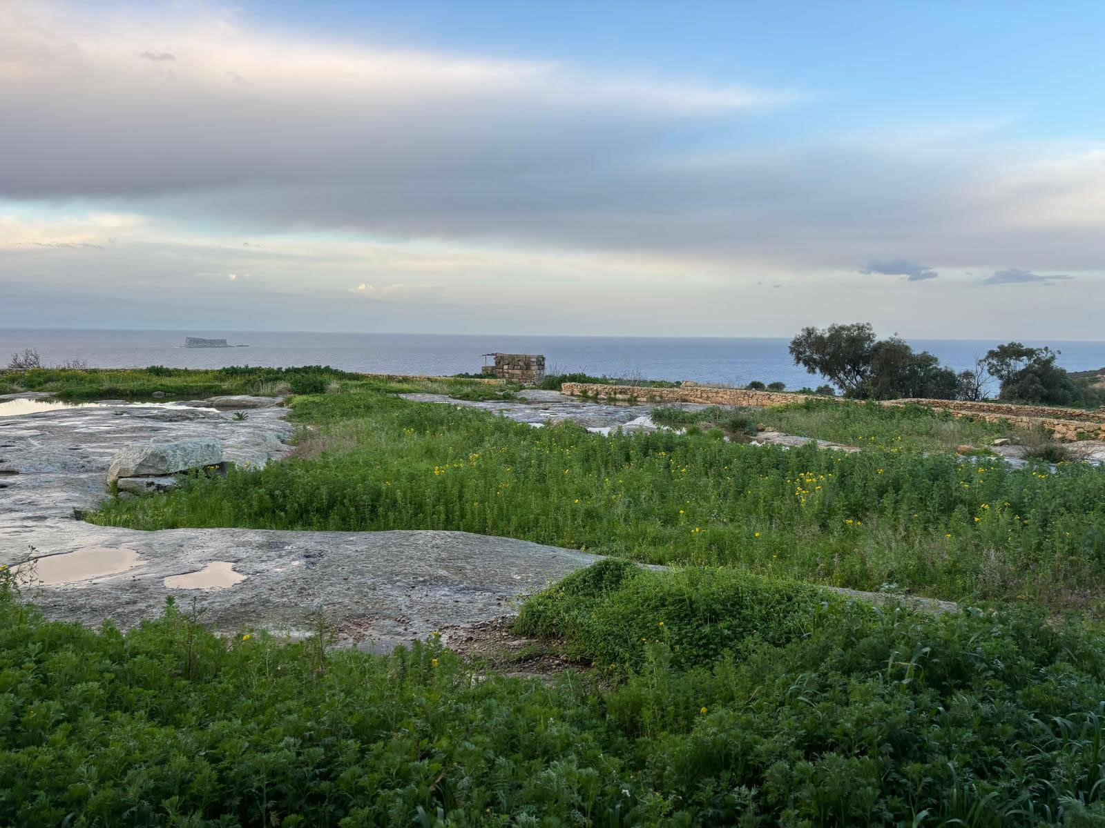
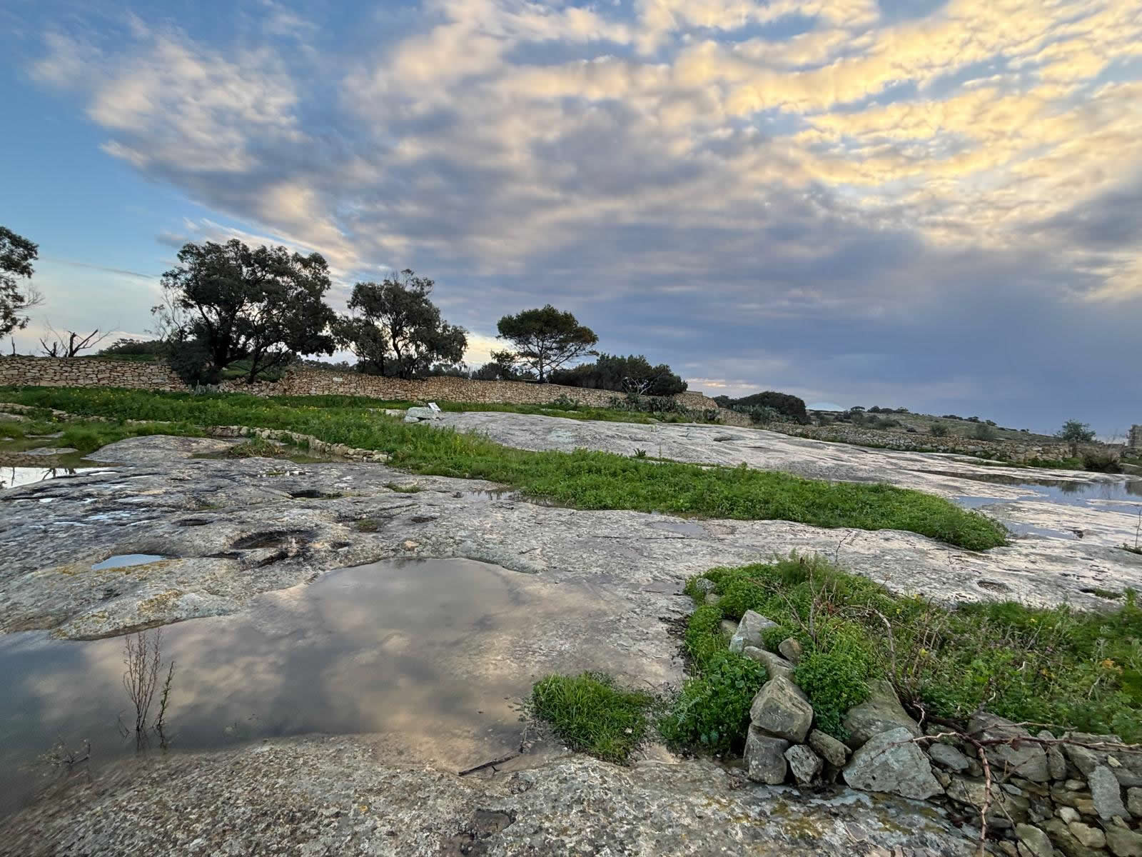
Il-Misqa sits a short walk from the main prehistoric temple area and is widely interpreted as a rainwater storage solution in a landscape where dependable
freshwater is scarce. The reservoirs are cut directly into limestone bedrock and still collect water in wetter seasons.
At-a-glance
Meaning: “Il-Misqa” is commonly explained as “the watering place.”
Type: rock-cut rainwater tanks / reservoirs (cavities used for water storage).
Modern role: heritage stop on walks and organised trails in the Ħaġar Qim & Mnajdra landscape.
Full detailed history
Why Il-Misqa matters in Malta’s prehistory
The Misqa Tanks are frequently discussed in the context of Malta’s Temple Period landscape. Because they lie close to Mnajdra and Ħaġar Qim,
many writers and local heritage summaries propose a connection with the communities who built and used the temples—possibly as a practical water supply
for workers, pilgrims, or daily life around the sacred complexes.
That said, firmly dating the tanks is difficult: the reservoirs have been cleared many times over the centuries, leaving little or no datable material
inside them. Several sources therefore frame the Neolithic attribution as plausible rather than proven.
How the tanks were made and how they worked
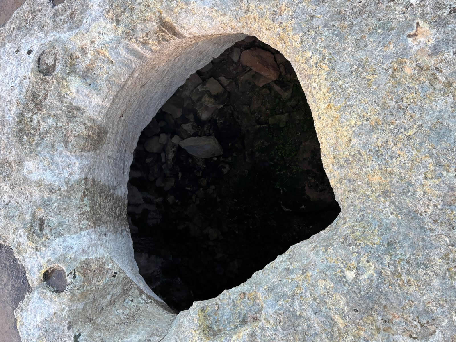
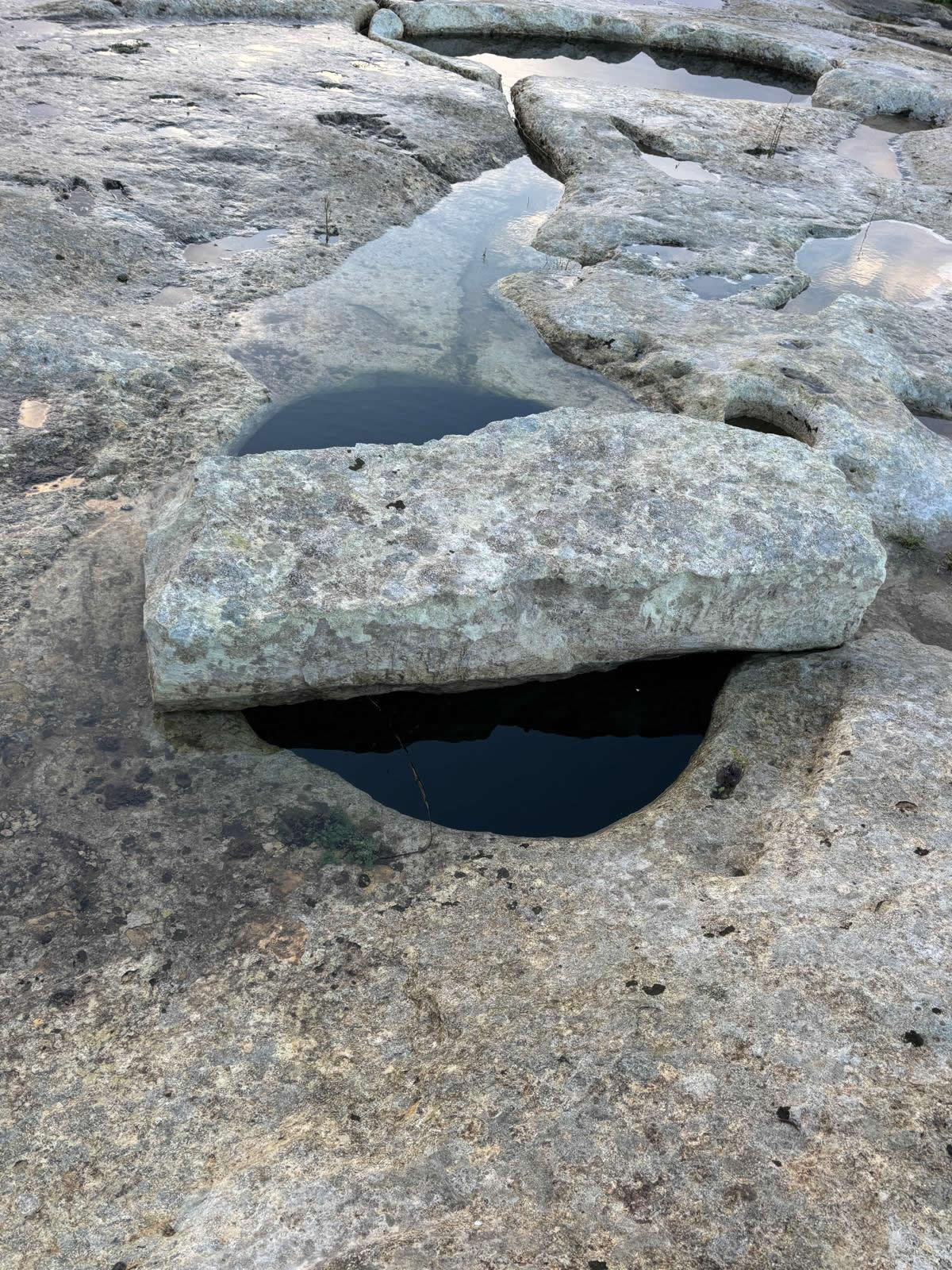
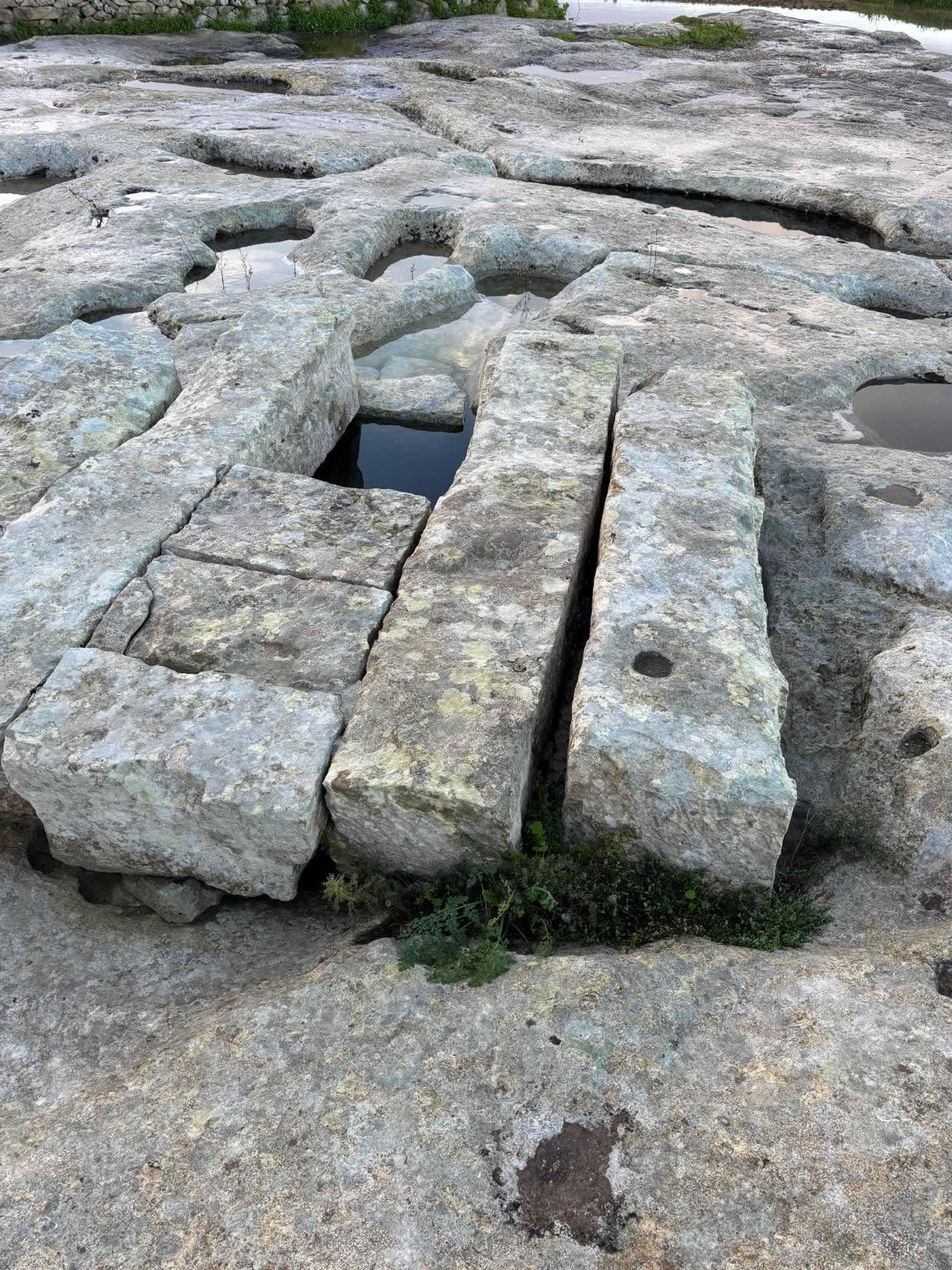
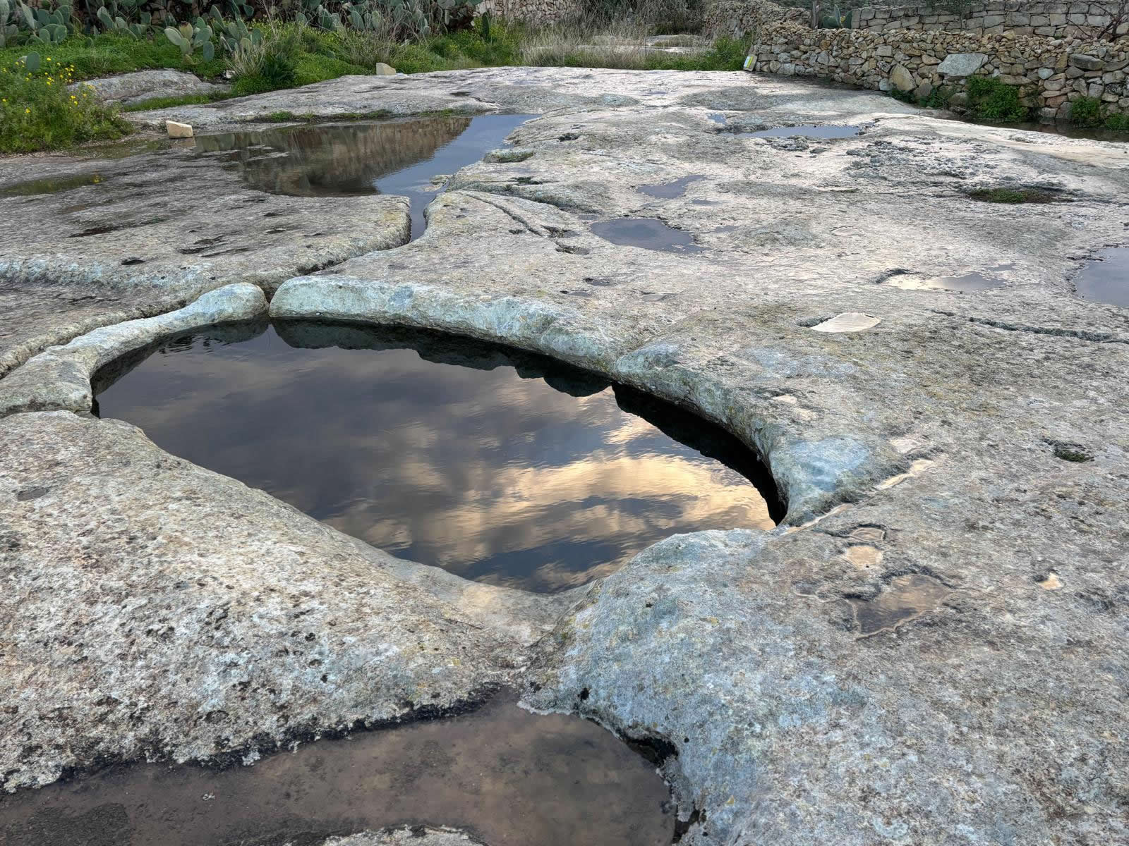
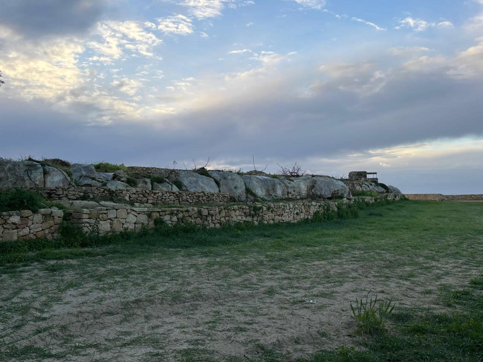
Il-Misqa is essentially engineered bedrock: deep cavities cut into limestone designed to capture and store rainwater.
Descriptions emphasise bell-shaped forms and access openings through which water could be drawn.
A particularly striking feature is the way openings were protected. Accounts describe heavy stone capping slabs, including interlocking stone arrangements,
and at least one opening with a round hole in its capping slab—suggesting controlled access to stored water.
The surrounding geology also matters: the tanks were dug where the rock structure made this kind of reservoir feasible and where runoff could be guided into
the cavities via rainwater collection channels/culverts.
How many tanks are there?
Sources differ on the exact count. Some summaries describe eight bell-shaped tanks, while others mention seven.
On the ground, visitors experience a cluster rather than a perfectly uniform set—irregular shapes and openings are part of the site’s character.
From ancient utility to modern heritage stop
In modern times, Il-Misqa is valued less as working infrastructure and more as heritage: an accessible example of early water management that deepens a visit
to the Mnajdra and Ħaġar Qim landscape. It is explicitly included in organised heritage activities and trails within the archaeological park area.
Visiting guide
How to get there
Il-Misqa is best reached on foot as part of the wider temple-and-countryside walk near Mnajdra and Ħaġar Qim. On Emalta’s Qrendi guide, the Misqa Tanks are
highlighted as a recommended stop on itineraries that combine temples and surrounding heritage.
What to bring
Water and sun protection (the plateau is exposed)
Sturdy footwear (uneven rock surface and rural paths)
Extra care near openings—do not climb on capping stones
Respecting the site
Il-Misqa is an open-air heritage feature. Avoid moving stones, entering openings, or disturbing sediment and vegetation around the tanks.
FAQ — Il-Misqa (Misqa Tanks)
Are the Misqa Tanks Neolithic?
They are often described as possibly Neolithic because of their proximity to Mnajdra and Ħaġar Qim, but definitive dating is difficult due to repeated clearing
and the lack of datable deposits.
What were they used for?
The prevailing interpretation is rainwater collection and storage—likely supporting activity in the surrounding landscape, potentially including temple-era use.
How do they differ from modern cisterns?
Il-Misqa is carved directly into bedrock, with access openings and stone capping solutions rather than built masonry chambers—an approach shaped by geology and
the practical challenge of storing water on an exposed plateau.