📍 Location
Location Map Coordinates 35.865761, 14.490218
Introduction to a Forgotten Landscape
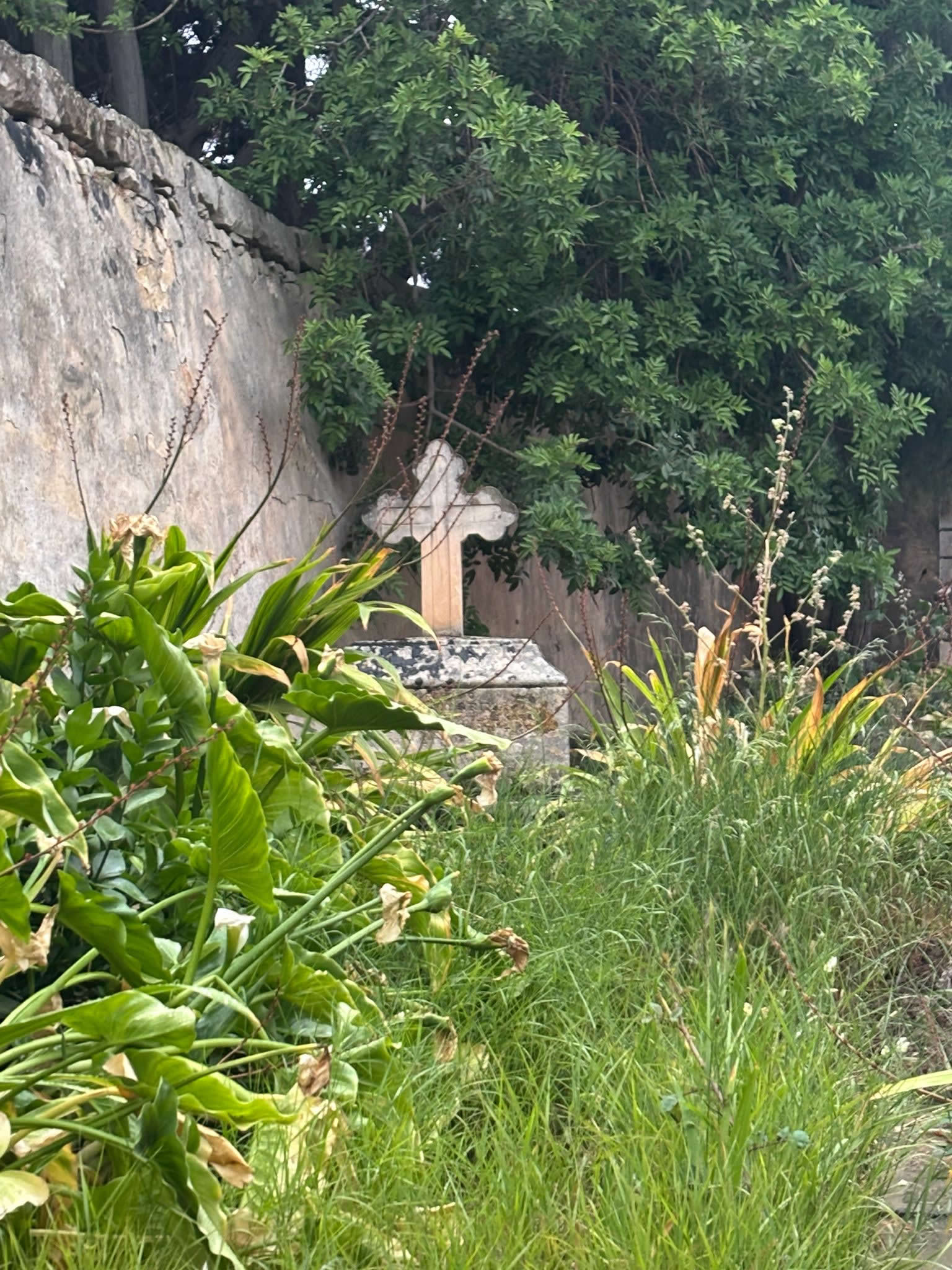
Standing quietly along the bustling arterial thoroughfare of Valletta Road on the approach to the village of Luqa, a stark, high stone wall guards a silent, historical secret. This is the Old Cholera Cemetery of Luqa, a mid-19th-century emergency burial ground constructed in the heat of a devastating epidemic. Unlike many of the older burial grounds scattered across the Maltese landscape, this enclosure represents a pivotal turning point in the way the islands managed public health crises under early British colonial administration.
For centuries, the Maltese buried their dead within the crypts of parish churches or inside designated vaults underneath public chapels. However, the unexpected arrival of highly contagious Asiatic cholera forced immediate, radical changes to these traditional religious customs. The site on Valletta Road is a concrete manifestation of those administrative, medical, and architectural shifts, preserving the memory of thirteen specific Luqa citizens who succumbed to the disease in the summer of 1850.

The Historic Outbreak of 1850: When Cholera Struck Luqa
To fully understand why this walled graveyard was built, one must step back to the epidemiological realities of 19th-century Europe. Throughout the 1800s, cholera swept across the globe in waves. Unlike the bubonic plague, which had plagued the Mediterranean for generations, Asiatic cholera was a relatively new, terrifying phenomenon that killed its victims swiftly through catastrophic dehydration, cramps, and organ failure.
The disease struck Malta in May 1850, having traveled along maritime trade routes. At the time, medical science was in a state of confusion; the dominant medical theory of the day was the miasma theory, which falsely argued that diseases were spread by inhaling noxious, foul odors rising from decaying matter or stagnant water. The true cause of cholera—the waterborne bacterium Vibrio cholerae—would not be formally isolated by Robert Koch until 1883.
As the epidemic spread into the rural south-central villages (the Casali), the village of Luqa found itself directly in the crosshairs. Between June and August of 1850, panic gripped the community as individuals who were healthy in the morning fell dead by nightfall. The British Governor of Malta, Sir Richard More O'Ferrall, acting on the strict recommendations of the newly formed General Board of Health, ordered immediate interventions. Among the most drastic of these mandates was the total ban on burying any suspected cholera victims inside the core of the village or its parish church vaults. The dead had to be taken outside the village walls immediately.
Epidemic Demographics: The Victims of Luqa
Historical records show that during the brief but intense 1850 outbreak, exactly thirteen Luqa residents succumbed to cholera. Rather than burying them in the main parish grounds where the infected soil might "off-gass" poisonous vapors into the air (according to the miasma theories of the time), a plot of land situated downwind on Valletta Road was hastily purchased or requisitioned to receive the dead.

Construction, Demarcation, and the Architectural Missing Link
The construction of the Old Cholera Cemetery was carried out rapidly in July and August of 1850. The British authorities hired local masons to build a specialized, self-contained structure known historically in Malta as a clausure—an isolated, high-walled enclosure intentionally designed to completely detach the infected ground from the public realm.
The Significance of the Missing Skull and Crossbones
A fascinating, highly distinct detail of the Luqa Cholera Cemetery is its structural aesthetic. Visitors who examine the gateway closely will notice that it completely lacks the terrifying skull and crossbones iconography that dominates older Maltese burial grounds. To understand this absence, one must contrast this site with earlier plague sites across the islands:
- The Baroque Era (17th & 18th Centuries): Older plague sites constructed under the rule of the Knights of St. John (such as those from the 1675 or 1784 epidemics) heavily utilized macabre stone carvings of skeletons, crossbones, and dramatic reliefs. This baroque art served a dual purpose: it warned the public of biological danger and acted as a memento mori, urging immediate spiritual penance in the face of God's wrath.
- The Victorian Era (19th Century): By 1850, Malta was fully integrated into British administrative systems. The British General Board of Health viewed epidemic control through a pragmatic, clinical, and secular lens. The construction of the Luqa cemetery was dictated by sanitation ordinances, not religious theater. The objective was to build a secure, impenetrable boundary wall that would contain the bodies and the heavy layers of quicklime used to accelerate decomposition.
Consequently, the gateway on Valletta Road reflects clean, minimalist functionality. It features a simple neoclassical pediment topped with a plain stone cross, framed by deep moldings, but entirely stripped of the macabre art seen on earlier historic plague sites. The main architectural feature is the sheer height of the perimeter walls, built to physically and psychologically separate the passing public from the infected dead.

Geographic Placement: The Valletta Road Spatial Strategy
The precise geographic location of the cemetery—plotted at coordinates 35.865761, 14.490218—was chosen intentionally based on the transport logistics and environmental theories of the 1850s. Situated on the main road connecting Luqa to the capital of Valletta, the site allowed the special "death carts" (il-karrettun tal-morda) to quickly transport bodies out of the town limits without forcing them to navigate the narrow, winding alleys of Luqa's inner core.
This layout minimized contact between the general populace and the deceased. Because the site sat along an open rural highway, it allowed for maximum airflow, which the doctors of the period believed would disperse the dangerous miasmas harmlessly into the surrounding fields. The interior layout was designed for raw utility, consisting of deep, parallel trenches where bodies could be stacked efficiently, layered with quicklime, and sealed under heavy soil.

Luqa's Epidemic Legacy: Preventing Common Confusion
Local historians, genealogists, and researchers frequently confuse the Valletta Road site with Luqa's other historic epidemic burial grounds. To maintain the highest level of research accuracy for your records, it is critical to understand that the village of Luqa does not have just one or two, but three distinct layers of epidemic burial sites spanning from the 16th to the 19th centuries.
Each site represents a completely different era of administration, type of disease, and architectural philosophy—marking the clear evolution of public health management in Malta from the rule of the Knights of St. John to the late Victorian British era.
| Historical Metric | The 1592 Plague Site (Carmel Street) | The 1814 Plague Cemetery (Triq Ta' Qormi) | The 1850 Cholera Cemetery (Valletta Road) |
|---|---|---|---|
| Disease & Outbreak | Bubonic Plague (1592–1593 Epidemic) |
Bubonic Plague (1813–1814 Outbreak) |
Asiatic Cholera (Summer 1850 Outbreak) |
| Exact Location | Tucked deep within the ancient residential core at Carmel Street, Alley 4. | On the outer village periphery heading northwest along Triq Ta' Qormi (35.859738, 14.484593). | Prominent arterial road frontage along Valletta Road (35.865761, 14.490218). |
| Administrative Era | Late Renaissance / Rule of the Knights of St. John and the Mdina Università. | Early British Military Rule under the strict dictatorial decrees of Governor Thomas Maitland. | Mid-Victorian British Civil Administration overseen by the statutory General Board of Health. |
| Funerary Iconography | None surviving or highly basic localized field markers from early agricultural holdings. | Features a prominent carved stone skull and crossbones above the entrance doorway. | Completely lacks the skull and crossbones icon. Uses a clean, plain neoclassical pediment. |
| Design Strategy | An emergency field burial trench, later built around as the village expanded over the centuries. | A traditional, military-cordoned clausure relying on baroque themes of spiritual warning and penance. | A modern, clinical, and secular sanitary structure focused strictly on quarantine containment logic. |
| Resource Links | Read 1592 Plague Article » | Read 1814 Plague Article » | Read 1850 Cholera Article » |
By mapping out all three settings within the eMalta database, we can vividly see the shifts in societal responses to mass mortality over a timeline spanning nearly three centuries.

Restoration Efforts and the Modern Preservation Movement
Following the eradication of cholera in the late 19th century, the Old Cholera Cemetery fell into a long period of abandonment. As the decades rolled on, the road system around Luqa expanded, and Valletta Road transformed from a quiet countryside lane into a high-traffic highway serving the heart of Malta's transport network. The cemetery walls suffered from continuous exposure to modern traffic emissions, structural vibrations, and wild vegetation growth, which threatened to burst through the lime mortar joints.
Fortunately, in recent years, local heritage enthusiasts, the Luqa Local Council, and national restoration entities recognized the immense architectural value of the site. Focused restoration campaigns were launched to clean the exterior limestone facade, clear the invasive wild roots from the interior trenches, and repoint the perimeter walls using traditional Maltese globerigina limestone methods. Today, while the interior remains locked to the general public to protect the structural stability of the inner soil beds, the facade stands beautifully preserved as an open-air historical museum piece along Valletta Road.
Frequently Asked Questions (FAQ)
Can I enter the interior of the Old Cholera Cemetery in Luqa?
No, the interior of the cemetery is locked and restricted to the general public. This policy preserves the fragile structural stability of the underlying soil beds and honors the final resting places of those buried within. However, the entire historic facade and main monumental gate are completely visible from the public pavement along Valletta Road.
Why are there no skull and crossbones carvings on this cemetery gate?
Unlike older epidemic sites from the Baroque period under the Knights, this cemetery was constructed in 1850 under British colonial rule. The British General Board of Health prioritized functional, clinical, and secular public health design over religious, macabre symbolism, resulting in a clean, minimalist neoclassical facade.
How many people are buried in the Luqa Valletta Road Cemetery?
Historical parish and civil records state that exactly thirteen residents of Luqa who contracted and died from Asiatic cholera during the brief summer outbreak of 1850 are interred at this site.
Is this the same site as the plague cemetery in Carmel Street?
No. The site in Carmel Street (Alley 4) dates back to the older Bubonic Plague outbreak of 1592–1593. The Valletta Road cemetery is a distinct site built 258 years later specifically for the cholera epidemic of 1850.
