📍 Location
Location Map Coordinates 35.903228, 14.500523
An Analytical Investigation into the Lazzaretto's Sole Surviving Necropolis, Chronological Discrepancies, and the Interior Lapidary Repository
1. Quarantine Origins: The Lazzaretto Cemetery Network
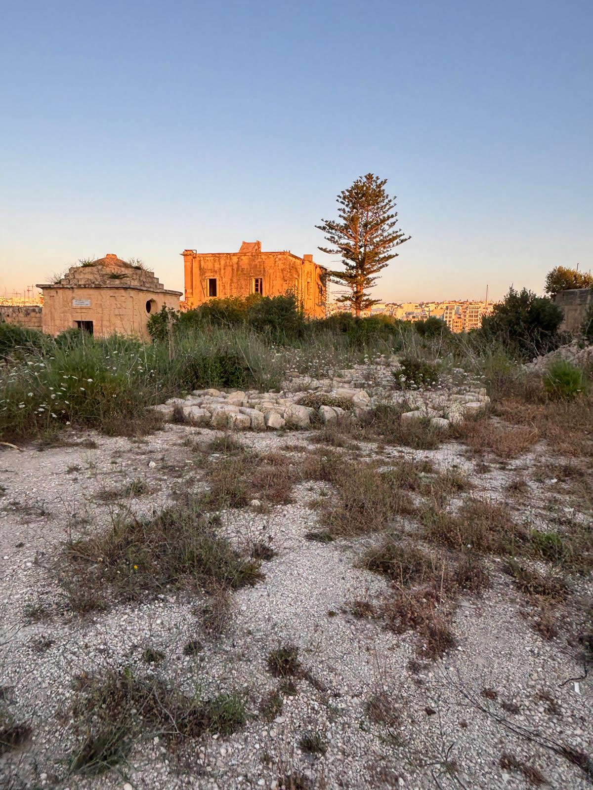
The Ħofra Cemetery, historically designated as St. George's Cemetery, occupies a unique position within the public health and epidemiological landscape of the Maltese Islands. Tucked away on the southern flank of Manoel Island, Gżira (formerly known as Bishop's Islet or Isolotto), this site is the last surviving link to a highly complex network of quarantine cemeteries. These burial grounds were operated by the Order of St. John and later expanded under British colonial rule to manage contagious outbreaks in the Mediterranean.
Ever since Marsamxett Harbour was chosen as Malta’s official quarantine anchorage in 1526, Manoel Island served as the front line against imported epidemics like bubonic plague, cholera, and smallpox. Following the construction of a permanent, stone quarantine hospital—the Lazzaretto—by Grand Master Giovanni Paolo Lascaris in 1643, international maritime laws required that anyone who died while undergoing isolation be buried immediately on-site. This strict policy led to the creation of six distinct cemeteries scattered across the immediate vicinity of the hospital and Fort Manoel. These plots safely interred infected sailors, passengers, local medical officers, and foreign travelers who succumbed to disease before they could step onto the mainland.
Of these six historical necropoli, five were completely wiped out by heavy aerial bombardment during World War II—when the island was utilized as a British submarine depot (HMS Talbot)—and by post-war development. The Ħofra Cemetery stands alone as the sole surviving burial field, preserving centuries of international quarantine records beneath its soil.
2. Chronological Separation: Were the Chapel and Cemetery the Same Age?
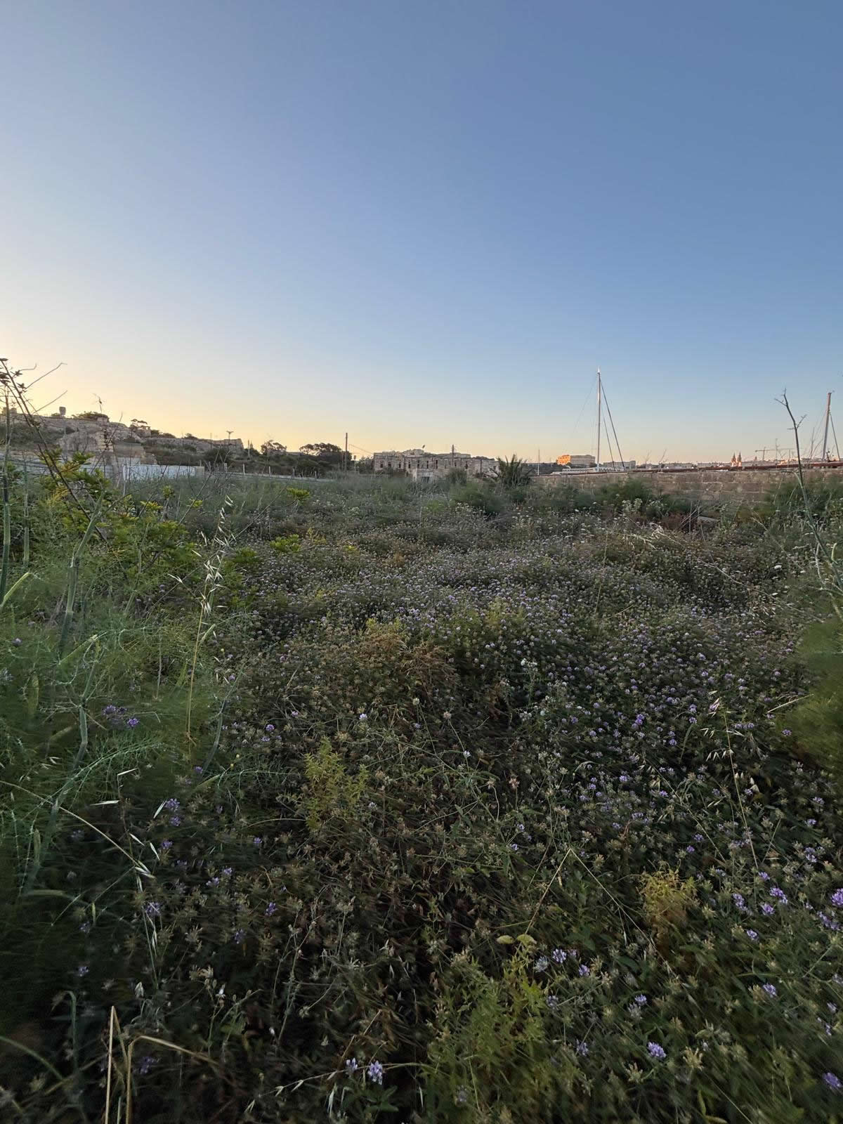
The burial field itself dates back to the late 18th century as an open quarantine plot, but cartographic evidence shows that the stone structural complex was formalized by the early 19th century. In fact, depictions of St. George's Chapel appear on early military maps dated around 1813. This confirms that the chapel's construction occurred around the time of the devastating 1813–1814 bubonic plague outbreak, a period marked by extensive rebuilding, sanitary consolidation, and public health upgrades across the Maltese islands under early British colonial rule.
The burial field itself dates back to the late 18th century. It was established as an open, unadorned quarantine lot to handle the rising number of deaths from merchant ships arriving from plague-endemic ports in the Levant. During the catastrophic 1813–1814 bubonic plague epidemic, this open field saw its most intensive use. Long before a permanent chapel was built on the site, the ground was systematically trenched to receive hundreds of plague victims, layered with quicklime to neutralize the biological contagion.
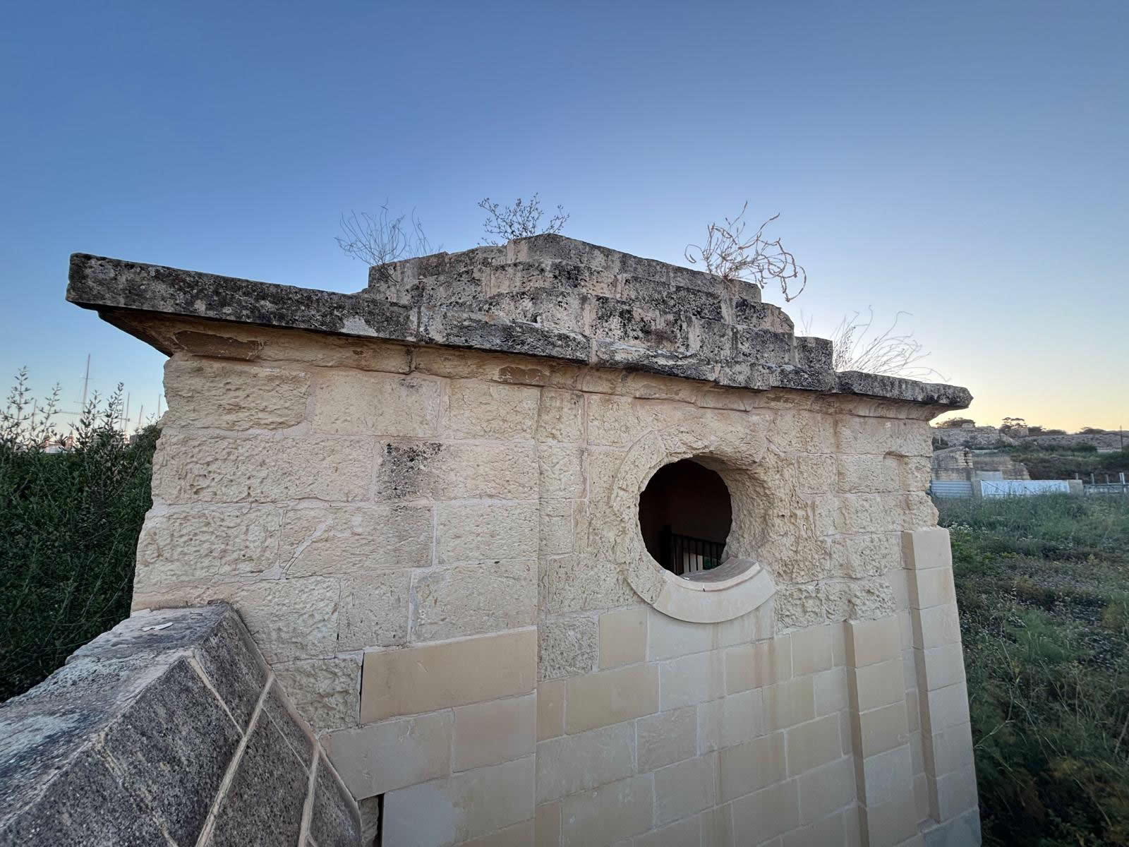
The formal, stone St. George's Funerary Chapel was constructed decades later, during the early years of British colonial rule (circa 1830s). As the British military upgraded the Lazzaretto into a primary quarantine station for the British Empire, they sought to organize and formalize the chaotic burial grounds. The chapel was built to anchor the existing late-18th-century graveyard, providing a dignified space to administer final rites for non-Catholic and Catholic personnel alike. Therefore, while the cemetery represents an 18th-century emergency burial lot, the chapel is a 19th-century Neo-Classical structure built over it. For a focused study on the spiritual profile of this structure, consult the dedicated monument log at St. George's Chapel Gżira Directory.
3. The "Ħofra" Enigma: Topographical Isolation
The colloquial Maltese name for the site, Il-Ħofra (meaning "The Hole" or "The Pit"), describes its unique physical layout. This name has sometimes caused confusion in older texts, with some writers misidentifying it as an old limestone quarry or an internal ditch of Fort Manoel. In reality, the name refers directly to its specific containment design.
The cemetery was built in a natural depression on the island, which was further hollowed out and enclosed by high boundary walls. This design kept the quarantine burial ground physically lower than the surrounding terrain, creating an isolated pit. During the 1813 plague outbreak, this low-lying, sunken layout helped contain the spread of disease by preventing wind currents from sweeping across the gravesites, a major concern at a time when medical authorities still believed contagion spread through foul air or "miasma."
4. Desecration and Discovery: The 1980s Industrial Leveling
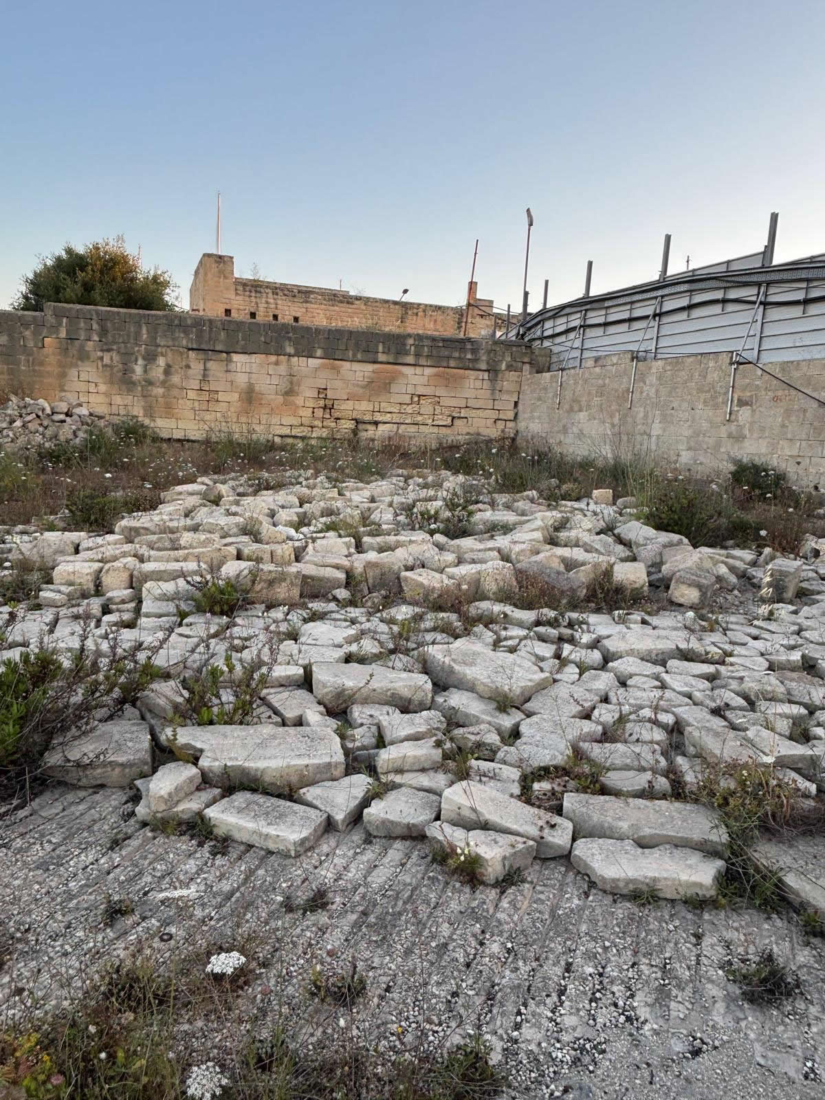
The modern layout of the Ħofra Cemetery was heavily altered by mid-twentieth-century industrial developments. Following the departure of the Royal Navy in the 1970s, the entire Lazzaretto complex was largely abandoned, exposing it to severe vandalism and weathering. The absolute low point in the cemetery's history occurred in the early 1980s, when the historic grounds were cleared to create a marshalling yard for an oil-drilling company operating in Marsamxett Harbour.
During this clearing process, almost all the standing headstones, elaborate British and Italian box-tombs, and decorative funerary monuments were completely leveled by heavy machinery. However, this destruction had an unexpected side effect. Instead of completely digging up the graves, workers pushed a thick layer of wartime rubble and soil over the entire area to level the ground for industrial vehicles. This action inadvertently sealed the lower grave cuts, vaults, and the lower sections of the original pathways underneath a protective layer of debris. Recent archaeological surveys overseen by the Superintendence of Cultural Heritage have confirmed that while the surface monuments were lost, the sub-surface graves and historic burials remain intact, offering a well-preserved cross-section of nineteenth-century quarantine practices.
5. The Interior Lapidary Repository of St. George's Chapel
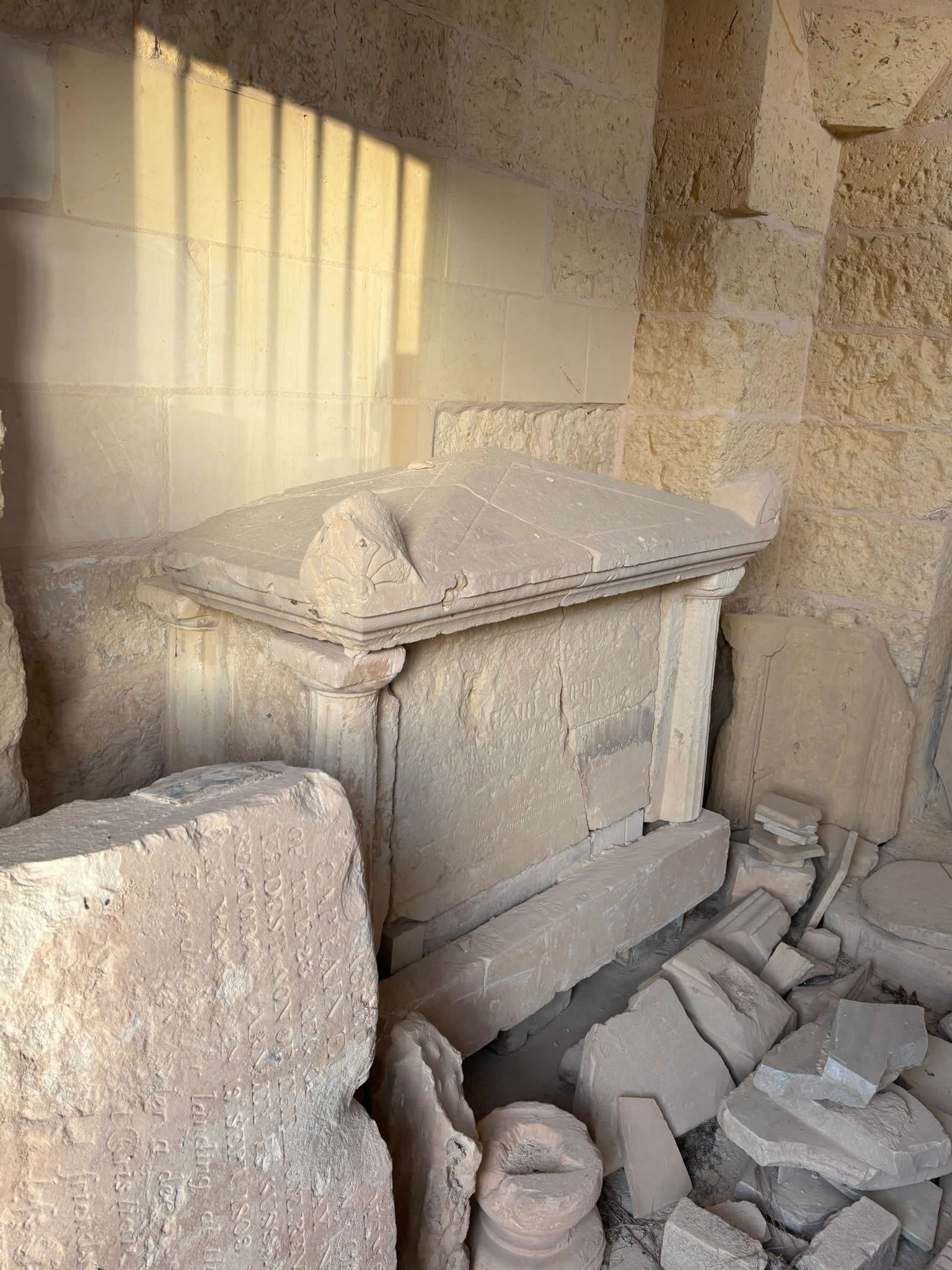
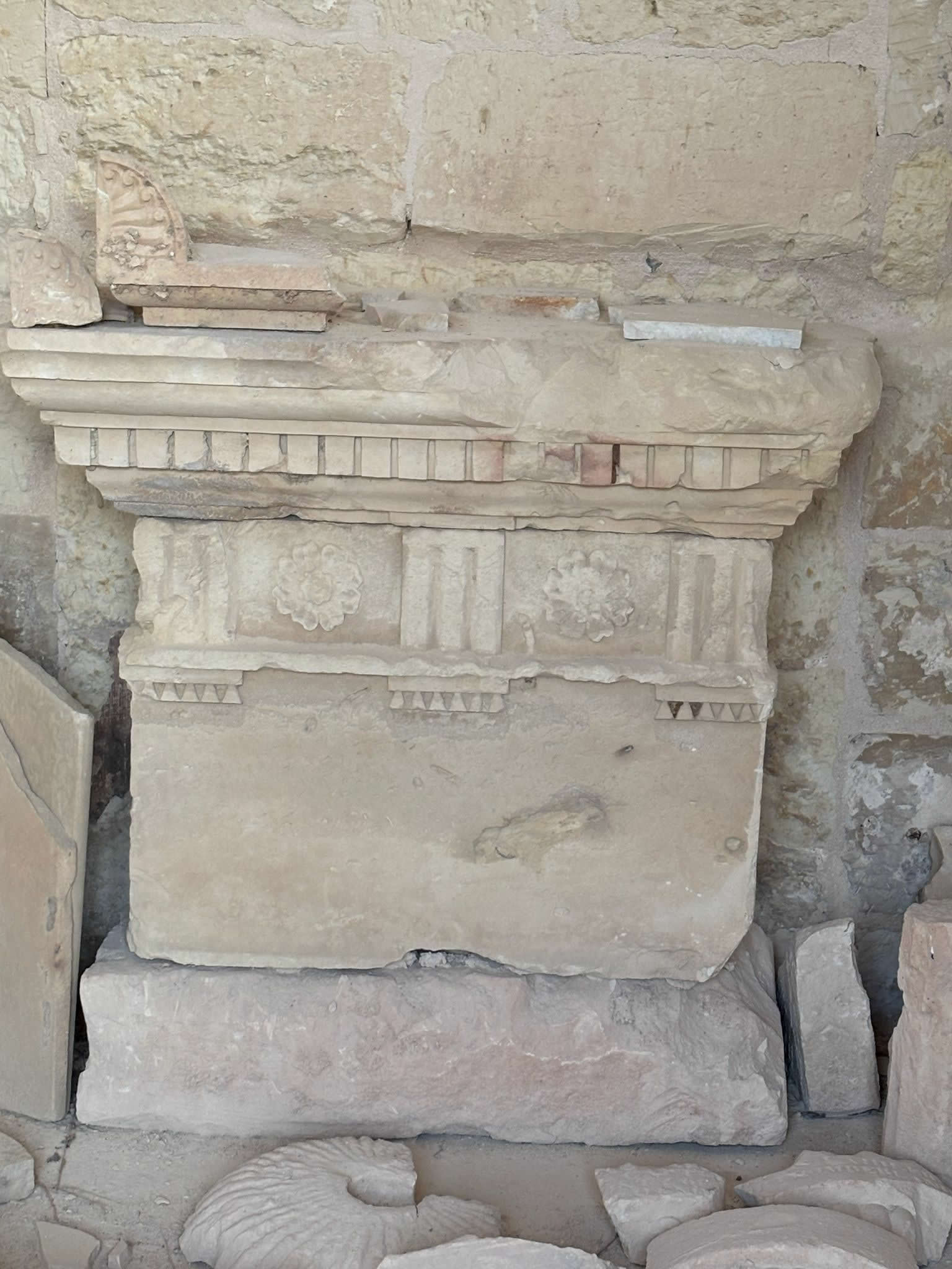
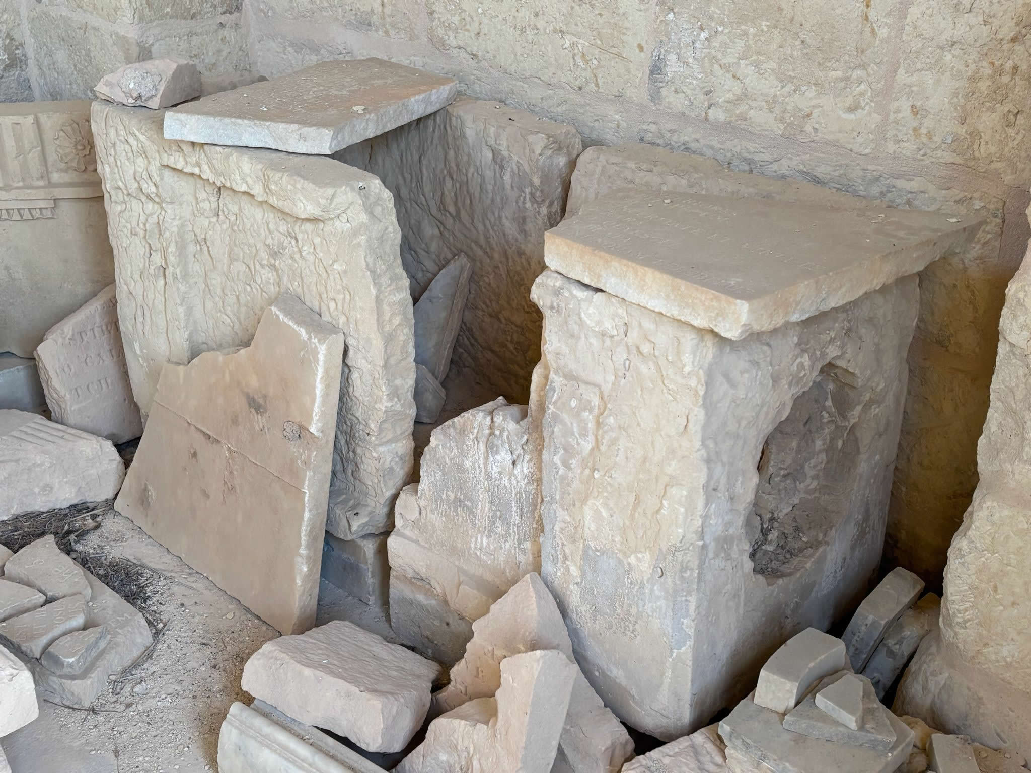
Because St. George's Chapel is structurally very small, the historic artifacts recovered from the outer cemetery grounds consume almost the entire floor space of its single chamber. Rather than functioning as an active place of worship, the chapel serves as a vital lapidary repository, protecting high-quality stone carvings, monumental tombs, and foundational structural blocks that were rescued from bulldozers in the early 1980s. A close inspection of these objects reveals three distinct categories of salvage:
A. Reassembled Classical Box-Tombs
Dominating the front section of the chapel floor is a completely reassembled, classic limestone box-tomb built in the fashion of Roman sarcophagi. This style of tomb was common throughout the early nineteenth century for elite naval officers and colonial officials buried within the Lazzaretto fields. The tomb is framed by structured pilasters at its corners and capped with a massive, heavy gabled limestone lid featuring raised acroteria carvings at its corners. Propped against its base are broken inscription tablets whose weathered letters record the losses of British sailors and foreign merchants who died while pinned within the quarantine walls.
B. Neo-Classical Friezes and Relief Carvings
Stacked along the side walls of the chapel are beautifully carved structural panels that showcase top-tier Maltese craftsmanship applied to British colonial orders. Several limestone chest-tomb facings feature highly refined Neo-Classical architectural elements, complete with detailed friezes showing triglyphs, metopes, and carved floral rosettes. These decorative structural elements prove that before its surface clearing, the Ħofra Cemetery was not merely a raw ditch, but a formal cemetery housing highly sophisticated funerary art built to honor important international figures.
C. Structural Debris and Vault Architecture
The rear sections of the small chapel contain dense piles of raw architectural fragments. These include broken vault voussoirs, hand-carved stone blocks, and parts of the original internal wall linings of the cemetery plots. These blocks show clear evidence of hand-tooling and salt erosion, giving historians raw material to analyze the specific masonry styles and structural techniques used during Malta’s major quarantine expansion periods.
6. Spatial Survey and Technical Data Profile
The Ħofra Cemetery is located on the southern flank of Manoel Island, positioned to balance isolation from the historic capital of Valletta with easy access to the Lazzaretto’s unloading docks. Researchers can utilize the verified geodetic and historical profile below for mapping and comparative studies:
| Technical Survey Parameter | Field Inventory Reference Data |
|---|---|
| Official Nomenclature | St. George's Cemetery (Ċimiterju ta' San Ġorġ) |
| Colloquial Maltese Name | Ċimiterju tal-Ħofra (Manoel Island) |
| WGS84 Coordinate Grid | 35.903228 Latitude, 14.500523 Longitude |
| Cemetery Grounds Age | Late 18th Century (Established c. 1790s) |
| Funerary Chapel Age | Early 19th Century (Constructed c. 1830s) |
| Major Epidemic Use | 1813–1814 Bubonic Plague Outbreak / 1865 Cholera Epidemic |
| Associated Chapel Profile | St. George's Chapel Page |
To see how the quarantine infrastructure and plague trenches on Manoel Island connect with other isolation sites, lazarettos, and municipal burial complexes across the islands, explore our comprehensive master guides at the Cemeteries of Malta and Gozo Directory as well as our specialized tracking portal at the Plague Cemeteries of Malta and Gozo Network.
7. Frequently Asked Questions (FAQ)
❓ Were St. George's Chapel and the Ħofra Cemetery built at the same time?
No, they are different ages. The open cemetery lot was first laid out in the late 18th century as an emergency containment space, while the stone chapel was added decades later, around the 1830s, under British rule to formalize the burial grounds.
❓ What is the purpose of the stone objects stored inside the chapel?
The chapel acts as a lapidary repository. The heavy stone artifacts filling the interior are reassembled box-tombs, decorative Neo-Classical panels, and vault remnants rescued from the outer burial fields when the surface grounds were cleared in the 1980s.
❓ Why is the site called the Ħofra Cemetery?
The name "Ħofra" (Maltese for "The Hole") refers to its sunken, natural limestone setting. This low layout was used to dig deep, isolated plague trenches that kept the burial space safely below the island's main walking paths.
❓ Did any graves survive the 1980s industrial clearing?
While almost all surface monuments and headstones were leveled by heavy machinery in the early 1980s, recent archaeological work shows that the underlying grave cuts and trenches remained protected under a thick layer of leveled soil and rubble.