📍 Location
Location Map Coordinates 36.018060, 14.285597
An in-depth study of the mid-shore 18th-century military engine positioned at the Xatt l-Aħmar parking loop, Gozo.
- Geographic Location: Coastal Shore Platform, Għajnsielem, Gozo
- Precise Mapping Coordinates: 36.018060, 14.285597
- Trail Proximity: Situated immediately next to the Xatt l-Aħmar parking area loop.
- Spatial Context: Positioned precisely midway between the historic Ras il-Ħobż Salt Pans to the west and the expansive Xatt l-Aħmar Salt Pans to the east.
- Fortification Context: Dominated by the soaring bastions of Fort Chambray on the hilltop cliffline directly inland.
Strategic Positioning & History
The rocky southern coastline of Gozo separating the modern dive sites of Ras il-Ħobż and the shallow shelf of Ix-Xatt l-Aħmar forms a wide, low limestone ledge. During the high tensions of the mid-18th century, the military engineers of the Order of St. John identified this low shore platform as highly vulnerable to sudden, close-range naval incursions. While the later construction of Fort Chambray on the high bluffs provided high-altitude artillery coverage, the immediately breaking surf required localized, close-in defense.
Under the guidance of Resident Engineer Francesco Marandon following his highly successful ballistic validation trials in September 1740, this specific Għajnsielem Coastal Fougasse was hewn deep into the flat upper surface of the lower coralline limestone shelf. Operating as a static, massive rock-cut mortar (*foggazza*), its target angle was calculated to command the exact coastal transition space flanking the main bay path.
Architectural Anatomy & Current State
As documented on the official rural development interpretative signage at the site, the installation follows the definitive design criteria of an inverted truncated cone. The stone cutters hollowed out a wide, sweeping mouth at the surface which tapers sharply inward as it descends toward a cylindrical powder pit at its base. The charge chamber was designed to hold several barrels of coarse marine gunpowder, isolated by a wooden barrier disc, and topped by roughly 10 to 15 metric tons of jagged limestone rocks gathered from the surrounding shoreline terraces.
Today, because the structure sits directly adjacent to the active **Xatt l-Aħmar parking area**, it is highly accessible to heritage hikers, scuba groups, and researchers. To ensure public safety along this flat, high-visibility walking route, the cavity is capped by a durable protective iron mesh grid and bounded by a low steel perimeter guardrail, which shields the open mouth from erosion and pedestrian falls while allowing clear visual exploration down its throat.
Photographic Record & Field Survey
The following sequenced field photographs illustrate the exact setting, construction metrics, and landscape context of the Għajnsielem installation, keeping a uniform vertical aspect ratio for clear visual analysis.
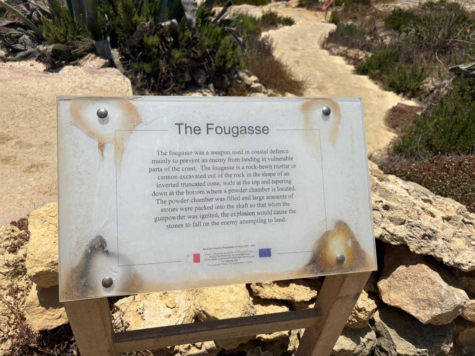
RasilHobzfougasse1.jpeg - The official rural interpretive signage erected near the path, describing the weapon's deployment parameters.
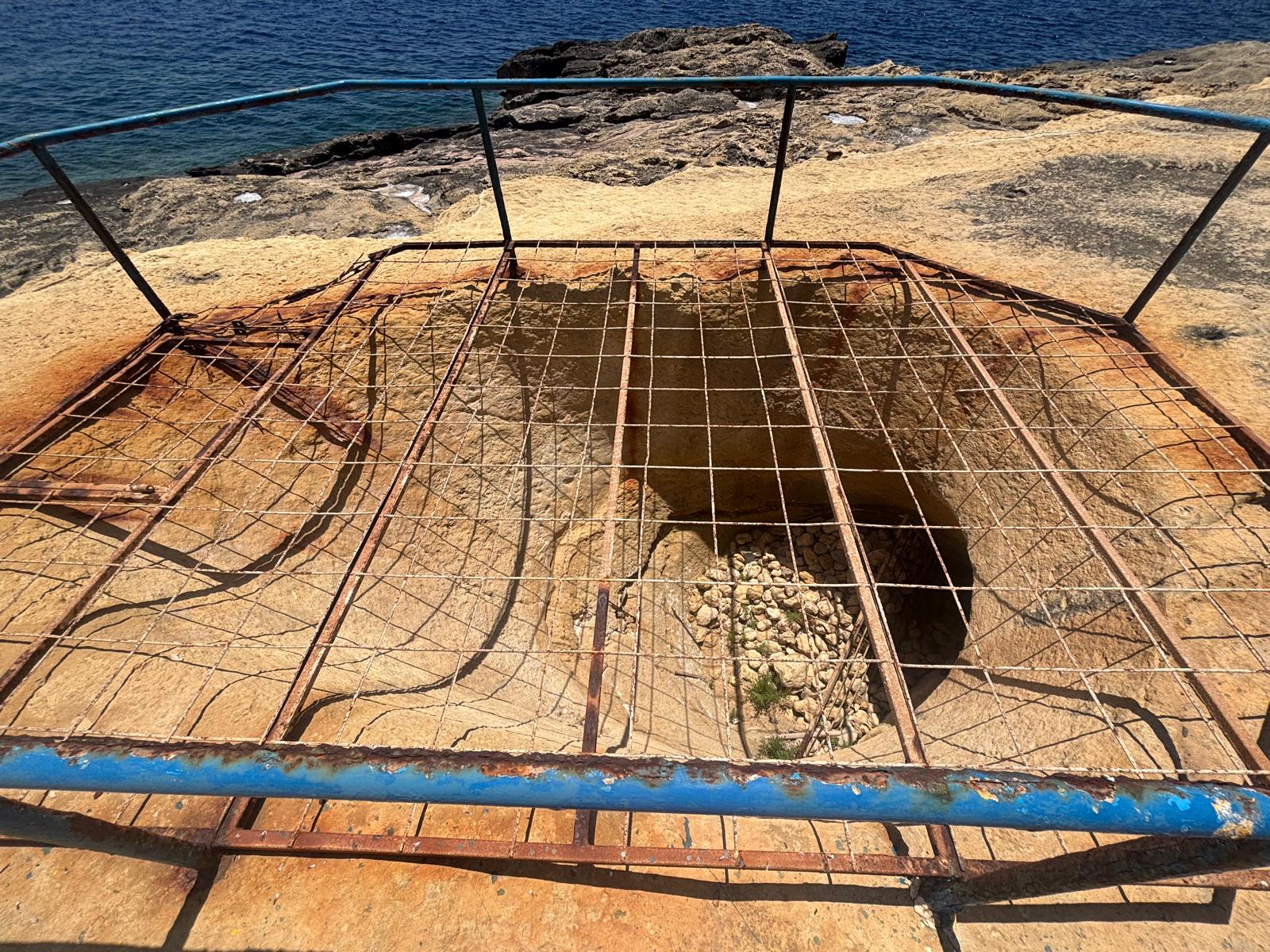
RasilHobzfougasse2.jpg - Direct vertical perspective showing the protective iron grid capping the wide mouth of the rock-cut cavity.
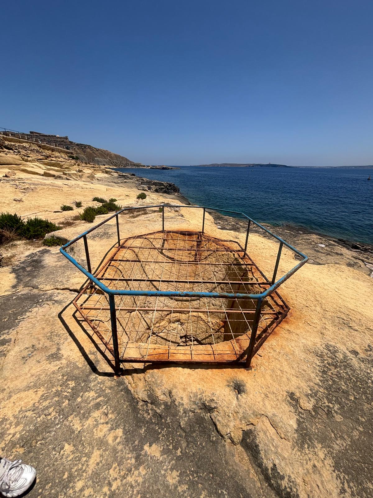
RasilHobzfougasse3.jpg - Long-range view highlighting the isolation of the installation on the low coralline shelf next to the shore track.
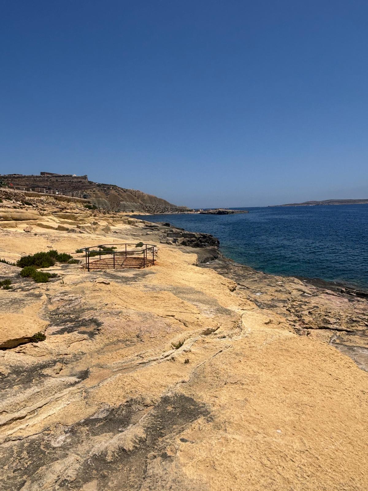
RasilHobzfougasse4.jpeg - Structural view of the protective safety enclosure, illustrating the shallow slope angle carved into the limestone floor.
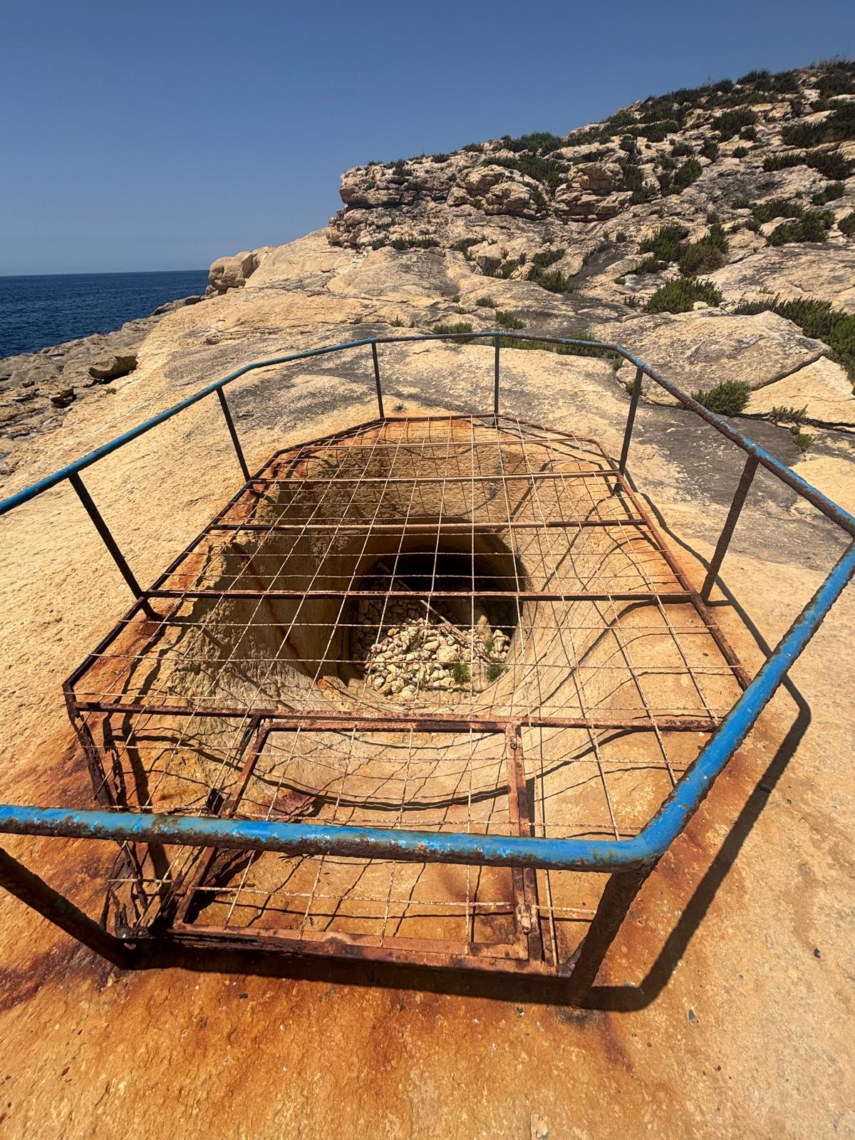
RasilHobzfougasse5.jpg - Interior close-up tracking the clean, circular hand-cut tool marks lining the descending barrel wall.
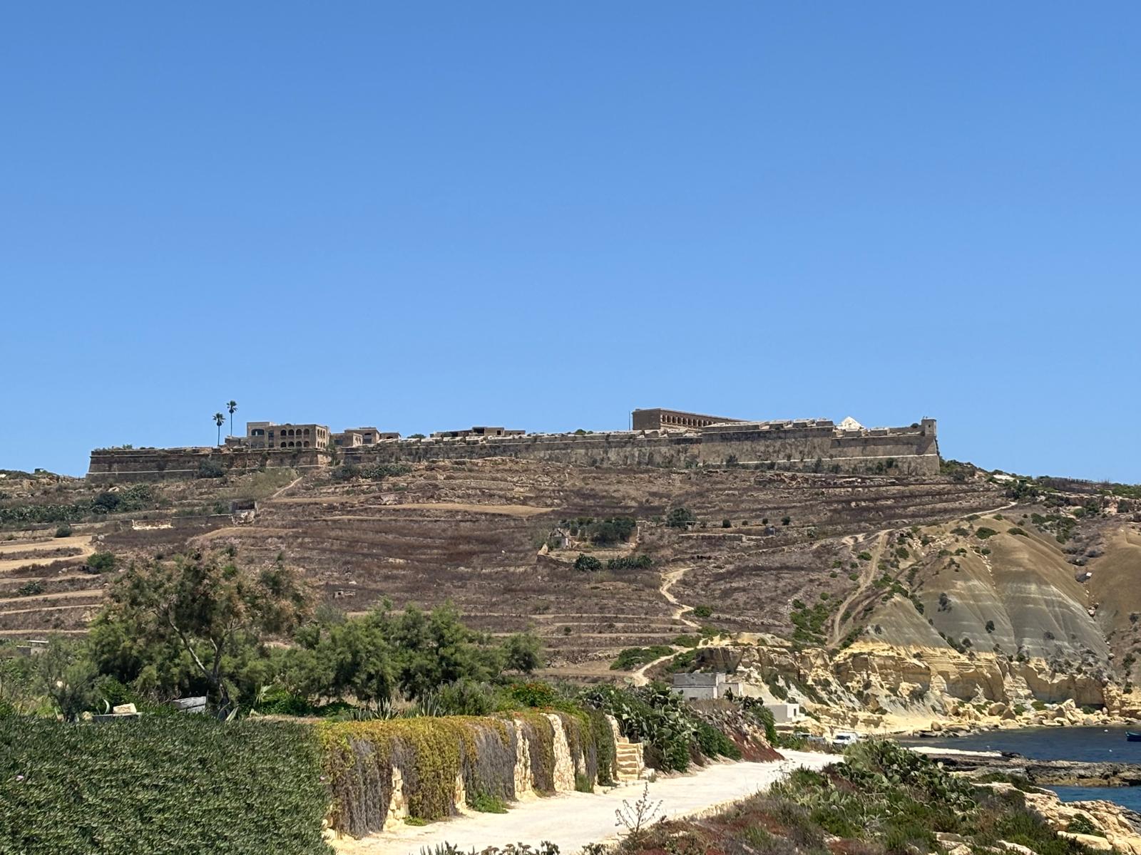
RasilHobzfougasse6.jpeg - Structural context showing the towering footprint of Fort Chambray on the high hilltop overlooking the coastal zone below.
Frequently Asked Questions
This heritage page serves as a master connective hub between our extensive agricultural site guides, including the Ras il-Ħobż Salt Pans Hub and the nearby eastern Xatt l-Aħmar Salt Pans Hub.
The mortar sits squarely on the coastal path line at coordinates 36.018060, 14.285597, perfectly reachable via the standard vehicular descent road leading to Xatt l-Aħmar.
While the perimeter grid of fougasses across Gozo was cleared and fully primed during the major French naval fleet scare of 1761, records show they were bypassed during the rapid capture of the island's fortifications by French forces in June 1798.
Research & Documentation
- Researcher: Paul Berman
- Last Updated: 2026
This page forms part of eMalta's ongoing documentation of the historical, cultural and religious heritage of Malta and Gozo.
Information has been compiled through site visits, field research, historical publications, archival records, maps, plans and other reference sources.
All locations that currently exist featured on eMalta have been personally visited and documented. Where historic sites no longer exist, information has been researched from archival sources and contemporary records.
Images used on eMalta include original photography as well as historical illustrations, maps and photographs reproduced with permission from archives, institutions and copyright holders where applicable. Individual image credits and archive reference numbers are provided where available.