Borġ l‑Imramma — Sannat (Gozo)
A sizeable but partly ruined temple‑period complex on the Ta' Ċenċ plateau. The remains are fragmentary, often blending into the surrounding landscape, yet they form an important part of Gozo’s prehistoric network of monuments.

Overview
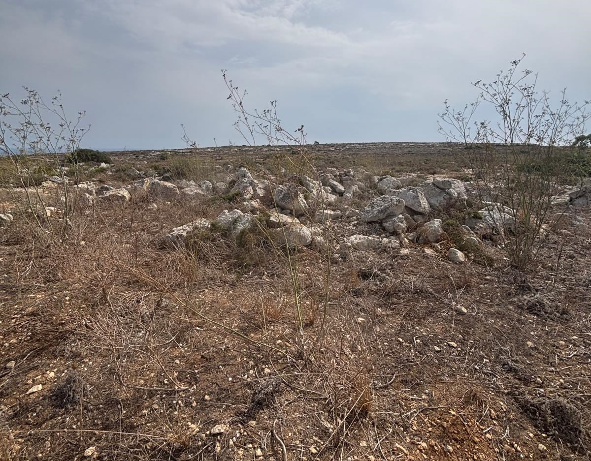
Borġ l‑Imramma (also written Borġ l‑Imramma / Borġ tal‑Imramma) is situated on the elevated Ta' Ċenċ plateau in the southeast of Gozo, within the modern locality of Sannat. The monument is generally described in guide literature as a "major building of the temple period": an open courtyard (c. 20 m across in many descriptions) surrounded by small circular or D‑shaped chambers, with an entrance passage to the courtyard. The visible remains today are partly collapsed or scattered—some uprights survive in situ while other slabs are fallen or partially buried.
Research, Discovery & Chronology
Borġ l‑Imramma has been known to antiquarians and to local observers for over a century, appearing in early site lists and in later survey work of Gozo’s megalithic remains. Unlike major complexes such as Ġgantija, Borġ l‑Imramma did not undergo large‑scale, well‑documented modern excavations (at least none widely published); much of the literature treats it as an important but under‑investigated temple complex. Published guides and local records describe the site’s plan and note associated features on the Ta' Ċenċ plateau such as cart‑ruts and dolmens in the vicinity, suggesting a broader ritual landscape of which Borġ l‑Imramma formed an integral part.

Chronological note
The monument is generally assigned to the temple period of Maltese prehistory. Some authors suggest an early date range (as early as c. 4100 BC) for initial courtyard traditions on Gozo, with continued activity and modification through the later Neolithic Temple phases. Because the site lacks extensive published radiocarbon series from controlled stratigraphic excavations, precise phasing remains tentative and is usually inferred by comparison to better‑excavated sites.

Site Description & Layout
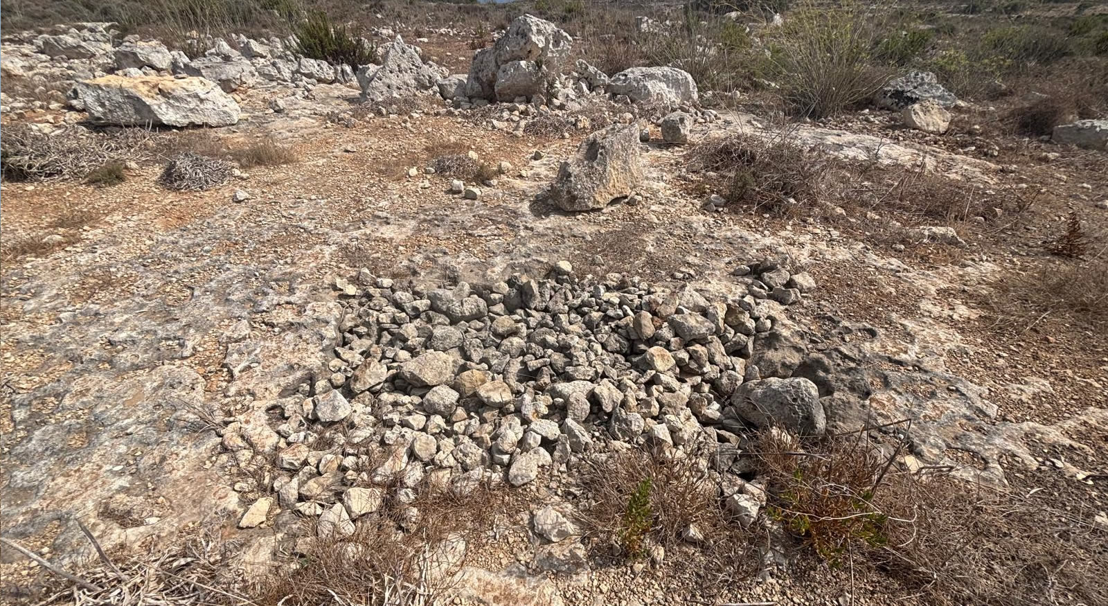
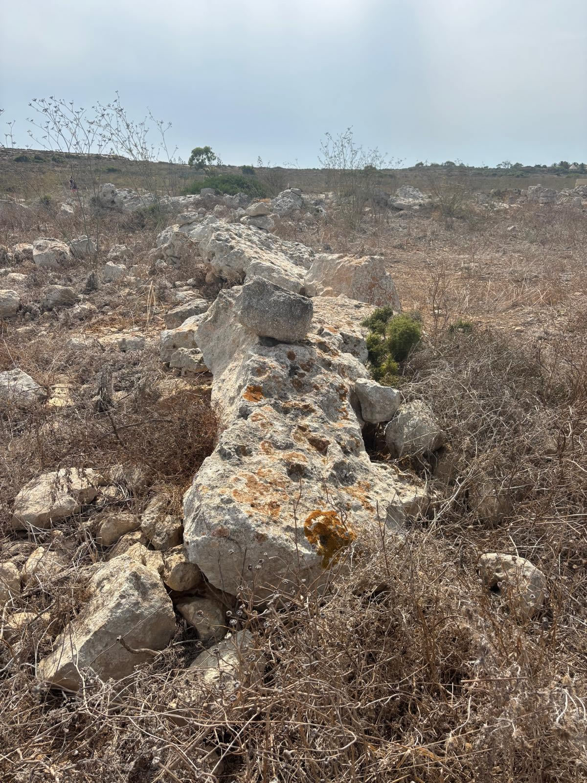
Descriptions in surveys and visitor guides emphasize an oval or roughly circular courtyard surrounded by small rounded chambers—an arrangement that fits comfortably within the corpus of Maltese megalithic temple architecture. The entrance passage faces northwest in several published plan interpretations, and the courtyard surface shows traces of paving stones in photographic records. Standing slabs and short curving wall segments can still be identified on the plateau although some stones are collapsed or have been partially removed over time.
Visible features
- Remnants of an oval courtyard, about 15–25 m across in published descriptions.
- Groups of small, near‑circular chambers opening from the courtyard.
- Scattered orthostats and collapsed slabs across a low raised area of the plateau.
- Nearby landscape features: cart‑ruts, dolmen‑type features, and other lower‑visibility megaliths.
Archaeological Context & Significance
Borġ l‑Imramma’s importance lies in being part of a dispersed network of temple and ritual sites on Gozo’s Ta' Ċenċ plateau — an elevated limestone landscape with panoramic views and numerous prehistoric traces. Comparative study with better‑excavated Gozo sites (especially Ġgantija and the Xagħra plateau monuments) suggests Borġ l‑Imramma played a role in regional ceremonial activity, perhaps acting as a community temple or a local focal point within a wider ritual topography.
Visitor Information
How to get there
From the Gozo ferry terminal at Mġarr, follow local roads toward Sannat and the Ta' Ċenċ plateau. The site is accessed from small local roads and is visible from roadside vantage points on the plateau; GPS and mapping apps (search "Borg l Imramma" or "Borġ tal‑Imramma") will bring you close. Approximate coordinates given above are a useful reference for mapping tools.
Parking & walking
There is no formal visitor car park. You may need to stop safely on the roadside or use nearby laybys; follow local signs and avoid blocking narrow lanes. A short walk over rough field paths will bring you to the visible stones—wear sturdy shoes and be prepared for uneven ground.

Facilities & services
The Ta' Ċenċ area has limited tourist facilities; refreshments and restrooms are available in nearby villages (Sannat/Żebbuġ) or at larger tourist hubs elsewhere on Gozo. There is no onsite visitor centre dedicated to Borġ l‑Imramma.
Access rules & etiquette
Borġ l‑Imramma may lie adjacent to private farmland; respect property boundaries and any signage. Avoid climbing on or moving stones, and do not remove objects. If you are unsure whether land is private, ask a local resident or consult the local council for guidance.
Best time to visit
Spring and autumn offer mild weather and pleasant light. Early morning and late afternoon are best for photography and for avoiding the strongest sun; the plateau is exposed so take water and sun protection during summer.
Guided visits
Because Borġ l‑Imramma is not a staffed national site, guided visits are less common, but some local Gozo tour operators include the Ta' Ċenċ plateau and its megaliths in landscape or archaeology‑themed tours. Contact local guides or the Gozo Tourism Office for options.
Conservation, Risks & Research Needs
Conservation status: Borġ l‑Imramma is a fragmentary, open‑air ruin without protective shelters. Threats include weathering, vegetation growth, inadvertent damage from visitors or agricultural activities, and occasional stone removal. The site would benefit from systematic survey, a published plan based on recent fieldwork, condition monitoring and, where justified, careful conservation of vulnerable uprights.
Scholars note that sites like Borġ l‑Imramma require updated documentation (photogrammetry/3D recording) and targeted shovel testing or trenching under controlled conditions to produce firm radiocarbon sequences and pottery-based phasing. Until more detailed fieldwork is carried out, much of Borġ l‑Imramma’s chronology must be inferred by analogy with nearby Gozo temples.

Sources & Further Reading
Selected references and public records helpful for further study and planning visits:
- Megalithic Portal / The Modern Antiquarian — site entries and user photos.
- GuideMeMalta — visitor summaries and short descriptions of Borġ l‑Imramma.
- Gozo Album / National Archives — historic photographs and locality notes.
- Wikipedia — Borġ l‑Imramma entry (updated summaries; check references listed there for excavation literature).
- Regional archaeological surveys of Gozo and David H. Trump, Malta: Prehistory and Temples for comparative context.

Quick facts
Nearby points of interest
- Ta' Ċenċ Cliffs and lookout points
- Cart ruts and other low‑visibility megalithic markers on the plateau
- Sannat village attractions and dramatic coastal views
This page is an independently compiled guide synthesising publicly available site records, guidebook summaries and photographic archives. For any formal research, quote or citation, consult primary excavation reports and the National Inventory of the Cultural Property of the Maltese Islands (NICPMI) / Heritage Malta archives.